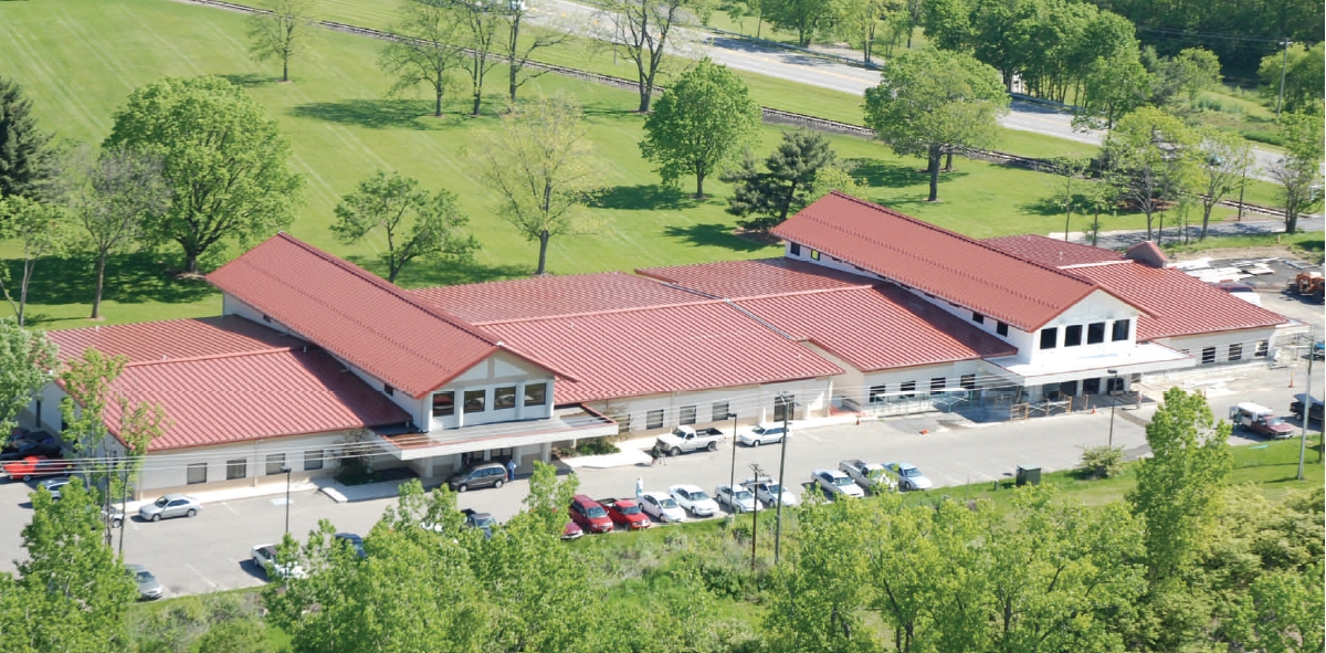
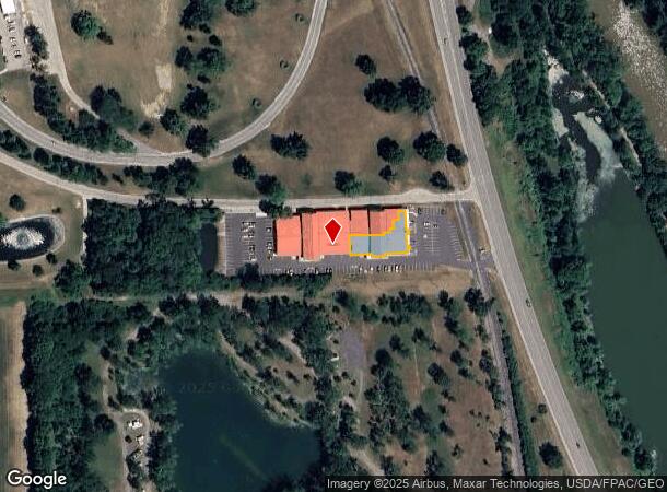
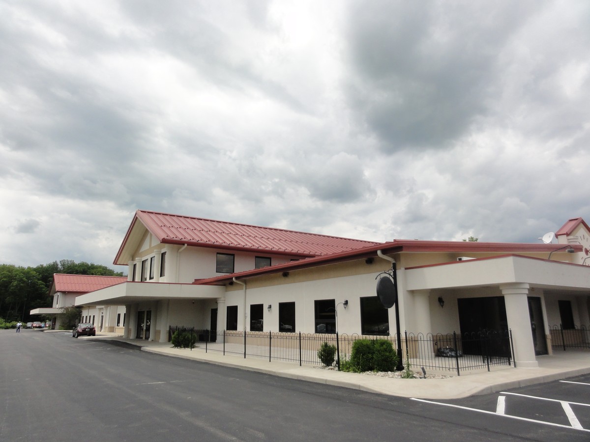
Property Record
3006 N County Road 25A, Troy, OH 45373
NEARBY LISTINGS FOR SALE OR LEASE
Property Detail
3006 N County Road 25A
C06084475
Upper Valley Medical Park Condominium
Medicalbuilding
6-5-5 PT SE COR SE (PARTIAL EXEMPTION - C06-250220)
X
Miami
39109C0164F
Ohio
2024
3.80 AC
2023
North Dayton
365002
Cincinnati/Dayton
34,293 SF
Dayton, OH
DEMOGRAPHICS near 3006 N County Road 25A
1 Mile
3 Mile
5 Mile
2024 Total Population
137
12,591
46,875
2029 Population
147
13,218
48,784
Pop Growth 2024-2029
+ 7.30%
+ 4.98%
+ 4.07%
Average Age
44
42
41
2024 Total Households
49
5,301
19,640
HH Growth 2024-2029
+ 8.16%
+ 4.87%
+ 4.06%
Median Household Inc
$63,000
$70,851
$59,759
Avg Household Size
2.40
2.30
2.30
2024 Avg HH Vehicles
2.00
2.00
2.00
Median Home Value
$235,000
$190,949
$164,461
Median Year Built
1972
1981
1966
Nearby Places
- Restaurants
- Banks
- Shops
- Fitness
- Groceries
PUBLIC TRANSPORTATION
AIRPORT
James M Cox Dayton International
DRIVE
WALK
Distance
James M Cox Dayton International
28 min
20.4 mi
Freight Ports
Port of Toledo
DRIVE
WALK
Distance
Port of Toledo
150 min
129.4 mi
SALE & LEASE HISTORY
LISTING DATE
SALE/LEASE

Sep 25, 2016
For Lease
Sep 22, 2017
For Sale
Mar 24, 2017
For Lease
Mar 24, 2017
For Sale
Mar 17, 2017
For Lease
Mar 17, 2017
For Sale
Aug 29, 2017
For Lease
Aug 29, 2017
For Sale
Nearby Properties
Address
Land Use
TOTAL SIZE
Lot Size
Zoning
Address
Land Use
TOTAL SIZE
Lot Size
Zoning
3,158 SF
113 AC
Address
Land Use
TOTAL SIZE
Lot Size
Zoning
536,448 SF
66.57 AC
Address
Land Use
TOTAL SIZE
Lot Size
Zoning
548,745 SF
56.35 AC
Address
Land Use
TOTAL SIZE
Lot Size
Zoning
48,363 SF
14.35 AC
Address
Land Use
TOTAL SIZE
Lot Size
Zoning
1,310 SF
12.31 AC
Address
Land Use
TOTAL SIZE
Lot Size
Zoning
75,861 SF
8 AC
Address
Land Use
TOTAL SIZE
Lot Size
Zoning
50,400 SF
54.09 AC
Address
Land Use
TOTAL SIZE
Lot Size
Zoning
160,000 SF
11.37 AC
Address
Land Use
TOTAL SIZE
Lot Size
Zoning
Address
Land Use
TOTAL SIZE
Lot Size
Zoning
3,944 SF
12.18 AC
Address
Land Use
TOTAL SIZE
Lot Size
Zoning
148,400 SF
37.74 AC
Address
Land Use
TOTAL SIZE
Lot Size
Zoning
32,633 SF
12.05 AC
Address
Land Use
TOTAL SIZE
Lot Size
Zoning
16.03 AC
Address
Land Use
TOTAL SIZE
Lot Size
Zoning
191,424 SF
26.97 AC
Address
Land Use
TOTAL SIZE
Lot Size
Zoning
44,300 SF
19.40 AC
Address
Land Use
TOTAL SIZE
Lot Size
Zoning
201,788 SF
10.11 AC
Address
Land Use
TOTAL SIZE
Lot Size
Zoning
54,671 SF
15.56 AC
Address
Land Use
TOTAL SIZE
Lot Size
Zoning
94,555 SF
13.32 AC
Address
Land Use
TOTAL SIZE
Lot Size
Zoning
4,700 SF
28.05 AC
Address
Land Use
TOTAL SIZE
Lot Size
Zoning
31,682 SF
2.40 AC
Address
Land Use
TOTAL SIZE
Lot Size
Zoning
68,653 SF
3.17 AC
Address
Land Use
TOTAL SIZE
Lot Size
Zoning
86,341 SF
8.58 AC
Address
Land Use
TOTAL SIZE
Lot Size
Zoning
145,268 SF
17.22 AC
Address
Land Use
TOTAL SIZE
Lot Size
Zoning
79,245 SF
8 AC
Address
Land Use
TOTAL SIZE
Lot Size
Zoning
23,542 SF
2.69 AC
Address
Land Use
TOTAL SIZE
Lot Size
Zoning
58,812 SF
2.24 AC
Address
Land Use
TOTAL SIZE
Lot Size
Zoning
160,000 SF
9.51 AC
Address
Land Use
TOTAL SIZE
Lot Size
Zoning
7.90 AC
Address
Land Use
TOTAL SIZE
Lot Size
Zoning
22,500 SF
180.97 AC
Address
Land Use
TOTAL SIZE
Lot Size
Zoning
47,887 SF
1.96 AC
The World's #1 Commercial Real Estate Marketplace
Connect with us
© 2025 CoStar Group
The information above has been obtained from sources believed reliable. While we do not doubt its accuracy we have not verified it and make no guarantee, warranty or representation about it. It is your responsibility to independently confirm its accuracy and completeness. Any projections, opinions, assumptions, or estimates used are for example only and do not represent the current or future performance of the property. The value of this transaction to you depends on tax and other factors which should be evaluated by your tax, financial, and legal advisors. You and your advisors should conduct a careful, independent investigation of the property to determine to your satisfaction the suitability of the property for your needs.