Property Record
3009 Shakertown Rd, Beavercreek, OH 45434


NEARBY LISTINGS FOR SALE OR LEASE
-
-
View all Beavercreek listings for sale on LoopNet.com
Property Detail
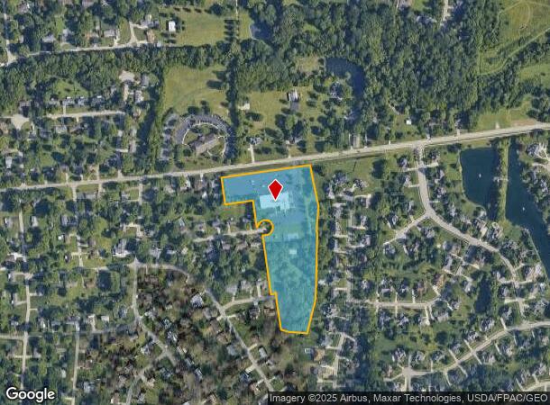
3009 Shakertown Rd
Dayton, OH
Beavercreek Christian Church Plat
B42-0006-0004-0-0208-00
7-3-31 BEAVERCREEK LOT 1 CHRISTIAN CHURCH PLT 3009 SHAKERTOWN RD
Religious
Greene
X
Ohio
39057C0108E
1
2023
9.13 AC
2023
East Dayton
210500
Cincinnati/Dayton
33,652 SF
DEMOGRAPHICS near 3009 Shakertown Rd
1 Mile
3 Mile
5 Mile
2024 Total Population
4,666
33,558
106,120
2029 Population
4,755
34,155
107,019
Pop Growth 2024-2029
+ 1.91%
+ 1.78%
+ 0.85%
Average Age
46
43
41
2024 Total Households
1,829
12,686
43,342
HH Growth 2024-2029
+ 1.86%
+ 1.75%
+ 0.64%
Median Household Inc
$118,310
$118,429
$87,505
Avg Household Size
2.50
2.60
2.40
2024 Avg HH Vehicles
2.00
2.00
2.00
Median Home Value
$265,583
$259,948
$207,493
Median Year Built
1975
1976
1971
Nearby Places
- Restaurants
- Banks
- Shops
- Fitness
- Groceries
PUBLIC TRANSPORTATION
AIRPORT
James M Cox Dayton International
DRIVE
WALK
Distance
James M Cox Dayton International
36 min
21.8 mi
Freight Ports
Port of Toledo
DRIVE
WALK
Distance
Port of Toledo
193 min
162.0 mi
Nearby Properties
Address
Land Use
TOTAL SIZE
Lot Size
Zoning
Address
Land Use
TOTAL SIZE
Lot Size
Zoning
286,260 SF
47.65 AC
Address
Land Use
TOTAL SIZE
Lot Size
Zoning
53.48 AC
RP1
Address
Land Use
TOTAL SIZE
Lot Size
Zoning
130,247 SF
14.12 AC
Address
Land Use
TOTAL SIZE
Lot Size
Zoning
145,500 SF
32.62 AC
A1
Address
Land Use
TOTAL SIZE
Lot Size
Zoning
1,008 SF
7 AC
R1A
Address
Land Use
TOTAL SIZE
Lot Size
Zoning
130,766 SF
1.68 AC
Address
Land Use
TOTAL SIZE
Lot Size
Zoning
70,754 SF
75.48 AC
Address
Land Use
TOTAL SIZE
Lot Size
Zoning
89,176 SF
17.52 AC
Address
Land Use
TOTAL SIZE
Lot Size
Zoning
108,274 SF
25.08 AC
RPUD427
Address
Land Use
TOTAL SIZE
Lot Size
Zoning
148,309 SF
1.50 AC
MXPUD02
Address
Land Use
TOTAL SIZE
Lot Size
Zoning
24,992 SF
17 AC
MULTIPLE
Address
Land Use
TOTAL SIZE
Lot Size
Zoning
20,144 SF
76.94 AC
A1
Address
Land Use
TOTAL SIZE
Lot Size
Zoning
7,694 SF
20.52 AC
MULTIPLE
Address
Land Use
TOTAL SIZE
Lot Size
Zoning
34,129 SF
4.92 AC
RPUD022
Address
Land Use
TOTAL SIZE
Lot Size
Zoning
72,824 SF
26.88 AC
A1
Address
Land Use
TOTAL SIZE
Lot Size
Zoning
51,648 SF
9.36 AC
R-PUD 95-2
Address
Land Use
TOTAL SIZE
Lot Size
Zoning
67,252 SF
1.04 AC
MXPUD02
Address
Land Use
TOTAL SIZE
Lot Size
Zoning
26.91 AC
Address
Land Use
TOTAL SIZE
Lot Size
Zoning
61,188 SF
0.90 AC
MXPUD02
Address
Land Use
TOTAL SIZE
Lot Size
Zoning
49,411 SF
0.66 AC
MXPUD02
Address
Land Use
TOTAL SIZE
Lot Size
Zoning
60,347 SF
0.82 AC
MXPUD02
Address
Land Use
TOTAL SIZE
Lot Size
Zoning
2,400 SF
37.61 AC
Address
Land Use
TOTAL SIZE
Lot Size
Zoning
51,372 SF
18.88 AC
Address
Land Use
TOTAL SIZE
Lot Size
Zoning
52,262 SF
9.71 AC
Address
Land Use
TOTAL SIZE
Lot Size
Zoning
64,911 SF
12.45 AC
R1A
Address
Land Use
TOTAL SIZE
Lot Size
Zoning
3.54 AC
MULTIPLE
Address
Land Use
TOTAL SIZE
Lot Size
Zoning
27,240 SF
5.92 AC
O1
Address
Land Use
TOTAL SIZE
Lot Size
Zoning
41,778 SF
6.82 AC
Address
Land Use
TOTAL SIZE
Lot Size
Zoning
77,673 SF
16.02 AC
A1
Address
Land Use
TOTAL SIZE
Lot Size
Zoning
50,520 SF
12.14 AC
CPUD962
The World's #1 Commercial Real Estate Marketplace
Connect with us
© 2025 CoStar Group
The information above has been obtained from sources believed reliable. While we do not doubt its accuracy we have not verified it and make no guarantee, warranty or representation about it. It is your responsibility to independently confirm its accuracy and completeness. Any projections, opinions, assumptions, or estimates used are for example only and do not represent the current or future performance of the property. The value of this transaction to you depends on tax and other factors which should be evaluated by your tax, financial, and legal advisors. You and your advisors should conduct a careful, independent investigation of the property to determine to your satisfaction the suitability of the property for your needs.