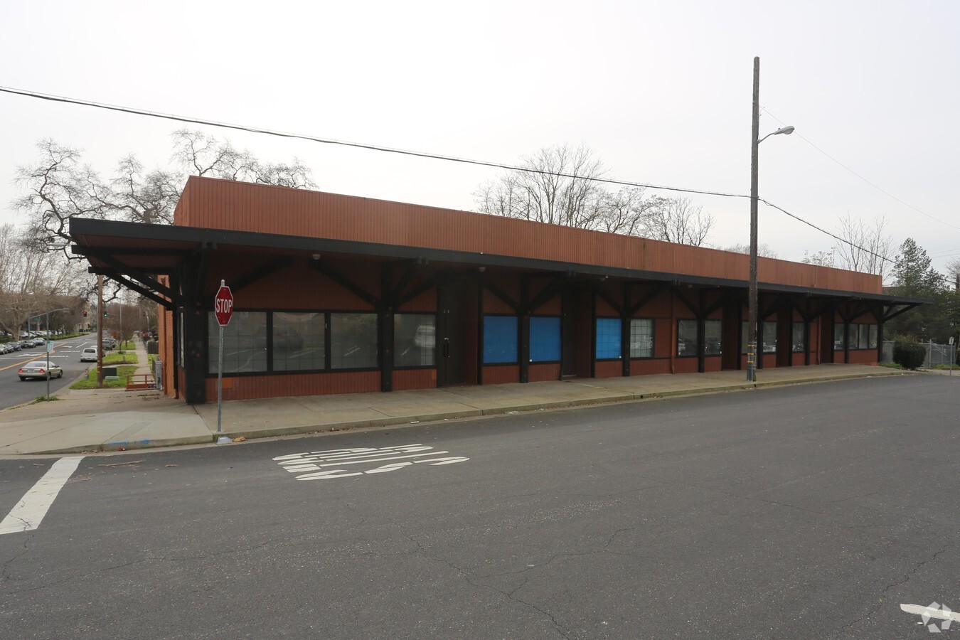
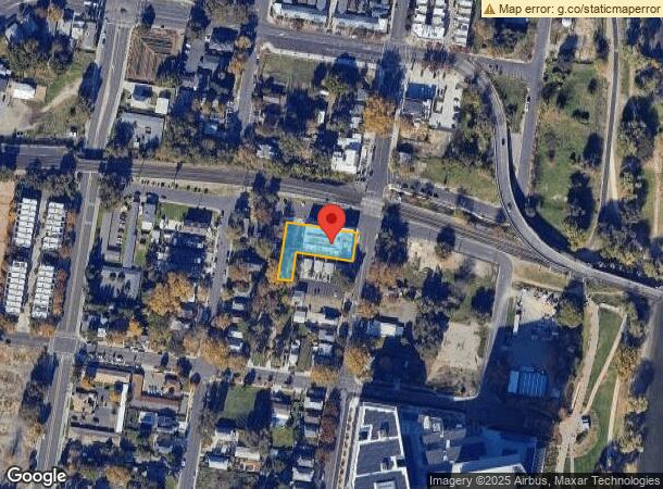
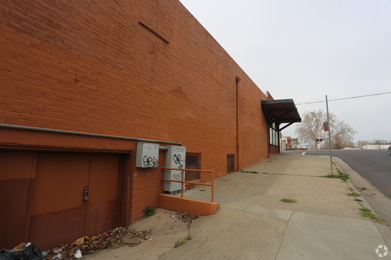
Property Record
301 D St, West Sacramento, CA 95605

NEARBY LISTINGS FOR SALE OR LEASE
Property Detail
301 D St
Sacramento--Roseville--Arden-Arcade, CA
Washington
010-483-001-000
DESC VERIFIED 2015-0019262
Apartment
Yolo
ARE
California
06067C0160J
19-24
2024
0.37 AC
2023
West Sacramento
010105
Sacramento
DEMOGRAPHICS near 301 D St
1 Mile
3 Mile
5 Mile
2024 Total Population
16,998
141,699
311,781
2029 Population
17,389
143,654
315,824
Pop Growth 2024-2029
+ 2.30%
+ 1.38%
+ 1.30%
Average Age
40
38
38
2024 Total Households
6,983
60,306
123,403
HH Growth 2024-2029
+ 2.92%
+ 1.62%
+ 1.42%
Median Household Inc
$52,151
$72,515
$76,396
Avg Household Size
2.00
2.20
2.40
2024 Avg HH Vehicles
1.00
2.00
2.00
Median Home Value
$402,804
$486,827
$489,565
Median Year Built
1976
1973
1972
Nearby Places
- Restaurants
- Banks
- Shops
- Fitness
- Groceries
PUBLIC TRANSPORTATION
TRANSIT/SUBWAY
8th & K (Gold Line - Sacramento Regional Transit District Light Rail (The RT))
DRIVE
WALK
Distance
8th & K (Gold Line - Sacramento Regional Transit District Light Rail (The RT))
5 min
8 min
0.5 mi
AIRPORT
Sacramento International
DRIVE
WALK
Distance
Sacramento International
15 min
11.1 mi
Freight Ports
Port of Richmond
DRIVE
WALK
Distance
Port of Richmond
1 min
66.1 mi
SALE & LEASE HISTORY
LISTING DATE
SALE/LEASE

Mar 06, 2017
For Lease
Nearby Properties
Address
Land Use
TOTAL SIZE
Lot Size
Zoning
Address
Land Use
TOTAL SIZE
Lot Size
Zoning
1,095,507 SF
1.39 AC
C-2-SPD H-
Address
Land Use
TOTAL SIZE
Lot Size
Zoning
5.64 AC
C-3-SPD
Address
Land Use
TOTAL SIZE
Lot Size
Zoning
487,483 SF
1.12 AC
C-3-SPD
Address
Land Use
TOTAL SIZE
Lot Size
Zoning
594,942 SF
2.39 AC
C-3-SPD
Address
Land Use
TOTAL SIZE
Lot Size
Zoning
1,095,507 SF
1.39 AC
C-2-SPD H-
Address
Land Use
TOTAL SIZE
Lot Size
Zoning
405,074 SF
2.39 AC
C-3-SPD
Address
Land Use
TOTAL SIZE
Lot Size
Zoning
399,626 SF
2.41 AC
C-3-SPD
Address
Land Use
TOTAL SIZE
Lot Size
Zoning
200,616 SF
2.54 AC
C-2-SPD
Address
Land Use
TOTAL SIZE
Lot Size
Zoning
366,730 SF
0.89 AC
C-3-SPD
Address
Land Use
TOTAL SIZE
Lot Size
Zoning
676,447 SF
1.43 AC
C-3-SPD
Address
Land Use
TOTAL SIZE
Lot Size
Zoning
508,916 SF
0.71 AC
C-3-SPD
Address
Land Use
TOTAL SIZE
Lot Size
Zoning
339,329 SF
6.40 AC
R-5-PUD-SP
Address
Land Use
TOTAL SIZE
Lot Size
Zoning
51,570 SF
9.76 AC
B-P
Address
Land Use
TOTAL SIZE
Lot Size
Zoning
193,521 SF
0.60 AC
C-3-SPD
Address
Land Use
TOTAL SIZE
Lot Size
Zoning
0.65 AC
C-4-SPD
Address
Land Use
TOTAL SIZE
Lot Size
Zoning
410,420 SF
0.95 AC
C-3-SPD
Address
Land Use
TOTAL SIZE
Lot Size
Zoning
213,557 SF
2.33 AC
C-3-SPD
Address
Land Use
TOTAL SIZE
Lot Size
Zoning
240,548 SF
0.86 AC
C-3-SPD
Address
Land Use
TOTAL SIZE
Lot Size
Zoning
401,025 SF
4.59 AC
W-F
Address
Land Use
TOTAL SIZE
Lot Size
Zoning
0.90 AC
C-3-SPD
Address
Land Use
TOTAL SIZE
Lot Size
Zoning
119,055 SF
1.18 AC
C-2-SPD
Address
Land Use
TOTAL SIZE
Lot Size
Zoning
318,616 SF
16.40 AC
R-2B-PUD
Address
Land Use
TOTAL SIZE
Lot Size
Zoning
R-4-PUD C-
Address
Land Use
TOTAL SIZE
Lot Size
Zoning
7.49 AC
WF
Address
Land Use
TOTAL SIZE
Lot Size
Zoning
26,712 SF
1.85 AC
R-5-PUD-SP
Address
Land Use
TOTAL SIZE
Lot Size
Zoning
26,712 SF
1.90 AC
R-5-PUD-SP
Address
Land Use
TOTAL SIZE
Lot Size
Zoning
345,359 SF
15.03 AC
OB-PUD
Address
Land Use
TOTAL SIZE
Lot Size
Zoning
303,254 SF
10.63 AC
OB-PUD
Address
Land Use
TOTAL SIZE
Lot Size
Zoning
246,417 SF
1.19 AC
C-3-SPD
Address
Land Use
TOTAL SIZE
Lot Size
Zoning
368,262 SF
0.72 AC
C-3-SPD
The World's #1 Commercial Real Estate Marketplace
Connect with us
© 2025 CoStar Group
The information above has been obtained from sources believed reliable. While we do not doubt its accuracy we have not verified it and make no guarantee, warranty or representation about it. It is your responsibility to independently confirm its accuracy and completeness. Any projections, opinions, assumptions, or estimates used are for example only and do not represent the current or future performance of the property. The value of this transaction to you depends on tax and other factors which should be evaluated by your tax, financial, and legal advisors. You and your advisors should conduct a careful, independent investigation of the property to determine to your satisfaction the suitability of the property for your needs.