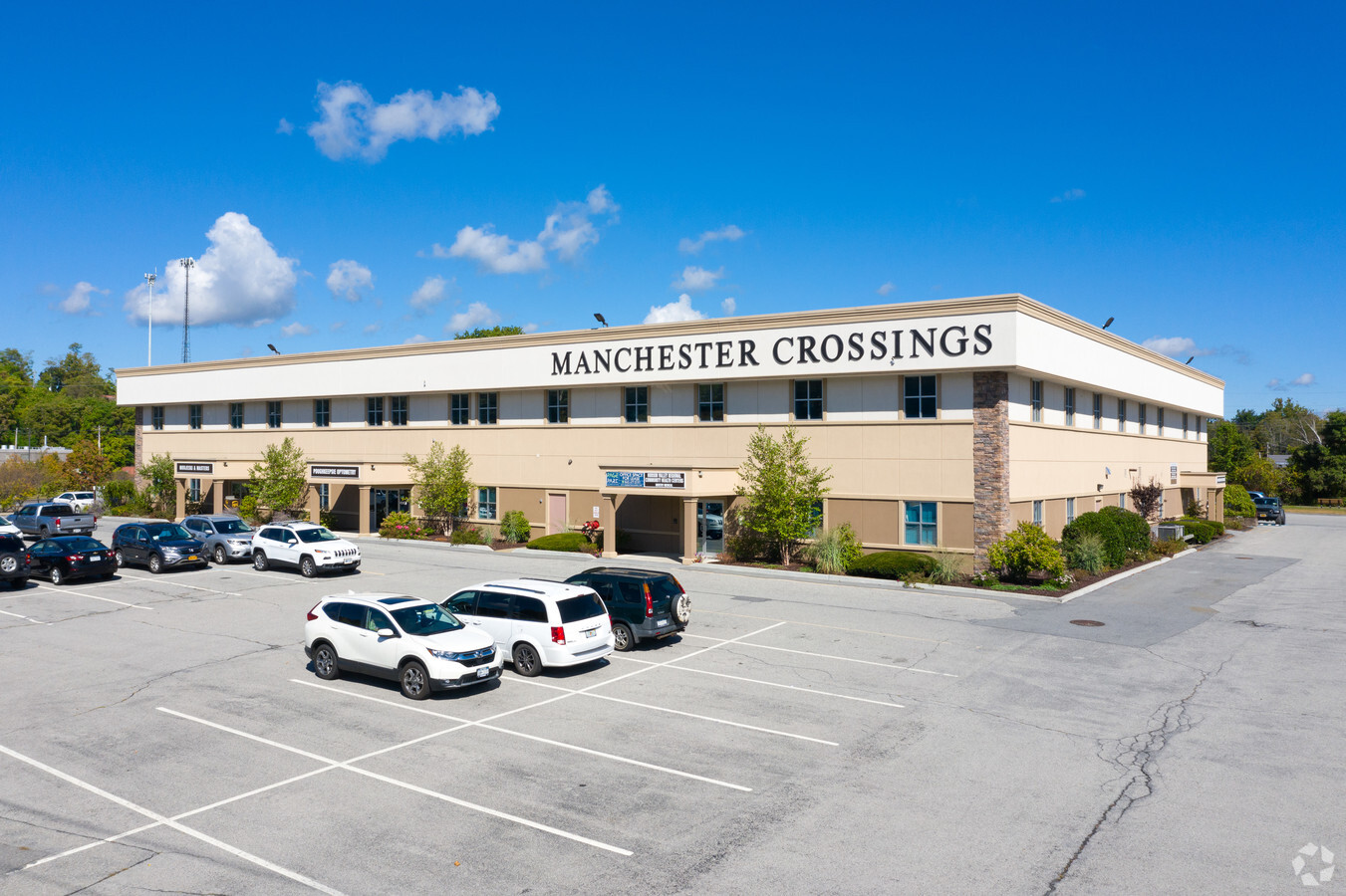
Property Record
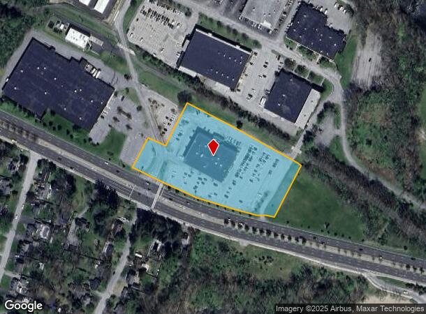
301 Manchester Rd, Poughkeepsie, NY 12603
Current Lease Availabilities
NEARBY LISTINGS FOR SALE OR LEASE
Property Detail
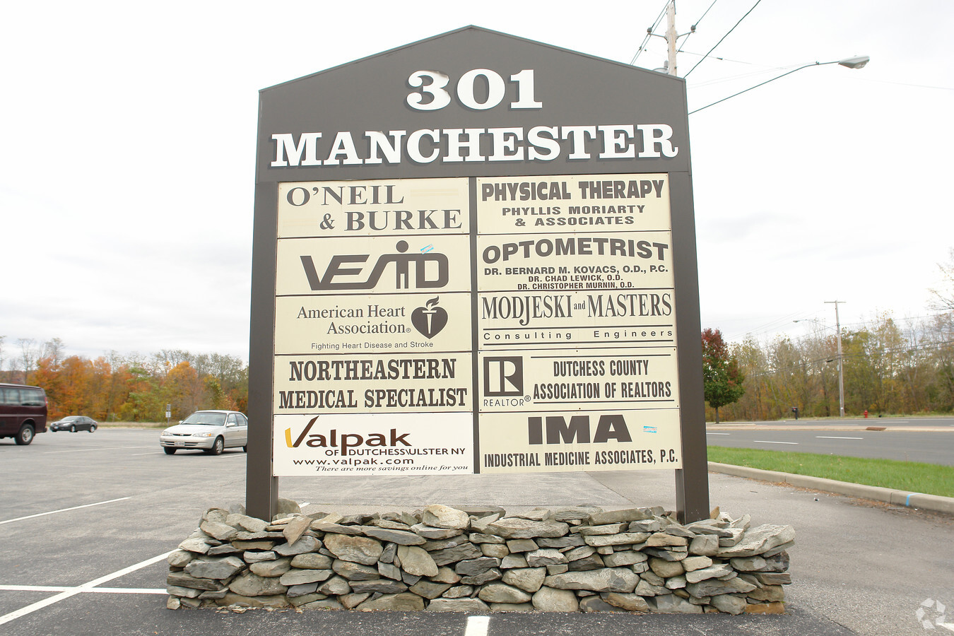
301 Manchester Rd
134689-6261-04-601449-0000
4.33 AC 1502 0601
Officebuilding
Dutchess
X
New York
36027C0386E
601
2023
4.17 AC
2023
Fishkill
140201
Westchester/So Connecticut
46,800 SF
Dutchess County-Putnam County, NY
DEMOGRAPHICS near 301 Manchester Rd
1 Mile
3 Mile
5 Mile
2024 Total Population
5,060
51,947
99,582
2029 Population
5,058
52,023
99,747
Pop Growth 2024-2029
(0.04%)
+ 0.15%
+ 0.17%
Average Age
34
41
40
2024 Total Households
1,148
19,757
37,075
HH Growth 2024-2029
(0.17%)
+ 0.22%
+ 0.23%
Median Household Inc
$90,042
$75,232
$76,756
Avg Household Size
2.60
2.40
2.40
2024 Avg HH Vehicles
2.00
2.00
2.00
Median Home Value
$324,021
$303,290
$305,099
Median Year Built
1960
1962
1965
Nearby Places
- Restaurants
- Banks
- Shops
- Fitness
- Groceries
PUBLIC TRANSPORTATION
COMMUTER RAIL
Poughkeepsie Station (Hudson Line - Metro-North Commuter Railroad Company (Metro-North))
DRIVE
WALK
Distance
Poughkeepsie Station (Hudson Line - Metro-North Commuter Railroad Company (Metro-North))
7 min
4.0 mi
AIRPORT
New York Stewart International
DRIVE
WALK
Distance
New York Stewart International
40 min
27.3 mi
Freight Ports
Port of New Haven
DRIVE
WALK
Distance
Port of New Haven
106 min
75.0 mi
Nearby Properties
Address
Land Use
TOTAL SIZE
Lot Size
Zoning
Address
Land Use
TOTAL SIZE
Lot Size
Zoning
1,279,884 SF
255.89 AC
IN
Address
Land Use
TOTAL SIZE
Lot Size
Zoning
488,904 SF
12.90 AC
R-3
Address
Land Use
TOTAL SIZE
Lot Size
Zoning
127,976 SF
6.57 AC
OR
Address
Land Use
TOTAL SIZE
Lot Size
Zoning
179,351 SF
18.34 AC
IN
Address
Land Use
TOTAL SIZE
Lot Size
Zoning
167,456 SF
18.50 AC
RM
Address
Land Use
TOTAL SIZE
Lot Size
Zoning
175,204 SF
4.50 AC
MHC
Address
Land Use
TOTAL SIZE
Lot Size
Zoning
119,832 SF
18.20 AC
RM
Address
Land Use
TOTAL SIZE
Lot Size
Zoning
121,040 SF
16.05 AC
OPD
Address
Land Use
TOTAL SIZE
Lot Size
Zoning
23,044 SF
12.60 AC
R-5
Address
Land Use
TOTAL SIZE
Lot Size
Zoning
126,616 SF
25.57 AC
R20
Address
Land Use
TOTAL SIZE
Lot Size
Zoning
32,864 SF
22.85 AC
RM
Address
Land Use
TOTAL SIZE
Lot Size
Zoning
30,420 SF
11.30 AC
R-2
Address
Land Use
TOTAL SIZE
Lot Size
Zoning
179,206 SF
8.19 AC
R-4
Address
Land Use
TOTAL SIZE
Lot Size
Zoning
31,608 SF
57 AC
IN
Address
Land Use
TOTAL SIZE
Lot Size
Zoning
56,477 SF
38.98 AC
IN
Address
Land Use
TOTAL SIZE
Lot Size
Zoning
6.24 AC
I
Address
Land Use
TOTAL SIZE
Lot Size
Zoning
87,550 SF
30 AC
R20
Address
Land Use
TOTAL SIZE
Lot Size
Zoning
47,877 SF
13.50 AC
RM
Address
Land Use
TOTAL SIZE
Lot Size
Zoning
123,650 SF
2.10 AC
ATC
Address
Land Use
TOTAL SIZE
Lot Size
Zoning
101,527 SF
13 AC
ATC
Address
Land Use
TOTAL SIZE
Lot Size
Zoning
41 SF
97.40 AC
R-3A
Address
Land Use
TOTAL SIZE
Lot Size
Zoning
61,990 SF
12.97 AC
RM
Address
Land Use
TOTAL SIZE
Lot Size
Zoning
108,404 SF
4.42 AC
C-3
Address
Land Use
TOTAL SIZE
Lot Size
Zoning
181,170 SF
19.90 AC
R20
Address
Land Use
TOTAL SIZE
Lot Size
Zoning
97,665 SF
11.33 AC
BSC
Address
Land Use
TOTAL SIZE
Lot Size
Zoning
92,822 SF
2.33 AC
FC
Address
Land Use
TOTAL SIZE
Lot Size
Zoning
65,458 SF
11.60 AC
RFD
Address
Land Use
TOTAL SIZE
Lot Size
Zoning
Address
Land Use
TOTAL SIZE
Lot Size
Zoning
70,830 SF
23.68 AC
R20
Address
Land Use
TOTAL SIZE
Lot Size
Zoning
69,312 SF
4.56 AC
R-D
The World's #1 Commercial Real Estate Marketplace
Connect with us
© 2025 CoStar Group
The information above has been obtained from sources believed reliable. While we do not doubt its accuracy we have not verified it and make no guarantee, warranty or representation about it. It is your responsibility to independently confirm its accuracy and completeness. Any projections, opinions, assumptions, or estimates used are for example only and do not represent the current or future performance of the property. The value of this transaction to you depends on tax and other factors which should be evaluated by your tax, financial, and legal advisors. You and your advisors should conduct a careful, independent investigation of the property to determine to your satisfaction the suitability of the property for your needs.