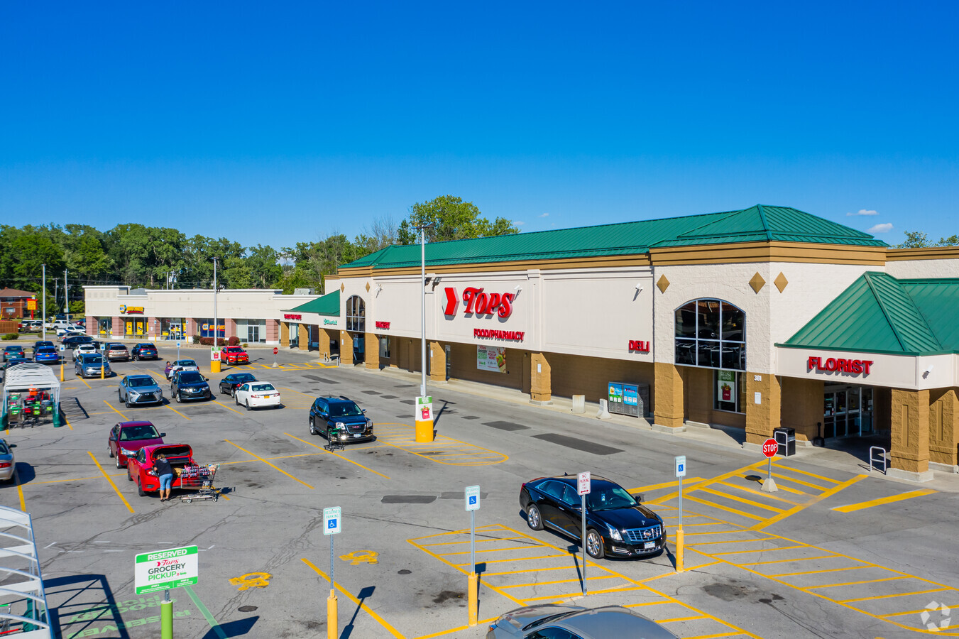
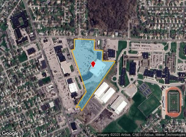
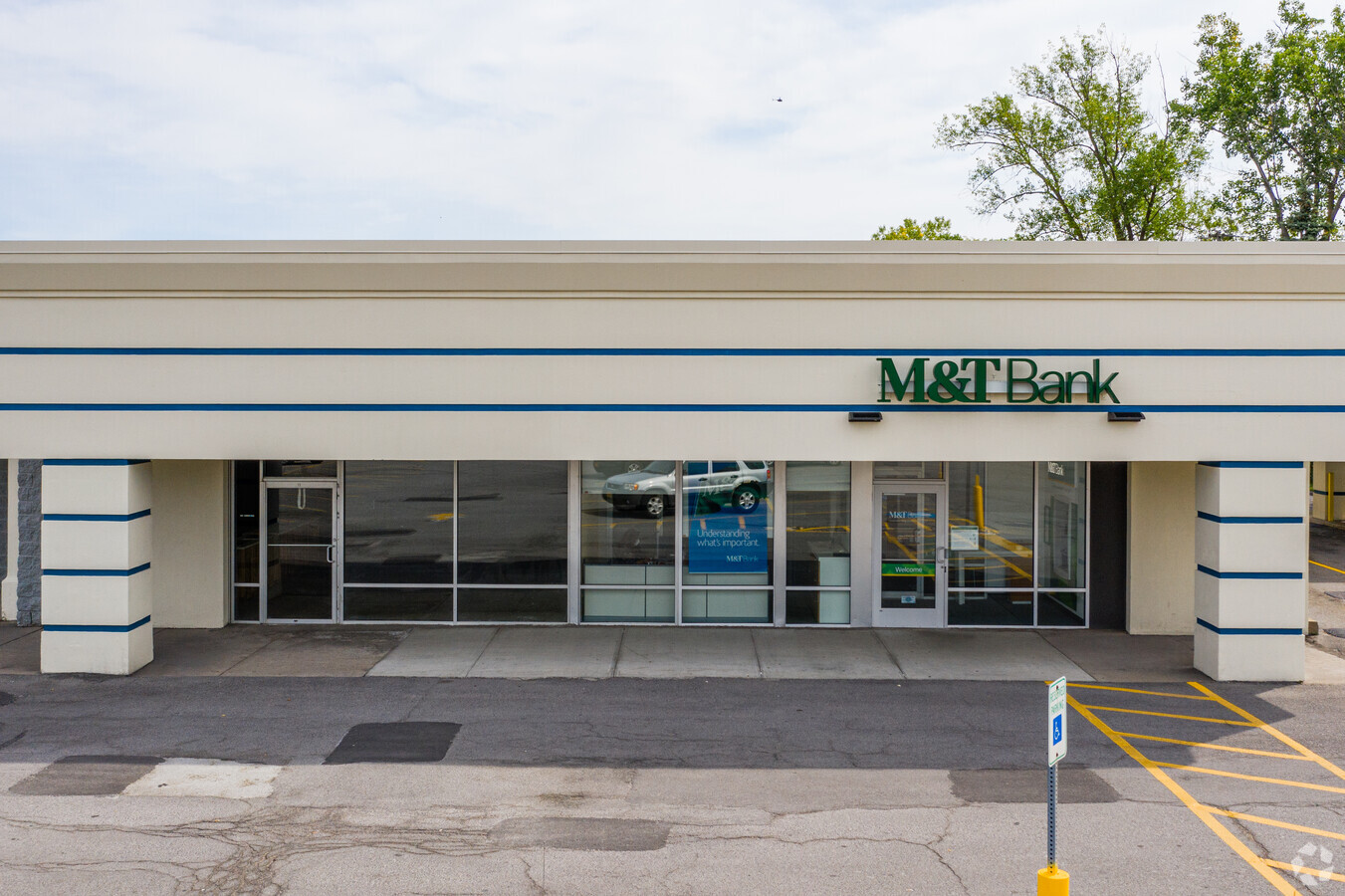
Property Record
301 Meadow Dr, North Tonawanda, NY 14120
NEARBY LISTINGS FOR SALE OR LEASE
Property Detail
301 Meadow Dr
291200-182-005-0002-006-011
Niagara
Stripcommercialcenter
New York
X
6.011
36063C0361E
11.30 AC
2024
North
2023
Buffalo/Niagara Falls
024600
Buffalo-Cheektowaga-Niagara Falls, NY
95,085 SF
DEMOGRAPHICS near 301 Meadow Dr
1 Mile
3 Mile
5 Mile
2024 Total Population
11,383
52,314
130,294
2029 Population
11,132
51,422
129,097
Pop Growth 2024-2029
(2.21%)
(1.71%)
(0.92%)
Average Age
44
43
43
2024 Total Households
5,206
23,521
57,870
HH Growth 2024-2029
(2.25%)
(1.79%)
(0.95%)
Median Household Inc
$63,253
$67,753
$67,711
Avg Household Size
2.20
2.20
2.20
2024 Avg HH Vehicles
2.00
2.00
2.00
Median Home Value
$153,640
$173,933
$180,237
Median Year Built
1953
1957
1961
Nearby Places
- Restaurants
- Banks
- Shops
- Fitness
- Groceries
PUBLIC TRANSPORTATION
AIRPORT
Niagara Falls International
DRIVE
WALK
Distance
Niagara Falls International
12 min
6.0 mi
Buffalo Niagara International
DRIVE
WALK
Distance
Buffalo Niagara International
25 min
13.9 mi
Freight Ports
Port of Toledo
DRIVE
WALK
Distance
Port of Toledo
380 min
318.5 mi
Nearby Properties
Address
Land Use
TOTAL SIZE
Lot Size
Zoning
Address
Land Use
TOTAL SIZE
Lot Size
Zoning
3,600 SF
72.50 AC
Address
Land Use
TOTAL SIZE
Lot Size
Zoning
223,916 SF
8.25 AC
R-C
Address
Land Use
TOTAL SIZE
Lot Size
Zoning
4,707 SF
13.60 AC
WD NT
Address
Land Use
TOTAL SIZE
Lot Size
Zoning
173,303 SF
24.40 AC
R1-2
Address
Land Use
TOTAL SIZE
Lot Size
Zoning
67,000 SF
6.50 AC
Address
Land Use
TOTAL SIZE
Lot Size
Zoning
47,400 SF
10.03 AC
MS
Address
Land Use
TOTAL SIZE
Lot Size
Zoning
137,878 SF
23.60 AC
R1-2
Address
Land Use
TOTAL SIZE
Lot Size
Zoning
107,490 SF
3.55 AC
Address
Land Use
TOTAL SIZE
Lot Size
Zoning
81,224 SF
0.45 AC
Address
Land Use
TOTAL SIZE
Lot Size
Zoning
175,793 SF
27.30 AC
M-1
Address
Land Use
TOTAL SIZE
Lot Size
Zoning
112,256 SF
38.33 AC
00000
Address
Land Use
TOTAL SIZE
Lot Size
Zoning
Address
Land Use
TOTAL SIZE
Lot Size
Zoning
96,554 SF
10.90 AC
Address
Land Use
TOTAL SIZE
Lot Size
Zoning
Address
Land Use
TOTAL SIZE
Lot Size
Zoning
1,323 SF
26.39 AC
R-2
Address
Land Use
TOTAL SIZE
Lot Size
Zoning
33,970 SF
9.70 AC
Address
Land Use
TOTAL SIZE
Lot Size
Zoning
51,232 SF
1.62 AC
WD
Address
Land Use
TOTAL SIZE
Lot Size
Zoning
51,232 SF
2.55 AC
WD
Address
Land Use
TOTAL SIZE
Lot Size
Zoning
106,967 SF
12.77 AC
C-1
Address
Land Use
TOTAL SIZE
Lot Size
Zoning
217,735 SF
34.80 AC
Address
Land Use
TOTAL SIZE
Lot Size
Zoning
39,654 SF
4.33 AC
R-2
Address
Land Use
TOTAL SIZE
Lot Size
Zoning
97,500 SF
6.20 AC
R1
Address
Land Use
TOTAL SIZE
Lot Size
Zoning
8.20 AC
R2
Address
Land Use
TOTAL SIZE
Lot Size
Zoning
96,458 SF
7.94 AC
GB
Address
Land Use
TOTAL SIZE
Lot Size
Zoning
154,516 SF
29.20 AC
Address
Land Use
TOTAL SIZE
Lot Size
Zoning
64,000 SF
4.10 AC
Address
Land Use
TOTAL SIZE
Lot Size
Zoning
64,815 SF
5.90 AC
Address
Land Use
TOTAL SIZE
Lot Size
Zoning
56,570 SF
6.20 AC
Address
Land Use
TOTAL SIZE
Lot Size
Zoning
54,000 SF
6.70 AC
The World's #1 Commercial Real Estate Marketplace
Connect with us
© 2025 CoStar Group
The information above has been obtained from sources believed reliable. While we do not doubt its accuracy we have not verified it and make no guarantee, warranty or representation about it. It is your responsibility to independently confirm its accuracy and completeness. Any projections, opinions, assumptions, or estimates used are for example only and do not represent the current or future performance of the property. The value of this transaction to you depends on tax and other factors which should be evaluated by your tax, financial, and legal advisors. You and your advisors should conduct a careful, independent investigation of the property to determine to your satisfaction the suitability of the property for your needs.