Property Record
301 Rio Communities Blvd, Rio Communities, NM 87002

NEARBY LISTINGS FOR SALE OR LEASE
-
-
View all Rio Communities listings for sale on LoopNet.com
Property Detail
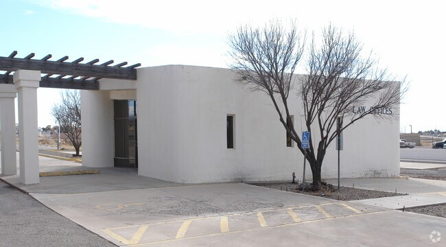
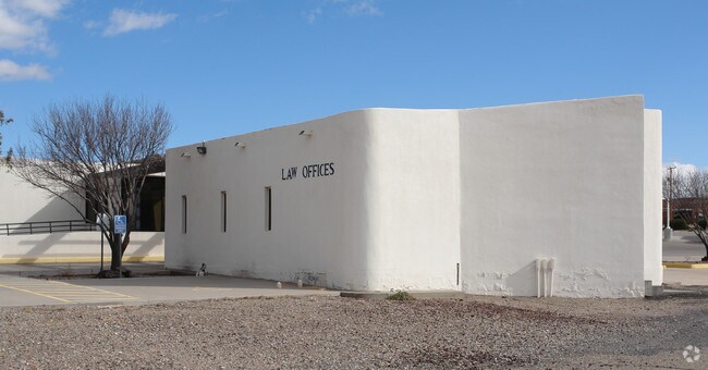
301 Rio Communities Blvd
Albuquerque, NM
Land Of Roy Lemons
1-009-027-415-465-000000
SUBD LAND OF ROY LEMONS TRACT D1 1.22 ACRES 2007 REV
Realpropertynec
Valencia
X
New Mexico
35061C0415E
1.22 AC
2025
Los Lunas Corridor
2025
Albuquerque
971000
DEMOGRAPHICS near 301 Rio Communities Blvd
1 Mile
3 Mile
5 Mile
2024 Total Population
3,200
13,132
20,123
2029 Population
3,404
13,972
21,383
Pop Growth 2024-2029
+ 6.38%
+ 6.40%
+ 6.26%
Average Age
45
43
43
2024 Total Households
1,327
5,311
8,022
HH Growth 2024-2029
+ 6.78%
+ 6.70%
+ 6.57%
Median Household Inc
$35,357
$38,646
$39,913
Avg Household Size
2.40
2.40
2.50
2024 Avg HH Vehicles
2.00
2.00
2.00
Median Home Value
$137,247
$138,099
$148,619
Median Year Built
1977
1979
1982
Nearby Places
Map Layers
Map Styles
 Street
 Aerial
- Restaurants
- Banks
- Shops
- Fitness
- Groceries
PUBLIC TRANSPORTATION
COMMUTER RAIL
Belen (Rail Runner Express - New Mexico Rail Runner Express)
DRIVE
WALK
Distance
Belen (Rail Runner Express - New Mexico Rail Runner Express)
5 min
2.4 mi
Belen Rail Runner Station (NMRX - Rio Metro Regional Transit District)
DRIVE
WALK
Distance
Belen Rail Runner Station (NMRX - Rio Metro Regional Transit District)
5 min
2.4 mi
AIRPORT
Albuquerque International Sunport
DRIVE
WALK
Distance
Albuquerque International Sunport
55 min
35.2 mi
Freight Ports
Port of San Diego
DRIVE
WALK
Distance
Port of San Diego
885 min
826.6 mi
Nearby Properties
Address
Land Use
TOTAL SIZE
Lot Size
Zoning
Address
Land Use
TOTAL SIZE
Lot Size
Zoning
253,164 SF
39.09 AC
Address
Land Use
TOTAL SIZE
Lot Size
Zoning
Address
Land Use
TOTAL SIZE
Lot Size
Zoning
Address
Land Use
TOTAL SIZE
Lot Size
Zoning
32.43 AC
Address
Land Use
TOTAL SIZE
Lot Size
Zoning
16.30 AC
Address
Land Use
TOTAL SIZE
Lot Size
Zoning
Address
Land Use
TOTAL SIZE
Lot Size
Zoning
Address
Land Use
TOTAL SIZE
Lot Size
Zoning
2.50 AC
Address
Land Use
TOTAL SIZE
Lot Size
Zoning
8.76 AC
Address
Land Use
TOTAL SIZE
Lot Size
Zoning
4.76 AC
Address
Land Use
TOTAL SIZE
Lot Size
Zoning
10.11 AC
Address
Land Use
TOTAL SIZE
Lot Size
Zoning
0.07 AC
Address
Land Use
TOTAL SIZE
Lot Size
Zoning
1.95 AC
Address
Land Use
TOTAL SIZE
Lot Size
Zoning
3.42 AC
Address
Land Use
TOTAL SIZE
Lot Size
Zoning
Address
Land Use
TOTAL SIZE
Lot Size
Zoning
0.49 AC
Address
Land Use
TOTAL SIZE
Lot Size
Zoning
48.42 AC
Address
Land Use
TOTAL SIZE
Lot Size
Zoning
1.26 AC
Address
Land Use
TOTAL SIZE
Lot Size
Zoning
3.13 AC
Address
Land Use
TOTAL SIZE
Lot Size
Zoning
0.98 AC
Address
Land Use
TOTAL SIZE
Lot Size
Zoning
0.32 AC
Address
Land Use
TOTAL SIZE
Lot Size
Zoning
18,926 SF
3.68 AC
Address
Land Use
TOTAL SIZE
Lot Size
Zoning
Address
Land Use
TOTAL SIZE
Lot Size
Zoning
9,540 SF
6.18 AC
Address
Land Use
TOTAL SIZE
Lot Size
Zoning
2.70 AC
Address
Land Use
TOTAL SIZE
Lot Size
Zoning
43,680 SF
3.89 AC
Address
Land Use
TOTAL SIZE
Lot Size
Zoning
8,492 SF
1.82 AC
Address
Land Use
TOTAL SIZE
Lot Size
Zoning
7,318 SF
0.97 AC
Address
Land Use
TOTAL SIZE
Lot Size
Zoning
8,492 SF
1.82 AC
Address
Land Use
TOTAL SIZE
Lot Size
Zoning
14,259 SF
1.56 AC
The World's #1 Commercial Real Estate Marketplace
Connect with us
© 2026 CoStar Group
The information above has been obtained from sources believed reliable. While we do not doubt its accuracy we have not verified it and make no guarantee, warranty or representation about it. It is your responsibility to independently confirm its accuracy and completeness. Any projections, opinions, assumptions, or estimates used are for example only and do not represent the current or future performance of the property. The value of this transaction to you depends on tax and other factors which should be evaluated by your tax, financial, and legal advisors. You and your advisors should conduct a careful, independent investigation of the property to determine to your satisfaction the suitability of the property for your needs.