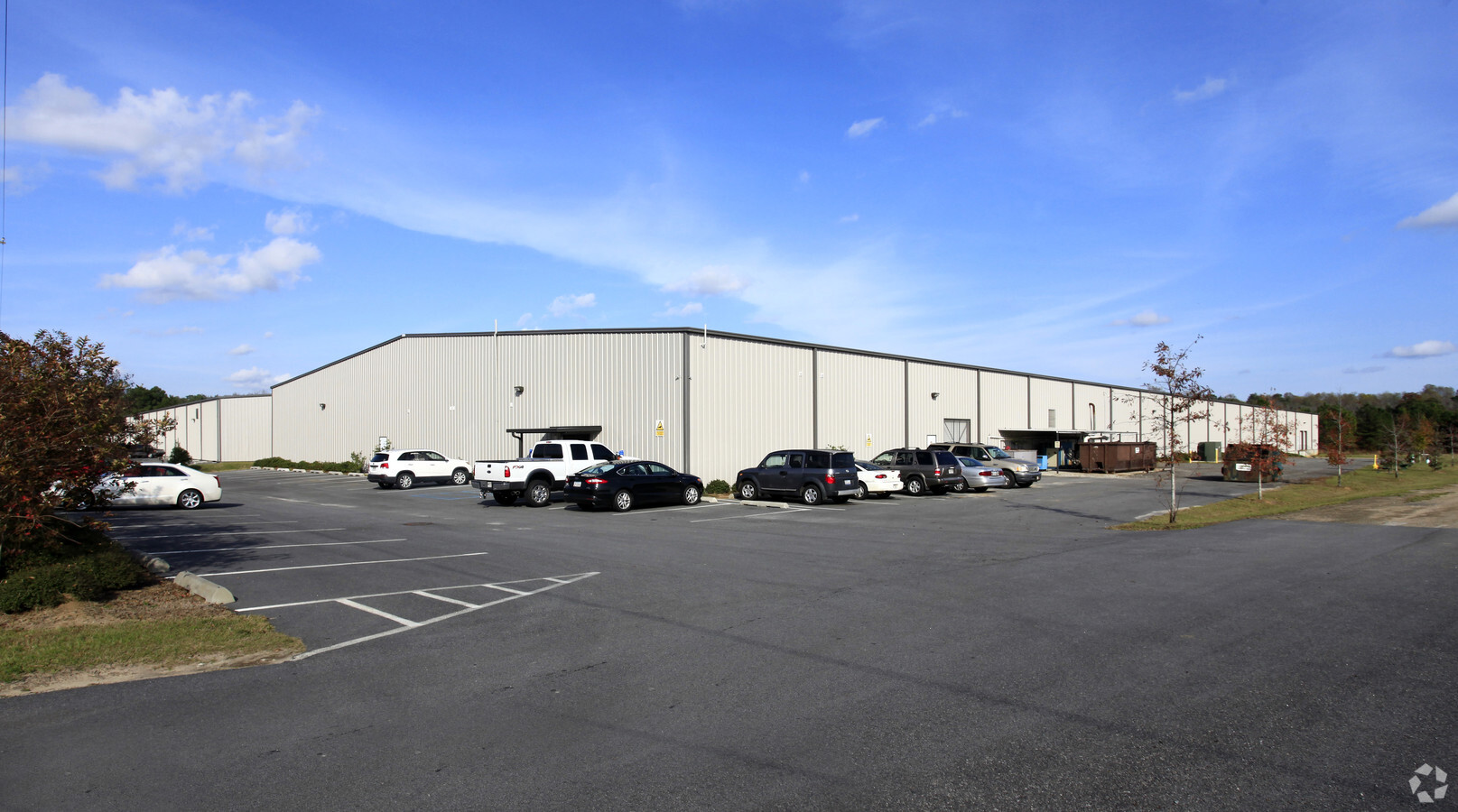
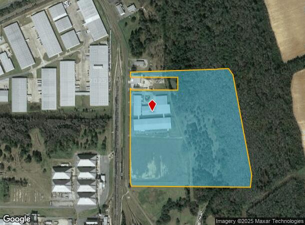
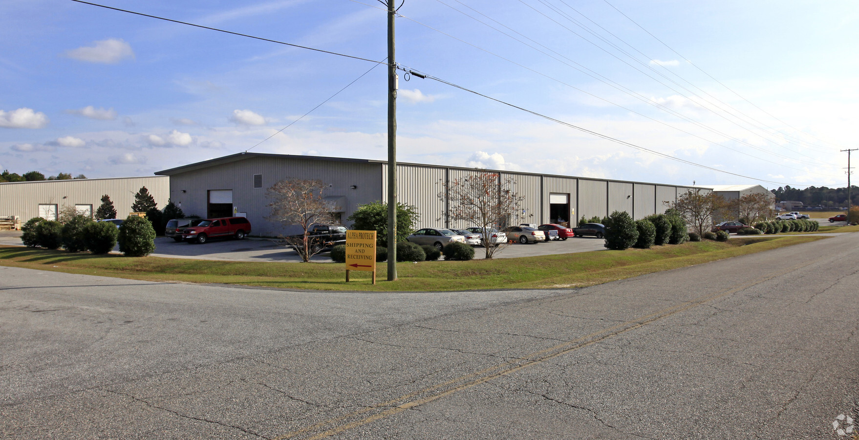
Property Record
301 S Blanchard St, Valdosta, GA 31601
NEARBY LISTINGS FOR SALE OR LEASE
Property Detail
301 S Blanchard St
0158A-006
Clay/Cypress Industrial
Lightindustrial
LL153 LD11
AE
Lowndes
13101C0025A
Georgia
2024
43.05 AC
2024
Valdosta/Lake Park
010801
Other Market Areas
166,300 SF
Valdosta, GA
DEMOGRAPHICS near 301 S Blanchard St
1 Mile
3 Mile
5 Mile
2024 Total Population
515
28,222
61,378
2029 Population
544
29,459
63,753
Pop Growth 2024-2029
+ 5.63%
+ 4.38%
+ 3.87%
Average Age
37
34
35
2024 Total Households
201
10,582
24,201
HH Growth 2024-2029
+ 5.97%
+ 4.66%
+ 4.06%
Median Household Inc
$14,948
$26,189
$30,822
Avg Household Size
2.50
2.40
2.30
2024 Avg HH Vehicles
2.00
1.00
2.00
Median Home Value
$79,850
$86,451
$145,838
Median Year Built
1984
1981
1986
Nearby Places
- Restaurants
- Banks
- Shops
- Fitness
- Groceries
PUBLIC TRANSPORTATION
AIRPORT
Valdosta Regional
DRIVE
WALK
Distance
Valdosta Regional
11 min
5.7 mi
Freight Ports
Jacksonville Port
DRIVE
WALK
Distance
Jacksonville Port
149 min
127.8 mi
Nearby Properties
Address
Land Use
TOTAL SIZE
Lot Size
Zoning
Address
Land Use
TOTAL SIZE
Lot Size
Zoning
60,000 SF
56.32 AC
M-1
Address
Land Use
TOTAL SIZE
Lot Size
Zoning
210,020 SF
4.22 AC
C-C
Address
Land Use
TOTAL SIZE
Lot Size
Zoning
339 SF
23.53 AC
E-R
Address
Land Use
TOTAL SIZE
Lot Size
Zoning
2,496 SF
63.73 AC
M-2
Address
Land Use
TOTAL SIZE
Lot Size
Zoning
142,140 SF
24.29 AC
DR-10
Address
Land Use
TOTAL SIZE
Lot Size
Zoning
65,664 SF
16.06 AC
R-M
Address
Land Use
TOTAL SIZE
Lot Size
Zoning
7,200 SF
9.92 AC
M-1
Address
Land Use
TOTAL SIZE
Lot Size
Zoning
40,800 SF
5.83 AC
R-P
Address
Land Use
TOTAL SIZE
Lot Size
Zoning
48,000 SF
9.06 AC
C-C
Address
Land Use
TOTAL SIZE
Lot Size
Zoning
100,000 SF
25.27 AC
M-1
Address
Land Use
TOTAL SIZE
Lot Size
Zoning
103,468 SF
9.38 AC
C-H
Address
Land Use
TOTAL SIZE
Lot Size
Zoning
2,610 SF
10 AC
R-M
Address
Land Use
TOTAL SIZE
Lot Size
Zoning
52,220 SF
181.31 AC
M-2
Address
Land Use
TOTAL SIZE
Lot Size
Zoning
480 SF
10 AC
R-M
Address
Land Use
TOTAL SIZE
Lot Size
Zoning
9,000 SF
72.18 AC
E-A
Address
Land Use
TOTAL SIZE
Lot Size
Zoning
18,936 SF
6.45 AC
R-M
Address
Land Use
TOTAL SIZE
Lot Size
Zoning
8,320 SF
61 AC
E-A
Address
Land Use
TOTAL SIZE
Lot Size
Zoning
66,395 SF
1.49 AC
M-1
Address
Land Use
TOTAL SIZE
Lot Size
Zoning
54,000 SF
9.15 AC
M-2
Address
Land Use
TOTAL SIZE
Lot Size
Zoning
90,710 SF
33.43 AC
PRD-10
Address
Land Use
TOTAL SIZE
Lot Size
Zoning
12,650 SF
55.68 AC
M-2
Address
Land Use
TOTAL SIZE
Lot Size
Zoning
80,000 SF
11.51 AC
M-2
Address
Land Use
TOTAL SIZE
Lot Size
Zoning
14,464 SF
4.01 AC
R-M
Address
Land Use
TOTAL SIZE
Lot Size
Zoning
38,352 SF
5.68 AC
R-P
Address
Land Use
TOTAL SIZE
Lot Size
Zoning
150,862 SF
30 AC
M-1
Address
Land Use
TOTAL SIZE
Lot Size
Zoning
37,321 SF
6.35 AC
R-P
Address
Land Use
TOTAL SIZE
Lot Size
Zoning
17,920 SF
6 AC
R-M
Address
Land Use
TOTAL SIZE
Lot Size
Zoning
43,297 SF
1.71 AC
E-R
Address
Land Use
TOTAL SIZE
Lot Size
Zoning
12,268 SF
2.88 AC
R-M
The World's #1 Commercial Real Estate Marketplace
Connect with us
© 2025 CoStar Group
The information above has been obtained from sources believed reliable. While we do not doubt its accuracy we have not verified it and make no guarantee, warranty or representation about it. It is your responsibility to independently confirm its accuracy and completeness. Any projections, opinions, assumptions, or estimates used are for example only and do not represent the current or future performance of the property. The value of this transaction to you depends on tax and other factors which should be evaluated by your tax, financial, and legal advisors. You and your advisors should conduct a careful, independent investigation of the property to determine to your satisfaction the suitability of the property for your needs.