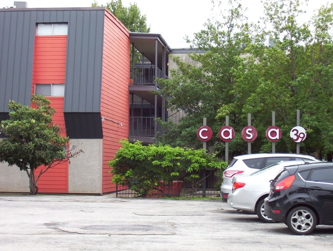
Property Record
301 W 39Th St, Austin, TX 78751


NEARBY LISTINGS FOR SALE OR LEASE
Property Detail
301 W 39Th St
Austin-Round Rock, TX
Hyde Park Addn No 2
214670
LOT 7-10 BLK 13 HYDE PARK ADDN NO 2
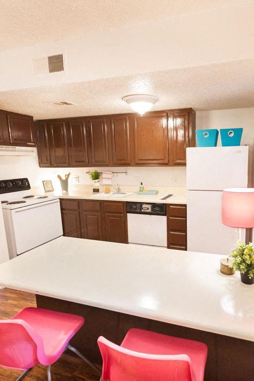
Multifamilydwelling
Travis
X
Texas
48453C0465K
7-10
2024
0.44 AC
2025
Hyde Park
000302
Austin
11,640 SF
DEMOGRAPHICS near 301 W 39Th St
1 Mile
3 Mile
5 Mile
2024 Total Population
26,382
179,215
392,630
2029 Population
28,533
195,681
428,425
Pop Growth 2024-2029
+ 8.15%
+ 9.19%
+ 9.12%
Average Age
32
35
36
2024 Total Households
12,716
82,925
177,640
HH Growth 2024-2029
+ 9.24%
+ 10.37%
+ 10.10%
Median Household Inc
$44,943
$81,298
$77,084
Avg Household Size
1.80
1.90
2.10
2024 Avg HH Vehicles
1.00
1.00
2.00
Median Home Value
$728,023
$743,363
$692,173
Median Year Built
1981
1992
1986
Nearby Places
Map Layers
Map Styles
 Street
 Aerial
- Restaurants
- Banks
- Shops
- Fitness
- Groceries
PUBLIC TRANSPORTATION
COMMUTER RAIL
DRIVE
WALK
Distance
10 min
3.8 mi
AIRPORT
Austin-Bergstrom International
DRIVE
WALK
Distance
Austin-Bergstrom International
26 min
12.9 mi
SALE & LEASE HISTORY
LISTING DATE
SALE/LEASE

Oct 29, 2018
For Sale
Jan 07, 2019
For Sale
Jan 07, 2019
For Sale
Nearby Properties
Address
Land Use
TOTAL SIZE
Lot Size
Zoning
Address
Land Use
TOTAL SIZE
Lot Size
Zoning
1,008,789 SF
17.50 AC
Address
Land Use
TOTAL SIZE
Lot Size
Zoning
20,550 SF
14.15 AC
Address
Land Use
TOTAL SIZE
Lot Size
Zoning
262 SF
65.06 AC
Address
Land Use
TOTAL SIZE
Lot Size
Zoning
29,594 SF
155.62 AC
Address
Land Use
TOTAL SIZE
Lot Size
Zoning
28.39 AC
Address
Land Use
TOTAL SIZE
Lot Size
Zoning
Address
Land Use
TOTAL SIZE
Lot Size
Zoning
28.62 AC
Address
Land Use
TOTAL SIZE
Lot Size
Zoning
1,156,135 SF
1.74 AC
Address
Land Use
TOTAL SIZE
Lot Size
Zoning
1,003,475 SF
1.84 AC
Address
Land Use
TOTAL SIZE
Lot Size
Zoning
27.17 AC
Address
Land Use
TOTAL SIZE
Lot Size
Zoning
136,900 SF
19.32 AC
Address
Land Use
TOTAL SIZE
Lot Size
Zoning
786,600 SF
1.27 AC
Address
Land Use
TOTAL SIZE
Lot Size
Zoning
24.50 AC
Address
Land Use
TOTAL SIZE
Lot Size
Zoning
9,034 SF
28.69 AC
Address
Land Use
TOTAL SIZE
Lot Size
Zoning
30.96 AC
Address
Land Use
TOTAL SIZE
Lot Size
Zoning
709,300 SF
0.94 AC
Address
Land Use
TOTAL SIZE
Lot Size
Zoning
18.52 AC
Address
Land Use
TOTAL SIZE
Lot Size
Zoning
74.69 AC
Address
Land Use
TOTAL SIZE
Lot Size
Zoning
1,400,000 SF
3.07 AC
Address
Land Use
TOTAL SIZE
Lot Size
Zoning
789,220 SF
14.34 AC
Address
Land Use
TOTAL SIZE
Lot Size
Zoning
548,399 SF
23.82 AC
Address
Land Use
TOTAL SIZE
Lot Size
Zoning
35,041 SF
28.65 AC
Address
Land Use
TOTAL SIZE
Lot Size
Zoning
623,000 SF
11.78 AC
Address
Land Use
TOTAL SIZE
Lot Size
Zoning
21 AC
Address
Land Use
TOTAL SIZE
Lot Size
Zoning
614,532 SF
66.07 AC
Address
Land Use
TOTAL SIZE
Lot Size
Zoning
513,567 SF
1.78 AC
Address
Land Use
TOTAL SIZE
Lot Size
Zoning
500,511 SF
0.82 AC
Address
Land Use
TOTAL SIZE
Lot Size
Zoning
609,613 SF
1.31 AC
Address
Land Use
TOTAL SIZE
Lot Size
Zoning
24.06 AC
The World's #1 Commercial Real Estate Marketplace
Connect with us
© 2025 CoStar Group
The information above has been obtained from sources believed reliable. While we do not doubt its accuracy we have not verified it and make no guarantee, warranty or representation about it. It is your responsibility to independently confirm its accuracy and completeness. Any projections, opinions, assumptions, or estimates used are for example only and do not represent the current or future performance of the property. The value of this transaction to you depends on tax and other factors which should be evaluated by your tax, financial, and legal advisors. You and your advisors should conduct a careful, independent investigation of the property to determine to your satisfaction the suitability of the property for your needs.