Property Record
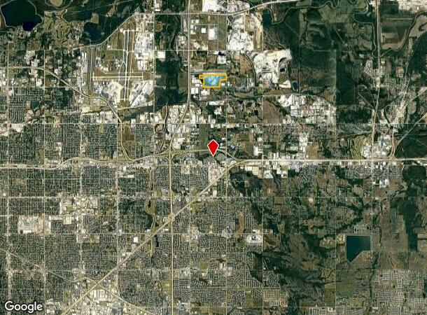
3010 N David Patrick Ave, Tulsa, OK 74116


NEARBY LISTINGS FOR SALE OR LEASE
Property Detail
3010 N David Patrick Ave
Tulsa, OK
Raceway Addn
33950-04-20-02855
PRT LT 1 BLK 1 RACEWAY ADDN & PART S/2 SEC 20 DESC AS BEG 1035W SECR SE TH W2344.12 N460.76 NW55.51 E125.63 N820.44 W626.97 N398.06 E17.35 NE3856.50 S500.60 E50 S220.16 W895.66 SW374.85 S84.70 W35 S657.50 POB LESS S50 & E50 THEREOF FOR RD & BEG 1035W
Lightindustrial
Tulsa
AE
Oklahoma
40143C0254L
1
2023
122.30 AC
2024
Northeast Tulsa
005900
Tulsa
674,500 SF
DEMOGRAPHICS near 3010 N David Patrick Ave
1 Mile
3 Mile
5 Mile
2024 Total Population
5
10,270
70,872
2029 Population
6
10,751
73,483
Pop Growth 2024-2029
+ 20.00%
+ 4.68%
+ 3.68%
Average Age
12
35
36
2024 Total Households
2
3,631
26,112
HH Growth 2024-2029
0.00%
+ 4.79%
+ 3.75%
Median Household Inc
$5,000
$46,066
$43,754
Avg Household Size
1.00
2.70
2.60
2024 Avg HH Vehicles
1.00
2.00
2.00
Median Home Value
$0
$82,195
$97,051
Median Year Built
0
1965
1968
Nearby Places
- Restaurants
- Banks
- Shops
- Fitness
- Groceries
PUBLIC TRANSPORTATION
AIRPORT
Tulsa International
DRIVE
WALK
Distance
Tulsa International
14 min
8.3 mi
Freight Ports
Tulsa Port Of Catoosa
DRIVE
WALK
Distance
Tulsa Port Of Catoosa
17 min
10.8 mi
Nearby Properties
Address
Land Use
TOTAL SIZE
Lot Size
Zoning
Address
Land Use
TOTAL SIZE
Lot Size
Zoning
349,823 SF
203.39 AC
IL
Address
Land Use
TOTAL SIZE
Lot Size
Zoning
2,689,602 SF
81.80 AC
IH
Address
Land Use
TOTAL SIZE
Lot Size
Zoning
228.59 AC
IL
Address
Land Use
TOTAL SIZE
Lot Size
Zoning
112,556 SF
11.07 AC
CH
Address
Land Use
TOTAL SIZE
Lot Size
Zoning
103,248 SF
8.87 AC
IL
Address
Land Use
TOTAL SIZE
Lot Size
Zoning
124,648 SF
21.23 AC
IL
Address
Land Use
TOTAL SIZE
Lot Size
Zoning
106,270 SF
9.47 AC
RM0
Address
Land Use
TOTAL SIZE
Lot Size
Zoning
101,090 SF
1.70 AC
RS2
Address
Land Use
TOTAL SIZE
Lot Size
Zoning
32,370 SF
45.90 AC
AG
Address
Land Use
TOTAL SIZE
Lot Size
Zoning
55,425 SF
2.96 AC
IL
Address
Land Use
TOTAL SIZE
Lot Size
Zoning
28,465 SF
6.71 AC
RS3
Address
Land Use
TOTAL SIZE
Lot Size
Zoning
24,113 SF
3.54 AC
CS
Address
Land Use
TOTAL SIZE
Lot Size
Zoning
56,531 SF
7.79 AC
RS3
Address
Land Use
TOTAL SIZE
Lot Size
Zoning
49,953 SF
2.36 AC
OL
Address
Land Use
TOTAL SIZE
Lot Size
Zoning
498,836 SF
50.22 AC
CS
Address
Land Use
TOTAL SIZE
Lot Size
Zoning
30,291 SF
4.49 AC
AG
Address
Land Use
TOTAL SIZE
Lot Size
Zoning
18,325 SF
3.05 AC
CS
Address
Land Use
TOTAL SIZE
Lot Size
Zoning
35,000 SF
14.10 AC
RS3
Address
Land Use
TOTAL SIZE
Lot Size
Zoning
673,050 SF
52.77 AC
IM
Address
Land Use
TOTAL SIZE
Lot Size
Zoning
609,418 SF
49.83 AC
IM
Address
Land Use
TOTAL SIZE
Lot Size
Zoning
40,626 SF
2.25 AC
CS
Address
Land Use
TOTAL SIZE
Lot Size
Zoning
22,825 SF
2.38 AC
CS
Address
Land Use
TOTAL SIZE
Lot Size
Zoning
129,087 SF
43.40 AC
IR
Address
Land Use
TOTAL SIZE
Lot Size
Zoning
371,153 SF
22.82 AC
IL
Address
Land Use
TOTAL SIZE
Lot Size
Zoning
40,202 SF
2.93 AC
RM0
Address
Land Use
TOTAL SIZE
Lot Size
Zoning
22,285 SF
2.83 AC
OL
The World's #1 Commercial Real Estate Marketplace
Connect with us
© 2025 CoStar Group
The information above has been obtained from sources believed reliable. While we do not doubt its accuracy we have not verified it and make no guarantee, warranty or representation about it. It is your responsibility to independently confirm its accuracy and completeness. Any projections, opinions, assumptions, or estimates used are for example only and do not represent the current or future performance of the property. The value of this transaction to you depends on tax and other factors which should be evaluated by your tax, financial, and legal advisors. You and your advisors should conduct a careful, independent investigation of the property to determine to your satisfaction the suitability of the property for your needs.