Property Record
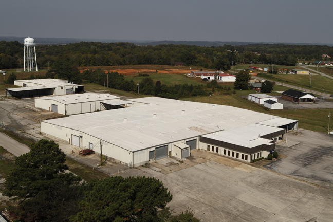
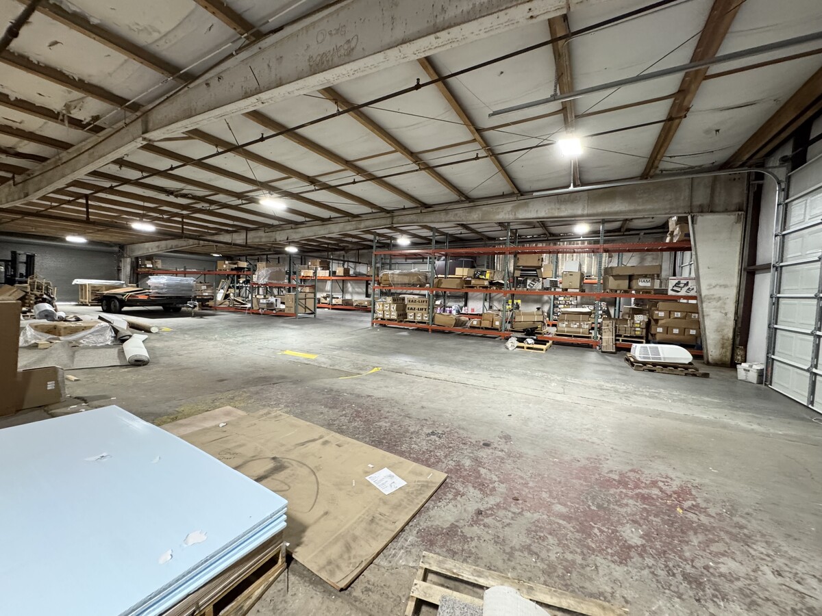
30225 Bankston Rd, Ardmore, TN 38449
This Property Is For Sale
NEARBY LISTINGS FOR SALE OR LEASE
-
-
View all Ardmore listings for sale on LoopNet.com
Property Detail
30225 Bankston Rd
Manufacturinglight
DISTRICT: 01, COUNTY AREA: R01
X
Giles
01083C0080F
Tennessee
0
8.50 AC
2024
Tennessee Central Area
920800
Other Market Areas
73,788 SF
181-034.01
DEMOGRAPHICS near 30225 Bankston Rd
1 Mile
3 Mile
5 Mile
2024 Total Population
644
5,334
9,835
2029 Population
692
6,031
11,095
Pop Growth 2024-2029
+ 7.45%
+ 13.07%
+ 12.81%
Average Age
44
43
43
2024 Total Households
275
2,217
4,019
HH Growth 2024-2029
+ 7.64%
+ 13.31%
+ 13.06%
Median Household Inc
$52,045
$54,908
$56,442
Avg Household Size
2.30
2.40
2.40
2024 Avg HH Vehicles
2.00
2.00
2.00
Median Home Value
$167,272
$195,076
$195,325
Median Year Built
1987
1988
1990
Nearby Places
- Restaurants
- Banks
- Shops
- Fitness
- Groceries
PUBLIC TRANSPORTATION
AIRPORT
Huntsville International-Carl T Jones Field
DRIVE
WALK
Distance
Huntsville International-Carl T Jones Field
49 min
40.7 mi
Freight Ports
Port of Mobile
DRIVE
WALK
Distance
Port of Mobile
398 min
365.5 mi
Nearby Properties
Address
Land Use
TOTAL SIZE
Lot Size
Zoning
Address
Land Use
TOTAL SIZE
Lot Size
Zoning
33,194 SF
9.19 AC
Address
Land Use
TOTAL SIZE
Lot Size
Zoning
5.30 AC
Address
Land Use
TOTAL SIZE
Lot Size
Zoning
75.76 AC
Address
Land Use
TOTAL SIZE
Lot Size
Zoning
21.62 AC
Address
Land Use
TOTAL SIZE
Lot Size
Zoning
24,973 SF
3.80 AC
Address
Land Use
TOTAL SIZE
Lot Size
Zoning
42,890 SF
9.80 AC
Address
Land Use
TOTAL SIZE
Lot Size
Zoning
34,662 SF
4.87 AC
Address
Land Use
TOTAL SIZE
Lot Size
Zoning
36,000 SF
5.70 AC
Address
Land Use
TOTAL SIZE
Lot Size
Zoning
1,420 SF
5.69 AC
Address
Land Use
TOTAL SIZE
Lot Size
Zoning
13,912 SF
1.40 AC
Address
Land Use
TOTAL SIZE
Lot Size
Zoning
44,365 SF
8.50 AC
Address
Land Use
TOTAL SIZE
Lot Size
Zoning
7,904 SF
3.09 AC
Address
Land Use
TOTAL SIZE
Lot Size
Zoning
9,779 SF
0.21 AC
Address
Land Use
TOTAL SIZE
Lot Size
Zoning
7,320 SF
3.14 AC
Address
Land Use
TOTAL SIZE
Lot Size
Zoning
56,315 SF
5.20 AC
Address
Land Use
TOTAL SIZE
Lot Size
Zoning
4,022 SF
3.30 AC
Address
Land Use
TOTAL SIZE
Lot Size
Zoning
17,388 SF
1.80 AC
Address
Land Use
TOTAL SIZE
Lot Size
Zoning
18,240 SF
8.50 AC
Address
Land Use
TOTAL SIZE
Lot Size
Zoning
5,412 SF
1.99 AC
Address
Land Use
TOTAL SIZE
Lot Size
Zoning
39,400 SF
9.30 AC
Address
Land Use
TOTAL SIZE
Lot Size
Zoning
10,222 SF
2.50 AC
Address
Land Use
TOTAL SIZE
Lot Size
Zoning
5,477 SF
0.77 AC
Address
Land Use
TOTAL SIZE
Lot Size
Zoning
5,260 SF
2.25 AC
Address
Land Use
TOTAL SIZE
Lot Size
Zoning
22,500 SF
2.78 AC
Address
Land Use
TOTAL SIZE
Lot Size
Zoning
14,000 SF
4 AC
Address
Land Use
TOTAL SIZE
Lot Size
Zoning
38.70 AC
Address
Land Use
TOTAL SIZE
Lot Size
Zoning
6,550 SF
2 AC
Address
Land Use
TOTAL SIZE
Lot Size
Zoning
30,000 SF
5.79 AC
Address
Land Use
TOTAL SIZE
Lot Size
Zoning
8,784 SF
1.06 AC
The World's #1 Commercial Real Estate Marketplace
Connect with us
© 2025 CoStar Group
The information above has been obtained from sources believed reliable. While we do not doubt its accuracy we have not verified it and make no guarantee, warranty or representation about it. It is your responsibility to independently confirm its accuracy and completeness. Any projections, opinions, assumptions, or estimates used are for example only and do not represent the current or future performance of the property. The value of this transaction to you depends on tax and other factors which should be evaluated by your tax, financial, and legal advisors. You and your advisors should conduct a careful, independent investigation of the property to determine to your satisfaction the suitability of the property for your needs.