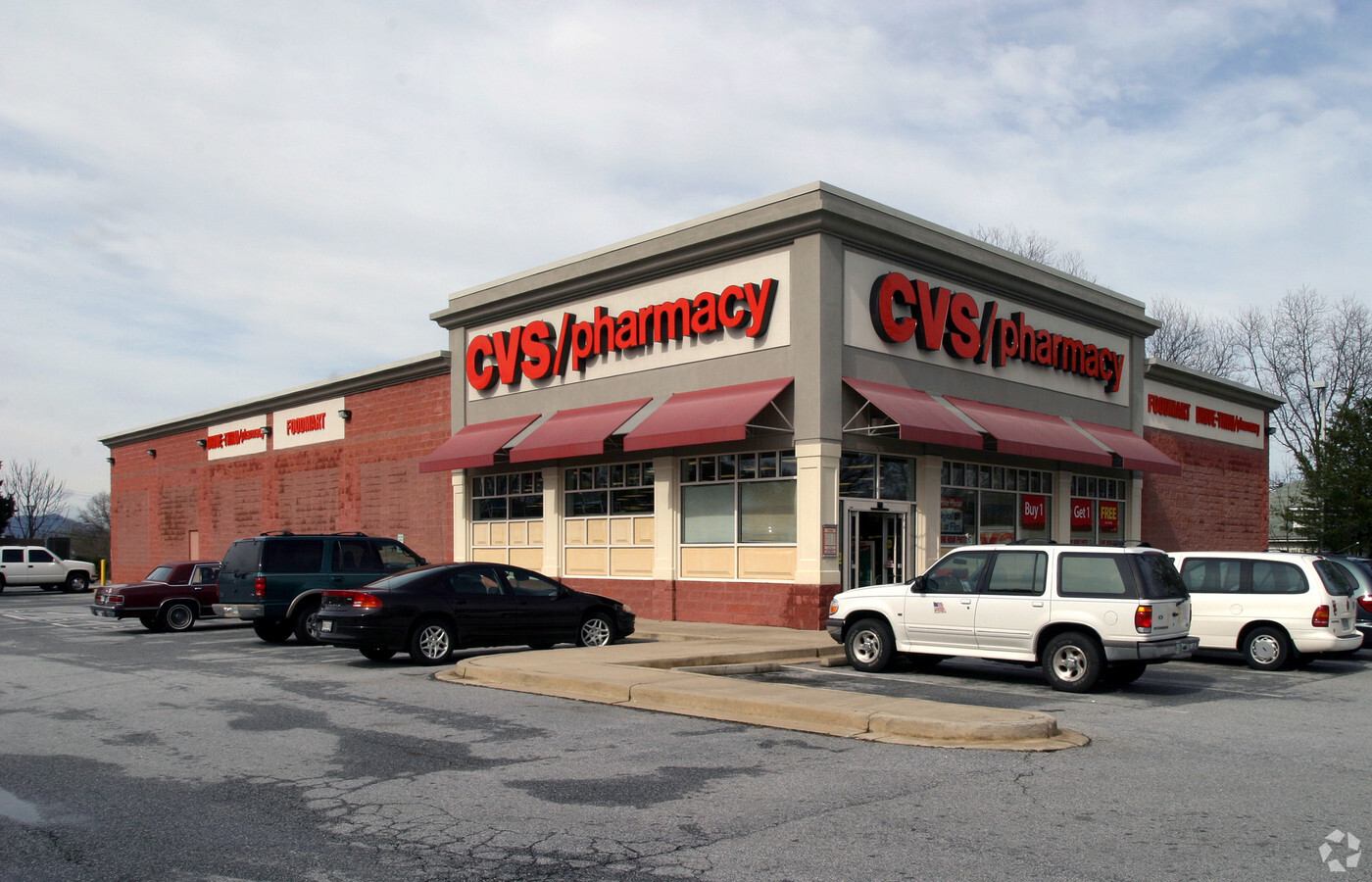
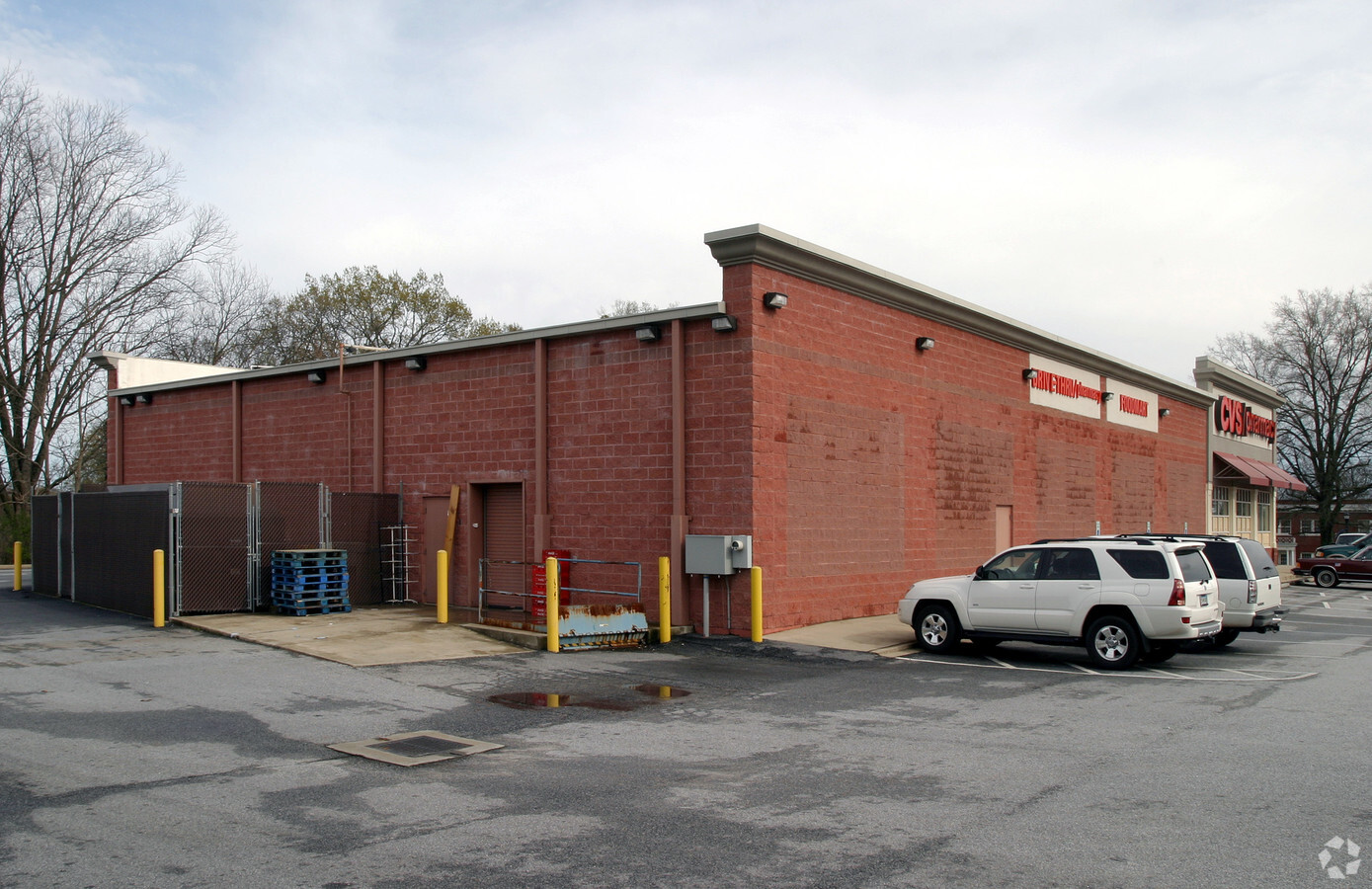
Property Record
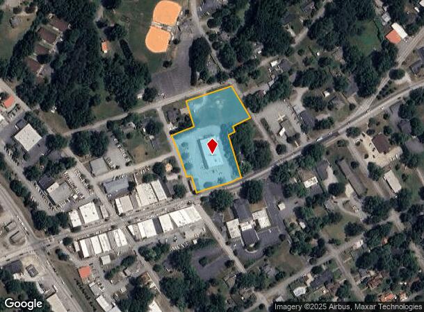
303 E Rutherford St, Landrum, SC 29356
NEARBY LISTINGS FOR SALE OR LEASE
-
-
View all Landrum listings for sale on LoopNet.com
Property Detail
303 E Rutherford St
1-08-01-070.00
N SIDE E RUTHERFORD ST & E OF CH PB 128-603 & 141-857 DB 62N-855 LEASE IN FILE
Storebuilding
Spartanburg
X
South Carolina
45083C0016D
2.41 AC
2024
Upper Spartanburg Cty
2023
Greenville/Spartanburg
022600
Spartanburg, SC
10,336 SF
DEMOGRAPHICS near 303 E Rutherford St
1 Mile
3 Mile
5 Mile
2024 Total Population
2,578
6,245
15,661
2029 Population
2,929
7,080
17,499
Pop Growth 2024-2029
+ 13.62%
+ 13.37%
+ 11.74%
Average Age
44
46
48
2024 Total Households
1,140
2,702
6,875
HH Growth 2024-2029
+ 13.86%
+ 13.51%
+ 11.77%
Median Household Inc
$48,402
$54,337
$54,632
Avg Household Size
2.30
2.30
2.20
2024 Avg HH Vehicles
2.00
2.00
2.00
Median Home Value
$197,048
$247,216
$265,930
Median Year Built
1974
1979
1982
Nearby Places
- Restaurants
- Banks
- Shops
- Fitness
- Groceries
PUBLIC TRANSPORTATION
AIRPORT
Greenville Spartanburg International
DRIVE
WALK
Distance
Greenville Spartanburg International
43 min
24.0 mi
Asheville Regional
DRIVE
WALK
Distance
Asheville Regional
44 min
34.0 mi
Freight Ports
North Charleston Terminal
DRIVE
WALK
Distance
North Charleston Terminal
240 min
214.5 mi
Nearby Properties
Address
Land Use
TOTAL SIZE
Lot Size
Zoning
Address
Land Use
TOTAL SIZE
Lot Size
Zoning
1,972.90 AC
UNZONED
Address
Land Use
TOTAL SIZE
Lot Size
Zoning
166.74 AC
RE5
Address
Land Use
TOTAL SIZE
Lot Size
Zoning
7,703 SF
190.87 AC
RE5
Address
Land Use
TOTAL SIZE
Lot Size
Zoning
289.30 AC
UNZONED
Address
Land Use
TOTAL SIZE
Lot Size
Zoning
304.75 AC
UNZONED
Address
Land Use
TOTAL SIZE
Lot Size
Zoning
2,812 SF
3.26 AC
RE5
Address
Land Use
TOTAL SIZE
Lot Size
Zoning
207.70 AC
UNZONED
Address
Land Use
TOTAL SIZE
Lot Size
Zoning
2,290 SF
23.19 AC
RE5
Address
Land Use
TOTAL SIZE
Lot Size
Zoning
21.61 AC
RE5
Address
Land Use
TOTAL SIZE
Lot Size
Zoning
2,386 SF
5.05 AC
M
Address
Land Use
TOTAL SIZE
Lot Size
Zoning
138.90 AC
UNZONED
Address
Land Use
TOTAL SIZE
Lot Size
Zoning
26,780 SF
5.28 AC
M
Address
Land Use
TOTAL SIZE
Lot Size
Zoning
93.70 AC
UNZONED
Address
Land Use
TOTAL SIZE
Lot Size
Zoning
1,584 SF
8.79 AC
RE5
Address
Land Use
TOTAL SIZE
Lot Size
Zoning
22.88 AC
RE5
Address
Land Use
TOTAL SIZE
Lot Size
Zoning
38.03 AC
RE5
Address
Land Use
TOTAL SIZE
Lot Size
Zoning
8.57 AC
RE5
Address
Land Use
TOTAL SIZE
Lot Size
Zoning
5.24 AC
RE5
Address
Land Use
TOTAL SIZE
Lot Size
Zoning
19.25 AC
RE5
Address
Land Use
TOTAL SIZE
Lot Size
Zoning
68,899 SF
16.01 AC
M
Address
Land Use
TOTAL SIZE
Lot Size
Zoning
1,953 SF
7.48 AC
RE5
Address
Land Use
TOTAL SIZE
Lot Size
Zoning
2,624 SF
2 AC
RE5
Address
Land Use
TOTAL SIZE
Lot Size
Zoning
48.33 AC
RE5
Address
Land Use
TOTAL SIZE
Lot Size
Zoning
8.07 AC
RE5
Address
Land Use
TOTAL SIZE
Lot Size
Zoning
40.65 AC
RE5
Address
Land Use
TOTAL SIZE
Lot Size
Zoning
64.50 AC
UNZONED
Address
Land Use
TOTAL SIZE
Lot Size
Zoning
20.30 AC
M
Address
Land Use
TOTAL SIZE
Lot Size
Zoning
8.74 AC
RE5
Address
Land Use
TOTAL SIZE
Lot Size
Zoning
84.10 AC
UNZONED
Address
Land Use
TOTAL SIZE
Lot Size
Zoning
1,065 SF
32.46 AC
RE5
The World's #1 Commercial Real Estate Marketplace
Connect with us
© 2025 CoStar Group
The information above has been obtained from sources believed reliable. While we do not doubt its accuracy we have not verified it and make no guarantee, warranty or representation about it. It is your responsibility to independently confirm its accuracy and completeness. Any projections, opinions, assumptions, or estimates used are for example only and do not represent the current or future performance of the property. The value of this transaction to you depends on tax and other factors which should be evaluated by your tax, financial, and legal advisors. You and your advisors should conduct a careful, independent investigation of the property to determine to your satisfaction the suitability of the property for your needs.