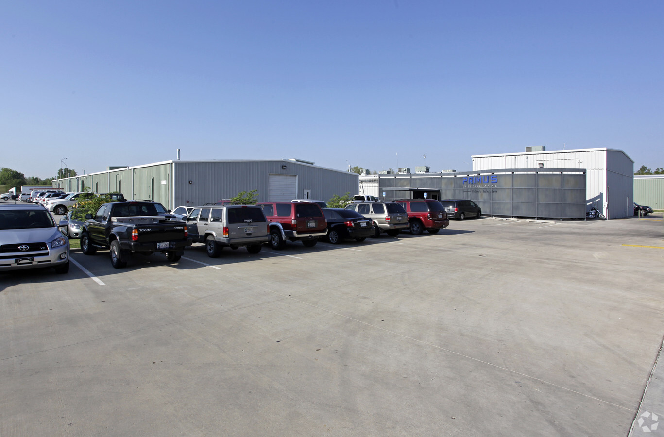
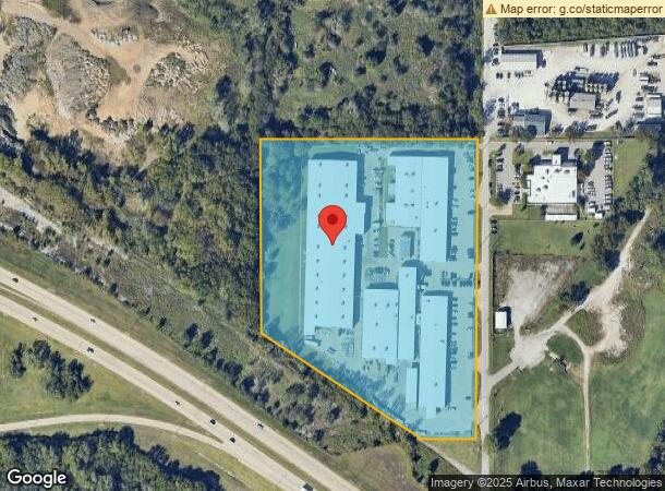
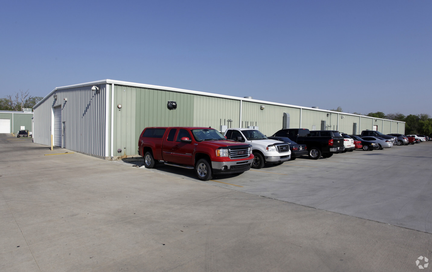
Property Record
3030 N Erie Ave, Tulsa, OK 74115
NEARBY LISTINGS FOR SALE OR LEASE
Property Detail
3030 N Erie Ave
Tulsa, OK
Wmi Addn Rsb L1 B1 Erie Ind Pk & Prt L1
47731-03-22-00460
LT 1 BLK 1
Lightindustrial
Tulsa
X
Oklahoma
40143C0233L
1
2023
10.79 AC
2024
Northeast Tulsa
011300
Tulsa
162,390 SF
DEMOGRAPHICS near 3030 N Erie Ave
1 Mile
3 Mile
5 Mile
2024 Total Population
2,368
41,524
127,019
2029 Population
2,463
43,335
132,936
Pop Growth 2024-2029
+ 4.01%
+ 4.36%
+ 4.66%
Average Age
35
34
37
2024 Total Households
825
14,586
49,551
HH Growth 2024-2029
+ 4.12%
+ 4.42%
+ 4.81%
Median Household Inc
$32,045
$35,558
$41,270
Avg Household Size
2.80
2.70
2.40
2024 Avg HH Vehicles
2.00
2.00
2.00
Median Home Value
$60,230
$65,990
$96,131
Median Year Built
1957
1955
1956
Nearby Places
- Restaurants
- Banks
- Shops
- Fitness
- Groceries
PUBLIC TRANSPORTATION
AIRPORT
Tulsa International
DRIVE
WALK
Distance
Tulsa International
8 min
3.7 mi
Freight Ports
Tulsa Port Of Catoosa
DRIVE
WALK
Distance
Tulsa Port Of Catoosa
19 min
11.9 mi
Nearby Properties
Address
Land Use
TOTAL SIZE
Lot Size
Zoning
Address
Land Use
TOTAL SIZE
Lot Size
Zoning
353.75 AC
IL
Address
Land Use
TOTAL SIZE
Lot Size
Zoning
94,115 SF
15.18 AC
IM
Address
Land Use
TOTAL SIZE
Lot Size
Zoning
1 SF
207.77 AC
IM
Address
Land Use
TOTAL SIZE
Lot Size
Zoning
246.16 AC
IM
Address
Land Use
TOTAL SIZE
Lot Size
Zoning
195,492 SF
17.11 AC
RM1
Address
Land Use
TOTAL SIZE
Lot Size
Zoning
228.59 AC
IL
Address
Land Use
TOTAL SIZE
Lot Size
Zoning
42,665 SF
493.63 AC
RS3
Address
Land Use
TOTAL SIZE
Lot Size
Zoning
110.77 AC
IL
Address
Land Use
TOTAL SIZE
Lot Size
Zoning
121,518 SF
8.52 AC
IM
Address
Land Use
TOTAL SIZE
Lot Size
Zoning
36,962 SF
1.23 AC
CH
Address
Land Use
TOTAL SIZE
Lot Size
Zoning
103,248 SF
8.87 AC
IL
Address
Land Use
TOTAL SIZE
Lot Size
Zoning
29,584 SF
2.99 AC
IM
Address
Land Use
TOTAL SIZE
Lot Size
Zoning
97.68 AC
CH
Address
Land Use
TOTAL SIZE
Lot Size
Zoning
41,874 SF
35.70 AC
RS3
Address
Land Use
TOTAL SIZE
Lot Size
Zoning
92,364 SF
8.58 AC
RM1
Address
Land Use
TOTAL SIZE
Lot Size
Zoning
34,356 SF
35.67 AC
RS3
Address
Land Use
TOTAL SIZE
Lot Size
Zoning
185,649 SF
56.23 AC
IL
Address
Land Use
TOTAL SIZE
Lot Size
Zoning
41,728 SF
10.06 AC
RS3
Address
Land Use
TOTAL SIZE
Lot Size
Zoning
513.99 AC
RS3
Address
Land Use
TOTAL SIZE
Lot Size
Zoning
36,450 SF
30.52 AC
RS3
Address
Land Use
TOTAL SIZE
Lot Size
Zoning
44,195 SF
5.07 AC
RS3
Address
Land Use
TOTAL SIZE
Lot Size
Zoning
51,485 SF
8.71 AC
IM
Address
Land Use
TOTAL SIZE
Lot Size
Zoning
43,225 SF
9.30 AC
RS3
Address
Land Use
TOTAL SIZE
Lot Size
Zoning
63,675 SF
3.26 AC
CH
Address
Land Use
TOTAL SIZE
Lot Size
Zoning
147,683 SF
9.18 AC
IL
Address
Land Use
TOTAL SIZE
Lot Size
Zoning
53.24 AC
IM
Address
Land Use
TOTAL SIZE
Lot Size
Zoning
36,425 SF
5.90 AC
RS3
Address
Land Use
TOTAL SIZE
Lot Size
Zoning
8,914 SF
39.35 AC
RS3
The World's #1 Commercial Real Estate Marketplace
Connect with us
© 2025 CoStar Group
The information above has been obtained from sources believed reliable. While we do not doubt its accuracy we have not verified it and make no guarantee, warranty or representation about it. It is your responsibility to independently confirm its accuracy and completeness. Any projections, opinions, assumptions, or estimates used are for example only and do not represent the current or future performance of the property. The value of this transaction to you depends on tax and other factors which should be evaluated by your tax, financial, and legal advisors. You and your advisors should conduct a careful, independent investigation of the property to determine to your satisfaction the suitability of the property for your needs.