Property Record
3030 N Rock Rd, Wichita, KS 67226
NEARBY LISTINGS FOR SALE OR LEASE
Property Detail
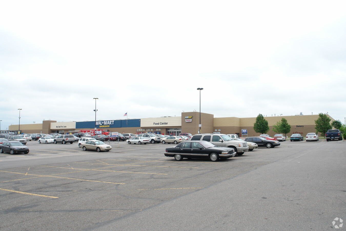
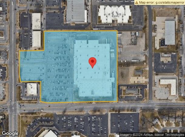
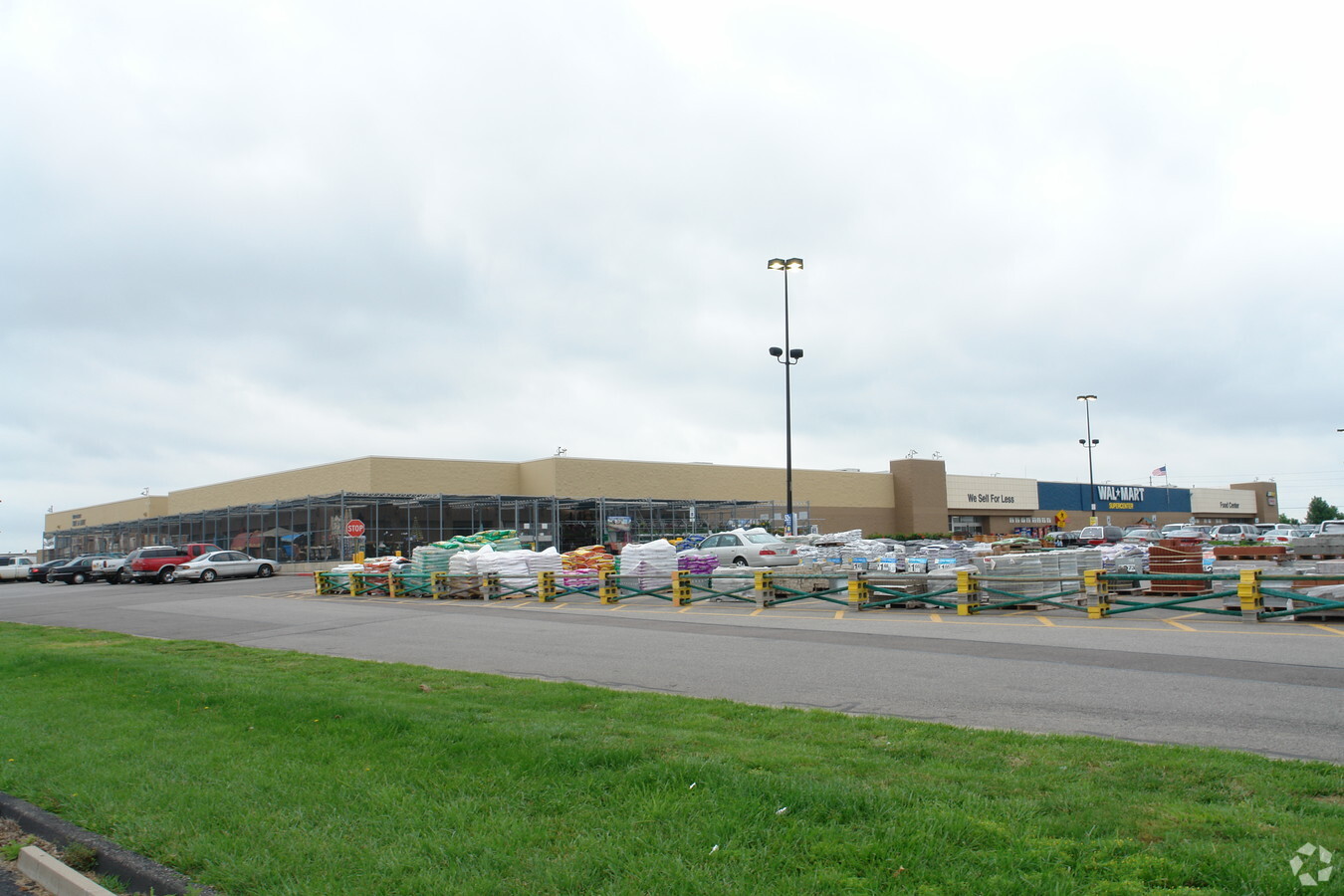
3030 N Rock Rd
Wichita, KS
Mediterranean Plaza Commercial Second Ad
109-32-0-33-01-006.00
LOT 7 BLOCK 1 MEDITERRANEAN PLAZA COMMERCIAL SECOND ADD.
Departmentstore
Sedgwick
X
Kansas
20173C0376G
7
2023
14.42 AC
2023
Northeast
010801
Wichita
204,213 SF
DEMOGRAPHICS near 3030 N Rock Rd
1 Mile
3 Mile
5 Mile
2024 Total Population
8,304
48,960
119,127
2029 Population
8,429
49,540
121,515
Pop Growth 2024-2029
+ 1.51%
+ 1.18%
+ 2.00%
Average Age
40
40
38
2024 Total Households
3,831
20,399
48,069
HH Growth 2024-2029
+ 1.51%
+ 1.07%
+ 1.91%
Median Household Inc
$59,788
$72,067
$64,278
Avg Household Size
2.10
2.30
2.40
2024 Avg HH Vehicles
2.00
2.00
2.00
Median Home Value
$211,712
$229,566
$201,838
Median Year Built
1988
1987
1977
Nearby Places
- Restaurants
- Banks
- Shops
- Fitness
- Groceries
PUBLIC TRANSPORTATION
AIRPORT
Wichita Dwight D Eisenhower Ntl
Drive
Walk
Distance
Wichita Dwight D Eisenhower Ntl
26 min
15.7 mi
Freight Ports
Tulsa Port Of Catoosa
Drive
Walk
Distance
Tulsa Port Of Catoosa
213 min
198.5 mi
Nearby Properties
Address
Land Use
TOTAL SIZE
Lot Size
Zoning
Address
Land Use
TOTAL SIZE
Lot Size
Zoning
340322
32.82 AC
SF-5,B
Address
Land Use
TOTAL SIZE
Lot Size
Zoning
243108
5.42 AC
LI
Address
Land Use
TOTAL SIZE
Lot Size
Zoning
338272
332.54 AC
LI
Address
Land Use
TOTAL SIZE
Lot Size
Zoning
104331
SF-5
Address
Land Use
TOTAL SIZE
Lot Size
Zoning
103261
5.49 AC
B
Address
Land Use
TOTAL SIZE
Lot Size
Zoning
138233
23 AC
SF-5
Address
Land Use
TOTAL SIZE
Lot Size
Zoning
186902
5.24 AC
SF-5
Address
Land Use
TOTAL SIZE
Lot Size
Zoning
169134
18.97 AC
SF-5
Address
Land Use
TOTAL SIZE
Lot Size
Zoning
199468
24.45 AC
SF-5
Address
Land Use
TOTAL SIZE
Lot Size
Zoning
79739
10.11 AC
R6
Address
Land Use
TOTAL SIZE
Lot Size
Zoning
134506
27.46 AC
SF-5
Address
Land Use
TOTAL SIZE
Lot Size
Zoning
102200
8.77 AC
R6
Address
Land Use
TOTAL SIZE
Lot Size
Zoning
88652
21.92 AC
SF-5
Address
Land Use
TOTAL SIZE
Lot Size
Zoning
146863
14.24 AC
SF-5
Address
Land Use
TOTAL SIZE
Lot Size
Zoning
74242
23.99 AC
GC
Address
Land Use
TOTAL SIZE
Lot Size
Zoning
67067
8.36 AC
SF-5
Address
Land Use
TOTAL SIZE
Lot Size
Zoning
99325
17.82 AC
SF-5
Address
Land Use
TOTAL SIZE
Lot Size
Zoning
41526
17.52 AC
LC
Address
Land Use
TOTAL SIZE
Lot Size
Zoning
121469
47.62 AC
LI
Address
Land Use
TOTAL SIZE
Lot Size
Zoning
40267
10.54 AC
R6
Address
Land Use
TOTAL SIZE
Lot Size
Zoning
116114
53.39 AC
SF-5
Address
Land Use
TOTAL SIZE
Lot Size
Zoning
60232
0.72 AC
SF-5
Address
Land Use
TOTAL SIZE
Lot Size
Zoning
154691
8.40 AC
SF-5
Address
Land Use
TOTAL SIZE
Lot Size
Zoning
81955
7.28 AC
R4
Address
Land Use
TOTAL SIZE
Lot Size
Zoning
56642
114.61 AC
SF-5
Address
Land Use
TOTAL SIZE
Lot Size
Zoning
70447
29.66 AC
SF-5,LC
Address
Land Use
TOTAL SIZE
Lot Size
Zoning
69383
9.53 AC
GO
Address
Land Use
TOTAL SIZE
Lot Size
Zoning
71556
19.67 AC
MF-18,MF-2
Address
Land Use
TOTAL SIZE
Lot Size
Zoning
54854
15 AC
LC
Address
Land Use
TOTAL SIZE
Lot Size
Zoning
70357
4.19 AC
SF-5
Start a new search to find other properties for sale or lease
Connect with us
© 2024 CoStar Group
The information above has been obtained from sources believed reliable. While we do not doubt its accuracy we have not verified it and make no guarantee, warranty or representation about it. It is your responsibility to independently confirm its accuracy and completeness. Any projections, opinions, assumptions, or estimates used are for example only and do not represent the current or future performance of the property. The value of this transaction to you depends on tax and other factors which should be evaluated by your tax, financial, and legal advisors. You and your advisors should conduct a careful, independent investigation of the property to determine to your satisfaction the suitability of the property for your needs.