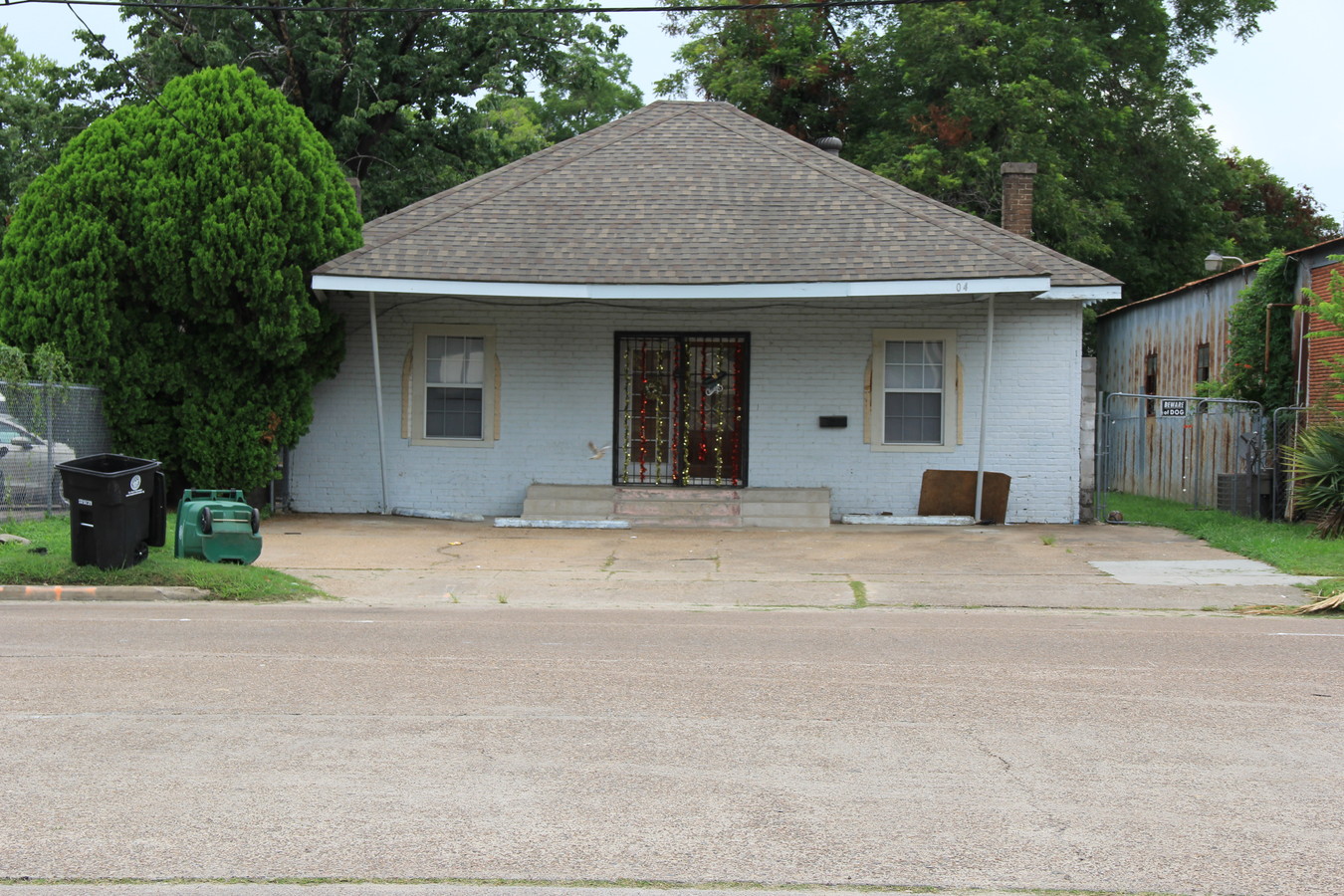
Property Record
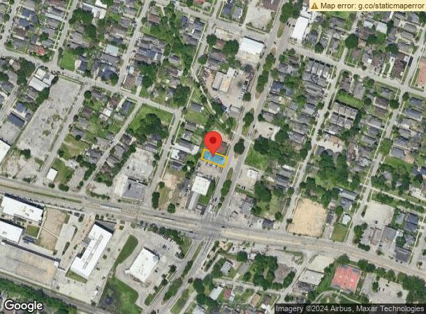
304 S Lockwood Dr, Houston, TX 77011

This Property Is For Sale
NEARBY LISTINGS FOR SALE OR LEASE
Property Detail
304 S Lockwood Dr
Houston-The Woodlands-Sugar Land, TX
Oak Lawn
0280100000007
Harris
Sfr
Texas
X
0.14 AC
48201C0880M
Inner Loop East End
1,885 SF
Houston
DEMOGRAPHICS near 304 S Lockwood Dr
1 Mile
3 Mile
5 Mile
2024 Total Population
17,223
157,258
407,119
2029 Population
17,882
163,110
422,353
Pop Growth 2024-2029
+ 3.83%
+ 3.72%
+ 3.74%
Average Age
40
36
37
2024 Total Households
7,101
58,476
166,386
HH Growth 2024-2029
+ 3.75%
+ 4.33%
+ 4.09%
Median Household Inc
$40,585
$48,570
$57,638
Avg Household Size
2.40
2.30
2.20
2024 Avg HH Vehicles
1.00
1.00
2.00
Median Home Value
$277,866
$242,091
$274,680
Median Year Built
1949
1966
1977
Nearby Places
- Restaurants
- Banks
- Shops
- Fitness
- Groceries
PUBLIC TRANSPORTATION
TRANSIT/SUBWAY
Lockwood / Eastwood Eb (METRORAIL GREEN LINE - Metropolitan Transit Authority of Harris County, METRORAIL PURPLE LINE - Metropolitan Transit Authority of Harris County)
Drive
Walk
Distance
Lockwood / Eastwood Eb (METRORAIL GREEN LINE - Metropolitan Transit Authority of Harris County, METRORAIL PURPLE LINE - Metropolitan Transit Authority of Harris County)
0 min
2 min
0.1 mi
Lockwood / Eastwood Wb (METRORAIL GREEN LINE - Metropolitan Transit Authority of Harris County, METRORAIL PURPLE LINE - Metropolitan Transit Authority of Harris County)
Drive
Walk
Distance
Lockwood / Eastwood Wb (METRORAIL GREEN LINE - Metropolitan Transit Authority of Harris County, METRORAIL PURPLE LINE - Metropolitan Transit Authority of Harris County)
0 min
2 min
0.1 mi
Altic / Howard Hughes Eb (METRORAIL GREEN LINE - Metropolitan Transit Authority of Harris County, METRORAIL PURPLE LINE - Metropolitan Transit Authority of Harris County)
Drive
Walk
Distance
Altic / Howard Hughes Eb (METRORAIL GREEN LINE - Metropolitan Transit Authority of Harris County, METRORAIL PURPLE LINE - Metropolitan Transit Authority of Harris County)
1 min
11 min
0.6 mi
Coffee Plant / 2Nd Ward Eb (METRORAIL GREEN LINE - Metropolitan Transit Authority of Harris County, METRORAIL PURPLE LINE - Metropolitan Transit Authority of Harris County)
Drive
Walk
Distance
Coffee Plant / 2Nd Ward Eb (METRORAIL GREEN LINE - Metropolitan Transit Authority of Harris County, METRORAIL PURPLE LINE - Metropolitan Transit Authority of Harris County)
2 min
15 min
0.8 mi
Harrisburg Blvd (METRORAIL PURPLE LINE - Metropolitan Transit Authority of Harris County)
Drive
Walk
Distance
Harrisburg Blvd (METRORAIL PURPLE LINE - Metropolitan Transit Authority of Harris County)
2 min
16 min
0.9 mi
COMMUTER RAIL
Houston (Sunset Limited - Amtrak)
Drive
Walk
Distance
Houston (Sunset Limited - Amtrak)
8 min
3.2 mi
AIRPORT
William P Hobby
Drive
Walk
Distance
William P Hobby
20 min
10.3 mi
George Bush Intcntl/Houston
Drive
Walk
Distance
George Bush Intcntl/Houston
29 min
20.5 mi
Freight Ports
Port of Houston
Drive
Walk
Distance
Port of Houston
15 min
6.7 mi
Nearby Properties
Address
Land Use
TOTAL SIZE
Lot Size
Zoning
Address
Land Use
TOTAL SIZE
Lot Size
Zoning
1101686
1.45 AC
Address
Land Use
TOTAL SIZE
Lot Size
Zoning
1383720
1.47 AC
Address
Land Use
TOTAL SIZE
Lot Size
Zoning
973861
1.18 AC
Address
Land Use
TOTAL SIZE
Lot Size
Zoning
1916394
1.46 AC
Address
Land Use
TOTAL SIZE
Lot Size
Zoning
1871418
1.44 AC
Address
Land Use
TOTAL SIZE
Lot Size
Zoning
899279
1.18 AC
Address
Land Use
TOTAL SIZE
Lot Size
Zoning
797208
1.46 AC
Address
Land Use
TOTAL SIZE
Lot Size
Zoning
1232364
1.49 AC
Address
Land Use
TOTAL SIZE
Lot Size
Zoning
1436400
1.44 AC
Address
Land Use
TOTAL SIZE
Lot Size
Zoning
1321033
1.46 AC
Address
Land Use
TOTAL SIZE
Lot Size
Zoning
2005097
1.44 AC
Address
Land Use
TOTAL SIZE
Lot Size
Zoning
1150681
1.17 AC
Address
Land Use
TOTAL SIZE
Lot Size
Zoning
1374271
1.44 AC
Address
Land Use
TOTAL SIZE
Lot Size
Zoning
1657484
1.44 AC
Address
Land Use
TOTAL SIZE
Lot Size
Zoning
1181384
1.47 AC
Address
Land Use
TOTAL SIZE
Lot Size
Zoning
1282908
2.74 AC
Address
Land Use
TOTAL SIZE
Lot Size
Zoning
1091726
2.60 AC
Address
Land Use
TOTAL SIZE
Lot Size
Zoning
515025
1.50 AC
Address
Land Use
TOTAL SIZE
Lot Size
Zoning
468513
0.86 AC
Address
Land Use
TOTAL SIZE
Lot Size
Zoning
1365801
1.44 AC
Address
Land Use
TOTAL SIZE
Lot Size
Zoning
1311133
1.44 AC
Address
Land Use
TOTAL SIZE
Lot Size
Zoning
1162204
1.44 AC
Address
Land Use
TOTAL SIZE
Lot Size
Zoning
1227182
4.43 AC
Address
Land Use
TOTAL SIZE
Lot Size
Zoning
1103424
1.44 AC
Address
Land Use
TOTAL SIZE
Lot Size
Zoning
1182525
1.11 AC
Address
Land Use
TOTAL SIZE
Lot Size
Zoning
934258
1.45 AC
Address
Land Use
TOTAL SIZE
Lot Size
Zoning
1017783
1.44 AC
Address
Land Use
TOTAL SIZE
Lot Size
Zoning
612078
1.44 AC
Address
Land Use
TOTAL SIZE
Lot Size
Zoning
1075210
2.26 AC
Address
Land Use
TOTAL SIZE
Lot Size
Zoning
930730
1.88 AC
Start a new search to find other properties for sale or lease
Connect with us
© 2024 CoStar Group
The information above has been obtained from sources believed reliable. While we do not doubt its accuracy we have not verified it and make no guarantee, warranty or representation about it. It is your responsibility to independently confirm its accuracy and completeness. Any projections, opinions, assumptions, or estimates used are for example only and do not represent the current or future performance of the property. The value of this transaction to you depends on tax and other factors which should be evaluated by your tax, financial, and legal advisors. You and your advisors should conduct a careful, independent investigation of the property to determine to your satisfaction the suitability of the property for your needs.