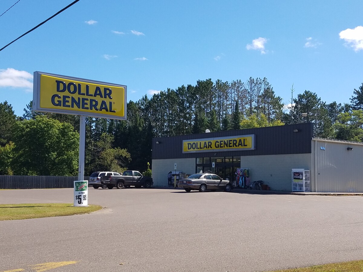
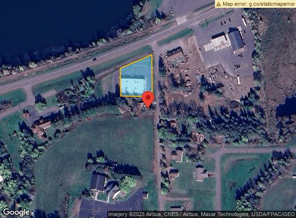
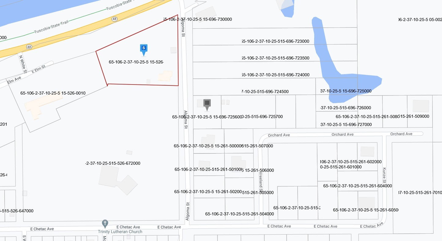
Property Record
305 N Algoma St, Birchwood, WI 54817
NEARBY LISTINGS FOR SALE OR LEASE
Property Detail
305 N Algoma St
65-106-2-37-10-25-5 15-526-730600
ORIGINAL PLAT (VB) PT BLOCK 30 & PT NW SE FORMER RR ROW L 1 CSM #4137 V 21 P 1 DOC# 401214 AMEND ESMT DOC# 404840 WD
Realpropertynec
Washburn
X
Wisconsin
55107C0025D
0.80 AC
2023
Wisconsin North Area
2023
Other Market Areas
950300
DEMOGRAPHICS near 305 N Algoma St
1 Mile
3 Mile
5 Mile
2024 Total Population
547
1,317
2,143
2029 Population
550
1,364
2,237
Pop Growth 2024-2029
+ 0.55%
+ 3.57%
+ 4.39%
Average Age
46
50
51
2024 Total Households
251
618
1,000
HH Growth 2024-2029
+ 0.80%
+ 3.56%
+ 4.40%
Median Household Inc
$63,871
$67,899
$68,687
Avg Household Size
2.20
2.10
2.10
2024 Avg HH Vehicles
2.00
2.00
2.00
Median Home Value
$190,565
$240,086
$247,449
Median Year Built
1970
1982
1985
Nearby Places
- Restaurants
- Banks
- Shops
- Fitness
- Groceries
SALE & LEASE HISTORY
LISTING DATE
SALE/LEASE

Jun 14, 2022
For Sale
Nearby Properties
Address
Land Use
TOTAL SIZE
Lot Size
Zoning
Address
Land Use
TOTAL SIZE
Lot Size
Zoning
14.87 AC
Address
Land Use
TOTAL SIZE
Lot Size
Zoning
4.12 AC
Address
Land Use
TOTAL SIZE
Lot Size
Zoning
3.46 AC
Z06
Address
Land Use
TOTAL SIZE
Lot Size
Zoning
1.10 AC
Z07
Address
Land Use
TOTAL SIZE
Lot Size
Zoning
0.63 AC
Address
Land Use
TOTAL SIZE
Lot Size
Zoning
1.96 AC
Address
Land Use
TOTAL SIZE
Lot Size
Zoning
1.73 AC
Address
Land Use
TOTAL SIZE
Lot Size
Zoning
2.18 AC
Address
Land Use
TOTAL SIZE
Lot Size
Zoning
2.98 AC
Z06
Address
Land Use
TOTAL SIZE
Lot Size
Zoning
5.25 AC
Z06
Address
Land Use
TOTAL SIZE
Lot Size
Zoning
0.32 AC
Address
Land Use
TOTAL SIZE
Lot Size
Zoning
0.47 AC
Address
Land Use
TOTAL SIZE
Lot Size
Zoning
34.08 AC
Z06
Address
Land Use
TOTAL SIZE
Lot Size
Zoning
0.90 AC
Z07
Address
Land Use
TOTAL SIZE
Lot Size
Zoning
0.20 AC
Address
Land Use
TOTAL SIZE
Lot Size
Zoning
10.93 AC
RR1
Address
Land Use
TOTAL SIZE
Lot Size
Zoning
2.80 AC
Z06
Address
Land Use
TOTAL SIZE
Lot Size
Zoning
1 AC
Z07
Address
Land Use
TOTAL SIZE
Lot Size
Zoning
3.96 AC
Z06
Address
Land Use
TOTAL SIZE
Lot Size
Zoning
Address
Land Use
TOTAL SIZE
Lot Size
Zoning
Address
Land Use
TOTAL SIZE
Lot Size
Zoning
3.70 AC
RR1
Address
Land Use
TOTAL SIZE
Lot Size
Zoning
0.25 AC
Address
Land Use
TOTAL SIZE
Lot Size
Zoning
0.43 AC
Address
Land Use
TOTAL SIZE
Lot Size
Zoning
1 AC
Z07
Address
Land Use
TOTAL SIZE
Lot Size
Zoning
Address
Land Use
TOTAL SIZE
Lot Size
Zoning
1.78 AC
Z07
Address
Land Use
TOTAL SIZE
Lot Size
Zoning
0.57 AC
Address
Land Use
TOTAL SIZE
Lot Size
Zoning
The World's #1 Commercial Real Estate Marketplace
Connect with us
© 2025 CoStar Group
The information above has been obtained from sources believed reliable. While we do not doubt its accuracy we have not verified it and make no guarantee, warranty or representation about it. It is your responsibility to independently confirm its accuracy and completeness. Any projections, opinions, assumptions, or estimates used are for example only and do not represent the current or future performance of the property. The value of this transaction to you depends on tax and other factors which should be evaluated by your tax, financial, and legal advisors. You and your advisors should conduct a careful, independent investigation of the property to determine to your satisfaction the suitability of the property for your needs.