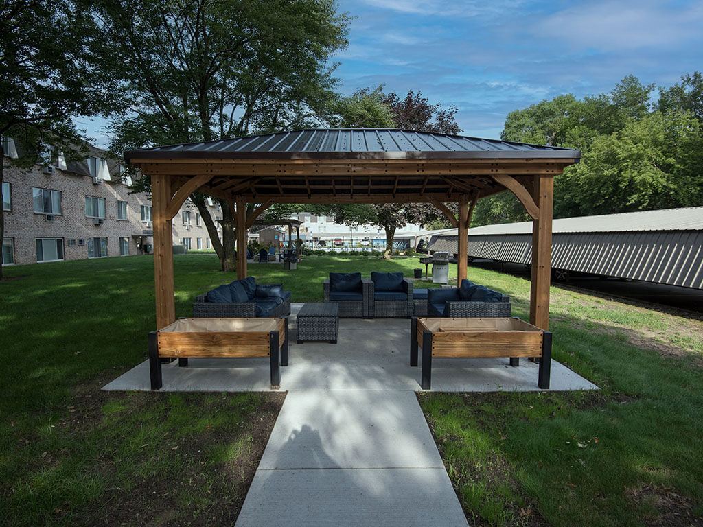
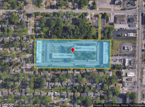
Property Record
3050 Maple Grove Rd, Muskegon, MI 49441
NEARBY LISTINGS FOR SALE OR LEASE
Property Detail
3050 Maple Grove Rd
Muskegon, MI
Torrent Home Gardens
25-001-400-0001-00
CITY OF ROOSEVELT PARK S 1/2 OF N 1/2 OF NE 1/4 OF SE 1/4EXC E 360 FT THEREOF. SEC 1 T9 NR 17WAND E 20 FT OF LOT 24 EXC N 5 F
Commercialnec
Muskegon
X
Michigan
26121C0259E
24
2023
7.41 AC
2024
Norton Shores
002200
West Michigan
124,416 SF
DEMOGRAPHICS near 3050 Maple Grove Rd
1 Mile
3 Mile
5 Mile
2024 Total Population
9,360
58,309
94,294
2029 Population
9,436
58,962
95,091
Pop Growth 2024-2029
+ 0.81%
+ 1.12%
+ 0.85%
Average Age
40
40
40
2024 Total Households
4,027
22,751
37,389
HH Growth 2024-2029
+ 0.72%
+ 1.10%
+ 0.83%
Median Household Inc
$52,908
$47,192
$49,967
Avg Household Size
2.30
2.30
2.30
2024 Avg HH Vehicles
2.00
2.00
2.00
Median Home Value
$137,085
$134,741
$143,802
Median Year Built
1961
1955
1959
Nearby Places
- Restaurants
- Banks
- Shops
- Fitness
- Groceries
Nearby Properties
Address
Land Use
TOTAL SIZE
Lot Size
Zoning
Address
Land Use
TOTAL SIZE
Lot Size
Zoning
82,643 SF
5.20 AC
MC
Address
Land Use
TOTAL SIZE
Lot Size
Zoning
273,059 SF
30.59 AC
PUD
Address
Land Use
TOTAL SIZE
Lot Size
Zoning
6,900 SF
165.61 AC
GI
Address
Land Use
TOTAL SIZE
Lot Size
Zoning
248,456 SF
19.18 AC
MFR
Address
Land Use
TOTAL SIZE
Lot Size
Zoning
41,382 SF
6.20 AC
PUD
Address
Land Use
TOTAL SIZE
Lot Size
Zoning
184,130 SF
3.16 AC
FBC-MS
Address
Land Use
TOTAL SIZE
Lot Size
Zoning
116,657 SF
1.60 AC
FBC-UR
Address
Land Use
TOTAL SIZE
Lot Size
Zoning
388,172 SF
21.50 AC
GI
Address
Land Use
TOTAL SIZE
Lot Size
Zoning
203,874 SF
18.55 AC
C-SE
Address
Land Use
TOTAL SIZE
Lot Size
Zoning
194,708 SF
15.59 AC
C-2
Address
Land Use
TOTAL SIZE
Lot Size
Zoning
142,000 SF
1.60 AC
FBC-DT
Address
Land Use
TOTAL SIZE
Lot Size
Zoning
19,171 SF
6.55 AC
MC
Address
Land Use
TOTAL SIZE
Lot Size
Zoning
193,750 SF
23.22 AC
GI
Address
Land Use
TOTAL SIZE
Lot Size
Zoning
33,750 SF
R - 1
Address
Land Use
TOTAL SIZE
Lot Size
Zoning
122.75 AC
R-2
Address
Land Use
TOTAL SIZE
Lot Size
Zoning
68,782 SF
10.52 AC
C-2
Address
Land Use
TOTAL SIZE
Lot Size
Zoning
73,313 SF
4.94 AC
FBC-MSW
Address
Land Use
TOTAL SIZE
Lot Size
Zoning
125,478 SF
7.90 AC
WM
Address
Land Use
TOTAL SIZE
Lot Size
Zoning
171,361 SF
12.26 AC
AR-8
Address
Land Use
TOTAL SIZE
Lot Size
Zoning
325,640 SF
49 AC
WM
Address
Land Use
TOTAL SIZE
Lot Size
Zoning
6.82 AC
PUD
Address
Land Use
TOTAL SIZE
Lot Size
Zoning
42,888 SF
2.10 AC
R - 1
Address
Land Use
TOTAL SIZE
Lot Size
Zoning
399,872 SF
16.99 AC
I-2
Address
Land Use
TOTAL SIZE
Lot Size
Zoning
32,811 SF
5.87 AC
B-4
Address
Land Use
TOTAL SIZE
Lot Size
Zoning
212,648 SF
9.20 AC
"B-2, PUD"
Address
Land Use
TOTAL SIZE
Lot Size
Zoning
66,252 SF
2.34 AC
D2-IND
Address
Land Use
TOTAL SIZE
Lot Size
Zoning
67,896 SF
8.56 AC
B-4
Address
Land Use
TOTAL SIZE
Lot Size
Zoning
123,081 SF
8.50 AC
B-4
Address
Land Use
TOTAL SIZE
Lot Size
Zoning
80,572 SF
12.98 AC
I-1
The World's #1 Commercial Real Estate Marketplace
Connect with us
© 2025 CoStar Group
The information above has been obtained from sources believed reliable. While we do not doubt its accuracy we have not verified it and make no guarantee, warranty or representation about it. It is your responsibility to independently confirm its accuracy and completeness. Any projections, opinions, assumptions, or estimates used are for example only and do not represent the current or future performance of the property. The value of this transaction to you depends on tax and other factors which should be evaluated by your tax, financial, and legal advisors. You and your advisors should conduct a careful, independent investigation of the property to determine to your satisfaction the suitability of the property for your needs.