Property Record
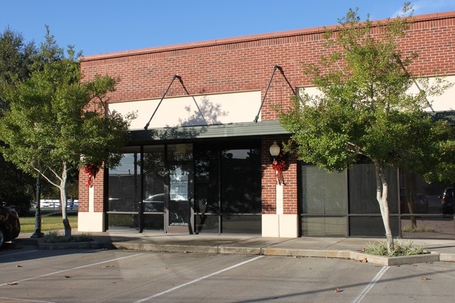
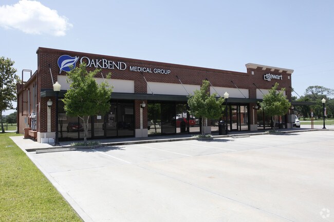
8506 Fm 359 Rd S, Fulshear, TX 77441

Property Detail
8506 Fm 359 Rd S
3380-00-003-0092-901
FULSHEAR, BLOCK 3, LOT 9,10,11,12 & ADJ 20ALLEY
Commercialnec
FORT BEND
X
Texas
B and X Area of moderate flood hazard, usually the area between the limits of the 100-year and 500-year floods.
9,10
2024
0.69 AC
2025
Far Katy South
673202
Houston
10,850 SF
Houston-Pasadena-The Woodlands, TX
NEARBY LISTINGS FOR SALE OR LEASE
DEMOGRAPHICS near 8506 Fm 359 Rd S
1 mile
3 mile
5 mile
2025 Total Population
3,447
27,812
93,609
2030 Population
4,072
33,044
108,617
Pop Growth 2025-2030
+ 18.13%
+ 18.81%
+ 16.03%
Average Age
40
38
36
2025 Total Households
1,143
9,073
28,472
HH Growth 2025-2030
+ 18.46%
+ 19.22%
+ 16.69%
Median Household Inc
$181,599
$162,137
$159,665
Avg Household Size
3.00
3.10
3.30
2025 Avg HH Vehicles
2.00
2.00
2.00
Median Home Value
$670,375
$624,231
$531,186
Median Year Built
2011
2011
2011
Nearby Places
Map Layers
Map Styles
 Street
 Aerial
Layers
 Traffic
 Biking
Places
Listings with unknown addresses are not visible on the map
- Restaurants
- Banks
- Shops
- Fitness
- Groceries
SALE & LEASE HISTORY
LISTING DATE
SALE/LEASE

Sep 06, 2017
For Lease
Jun 12, 2024
For Lease
Nearby Properties
Address
Land Use
TOTAL SIZE
Lot Size
Zoning
Address
Land Use
TOTAL SIZE
Lot Size
Zoning
83.43 AC
Address
Land Use
TOTAL SIZE
Lot Size
Zoning
Address
Land Use
TOTAL SIZE
Lot Size
Zoning
14.80 AC
Address
Land Use
TOTAL SIZE
Lot Size
Zoning
4.73 AC
Z
Address
Land Use
TOTAL SIZE
Lot Size
Zoning
14.88 AC
Address
Land Use
TOTAL SIZE
Lot Size
Zoning
Address
Land Use
TOTAL SIZE
Lot Size
Zoning
6,725 SF
23.26 AC
S
Address
Land Use
TOTAL SIZE
Lot Size
Zoning
Address
Land Use
TOTAL SIZE
Lot Size
Zoning
25,956 SF
16.56 AC
S
Address
Land Use
TOTAL SIZE
Lot Size
Zoning
58,037 SF
18.96 AC
QXS
Address
Land Use
TOTAL SIZE
Lot Size
Zoning
5.10 AC
Address
Land Use
TOTAL SIZE
Lot Size
Zoning
14.98 AC
Address
Land Use
TOTAL SIZE
Lot Size
Zoning
9.26 AC
Address
Land Use
TOTAL SIZE
Lot Size
Zoning
296.94 AC
YQO
Address
Land Use
TOTAL SIZE
Lot Size
Zoning
3.78 AC
Address
Land Use
TOTAL SIZE
Lot Size
Zoning
6.69 AC
Address
Land Use
TOTAL SIZE
Lot Size
Zoning
26.67 AC
Address
Land Use
TOTAL SIZE
Lot Size
Zoning
15,974 SF
29.79 AC
S
Address
Land Use
TOTAL SIZE
Lot Size
Zoning
86.07 AC
S
Address
Land Use
TOTAL SIZE
Lot Size
Zoning
88,550 SF
7.53 AC
YNS
Address
Land Use
TOTAL SIZE
Lot Size
Zoning
9.92 AC
QSY
Address
Land Use
TOTAL SIZE
Lot Size
Zoning
14.01 AC
TS
Address
Land Use
TOTAL SIZE
Lot Size
Zoning
6.40 AC
Address
Land Use
TOTAL SIZE
Lot Size
Zoning
1,105 SF
196.73 AC
QTYS
Address
Land Use
TOTAL SIZE
Lot Size
Zoning
22.21 AC
Address
Land Use
TOTAL SIZE
Lot Size
Zoning
1,072 SF
2.83 AC
SY
Address
Land Use
TOTAL SIZE
Lot Size
Zoning
2.49 AC
Address
Land Use
TOTAL SIZE
Lot Size
Zoning
80.22 AC
Address
Land Use
TOTAL SIZE
Lot Size
Zoning
69.68 AC
Address
Land Use
TOTAL SIZE
Lot Size
Zoning
71,659 SF
8.61 AC
SNY
The World's #1 Commercial Real Estate Marketplace
Connect with us
© 2026 CoStar Group
The information above has been obtained from sources believed reliable. While we do not doubt its accuracy we have not verified it and make no guarantee, warranty or representation about it. It is your responsibility to independently confirm its accuracy and completeness. Any projections, opinions, assumptions, or estimates used are for example only and do not represent the current or future performance of the property. The value of this transaction to you depends on tax and other factors which should be evaluated by your tax, financial, and legal advisors. You and your advisors should conduct a careful, independent investigation of the property to determine to your satisfaction the suitability of the property for your needs.