Property Record
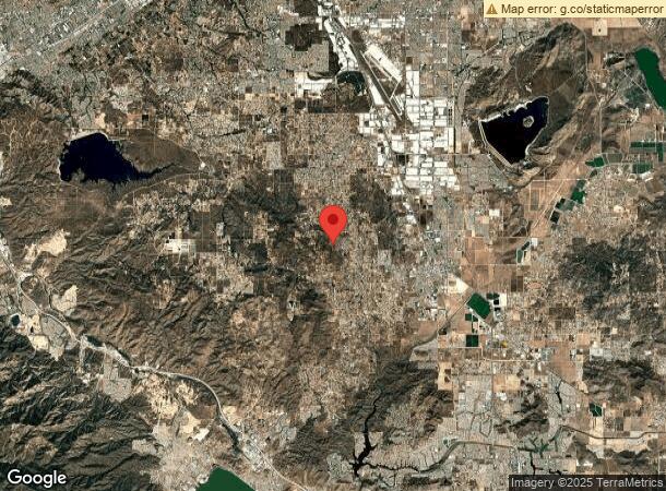
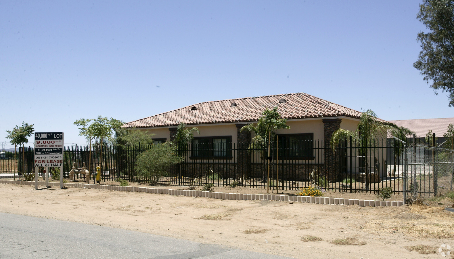
3060 Sherman Rd, Perris, CA 92570


NEARBY LISTINGS FOR SALE OR LEASE
-
-
View all Perris listings for sale on LoopNet.com
Property Detail
3060 Sherman Rd
Riverside-San Bernardino-Ontario, CA
Romola Farms 6A
329-240-054
.89 ACRES M/L IN POR LOT 738 MB 014/063 ROMOLA FARMS 6A
Lightindustrial
Riverside
X
California
06065C2060H
738
2023
0.89 AC
2023
South Riverside
042903
Inland Empire (California)
2,322 SF
DEMOGRAPHICS near 3060 Sherman Rd
1 Mile
3 Mile
5 Mile
2024 Total Population
3,762
39,349
143,975
2029 Population
3,970
41,621
152,464
Pop Growth 2024-2029
+ 5.53%
+ 5.77%
+ 5.90%
Average Age
36
42
38
2024 Total Households
1,010
13,848
43,736
HH Growth 2024-2029
+ 5.45%
+ 5.37%
+ 5.47%
Median Household Inc
$75,852
$69,316
$73,404
Avg Household Size
3.50
2.80
3.20
2024 Avg HH Vehicles
3.00
2.00
2.00
Median Home Value
$358,781
$371,021
$387,977
Median Year Built
1990
1990
1993
Nearby Places
- Restaurants
- Banks
- Shops
- Fitness
- Groceries
PUBLIC TRANSPORTATION
COMMUTER RAIL
Perris Downtown (Metrolink 91-Perris Valley Line - Metrolink Trains)
DRIVE
WALK
Distance
Perris Downtown (Metrolink 91-Perris Valley Line - Metrolink Trains)
20 min
6.3 mi
South Perris (Metrolink 91-Perris Valley Line - Metrolink Trains)
DRIVE
WALK
Distance
South Perris (Metrolink 91-Perris Valley Line - Metrolink Trains)
23 min
8.2 mi
AIRPORT
Ontario International
DRIVE
WALK
Distance
Ontario International
60 min
37.6 mi
Freight Ports
Port of Long Beach
DRIVE
WALK
Distance
Port of Long Beach
102 min
67.2 mi
Nearby Properties
Address
Land Use
TOTAL SIZE
Lot Size
Zoning
Address
Land Use
TOTAL SIZE
Lot Size
Zoning
1,138,800 SF
43.93 AC
Address
Land Use
TOTAL SIZE
Lot Size
Zoning
325,560 SF
16.65 AC
Address
Land Use
TOTAL SIZE
Lot Size
Zoning
197,865 SF
10.74 AC
Address
Land Use
TOTAL SIZE
Lot Size
Zoning
6.99 AC
MIX
Address
Land Use
TOTAL SIZE
Lot Size
Zoning
406,496 SF
19.13 AC
MSC
Address
Land Use
TOTAL SIZE
Lot Size
Zoning
49,470 SF
9.80 AC
IP
Address
Land Use
TOTAL SIZE
Lot Size
Zoning
198.39 AC
RR
Address
Land Use
TOTAL SIZE
Lot Size
Zoning
17,708 SF
8.95 AC
R1
Address
Land Use
TOTAL SIZE
Lot Size
Zoning
8,900 SF
1.68 AC
C1
Address
Land Use
TOTAL SIZE
Lot Size
Zoning
4,841 SF
1.14 AC
Address
Land Use
TOTAL SIZE
Lot Size
Zoning
18.96 AC
Address
Land Use
TOTAL SIZE
Lot Size
Zoning
13,424 SF
11.17 AC
RR
Address
Land Use
TOTAL SIZE
Lot Size
Zoning
672 SF
39.38 AC
RR
Address
Land Use
TOTAL SIZE
Lot Size
Zoning
920 SF
8.68 AC
Address
Land Use
TOTAL SIZE
Lot Size
Zoning
1,152 SF
203 AC
RR12
Address
Land Use
TOTAL SIZE
Lot Size
Zoning
17,035 SF
10.90 AC
Address
Land Use
TOTAL SIZE
Lot Size
Zoning
1,344 SF
8.72 AC
IP
Address
Land Use
TOTAL SIZE
Lot Size
Zoning
1,500 SF
3.07 AC
MSC
Address
Land Use
TOTAL SIZE
Lot Size
Zoning
19,800 SF
9.33 AC
IP
Address
Land Use
TOTAL SIZE
Lot Size
Zoning
1,440 SF
3.13 AC
RR
Address
Land Use
TOTAL SIZE
Lot Size
Zoning
3,170 SF
0.76 AC
CPS
Address
Land Use
TOTAL SIZE
Lot Size
Zoning
10,133 SF
10 AC
RA10
Address
Land Use
TOTAL SIZE
Lot Size
Zoning
3.20 AC
CPS
Address
Land Use
TOTAL SIZE
Lot Size
Zoning
31.14 AC
A15
Address
Land Use
TOTAL SIZE
Lot Size
Zoning
1,368 SF
9.46 AC
Address
Land Use
TOTAL SIZE
Lot Size
Zoning
24,800 SF
1.60 AC
LI
Address
Land Use
TOTAL SIZE
Lot Size
Zoning
3 AC
RR
The World's #1 Commercial Real Estate Marketplace
Connect with us
© 2025 CoStar Group
The information above has been obtained from sources believed reliable. While we do not doubt its accuracy we have not verified it and make no guarantee, warranty or representation about it. It is your responsibility to independently confirm its accuracy and completeness. Any projections, opinions, assumptions, or estimates used are for example only and do not represent the current or future performance of the property. The value of this transaction to you depends on tax and other factors which should be evaluated by your tax, financial, and legal advisors. You and your advisors should conduct a careful, independent investigation of the property to determine to your satisfaction the suitability of the property for your needs.