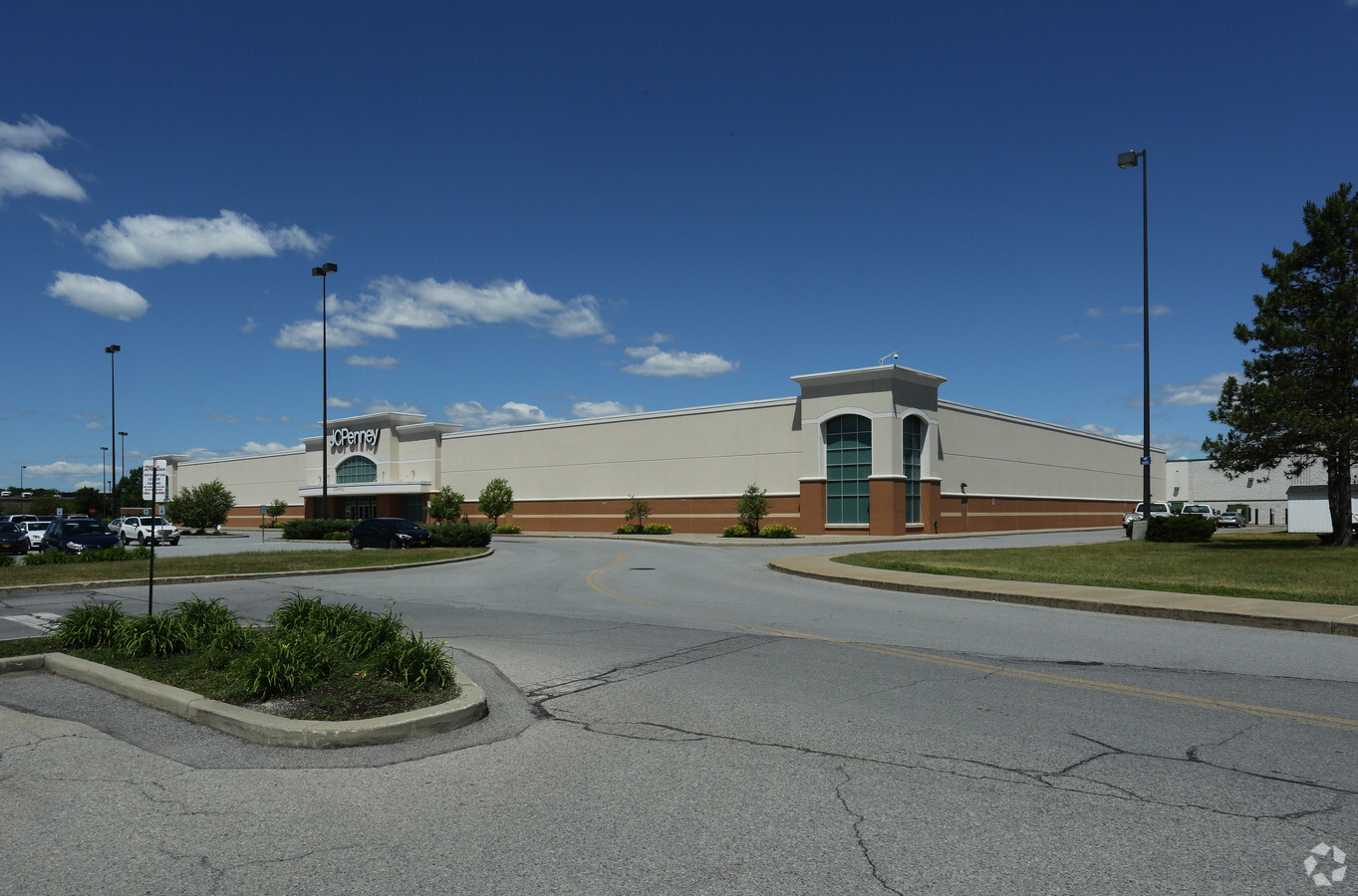
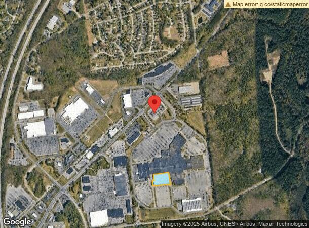
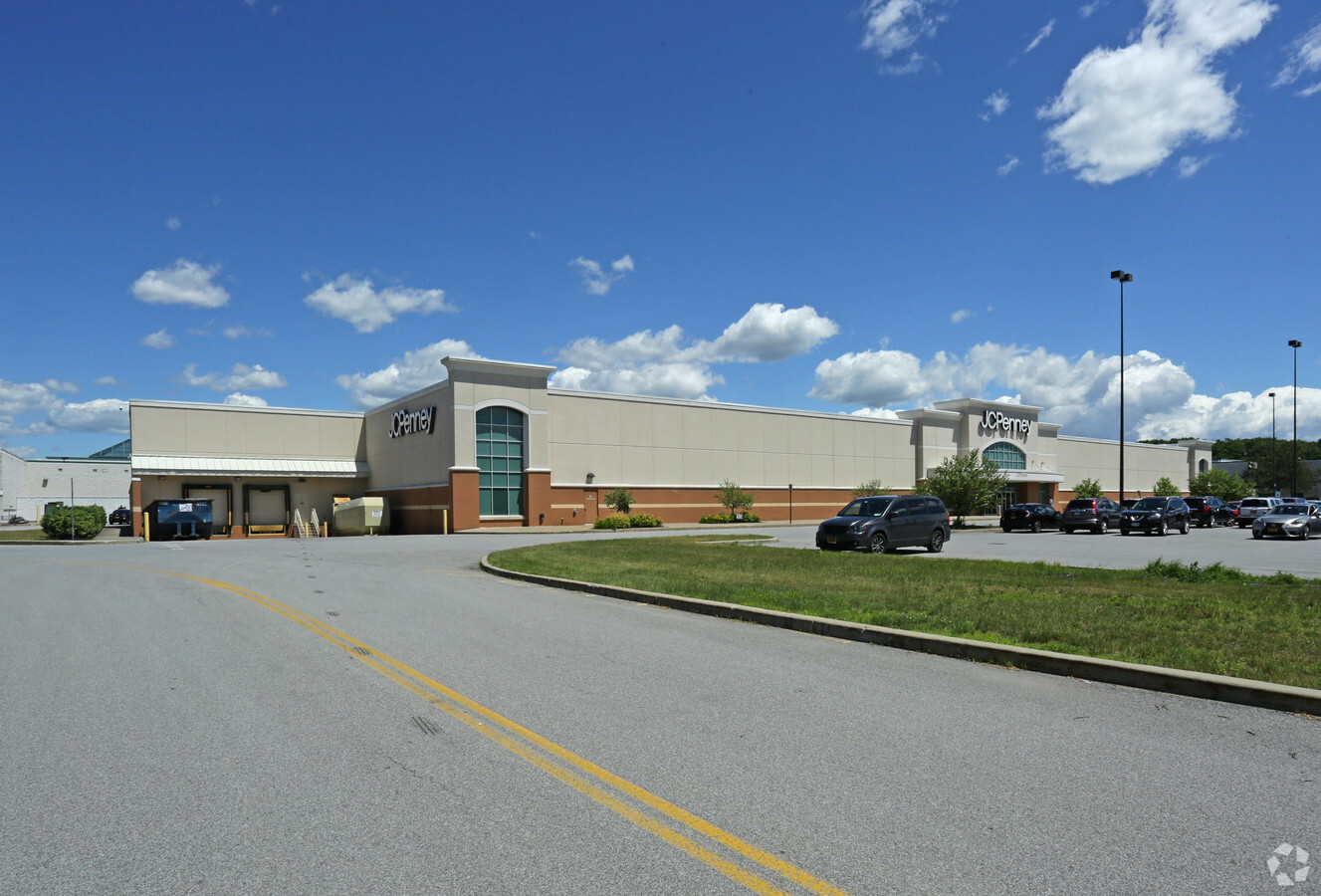
Property Record
3065 Route 50, Saratoga Springs, NY 12866
NEARBY LISTINGS FOR SALE OR LEASE
-
-
-
-
-
-
No Photo
-
-
View all Saratoga Springs listings for sale on LoopNet.com
Property Detail
3065 Route 50
Albany-Schenectady-Troy, NY
Saratoga
415600-153-000-0003-086-112-0000
New York
Communitycenter
86.112
2016
2.24 AC
2023
Saratoga County
060704
Albany/Schenectady/Troy
83,172 SF
DEMOGRAPHICS near 3065 Route 50
1 Mile
3 Mile
5 Mile
2024 Total Population
2,714
25,794
46,550
2029 Population
2,814
27,020
48,747
Pop Growth 2024-2029
+ 3.68%
+ 4.75%
+ 4.72%
Average Age
46
45
44
2024 Total Households
1,285
11,936
21,024
HH Growth 2024-2029
+ 3.58%
+ 4.84%
+ 4.84%
Median Household Inc
$96,695
$92,667
$89,129
Avg Household Size
2.10
2.10
2.10
2024 Avg HH Vehicles
2.00
2.00
2.00
Median Home Value
$367,289
$460,744
$398,726
Median Year Built
2003
1988
1989
Nearby Places
- Restaurants
- Banks
- Shops
- Fitness
- Groceries
PUBLIC TRANSPORTATION
COMMUTER RAIL
Saratoga Springs Amtrak Station (Adirondack - Amtrak, Ethan Allen Express - Amtrak)
DRIVE
WALK
Distance
Saratoga Springs Amtrak Station (Adirondack - Amtrak, Ethan Allen Express - Amtrak)
10 min
4.4 mi
AIRPORT
Albany International
DRIVE
WALK
Distance
Albany International
37 min
28.0 mi
Freight Ports
Albany, NY Port
DRIVE
WALK
Distance
Albany, NY Port
52 min
38.5 mi
Nearby Properties
Address
Land Use
TOTAL SIZE
Lot Size
Zoning
Address
Land Use
TOTAL SIZE
Lot Size
Zoning
3,000 SF
37.95 AC
C-1
Address
Land Use
TOTAL SIZE
Lot Size
Zoning
214,000 SF
127.30 AC
INSHT
Address
Land Use
TOTAL SIZE
Lot Size
Zoning
Address
Land Use
TOTAL SIZE
Lot Size
Zoning
3,863 SF
27.70 AC
PUDD
Address
Land Use
TOTAL SIZE
Lot Size
Zoning
606,904 SF
93.59 AC
C-1
Address
Land Use
TOTAL SIZE
Lot Size
Zoning
178,182 SF
36.63 AC
OR
Address
Land Use
TOTAL SIZE
Lot Size
Zoning
76,938 SF
10.53 AC
PUD
Address
Land Use
TOTAL SIZE
Lot Size
Zoning
173,482 SF
5.27 AC
C1
Address
Land Use
TOTAL SIZE
Lot Size
Zoning
42,840 SF
8.07 AC
C-1
Address
Land Use
TOTAL SIZE
Lot Size
Zoning
90,950 SF
12.09 AC
INSED
Address
Land Use
TOTAL SIZE
Lot Size
Zoning
200,242 SF
21.65 AC
C-1
Address
Land Use
TOTAL SIZE
Lot Size
Zoning
78,848 SF
6.54 AC
PUD
Address
Land Use
TOTAL SIZE
Lot Size
Zoning
35,733 SF
6.71 AC
INSED
Address
Land Use
TOTAL SIZE
Lot Size
Zoning
219,498 SF
9.79 AC
H-1
Address
Land Use
TOTAL SIZE
Lot Size
Zoning
1,380 SF
55 AC
R-M
Address
Land Use
TOTAL SIZE
Lot Size
Zoning
1,818 SF
14.31 AC
RB-1
Address
Land Use
TOTAL SIZE
Lot Size
Zoning
39,632 SF
19.11 AC
C7
Address
Land Use
TOTAL SIZE
Lot Size
Zoning
7,680 SF
19.78 AC
RB-1
Address
Land Use
TOTAL SIZE
Lot Size
Zoning
137,617 SF
19.08 AC
C-1
Address
Land Use
TOTAL SIZE
Lot Size
Zoning
14,397 SF
25.31 AC
PUDD
Address
Land Use
TOTAL SIZE
Lot Size
Zoning
198,381 SF
10.06 AC
PUD
Address
Land Use
TOTAL SIZE
Lot Size
Zoning
143,268 SF
11.59 AC
C-1
Address
Land Use
TOTAL SIZE
Lot Size
Zoning
2,700 SF
162.85 AC
C1
Address
Land Use
TOTAL SIZE
Lot Size
Zoning
5,276 SF
9.20 AC
C-1
Address
Land Use
TOTAL SIZE
Lot Size
Zoning
7,980 SF
8.35 AC
C-1
Address
Land Use
TOTAL SIZE
Lot Size
Zoning
28,068 SF
2.20 AC
C5
Address
Land Use
TOTAL SIZE
Lot Size
Zoning
100,453 SF
2.85 AC
C5
Address
Land Use
TOTAL SIZE
Lot Size
Zoning
111,657 SF
1.05 AC
C1
Address
Land Use
TOTAL SIZE
Lot Size
Zoning
131,256 SF
16.70 AC
INSED
Address
Land Use
TOTAL SIZE
Lot Size
Zoning
14,397 SF
13.16 AC
PUDD
The World's #1 Commercial Real Estate Marketplace
Connect with us
© 2025 CoStar Group
The information above has been obtained from sources believed reliable. While we do not doubt its accuracy we have not verified it and make no guarantee, warranty or representation about it. It is your responsibility to independently confirm its accuracy and completeness. Any projections, opinions, assumptions, or estimates used are for example only and do not represent the current or future performance of the property. The value of this transaction to you depends on tax and other factors which should be evaluated by your tax, financial, and legal advisors. You and your advisors should conduct a careful, independent investigation of the property to determine to your satisfaction the suitability of the property for your needs.