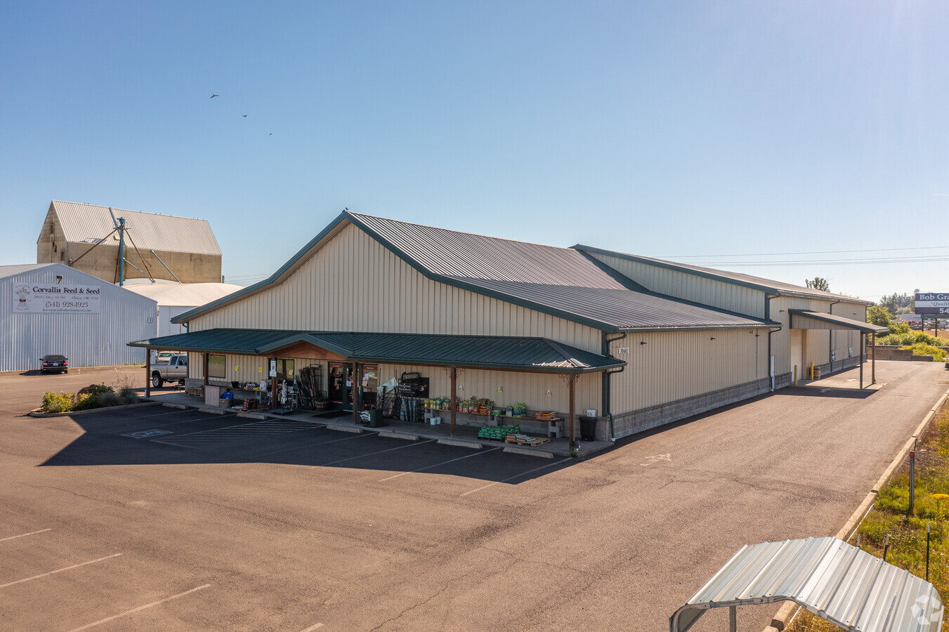
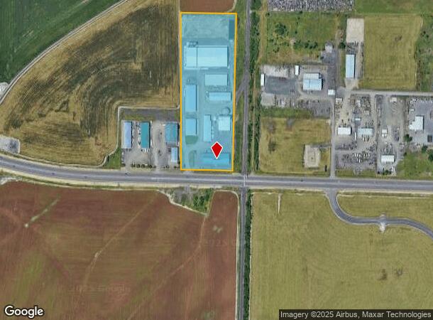
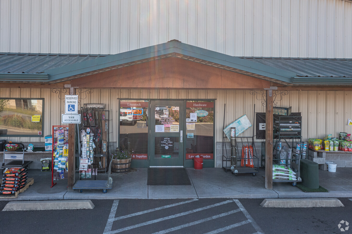
Property Record
30685 Highway 34 Sw, Albany, OR 97321
NEARBY LISTINGS FOR SALE OR LEASE
Property Detail
30685 Highway 34 Sw
0154613
11S04W3400
Municipalproperty
Linn
AE
Oregon
41003C0210F
11.89 AC
2024
Linn County
2024
Portland
030700
Albany, OR
13,600 SF
DEMOGRAPHICS near 30685 Highway 34 Sw
1 Mile
3 Mile
5 Mile
2024 Total Population
42
5,464
30,909
2029 Population
43
5,668
32,260
Pop Growth 2024-2029
+ 2.38%
+ 3.73%
+ 4.37%
Average Age
46
43
41
2024 Total Households
16
2,211
12,650
HH Growth 2024-2029
0.00%
+ 3.93%
+ 4.60%
Median Household Inc
$93,749
$85,145
$67,228
Avg Household Size
2.40
2.40
2.40
2024 Avg HH Vehicles
3.00
2.00
2.00
Median Home Value
$499,999
$371,266
$310,325
Median Year Built
1967
1982
1977
Nearby Places
- Restaurants
- Banks
- Shops
- Fitness
- Groceries
PUBLIC TRANSPORTATION
COMMUTER RAIL
Albany Amtrak Station (Amtrak Cascades - Amtrak, Coast Starlight - Amtrak)
DRIVE
WALK
Distance
Albany Amtrak Station (Amtrak Cascades - Amtrak, Coast Starlight - Amtrak)
11 min
6.1 mi
Freight Ports
Port of Portland
DRIVE
WALK
Distance
Port of Portland
101 min
81.2 mi
SALE & LEASE HISTORY
LISTING DATE
SALE/LEASE

Sep 10, 2019
For Sale
Nearby Properties
Address
Land Use
TOTAL SIZE
Lot Size
Zoning
Address
Land Use
TOTAL SIZE
Lot Size
Zoning
8,842 SF
73.88 AC
RS-6.5
Address
Land Use
TOTAL SIZE
Lot Size
Zoning
104.75 AC
LI
Address
Land Use
TOTAL SIZE
Lot Size
Zoning
9.32 AC
LI
Address
Land Use
TOTAL SIZE
Lot Size
Zoning
11.43 AC
HC/I
Address
Land Use
TOTAL SIZE
Lot Size
Zoning
8.70 AC
IND
Address
Land Use
TOTAL SIZE
Lot Size
Zoning
69,760 SF
2.80 AC
RMA
Address
Land Use
TOTAL SIZE
Lot Size
Zoning
64,046 SF
5.22 AC
HC/I
Address
Land Use
TOTAL SIZE
Lot Size
Zoning
36,574 SF
5.10 AC
IP
Address
Land Use
TOTAL SIZE
Lot Size
Zoning
10.56 AC
HC/I
Address
Land Use
TOTAL SIZE
Lot Size
Zoning
55,725 SF
5.98 AC
HC/I
Address
Land Use
TOTAL SIZE
Lot Size
Zoning
4.64 AC
IND
Address
Land Use
TOTAL SIZE
Lot Size
Zoning
7.33 AC
IND
Address
Land Use
TOTAL SIZE
Lot Size
Zoning
32,800 SF
3.51 AC
CC
Address
Land Use
TOTAL SIZE
Lot Size
Zoning
105 SF
33.79 AC
EFU
Address
Land Use
TOTAL SIZE
Lot Size
Zoning
8.09 AC
CC
Address
Land Use
TOTAL SIZE
Lot Size
Zoning
40,416 SF
2.20 AC
RMA
Address
Land Use
TOTAL SIZE
Lot Size
Zoning
7.61 AC
IP
Address
Land Use
TOTAL SIZE
Lot Size
Zoning
54,000 SF
3.17 AC
IND
Address
Land Use
TOTAL SIZE
Lot Size
Zoning
50,000 SF
3.13 AC
IND
Address
Land Use
TOTAL SIZE
Lot Size
Zoning
10,920 SF
9.12 AC
LI
Address
Land Use
TOTAL SIZE
Lot Size
Zoning
51,840 SF
3.08 AC
IND
Address
Land Use
TOTAL SIZE
Lot Size
Zoning
40,800 SF
8 AC
RR-5
Address
Land Use
TOTAL SIZE
Lot Size
Zoning
19,950 SF
5.60 AC
HC/I
Address
Land Use
TOTAL SIZE
Lot Size
Zoning
0.98 AC
CC
Address
Land Use
TOTAL SIZE
Lot Size
Zoning
29,350 SF
4 AC
IND
Address
Land Use
TOTAL SIZE
Lot Size
Zoning
2.75 AC
HC/I
Address
Land Use
TOTAL SIZE
Lot Size
Zoning
19,152 SF
3.26 AC
HC/I
Address
Land Use
TOTAL SIZE
Lot Size
Zoning
7 AC
HI
The World's #1 Commercial Real Estate Marketplace
Connect with us
© 2025 CoStar Group
The information above has been obtained from sources believed reliable. While we do not doubt its accuracy we have not verified it and make no guarantee, warranty or representation about it. It is your responsibility to independently confirm its accuracy and completeness. Any projections, opinions, assumptions, or estimates used are for example only and do not represent the current or future performance of the property. The value of this transaction to you depends on tax and other factors which should be evaluated by your tax, financial, and legal advisors. You and your advisors should conduct a careful, independent investigation of the property to determine to your satisfaction the suitability of the property for your needs.