Property Record
3070 Manley St, Carnesville, GA 30521

NEARBY LISTINGS FOR SALE OR LEASE
-
-
View all Carnesville listings for sale on LoopNet.com
Property Detail
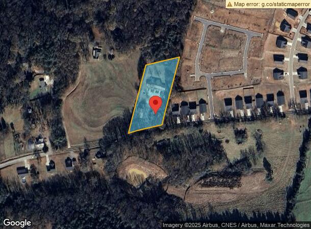
3070 Manley St
C005-009
Carnesville Twnhses
Apartment
2.0 AC MANLEY ST
X
Franklin
13195C0050C
Georgia
2025
2 AC
2025
Georgia Northeast
890202
Other Market Areas
4,930 SF
DEMOGRAPHICS near 3070 Manley St
1 Mile
3 Mile
5 Mile
2024 Total Population
625
1,949
4,491
2029 Population
671
2,088
4,796
Pop Growth 2024-2029
+ 7.36%
+ 7.13%
+ 6.79%
Average Age
40
40
41
2024 Total Households
228
715
1,677
HH Growth 2024-2029
+ 7.02%
+ 6.85%
+ 6.56%
Median Household Inc
$55,781
$55,176
$55,754
Avg Household Size
2.50
2.50
2.60
2024 Avg HH Vehicles
3.00
3.00
3.00
Median Home Value
$118,657
$122,081
$143,513
Median Year Built
1978
1983
1989
Nearby Places
Map Layers
Map Styles
 Street
 Aerial
- Restaurants
- Banks
- Shops
- Fitness
- Groceries
Nearby Properties
Address
Land Use
TOTAL SIZE
Lot Size
Zoning
Address
Land Use
TOTAL SIZE
Lot Size
Zoning
33,380 SF
44.04 AC
UNZONED RU
Address
Land Use
TOTAL SIZE
Lot Size
Zoning
85,179 SF
121.27 AC
UNZONED RU
Address
Land Use
TOTAL SIZE
Lot Size
Zoning
178.03 AC
UNZONED RU
Address
Land Use
TOTAL SIZE
Lot Size
Zoning
66,800 SF
10 AC
UNZONED RU
Address
Land Use
TOTAL SIZE
Lot Size
Zoning
49,000 SF
14 AC
UNZONED RU
Address
Land Use
TOTAL SIZE
Lot Size
Zoning
5,964 SF
46.07 AC
UNZONED RU
Address
Land Use
TOTAL SIZE
Lot Size
Zoning
28,376 SF
30.69 AC
COMMERCIAL
Address
Land Use
TOTAL SIZE
Lot Size
Zoning
960 SF
11.46 AC
UNZONED RU
Address
Land Use
TOTAL SIZE
Lot Size
Zoning
97.13 AC
UNZONED RU
Address
Land Use
TOTAL SIZE
Lot Size
Zoning
15,152 SF
7.54 AC
COMMERCIAL
Address
Land Use
TOTAL SIZE
Lot Size
Zoning
1,064 SF
115.61 AC
UNZONED RU
Address
Land Use
TOTAL SIZE
Lot Size
Zoning
55.99 AC
UNZONED RU
Address
Land Use
TOTAL SIZE
Lot Size
Zoning
38.58 AC
UNZONED RU
Address
Land Use
TOTAL SIZE
Lot Size
Zoning
226.50 AC
UNZONED RU
Address
Land Use
TOTAL SIZE
Lot Size
Zoning
1,968 SF
207.35 AC
UNZONED RU
Address
Land Use
TOTAL SIZE
Lot Size
Zoning
7,200 SF
14.22 AC
COMMERCIAL
Address
Land Use
TOTAL SIZE
Lot Size
Zoning
201.93 AC
UNZONED RU
Address
Land Use
TOTAL SIZE
Lot Size
Zoning
33.68 AC
COMMERCIAL
Address
Land Use
TOTAL SIZE
Lot Size
Zoning
5,632 SF
58.81 AC
COMMERCIAL
Address
Land Use
TOTAL SIZE
Lot Size
Zoning
10,000 SF
6.13 AC
RESIDENTIA
Address
Land Use
TOTAL SIZE
Lot Size
Zoning
191.01 AC
UNZONED RU
Address
Land Use
TOTAL SIZE
Lot Size
Zoning
2,176 SF
1.26 AC
UNZONED RU
Address
Land Use
TOTAL SIZE
Lot Size
Zoning
1,344 SF
96 AC
UNZONED RU
Address
Land Use
TOTAL SIZE
Lot Size
Zoning
4,000 SF
5.94 AC
Address
Land Use
TOTAL SIZE
Lot Size
Zoning
44,311 SF
20 AC
RESIDENTIA
Address
Land Use
TOTAL SIZE
Lot Size
Zoning
6,400 SF
4 AC
UNZONED RU
Address
Land Use
TOTAL SIZE
Lot Size
Zoning
126.78 AC
UNZONED RU
Address
Land Use
TOTAL SIZE
Lot Size
Zoning
34.87 AC
UNZONED RU
Address
Land Use
TOTAL SIZE
Lot Size
Zoning
12,760 SF
RESIDENTIA
Address
Land Use
TOTAL SIZE
Lot Size
Zoning
137.50 AC
UNZONED RU
The World's #1 Commercial Real Estate Marketplace
Connect with us
© 2026 CoStar Group
The information above has been obtained from sources believed reliable. While we do not doubt its accuracy we have not verified it and make no guarantee, warranty or representation about it. It is your responsibility to independently confirm its accuracy and completeness. Any projections, opinions, assumptions, or estimates used are for example only and do not represent the current or future performance of the property. The value of this transaction to you depends on tax and other factors which should be evaluated by your tax, financial, and legal advisors. You and your advisors should conduct a careful, independent investigation of the property to determine to your satisfaction the suitability of the property for your needs.