Property Record
3070 S Nellis Blvd, Las Vegas, NV 89121
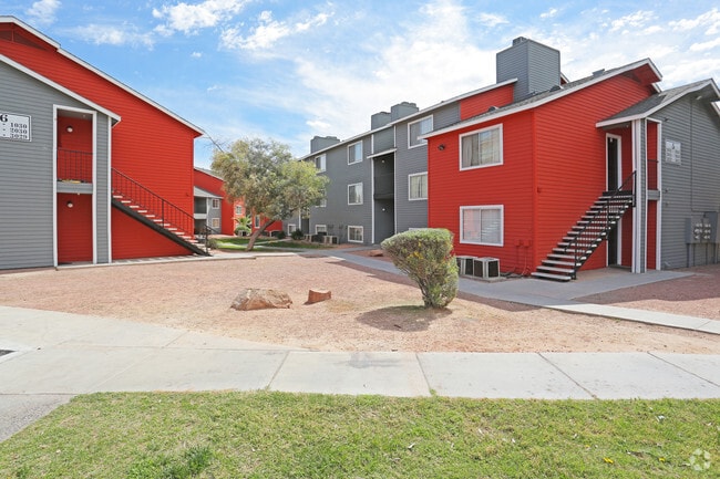

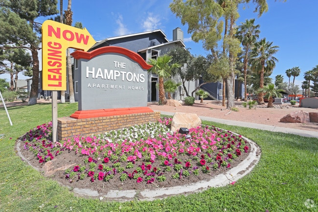

Property Detail
3070 S Nellis Blvd
161-09-301-004
PARCEL MAP FILE 56 PAGE 52 LOT 4
Apartment
Clark
R4
Nevada
B and X Area of moderate flood hazard, usually the area between the limits of the 100-year and 500-year floods.
4
2026
24.13 AC
2026
Sunrise Manor
005006
Las Vegas
7,908 SF
Las Vegas-Henderson-North Las Vegas, NV
NEARBY LISTINGS FOR SALE OR LEASE
-
-
View all Las Vegas listings for sale on LoopNet.com
DEMOGRAPHICS near 3070 S Nellis Blvd
1 mile
3 mile
5 mile
2025 Total Population
30,592
202,152
473,734
2030 Population
31,904
210,288
494,294
Pop Growth 2025-2030
+ 4.29%
+ 4.02%
+ 4.34%
Average Age
39
39
38
2025 Total Households
11,966
70,678
172,870
HH Growth 2025-2030
+ 4.35%
+ 4.07%
+ 4.43%
Median Household Inc
$46,538
$58,334
$56,383
Avg Household Size
2.50
2.80
2.70
2025 Avg HH Vehicles
1.00
2.00
2.00
Median Home Value
$222,687
$321,865
$335,646
Median Year Built
1990
1986
1985
Nearby Places
Map Layers
Map Styles
 Street
 Aerial
Layers
 Traffic
 Biking
Places
Listings with unknown addresses are not visible on the map
- Restaurants
- Banks
- Shops
- Fitness
- Groceries
PUBLIC TRANSPORTATION
AIRPORT
Harry Reid International
Drive
Walk
Distance
Harry Reid International
15 min
8.6 mi
Boulder City Municipal
Drive
Walk
Distance
Boulder City Municipal
30 min
20.5 mi
Freight Ports
Port of Long Beach
Drive
Walk
Distance
Port of Long Beach
324 min
284.7 mi
Nearby Properties
Address
Land Use
TOTAL SIZE
Lot Size
Zoning
Address
Land Use
TOTAL SIZE
Lot Size
Zoning
265,609 SF
47.36 AC
H1
Address
Land Use
TOTAL SIZE
Lot Size
Zoning
3,356 SF
336.99 AC
RE
Address
Land Use
TOTAL SIZE
Lot Size
Zoning
345,133 SF
27.01 AC
H1
Address
Land Use
TOTAL SIZE
Lot Size
Zoning
20,727 SF
319.86 AC
PF
Address
Land Use
TOTAL SIZE
Lot Size
Zoning
280 AC
PF
Address
Land Use
TOTAL SIZE
Lot Size
Zoning
137.65 AC
Address
Land Use
TOTAL SIZE
Lot Size
Zoning
35.95 AC
PF
Address
Land Use
TOTAL SIZE
Lot Size
Zoning
38,764 SF
12.66 AC
H1
Address
Land Use
TOTAL SIZE
Lot Size
Zoning
4,460 SF
27.52 AC
Address
Land Use
TOTAL SIZE
Lot Size
Zoning
15.95 AC
PF
Address
Land Use
TOTAL SIZE
Lot Size
Zoning
43.25 AC
PF
Address
Land Use
TOTAL SIZE
Lot Size
Zoning
9.37 AC
RE
Address
Land Use
TOTAL SIZE
Lot Size
Zoning
4.34 AC
RE
Address
Land Use
TOTAL SIZE
Lot Size
Zoning
19.30 AC
RE
Address
Land Use
TOTAL SIZE
Lot Size
Zoning
6,659 SF
6.05 AC
H1
Address
Land Use
TOTAL SIZE
Lot Size
Zoning
4.18 AC
PF
Address
Land Use
TOTAL SIZE
Lot Size
Zoning
9,044 SF
8.62 AC
Address
Land Use
TOTAL SIZE
Lot Size
Zoning
223,422 SF
18.21 AC
R3
Address
Land Use
TOTAL SIZE
Lot Size
Zoning
2,926 SF
19.73 AC
R3
Address
Land Use
TOTAL SIZE
Lot Size
Zoning
3,183 SF
18.35 AC
R3
Address
Land Use
TOTAL SIZE
Lot Size
Zoning
9.11 AC
PF
Address
Land Use
TOTAL SIZE
Lot Size
Zoning
40.07 AC
PF
Address
Land Use
TOTAL SIZE
Lot Size
Zoning
7,304 SF
12.58 AC
R4
Address
Land Use
TOTAL SIZE
Lot Size
Zoning
3,424 SF
14.53 AC
R3
Address
Land Use
TOTAL SIZE
Lot Size
Zoning
9,154 SF
8.94 AC
CV
Address
Land Use
TOTAL SIZE
Lot Size
Zoning
26,067 SF
20.09 AC
R4
Address
Land Use
TOTAL SIZE
Lot Size
Zoning
5,425 SF
14.38 AC
C:R-4
Address
Land Use
TOTAL SIZE
Lot Size
Zoning
207,560 SF
10.36 AC
R4
Address
Land Use
TOTAL SIZE
Lot Size
Zoning
187,617 SF
21.71 AC
C2
The World's #1 Commercial Real Estate Marketplace
Connect with us
© 2026 CoStar Group
The information above has been obtained from sources believed reliable. While we do not doubt its accuracy we have not verified it and make no guarantee, warranty or representation about it. It is your responsibility to independently confirm its accuracy and completeness. Any projections, opinions, assumptions, or estimates used are for example only and do not represent the current or future performance of the property. The value of this transaction to you depends on tax and other factors which should be evaluated by your tax, financial, and legal advisors. You and your advisors should conduct a careful, independent investigation of the property to determine to your satisfaction the suitability of the property for your needs.