No Photo
Property Record
308 Beaver Valley Pike, Willow Street, PA 17584

NEARBY LISTINGS FOR SALE OR LEASE
Property Detail
308 Beaver Valley Pike
Lancaster, PA
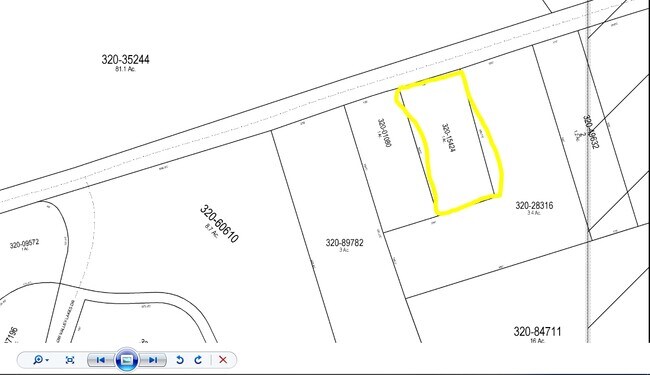
Glen Moore Sec 01
320-15424-0-0000
308 BEAVER VALLEY PIKE
Servicestation
Lancaster
X
Pennsylvania
42071C0507F
2
2024
1 AC
2025
Lancaster County
013303
Philadelphia
16,788 SF
DEMOGRAPHICS near 308 Beaver Valley Pike
1 Mile
3 Mile
5 Mile
2024 Total Population
5,114
27,324
132,021
2029 Population
5,099
27,362
132,812
Pop Growth 2024-2029
(0.29%)
+ 0.14%
+ 0.60%
Average Age
60
45
39
2024 Total Households
2,460
10,334
50,002
HH Growth 2024-2029
(0.98%)
(0.12%)
+ 0.52%
Median Household Inc
$88,376
$89,406
$68,014
Avg Household Size
1.90
2.50
2.40
2024 Avg HH Vehicles
2.00
2.00
2.00
Median Home Value
$282,796
$273,410
$224,038
Median Year Built
1984
1986
1961
Nearby Places
Map Layers
Map Styles
 Street
 Aerial
- Restaurants
- Banks
- Shops
- Fitness
- Groceries
PUBLIC TRANSPORTATION
COMMUTER RAIL
Lancaster (Keystone Service - Amtrak, Pennsylvanian - Amtrak)
DRIVE
WALK
Distance
Lancaster (Keystone Service - Amtrak, Pennsylvanian - Amtrak)
14 min
5.7 mi
AIRPORT
Harrisburg International
DRIVE
WALK
Distance
Harrisburg International
54 min
37.4 mi
Freight Ports
Port of Wilmington, RI
DRIVE
WALK
Distance
Port of Wilmington, RI
85 min
55.6 mi
Nearby Properties
Address
Land Use
TOTAL SIZE
Lot Size
Zoning
Address
Land Use
TOTAL SIZE
Lot Size
Zoning
1,906,102 SF
136.98 AC
R3
Address
Land Use
TOTAL SIZE
Lot Size
Zoning
2,008,418 SF
76.74 AC
Address
Land Use
TOTAL SIZE
Lot Size
Zoning
333,041 SF
159.39 AC
RV
Address
Land Use
TOTAL SIZE
Lot Size
Zoning
35,920 SF
35.68 AC
Address
Land Use
TOTAL SIZE
Lot Size
Zoning
216,206 SF
17.88 AC
Address
Land Use
TOTAL SIZE
Lot Size
Zoning
156,190 SF
26.53 AC
Address
Land Use
TOTAL SIZE
Lot Size
Zoning
98,798 SF
42.19 AC
Address
Land Use
TOTAL SIZE
Lot Size
Zoning
32.52 AC
R-2
Address
Land Use
TOTAL SIZE
Lot Size
Zoning
109,300 SF
18.63 AC
Address
Land Use
TOTAL SIZE
Lot Size
Zoning
172,568 SF
9.76 AC
R3
Address
Land Use
TOTAL SIZE
Lot Size
Zoning
146,813 SF
96.80 AC
A
Address
Land Use
TOTAL SIZE
Lot Size
Zoning
87,866 SF
5.10 AC
R-3
Address
Land Use
TOTAL SIZE
Lot Size
Zoning
278,244 SF
29.90 AC
R-3
Address
Land Use
TOTAL SIZE
Lot Size
Zoning
65,964 SF
12.80 AC
A
Address
Land Use
TOTAL SIZE
Lot Size
Zoning
95,432 SF
10.19 AC
Address
Land Use
TOTAL SIZE
Lot Size
Zoning
156,140 SF
23.50 AC
RV
Address
Land Use
TOTAL SIZE
Lot Size
Zoning
102,768 SF
11.30 AC
Address
Land Use
TOTAL SIZE
Lot Size
Zoning
131,604 SF
18.90 AC
R-3
Address
Land Use
TOTAL SIZE
Lot Size
Zoning
39,810 SF
51.60 AC
OSR
Address
Land Use
TOTAL SIZE
Lot Size
Zoning
124,192 SF
14.90 AC
R4
Address
Land Use
TOTAL SIZE
Lot Size
Zoning
6,048 SF
8.10 AC
Address
Land Use
TOTAL SIZE
Lot Size
Zoning
4,362 SF
45 AC
PO
Address
Land Use
TOTAL SIZE
Lot Size
Zoning
31,655 SF
0.14 AC
OTR
Address
Land Use
TOTAL SIZE
Lot Size
Zoning
18,000 SF
1.20 AC
MS
Address
Land Use
TOTAL SIZE
Lot Size
Zoning
34,040 SF
5.32 AC
Address
Land Use
TOTAL SIZE
Lot Size
Zoning
1,260 SF
151.80 AC
PO
Address
Land Use
TOTAL SIZE
Lot Size
Zoning
40,477 SF
7.30 AC
A
Address
Land Use
TOTAL SIZE
Lot Size
Zoning
29,463 SF
5.20 AC
MSL
Address
Land Use
TOTAL SIZE
Lot Size
Zoning
7,252 SF
13.60 AC
MSL
Address
Land Use
TOTAL SIZE
Lot Size
Zoning
46,932 SF
3.70 AC
R1
The World's #1 Commercial Real Estate Marketplace
Connect with us
© 2026 CoStar Group
The information above has been obtained from sources believed reliable. While we do not doubt its accuracy we have not verified it and make no guarantee, warranty or representation about it. It is your responsibility to independently confirm its accuracy and completeness. Any projections, opinions, assumptions, or estimates used are for example only and do not represent the current or future performance of the property. The value of this transaction to you depends on tax and other factors which should be evaluated by your tax, financial, and legal advisors. You and your advisors should conduct a careful, independent investigation of the property to determine to your satisfaction the suitability of the property for your needs.