Property Record
308 W Dayton St, West Alexandria, OH 45381
NEARBY LISTINGS FOR SALE OR LEASE
-
-
View all West Alexandria listings for sale on LoopNet.com
Property Detail
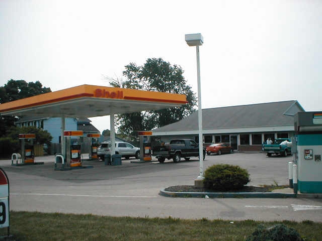
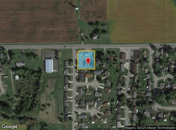
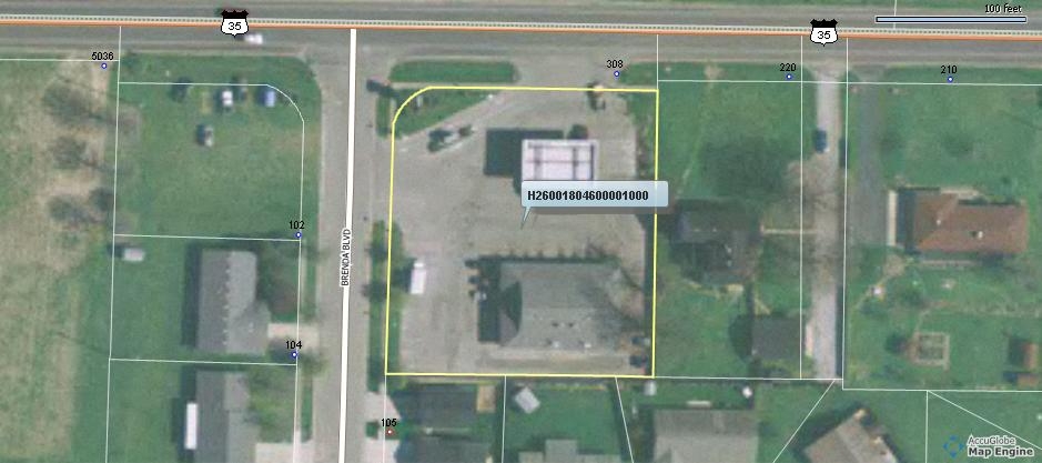
308 W Dayton St
H26-0018-0-4-60-000-1000
South Golden Gate Subd Sec 2
Conveniencestore
LOT 477-478 (0.403 + 0.374) SOUTH GOLDEN GATE SUBD SEC 2
X
Preble
39135C0260E
Ohio
2024
477-478
2024
0.78 AC
440100
Preble County
3,408 SF
Cincinnati/Dayton
DEMOGRAPHICS near 308 W Dayton St
1 Mile
3 Mile
5 Mile
2024 Total Population
2,065
4,403
12,473
2029 Population
2,058
4,380
12,411
Pop Growth 2024-2029
(0.34%)
(0.52%)
(0.50%)
Average Age
42
42
43
2024 Total Households
802
1,699
5,094
HH Growth 2024-2029
(0.37%)
(0.53%)
(0.53%)
Median Household Inc
$69,099
$68,718
$59,824
Avg Household Size
2.60
2.60
2.40
2024 Avg HH Vehicles
2.00
2.00
2.00
Median Home Value
$157,668
$164,081
$168,351
Median Year Built
1968
1969
1973
Nearby Places
- Restaurants
- Banks
- Shops
- Fitness
- Groceries
PUBLIC TRANSPORTATION
AIRPORT
James M Cox Dayton International
DRIVE
WALK
Distance
James M Cox Dayton International
39 min
28.0 mi
Freight Ports
Port of Toledo
DRIVE
WALK
Distance
Port of Toledo
202 min
171.7 mi
Nearby Properties
Address
Land Use
TOTAL SIZE
Lot Size
Zoning
Address
Land Use
TOTAL SIZE
Lot Size
Zoning
163,030 SF
17.51 AC
Address
Land Use
TOTAL SIZE
Lot Size
Zoning
2,500 SF
2.30 AC
Address
Land Use
TOTAL SIZE
Lot Size
Zoning
2,500 SF
2.35 AC
Address
Land Use
TOTAL SIZE
Lot Size
Zoning
2,688 SF
7.38 AC
Address
Land Use
TOTAL SIZE
Lot Size
Zoning
792 SF
4.62 AC
Address
Land Use
TOTAL SIZE
Lot Size
Zoning
40,511 SF
2.88 AC
Address
Land Use
TOTAL SIZE
Lot Size
Zoning
64.73 AC
Address
Land Use
TOTAL SIZE
Lot Size
Zoning
8,160 SF
5.15 AC
Address
Land Use
TOTAL SIZE
Lot Size
Zoning
3.91 AC
Address
Land Use
TOTAL SIZE
Lot Size
Zoning
12,681 SF
18.84 AC
Address
Land Use
TOTAL SIZE
Lot Size
Zoning
4,404 SF
1.93 AC
Address
Land Use
TOTAL SIZE
Lot Size
Zoning
10,000 SF
3.59 AC
Address
Land Use
TOTAL SIZE
Lot Size
Zoning
6,120 SF
4.23 AC
Address
Land Use
TOTAL SIZE
Lot Size
Zoning
621 SF
3.05 AC
Address
Land Use
TOTAL SIZE
Lot Size
Zoning
101.56 AC
Address
Land Use
TOTAL SIZE
Lot Size
Zoning
2,872 SF
8.16 AC
Address
Land Use
TOTAL SIZE
Lot Size
Zoning
7,200 SF
8.50 AC
Address
Land Use
TOTAL SIZE
Lot Size
Zoning
9,100 SF
1.31 AC
Address
Land Use
TOTAL SIZE
Lot Size
Zoning
82.58 AC
Address
Land Use
TOTAL SIZE
Lot Size
Zoning
5,018 SF
0.74 AC
Address
Land Use
TOTAL SIZE
Lot Size
Zoning
Address
Land Use
TOTAL SIZE
Lot Size
Zoning
79.63 AC
Address
Land Use
TOTAL SIZE
Lot Size
Zoning
5,395 SF
1.40 AC
Address
Land Use
TOTAL SIZE
Lot Size
Zoning
37.62 AC
Address
Land Use
TOTAL SIZE
Lot Size
Zoning
154.17 AC
Address
Land Use
TOTAL SIZE
Lot Size
Zoning
7,524 SF
1.53 AC
Address
Land Use
TOTAL SIZE
Lot Size
Zoning
7,200 SF
1.89 AC
Address
Land Use
TOTAL SIZE
Lot Size
Zoning
3,250 SF
0.42 AC
Address
Land Use
TOTAL SIZE
Lot Size
Zoning
The World's #1 Commercial Real Estate Marketplace
Connect with us
© 2025 CoStar Group
The information above has been obtained from sources believed reliable. While we do not doubt its accuracy we have not verified it and make no guarantee, warranty or representation about it. It is your responsibility to independently confirm its accuracy and completeness. Any projections, opinions, assumptions, or estimates used are for example only and do not represent the current or future performance of the property. The value of this transaction to you depends on tax and other factors which should be evaluated by your tax, financial, and legal advisors. You and your advisors should conduct a careful, independent investigation of the property to determine to your satisfaction the suitability of the property for your needs.