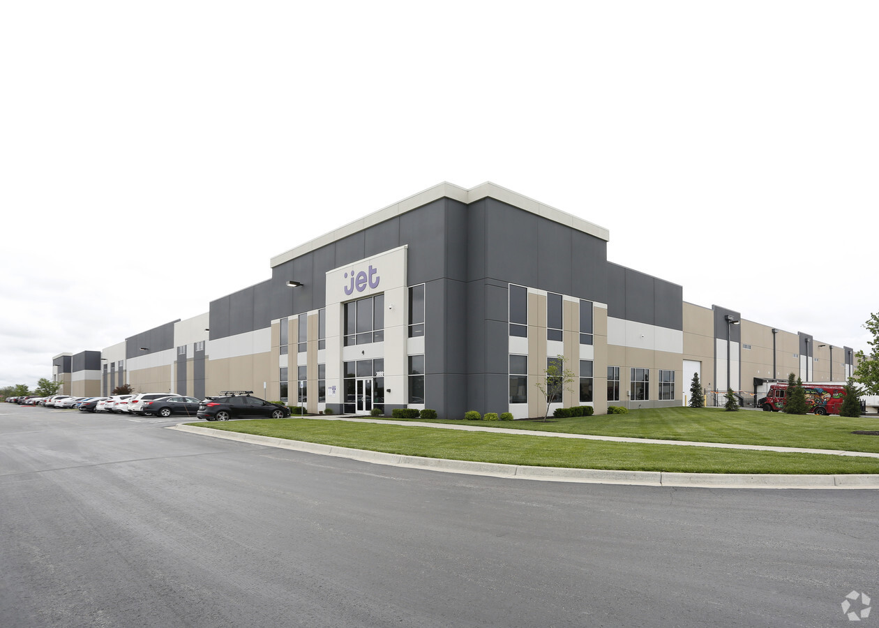
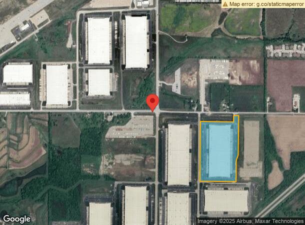
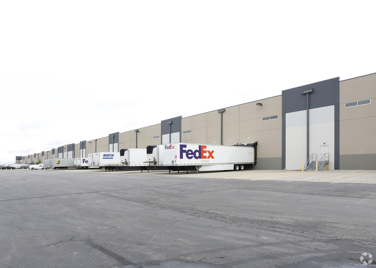
Property Record
30801 W 191St St, Gardner, KS 66030
NEARBY LISTINGS FOR SALE OR LEASE
Property Detail
30801 W 191St St
Kansas City, MO-KS
Logistics Park Kansas City -
BP55810000-0002
LOGISTICS PARK KANSAS CITY - SOUTHEAST FOURTH PLAT LT 2
Warehouse
Johnson
X
Kansas
20091C0134G
2
2023
30.96 AC
2023
Olathe
053712
Kansas City
650,915 SF
DEMOGRAPHICS near 30801 W 191St St
1 Mile
3 Mile
5 Mile
2024 Total Population
770
18,437
29,849
2029 Population
831
19,233
31,206
Pop Growth 2024-2029
+ 7.92%
+ 4.32%
+ 4.55%
Average Age
37
35
36
2024 Total Households
280
6,502
10,171
HH Growth 2024-2029
+ 7.50%
+ 4.44%
+ 4.78%
Median Household Inc
$87,250
$79,336
$83,265
Avg Household Size
2.80
2.80
2.80
2024 Avg HH Vehicles
3.00
2.00
2.00
Median Home Value
$477,585
$244,864
$253,889
Median Year Built
2007
2000
1998
Nearby Places
- Restaurants
- Banks
- Shops
- Fitness
- Groceries
Nearby Properties
Address
Land Use
TOTAL SIZE
Lot Size
Zoning
Address
Land Use
TOTAL SIZE
Lot Size
Zoning
1,952,263 SF
191.05 AC
RUR
Address
Land Use
TOTAL SIZE
Lot Size
Zoning
616,745 SF
48.06 AC
A-G
Address
Land Use
TOTAL SIZE
Lot Size
Zoning
951,860 SF
55.73 AC
RUR
Address
Land Use
TOTAL SIZE
Lot Size
Zoning
1,007,020 SF
57.84 AC
RUR
Address
Land Use
TOTAL SIZE
Lot Size
Zoning
921,308 SF
46.62 AC
RUR
Address
Land Use
TOTAL SIZE
Lot Size
Zoning
345,346 SF
73.42 AC
R-1
Address
Land Use
TOTAL SIZE
Lot Size
Zoning
822,082 SF
42.61 AC
RUR
Address
Land Use
TOTAL SIZE
Lot Size
Zoning
790,120 SF
38.55 AC
RUR
Address
Land Use
TOTAL SIZE
Lot Size
Zoning
750,100 SF
39.48 AC
RUR
Address
Land Use
TOTAL SIZE
Lot Size
Zoning
748,227 SF
38.70 AC
RUR
Address
Land Use
TOTAL SIZE
Lot Size
Zoning
764,500 SF
62.27 AC
RUR
Address
Land Use
TOTAL SIZE
Lot Size
Zoning
760,255 SF
36.45 AC
RUR
Address
Land Use
TOTAL SIZE
Lot Size
Zoning
655,128 SF
36.79 AC
A-G
Address
Land Use
TOTAL SIZE
Lot Size
Zoning
206,145 SF
55.77 AC
Address
Land Use
TOTAL SIZE
Lot Size
Zoning
573,983 SF
29.43 AC
A-G
Address
Land Use
TOTAL SIZE
Lot Size
Zoning
548,880 SF
33.62 AC
RUR
Address
Land Use
TOTAL SIZE
Lot Size
Zoning
511,945 SF
30.34 AC
RUR
Address
Land Use
TOTAL SIZE
Lot Size
Zoning
500,770 SF
26.61 AC
L-P
Address
Land Use
TOTAL SIZE
Lot Size
Zoning
379,400 SF
22.06 AC
RUR
Address
Land Use
TOTAL SIZE
Lot Size
Zoning
327,218 SF
18.66 AC
L-P
Address
Land Use
TOTAL SIZE
Lot Size
Zoning
301,675 SF
15.57 AC
I-H, L-P
Address
Land Use
TOTAL SIZE
Lot Size
Zoning
141,329 SF
20.88 AC
R-1
Address
Land Use
TOTAL SIZE
Lot Size
Zoning
186,110 SF
11.06 AC
I-H, L-P
Address
Land Use
TOTAL SIZE
Lot Size
Zoning
73,451 SF
14.39 AC
R-1
Address
Land Use
TOTAL SIZE
Lot Size
Zoning
88,724 SF
127.92 AC
A
Address
Land Use
TOTAL SIZE
Lot Size
Zoning
73,451 SF
12.58 AC
A
Address
Land Use
TOTAL SIZE
Lot Size
Zoning
71,146 SF
16.20 AC
A
Address
Land Use
TOTAL SIZE
Lot Size
Zoning
25,407 SF
4.24 AC
RUR
Address
Land Use
TOTAL SIZE
Lot Size
Zoning
49,060 SF
7.36 AC
A
The World's #1 Commercial Real Estate Marketplace
Connect with us
© 2025 CoStar Group
The information above has been obtained from sources believed reliable. While we do not doubt its accuracy we have not verified it and make no guarantee, warranty or representation about it. It is your responsibility to independently confirm its accuracy and completeness. Any projections, opinions, assumptions, or estimates used are for example only and do not represent the current or future performance of the property. The value of this transaction to you depends on tax and other factors which should be evaluated by your tax, financial, and legal advisors. You and your advisors should conduct a careful, independent investigation of the property to determine to your satisfaction the suitability of the property for your needs.