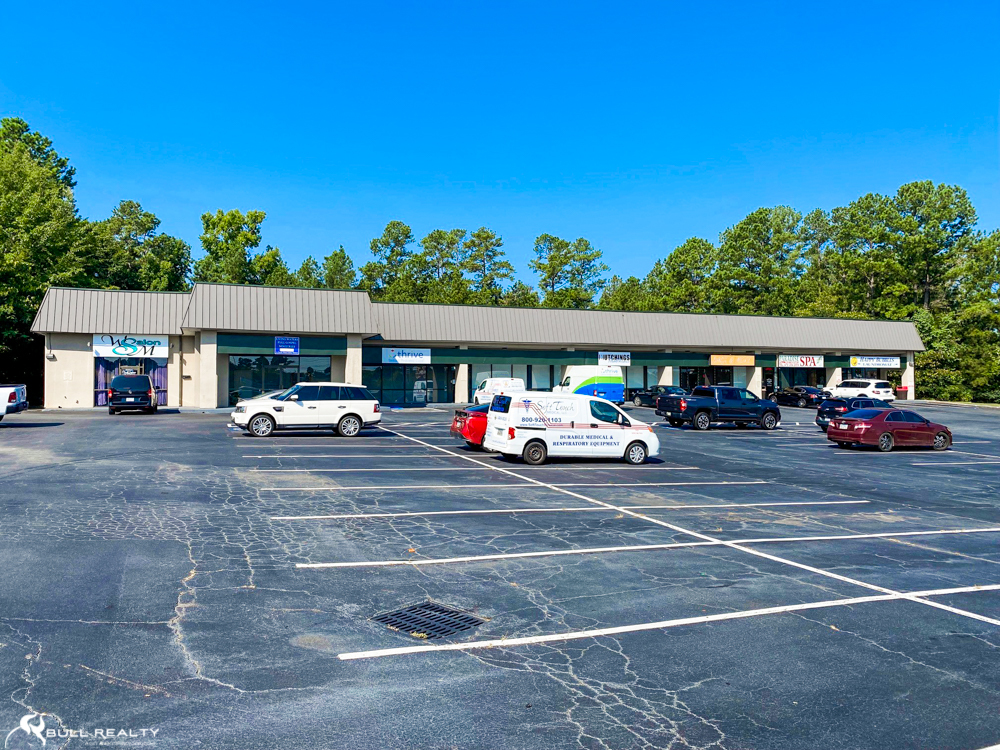
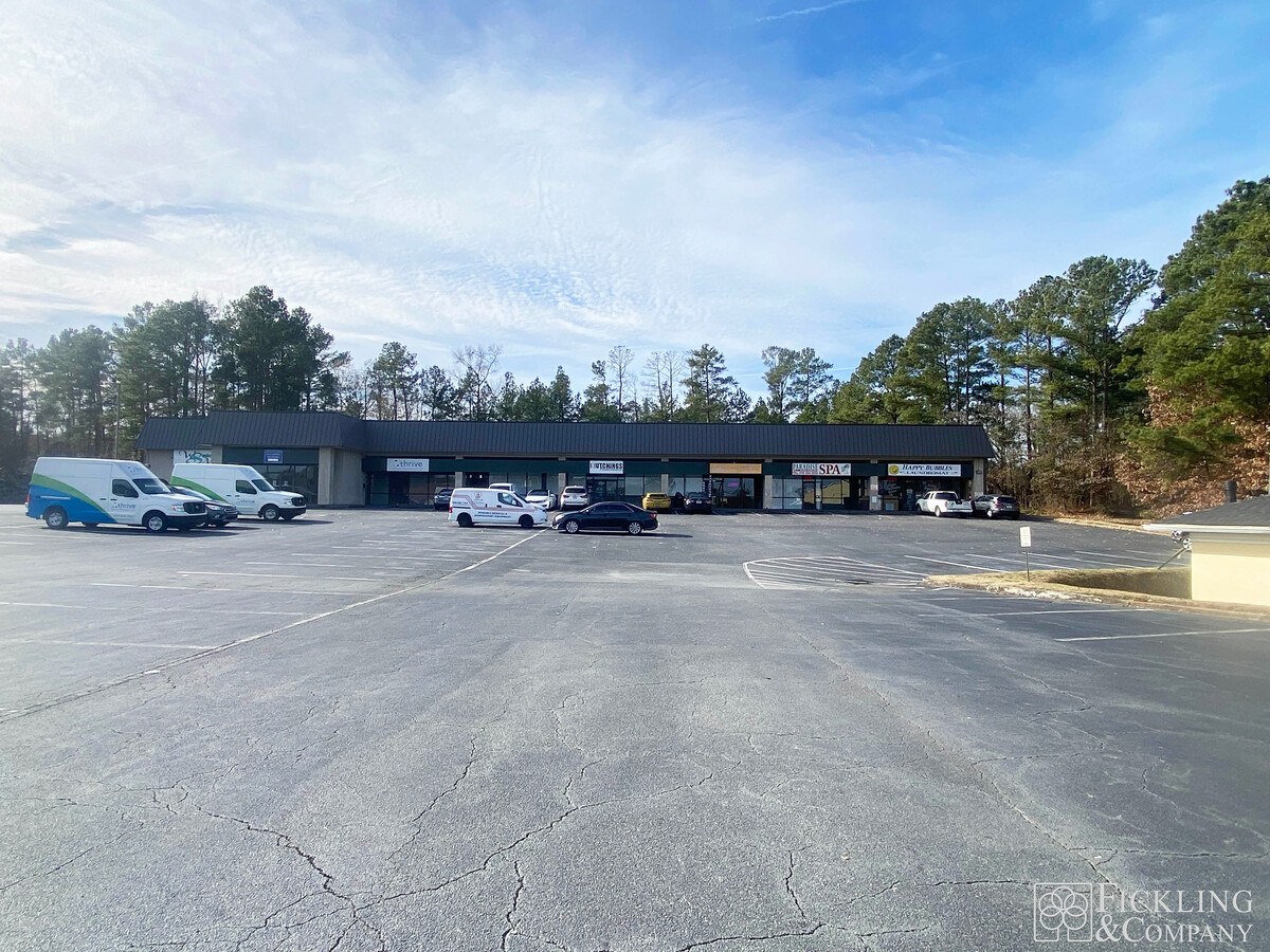
Property Record
3200 Northside Dr, Macon, GA 31210
NEARBY LISTINGS FOR SALE OR LEASE
Property Detail
3200 Northside Dr
N052-0108
Retail Dev Inc Ph Ii
Stripcommercialcenter
Bibb
X
Georgia
13169C0220E
347&358
2024
2.37 AC
2024
Suburban Macon
013408
Atlanta
19,187 SF
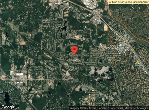
Macon-Bibb County, GA
DEMOGRAPHICS near 3200 Northside Dr
1 Mile
3 Mile
5 Mile
2024 Total Population
3,494
26,401
78,965
2029 Population
3,376
25,910
78,275
Pop Growth 2024-2029
(3.38%)
(1.86%)
(0.87%)
Average Age
41
39
39
2024 Total Households
1,505
11,326
33,830
HH Growth 2024-2029
(3.39%)
(1.88%)
(0.81%)
Median Household Inc
$71,624
$67,585
$49,489
Avg Household Size
2.30
2.30
2.20
2024 Avg HH Vehicles
2.00
2.00
2.00
Median Home Value
$148,301
$175,363
$170,734
Median Year Built
1968
1976
1974
Nearby Places
- Restaurants
- Banks
- Shops
- Fitness
- Groceries
SALE & LEASE HISTORY
LISTING DATE
SALE/LEASE

Sep 25, 2016
For Lease
Sep 24, 2016
For Sale
May 09, 2023
For Lease
Jun 12, 2020
For Sale
Jul 31, 2017
For Sale
Feb 28, 2020
For Sale
Feb 13, 2018
For Lease
Dec 26, 2023
For Lease
Aug 10, 2021
For Sale
Aug 01, 2017
For Sale
Nearby Properties
Address
Land Use
TOTAL SIZE
Lot Size
Zoning
Address
Land Use
TOTAL SIZE
Lot Size
Zoning
83,990 SF
42.03 AC
C-2
Address
Land Use
TOTAL SIZE
Lot Size
Zoning
Address
Land Use
TOTAL SIZE
Lot Size
Zoning
6,222 SF
56.17 AC
PDR
Address
Land Use
TOTAL SIZE
Lot Size
Zoning
298,760 SF
60.24 AC
PDE
Address
Land Use
TOTAL SIZE
Lot Size
Zoning
2,559 SF
45.58 AC
R-3
Address
Land Use
TOTAL SIZE
Lot Size
Zoning
196,702 SF
37.72 AC
PDE
Address
Land Use
TOTAL SIZE
Lot Size
Zoning
83,104 SF
20.39 AC
PDE
Address
Land Use
TOTAL SIZE
Lot Size
Zoning
4,671 SF
22.66 AC
R-3
Address
Land Use
TOTAL SIZE
Lot Size
Zoning
94,879 SF
18.77 AC
C-4
Address
Land Use
TOTAL SIZE
Lot Size
Zoning
211,536 SF
16.48 AC
C-2
Address
Land Use
TOTAL SIZE
Lot Size
Zoning
194,734 SF
6.37 AC
C-2
Address
Land Use
TOTAL SIZE
Lot Size
Zoning
5,684 SF
29.99 AC
PDE
Address
Land Use
TOTAL SIZE
Lot Size
Zoning
98,912 SF
13.95 AC
PDE
Address
Land Use
TOTAL SIZE
Lot Size
Zoning
0.63 AC
007
Address
Land Use
TOTAL SIZE
Lot Size
Zoning
3,204 SF
49.78 AC
R-3
Address
Land Use
TOTAL SIZE
Lot Size
Zoning
172,808 SF
38.40 AC
C-4/PDE
Address
Land Use
TOTAL SIZE
Lot Size
Zoning
4,734 SF
40 AC
PDE
Address
Land Use
TOTAL SIZE
Lot Size
Zoning
71,021 SF
8.94 AC
PDC
Address
Land Use
TOTAL SIZE
Lot Size
Zoning
5,270 SF
20 AC
Address
Land Use
TOTAL SIZE
Lot Size
Zoning
61,540 SF
130.80 AC
A
Address
Land Use
TOTAL SIZE
Lot Size
Zoning
231,774 SF
21.27 AC
R-1AAA
Address
Land Use
TOTAL SIZE
Lot Size
Zoning
3,902 SF
53.40 AC
PDE
Address
Land Use
TOTAL SIZE
Lot Size
Zoning
2,366 SF
14.46 AC
PDE
Address
Land Use
TOTAL SIZE
Lot Size
Zoning
62,688 SF
32.47 AC
R-3
Address
Land Use
TOTAL SIZE
Lot Size
Zoning
133,220 SF
9.15 AC
C-2
Address
Land Use
TOTAL SIZE
Lot Size
Zoning
1,452 SF
12.16 AC
R-3
Address
Land Use
TOTAL SIZE
Lot Size
Zoning
51,786 SF
21.05 AC
PDR
Address
Land Use
TOTAL SIZE
Lot Size
Zoning
20,544 SF
62.02 AC
A
Address
Land Use
TOTAL SIZE
Lot Size
Zoning
162,132 SF
21.95 AC
PDE
Address
Land Use
TOTAL SIZE
Lot Size
Zoning
55,536 SF
20.36 AC
PDE
The World's #1 Commercial Real Estate Marketplace
Connect with us
© 2025 CoStar Group
The information above has been obtained from sources believed reliable. While we do not doubt its accuracy we have not verified it and make no guarantee, warranty or representation about it. It is your responsibility to independently confirm its accuracy and completeness. Any projections, opinions, assumptions, or estimates used are for example only and do not represent the current or future performance of the property. The value of this transaction to you depends on tax and other factors which should be evaluated by your tax, financial, and legal advisors. You and your advisors should conduct a careful, independent investigation of the property to determine to your satisfaction the suitability of the property for your needs.