Property Record
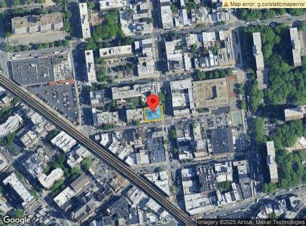
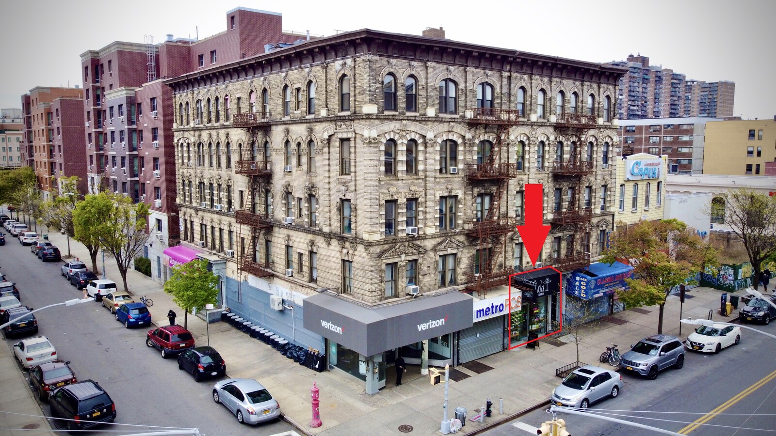
31 Graham Ave, Brooklyn, NY 11206

NEARBY LISTINGS FOR SALE OR LEASE
Property Detail
31 Graham Ave
03113-0022
Kings
Apartment
New York
X
22
3604970204F
0.17 AC
2024
North Brooklyn
2024
Long Island (New York)
049100
New York-Jersey City-White Plains, NY-NJ
27,480 SF
DEMOGRAPHICS near 31 Graham Ave
1 Mile
3 Mile
5 Mile
2024 Total Population
196,548
1,217,268
3,103,414
2029 Population
187,993
1,149,216
2,911,902
Pop Growth 2024-2029
(4.35%)
(5.59%)
(6.17%)
Average Age
34
38
39
2024 Total Households
69,473
494,410
1,290,031
HH Growth 2024-2029
(4.95%)
(6.00%)
(6.46%)
Median Household Inc
$61,392
$77,050
$83,101
Avg Household Size
2.70
2.30
2.30
2024 Avg HH Vehicles
.00
.00
.00
Median Home Value
$895,549
$942,929
$853,189
Median Year Built
1959
1948
1950
Nearby Places
- Restaurants
- Banks
- Shops
- Fitness
- Groceries
PUBLIC TRANSPORTATION
TRANSIT/SUBWAY
Lorimer Street (J,M Line) (J - New York MTA Subway (The Subway), M - New York MTA Subway (The Subway))
DRIVE
WALK
Distance
Lorimer Street (J,M Line) (J - New York MTA Subway (The Subway), M - New York MTA Subway (The Subway))
1 min
5 min
0.3 mi
Montrose Avenue (L - New York MTA Subway (The Subway))
DRIVE
WALK
Distance
Montrose Avenue (L - New York MTA Subway (The Subway))
2 min
9 min
0.5 mi
COMMUTER RAIL
Hunterspoint Avenue Station (Hempstead Branch - Long Island Rail Road, Oyster Bay Branch - Long Island Rail Road)
DRIVE
WALK
Distance
Hunterspoint Avenue Station (Hempstead Branch - Long Island Rail Road, Oyster Bay Branch - Long Island Rail Road)
12 min
3.2 mi
AIRPORT
John F. Kennedy International
DRIVE
WALK
Distance
John F. Kennedy International
24 min
14.6 mi
Newark Liberty International
DRIVE
WALK
Distance
Newark Liberty International
30 min
16.5 mi
Westchester County
DRIVE
WALK
Distance
Westchester County
50 min
36.2 mi
SALE & LEASE HISTORY
LISTING DATE
SALE/LEASE

Sep 25, 2016
For Lease
Oct 05, 2018
For Lease
Oct 03, 2017
For Lease
Nov 13, 2018
For Lease
Mar 22, 2021
For Lease
Nearby Properties
Address
Land Use
TOTAL SIZE
Lot Size
Zoning
Address
Land Use
TOTAL SIZE
Lot Size
Zoning
2,812,739 SF
2.10 AC
C5-3
Address
Land Use
TOTAL SIZE
Lot Size
Zoning
1,104,505 SF
2.32 AC
C4-7
Address
Land Use
TOTAL SIZE
Lot Size
Zoning
3,122,165 SF
19.02 AC
R7-2
Address
Land Use
TOTAL SIZE
Lot Size
Zoning
1,385,425 SF
6.43 AC
R8
Address
Land Use
TOTAL SIZE
Lot Size
Zoning
758 SF
1.45 AC
PARK
Address
Land Use
TOTAL SIZE
Lot Size
Zoning
805,287 SF
1 AC
R10
Address
Land Use
TOTAL SIZE
Lot Size
Zoning
1,503,235 SF
5.28 AC
C2-7
Address
Land Use
TOTAL SIZE
Lot Size
Zoning
393.54 AC
PARK
Address
Land Use
TOTAL SIZE
Lot Size
Zoning
942,992 SF
2.22 AC
R7-1
Address
Land Use
TOTAL SIZE
Lot Size
Zoning
2,948,300 SF
27.71 AC
R7-2
Address
Land Use
TOTAL SIZE
Lot Size
Zoning
1,330,743 SF
2.20 AC
C6-4
Address
Land Use
TOTAL SIZE
Lot Size
Zoning
296,915 SF
0.31 AC
C5-3
Address
Land Use
TOTAL SIZE
Lot Size
Zoning
830,879 SF
1 AC
C5-4
Address
Land Use
TOTAL SIZE
Lot Size
Zoning
383,249 SF
1.32 AC
R6
Address
Land Use
TOTAL SIZE
Lot Size
Zoning
835,231 SF
11.32 AC
R6
Address
Land Use
TOTAL SIZE
Lot Size
Zoning
449,695 SF
0.60 AC
C6-2
Address
Land Use
TOTAL SIZE
Lot Size
Zoning
1,658,649 SF
15.93 AC
R7-2
Address
Land Use
TOTAL SIZE
Lot Size
Zoning
410,239 SF
0.77 AC
R10
Address
Land Use
TOTAL SIZE
Lot Size
Zoning
798,819 SF
2.57 AC
R6
Address
Land Use
TOTAL SIZE
Lot Size
Zoning
579,404 SF
11.20 AC
R6
Address
Land Use
TOTAL SIZE
Lot Size
Zoning
790,392 SF
0.74 AC
M1-1
Address
Land Use
TOTAL SIZE
Lot Size
Zoning
550,232 SF
1.68 AC
R7-2
Address
Land Use
TOTAL SIZE
Lot Size
Zoning
589,750 SF
1.19 AC
R6
Address
Land Use
TOTAL SIZE
Lot Size
Zoning
662,532 SF
1.21 AC
C6-4
Address
Land Use
TOTAL SIZE
Lot Size
Zoning
978,544 SF
1.60 AC
C61A
Address
Land Use
TOTAL SIZE
Lot Size
Zoning
370,363 SF
0.34 AC
C6-4
Address
Land Use
TOTAL SIZE
Lot Size
Zoning
392,162 SF
1.86 AC
M3-1
Address
Land Use
TOTAL SIZE
Lot Size
Zoning
667,250 SF
1.06 AC
C64.5
Address
Land Use
TOTAL SIZE
Lot Size
Zoning
629,064 SF
0.99 AC
C6-4
Address
Land Use
TOTAL SIZE
Lot Size
Zoning
472,115 SF
0.49 AC
C64.5
The World's #1 Commercial Real Estate Marketplace
Connect with us
© 2025 CoStar Group
The information above has been obtained from sources believed reliable. While we do not doubt its accuracy we have not verified it and make no guarantee, warranty or representation about it. It is your responsibility to independently confirm its accuracy and completeness. Any projections, opinions, assumptions, or estimates used are for example only and do not represent the current or future performance of the property. The value of this transaction to you depends on tax and other factors which should be evaluated by your tax, financial, and legal advisors. You and your advisors should conduct a careful, independent investigation of the property to determine to your satisfaction the suitability of the property for your needs.