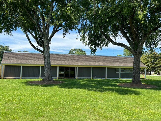
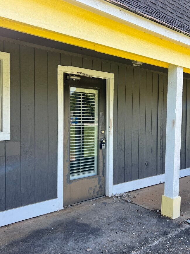
Property Record
31 J D Foshee Rd, Montgomery, AL 36117

NEARBY LISTINGS FOR SALE OR LEASE
-
-
View all Montgomery listings for lease on LoopNet.com
Property Detail
31 J D Foshee Rd
05-07-35-0-000-014.000
COM NW COR SW1/4 SEC 35 T17N R19E TH E 1584 TH S 60.7 TO POB TH E 115 TH S 266.3 TH WLY 198.9 TH NELY 280.1 TO POB
Publicstorage
Montgomery
AE
Alabama
01101C0117J
0.96 AC
2025
Outlying Montgomery Cnty
2025
Montgomery
005414
Montgomery, AL
4,187 SF
DEMOGRAPHICS near 31 J D Foshee Rd
1 Mile
3 Mile
5 Mile
2024 Total Population
44
8,994
37,408
2029 Population
42
8,761
36,461
Pop Growth 2024-2029
(4.55%)
(2.59%)
(2.53%)
Average Age
35
43
40
2024 Total Households
17
3,366
14,908
HH Growth 2024-2029
0.00%
(3.00%)
(2.72%)
Median Household Inc
$96,874
$89,838
$76,248
Avg Household Size
2.40
2.30
2.40
2024 Avg HH Vehicles
3.00
2.00
2.00
Median Home Value
$154,545
$228,831
$218,273
Median Year Built
1997
1996
1994
Nearby Places
Map Layers
Map Styles
 Street
 Aerial
- Restaurants
- Banks
- Shops
- Fitness
- Groceries
PUBLIC TRANSPORTATION
AIRPORT
Montgomery Regional (Dannelly Field)
DRIVE
WALK
Distance
Montgomery Regional (Dannelly Field)
29 min
25.5 mi
SALE & LEASE HISTORY
LISTING DATE
SALE/LEASE

Sep 25, 2016
For Lease
Jun 11, 2024
For Lease
Nearby Properties
Address
Land Use
TOTAL SIZE
Lot Size
Zoning
Address
Land Use
TOTAL SIZE
Lot Size
Zoning
208,799 SF
17.34 AC
O-2
Address
Land Use
TOTAL SIZE
Lot Size
Zoning
1,996 SF
15.81 AC
PUD
Address
Land Use
TOTAL SIZE
Lot Size
Zoning
6,605 SF
6 AC
PUD
Address
Land Use
TOTAL SIZE
Lot Size
Zoning
344,095 SF
30.02 AC
Address
Land Use
TOTAL SIZE
Lot Size
Zoning
170,644 SF
12.34 AC
Address
Land Use
TOTAL SIZE
Lot Size
Zoning
117,633 SF
52.48 AC
Address
Land Use
TOTAL SIZE
Lot Size
Zoning
Address
Land Use
TOTAL SIZE
Lot Size
Zoning
96,764 SF
13.64 AC
M-1
Address
Land Use
TOTAL SIZE
Lot Size
Zoning
168,209 SF
21.62 AC
Address
Land Use
TOTAL SIZE
Lot Size
Zoning
168,209 SF
21.62 AC
Address
Land Use
TOTAL SIZE
Lot Size
Zoning
36,514 SF
4.57 AC
R-65-M
Address
Land Use
TOTAL SIZE
Lot Size
Zoning
34.70 AC
B-2
Address
Land Use
TOTAL SIZE
Lot Size
Zoning
139,221 SF
11.77 AC
M-1
Address
Land Use
TOTAL SIZE
Lot Size
Zoning
49,843 SF
11.99 AC
M-1
Address
Land Use
TOTAL SIZE
Lot Size
Zoning
52,059 SF
4.10 AC
O-2
Address
Land Use
TOTAL SIZE
Lot Size
Zoning
28,237 SF
7.59 AC
PUD
Address
Land Use
TOTAL SIZE
Lot Size
Zoning
27,600 SF
7.55 AC
O-2
Address
Land Use
TOTAL SIZE
Lot Size
Zoning
4,281 SF
9.52 AC
B-3
Address
Land Use
TOTAL SIZE
Lot Size
Zoning
33,870 SF
5.10 AC
Address
Land Use
TOTAL SIZE
Lot Size
Zoning
43,260 SF
6.27 AC
M-1
Address
Land Use
TOTAL SIZE
Lot Size
Zoning
16,162 SF
3.41 AC
PUD
Address
Land Use
TOTAL SIZE
Lot Size
Zoning
44,267 SF
9.99 AC
M-1
Address
Land Use
TOTAL SIZE
Lot Size
Zoning
23,110 SF
5 AC
B-2
Address
Land Use
TOTAL SIZE
Lot Size
Zoning
24,574 SF
120 AC
AGR-1
Address
Land Use
TOTAL SIZE
Lot Size
Zoning
18,546 SF
80.40 AC
Address
Land Use
TOTAL SIZE
Lot Size
Zoning
21,600 SF
4 AC
Address
Land Use
TOTAL SIZE
Lot Size
Zoning
31,193 SF
4.90 AC
O-2
Address
Land Use
TOTAL SIZE
Lot Size
Zoning
15.70 AC
B-3
Address
Land Use
TOTAL SIZE
Lot Size
Zoning
25,048 SF
3 AC
Address
Land Use
TOTAL SIZE
Lot Size
Zoning
46,440 SF
10.80 AC
M-3
The World's #1 Commercial Real Estate Marketplace
Connect with us
© 2026 CoStar Group
The information above has been obtained from sources believed reliable. While we do not doubt its accuracy we have not verified it and make no guarantee, warranty or representation about it. It is your responsibility to independently confirm its accuracy and completeness. Any projections, opinions, assumptions, or estimates used are for example only and do not represent the current or future performance of the property. The value of this transaction to you depends on tax and other factors which should be evaluated by your tax, financial, and legal advisors. You and your advisors should conduct a careful, independent investigation of the property to determine to your satisfaction the suitability of the property for your needs.