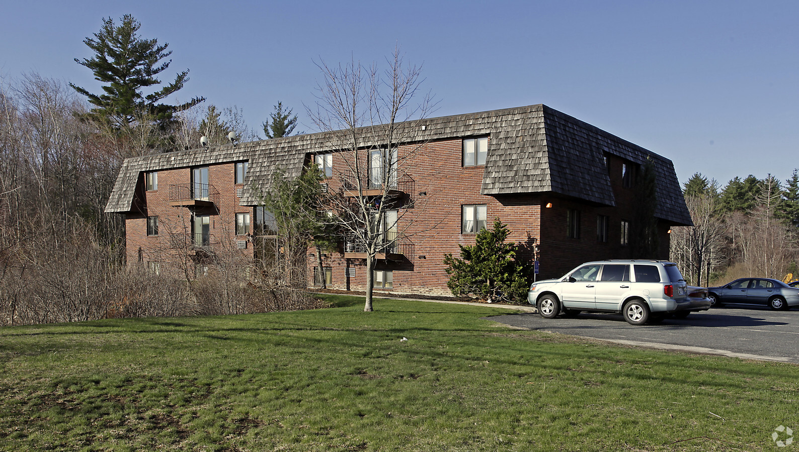
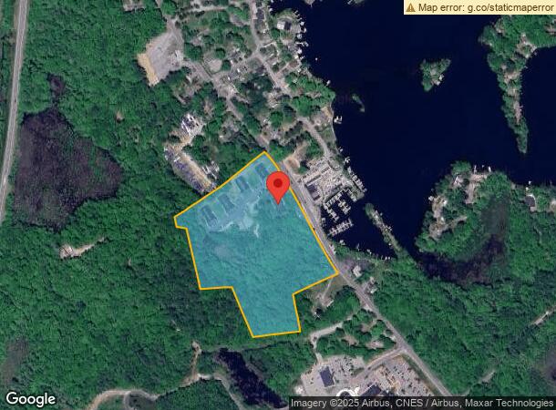
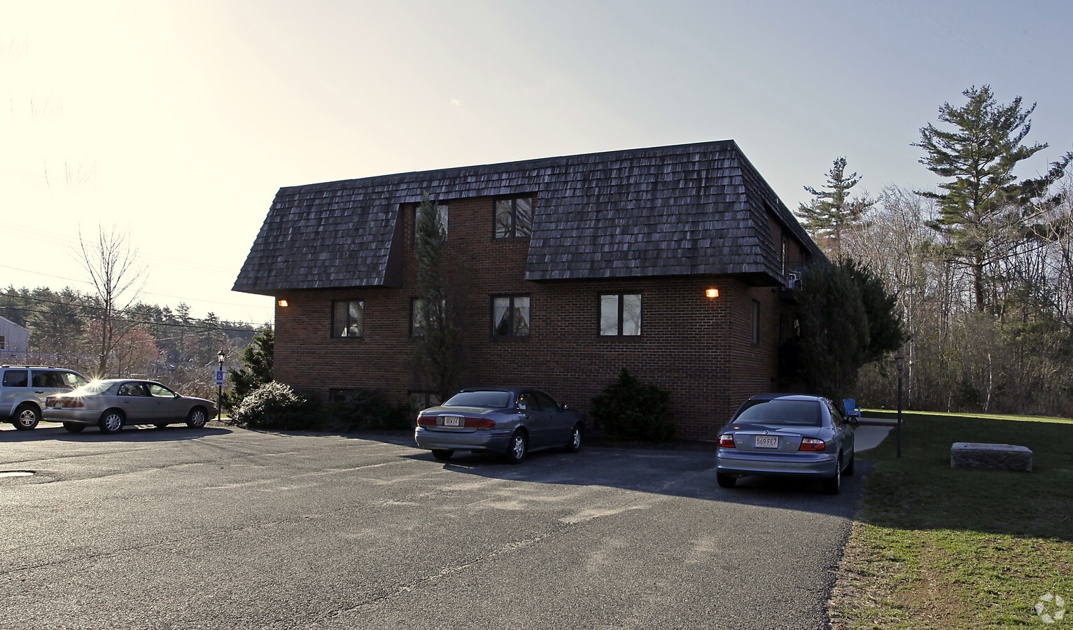
Property Record
310 Thompson Rd, Webster, MA 01570
NEARBY LISTINGS FOR SALE OR LEASE
-
-
View all Webster listings for sale on LoopNet.com
Property Detail
310 Thompson Rd
WEBS-000034-A000000-000009
Worcester
Apartment
Massachusetts
A
14 AC
25027C0988F
Outlying Worcester County
2024
Boston
2024
Worcester, MA-CT
754100
DEMOGRAPHICS near 310 Thompson Rd
1 Mile
3 Mile
5 Mile
2024 Total Population
1,583
23,454
36,857
2029 Population
1,586
23,295
36,663
Pop Growth 2024-2029
+ 0.19%
(0.68%)
(0.53%)
Average Age
48
43
42
2024 Total Households
696
10,049
15,059
HH Growth 2024-2029
+ 0.14%
(0.71%)
(0.54%)
Median Household Inc
$95,438
$68,913
$81,168
Avg Household Size
2.20
2.30
2.40
2024 Avg HH Vehicles
2.00
2.00
2.00
Median Home Value
$409,615
$304,415
$312,129
Median Year Built
1977
1963
1966
Nearby Places
- Restaurants
- Banks
- Shops
- Fitness
- Groceries
PUBLIC TRANSPORTATION
AIRPORT
Worcester Regional
DRIVE
WALK
Distance
Worcester Regional
32 min
19.3 mi
Freight Ports
Port of Davisville, RI
DRIVE
WALK
Distance
Port of Davisville, RI
75 min
59.4 mi
Nearby Properties
Address
Land Use
TOTAL SIZE
Lot Size
Zoning
Address
Land Use
TOTAL SIZE
Lot Size
Zoning
60.14 AC
Address
Land Use
TOTAL SIZE
Lot Size
Zoning
95,274 SF
10.18 AC
Address
Land Use
TOTAL SIZE
Lot Size
Zoning
9.05 AC
INDUST
Address
Land Use
TOTAL SIZE
Lot Size
Zoning
131,686 SF
14.60 AC
INDUST
Address
Land Use
TOTAL SIZE
Lot Size
Zoning
4.87 AC
INDUST
Address
Land Use
TOTAL SIZE
Lot Size
Zoning
10.09 AC
Address
Land Use
TOTAL SIZE
Lot Size
Zoning
101,227 SF
8.48 AC
Address
Land Use
TOTAL SIZE
Lot Size
Zoning
2.15 AC
GB-4 W
Address
Land Use
TOTAL SIZE
Lot Size
Zoning
102,704 SF
31 AC
GB-4 W
Address
Land Use
TOTAL SIZE
Lot Size
Zoning
123,592 SF
10 AC
INDUST
Address
Land Use
TOTAL SIZE
Lot Size
Zoning
164,960 SF
15.40 AC
INDUST
Address
Land Use
TOTAL SIZE
Lot Size
Zoning
52,677 SF
15.17 AC
Address
Land Use
TOTAL SIZE
Lot Size
Zoning
54,273 SF
8.94 AC
INDUST
Address
Land Use
TOTAL SIZE
Lot Size
Zoning
3.60 AC
Address
Land Use
TOTAL SIZE
Lot Size
Zoning
37,907 SF
28.50 AC
Address
Land Use
TOTAL SIZE
Lot Size
Zoning
21,111 SF
1.71 AC
GB-4 W
Address
Land Use
TOTAL SIZE
Lot Size
Zoning
18.60 AC
GB-5 W
Address
Land Use
TOTAL SIZE
Lot Size
Zoning
5.24 AC
GB-4 W
Address
Land Use
TOTAL SIZE
Lot Size
Zoning
33,063 SF
1.96 AC
Address
Land Use
TOTAL SIZE
Lot Size
Zoning
6.08 AC
MR-12,
Address
Land Use
TOTAL SIZE
Lot Size
Zoning
70,160 SF
10.57 AC
Address
Land Use
TOTAL SIZE
Lot Size
Zoning
8.96 AC
GB-5 W
Address
Land Use
TOTAL SIZE
Lot Size
Zoning
47,692 SF
1.89 AC
SFR-12
Address
Land Use
TOTAL SIZE
Lot Size
Zoning
4,993 SF
4.38 AC
MR-12,
Address
Land Use
TOTAL SIZE
Lot Size
Zoning
29,360 SF
0.38 AC
Address
Land Use
TOTAL SIZE
Lot Size
Zoning
60,233 SF
4.09 AC
GB-4 W
Address
Land Use
TOTAL SIZE
Lot Size
Zoning
3.42 AC
GB-4 W
Address
Land Use
TOTAL SIZE
Lot Size
Zoning
5,353 SF
38.95 AC
Address
Land Use
TOTAL SIZE
Lot Size
Zoning
23,435 SF
1.54 AC
The World's #1 Commercial Real Estate Marketplace
Connect with us
© 2025 CoStar Group
The information above has been obtained from sources believed reliable. While we do not doubt its accuracy we have not verified it and make no guarantee, warranty or representation about it. It is your responsibility to independently confirm its accuracy and completeness. Any projections, opinions, assumptions, or estimates used are for example only and do not represent the current or future performance of the property. The value of this transaction to you depends on tax and other factors which should be evaluated by your tax, financial, and legal advisors. You and your advisors should conduct a careful, independent investigation of the property to determine to your satisfaction the suitability of the property for your needs.