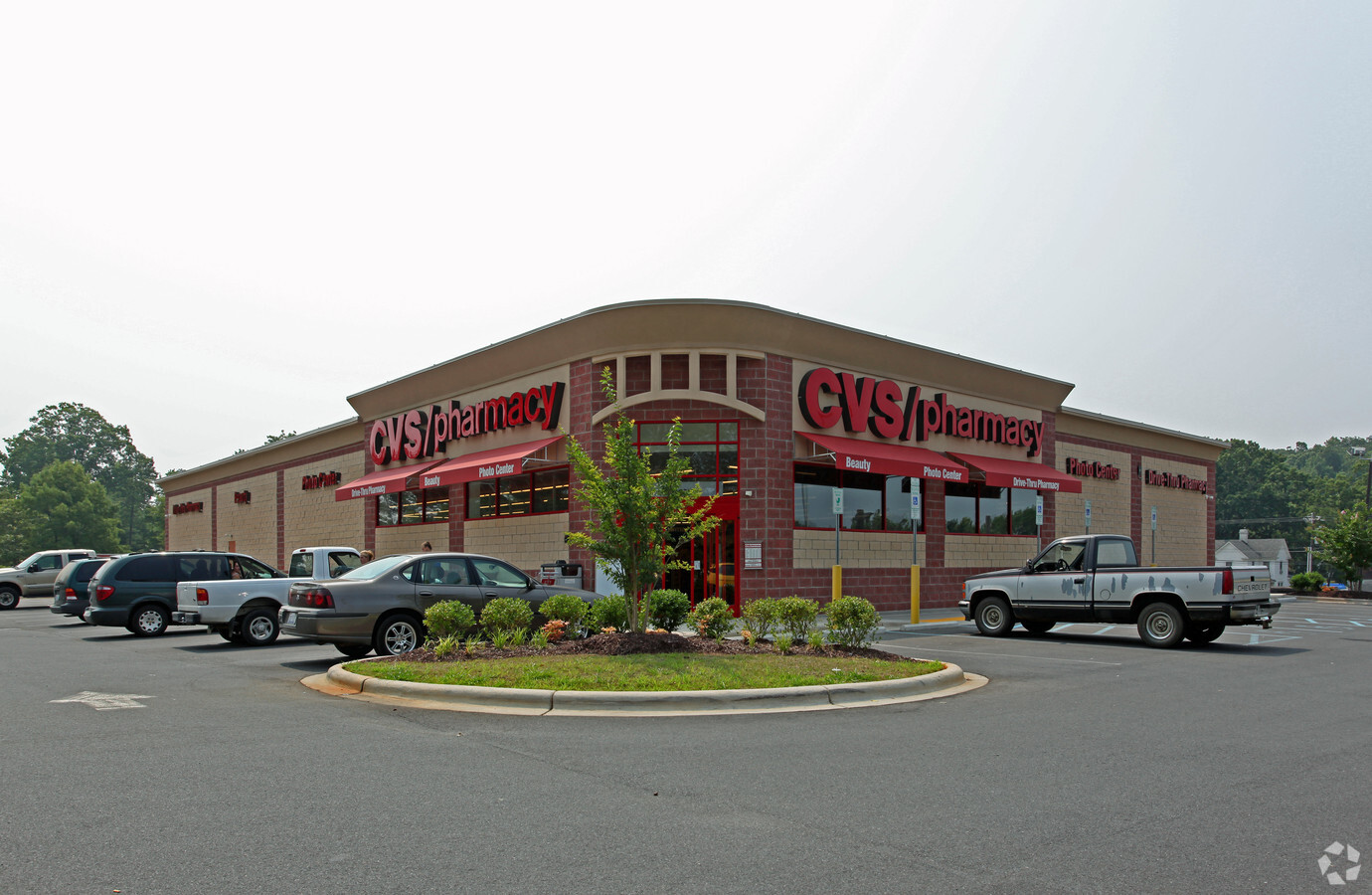
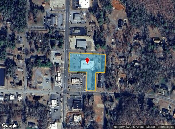
Property Record
310 Vernon Ave, Denton, NC 27239
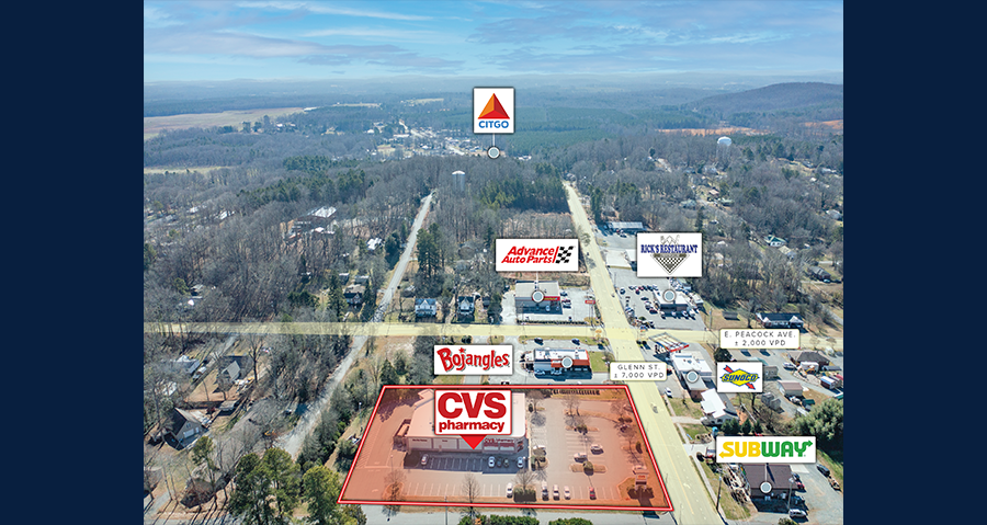
NEARBY LISTINGS FOR SALE OR LEASE
Property Detail
310 Vernon Ave
07-052-0-037-0001-0-0-0
2 270 Acros Done E Miller Patsy K Miller
Drugstorepharmacycvswalgreens
P=1-13&52-37&41 B37 L1-8&13&14 BK2380-296
X
Davidson
3710667800J
North Carolina
2024
2.27 AC
2024
South Davidson County
062002
Greensboro/Winston-Salem
15,038 SF
Winston-Salem, NC
DEMOGRAPHICS near 310 Vernon Ave
1 Mile
3 Mile
5 Mile
2024 Total Population
1,591
3,463
6,146
2029 Population
1,647
3,602
6,419
Pop Growth 2024-2029
+ 3.52%
+ 4.01%
+ 4.44%
Average Age
43
44
44
2024 Total Households
671
1,444
2,549
HH Growth 2024-2029
+ 3.43%
+ 3.95%
+ 4.39%
Median Household Inc
$42,738
$46,111
$52,490
Avg Household Size
2.30
2.30
2.30
2024 Avg HH Vehicles
2.00
2.00
2.00
Median Home Value
$164,779
$163,450
$171,414
Median Year Built
1978
1981
1984
Nearby Places
- Restaurants
- Banks
- Shops
- Fitness
- Groceries
SALE & LEASE HISTORY
LISTING DATE
SALE/LEASE

Jan 26, 2022
For Sale
Feb 13, 2019
For Sale
Nearby Properties
Address
Land Use
TOTAL SIZE
Lot Size
Zoning
Address
Land Use
TOTAL SIZE
Lot Size
Zoning
119,123 SF
57.62 AC
RA1
Address
Land Use
TOTAL SIZE
Lot Size
Zoning
44,898 SF
50.41 AC
RA
Address
Land Use
TOTAL SIZE
Lot Size
Zoning
14,515 SF
17.54 AC
R8A
Address
Land Use
TOTAL SIZE
Lot Size
Zoning
900 SF
6.59 AC
RA2
Address
Land Use
TOTAL SIZE
Lot Size
Zoning
1,720 SF
16.24 AC
LI
Address
Land Use
TOTAL SIZE
Lot Size
Zoning
48,158 SF
4.59 AC
LI
Address
Land Use
TOTAL SIZE
Lot Size
Zoning
2,216 SF
37.71 AC
RA
Address
Land Use
TOTAL SIZE
Lot Size
Zoning
63,750 SF
17.13 AC
LI
Address
Land Use
TOTAL SIZE
Lot Size
Zoning
79,200 SF
189.02 AC
RM1
Address
Land Use
TOTAL SIZE
Lot Size
Zoning
12,715 SF
1.95 AC
HB
Address
Land Use
TOTAL SIZE
Lot Size
Zoning
43,008 SF
5.91 AC
HB
Address
Land Use
TOTAL SIZE
Lot Size
Zoning
0.03 AC
RA1
Address
Land Use
TOTAL SIZE
Lot Size
Zoning
9,000 SF
7.89 AC
R15
Address
Land Use
TOTAL SIZE
Lot Size
Zoning
5,340 SF
1.27 AC
B3
Address
Land Use
TOTAL SIZE
Lot Size
Zoning
139,329 SF
12.68 AC
LI
Address
Land Use
TOTAL SIZE
Lot Size
Zoning
9,265 SF
1.28 AC
B2
Address
Land Use
TOTAL SIZE
Lot Size
Zoning
16,000 SF
7.14 AC
RA2
Address
Land Use
TOTAL SIZE
Lot Size
Zoning
7,408 SF
0.83 AC
B2
Address
Land Use
TOTAL SIZE
Lot Size
Zoning
16,287 SF
16.97 AC
RA1
Address
Land Use
TOTAL SIZE
Lot Size
Zoning
7,972 SF
3.70 AC
R8A
Address
Land Use
TOTAL SIZE
Lot Size
Zoning
7,200 SF
7.02 AC
LI
Address
Land Use
TOTAL SIZE
Lot Size
Zoning
4,500 SF
1.04 AC
R15
Address
Land Use
TOTAL SIZE
Lot Size
Zoning
7,674 SF
0.87 AC
HB
Address
Land Use
TOTAL SIZE
Lot Size
Zoning
19,876 SF
5.36 AC
LI
Address
Land Use
TOTAL SIZE
Lot Size
Zoning
23,800 SF
5.02 AC
LI
Address
Land Use
TOTAL SIZE
Lot Size
Zoning
5,428 SF
0.89 AC
R8A
Address
Land Use
TOTAL SIZE
Lot Size
Zoning
2.83 AC
RA
Address
Land Use
TOTAL SIZE
Lot Size
Zoning
197.82 AC
RA2
Address
Land Use
TOTAL SIZE
Lot Size
Zoning
11,180 SF
6.33 AC
LI
The World's #1 Commercial Real Estate Marketplace
Connect with us
© 2025 CoStar Group
The information above has been obtained from sources believed reliable. While we do not doubt its accuracy we have not verified it and make no guarantee, warranty or representation about it. It is your responsibility to independently confirm its accuracy and completeness. Any projections, opinions, assumptions, or estimates used are for example only and do not represent the current or future performance of the property. The value of this transaction to you depends on tax and other factors which should be evaluated by your tax, financial, and legal advisors. You and your advisors should conduct a careful, independent investigation of the property to determine to your satisfaction the suitability of the property for your needs.