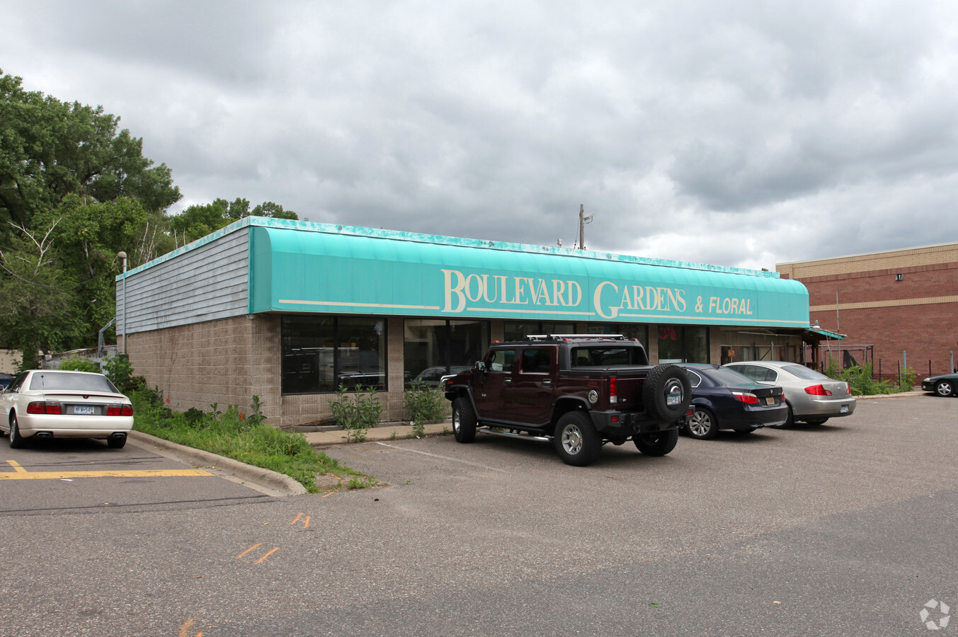
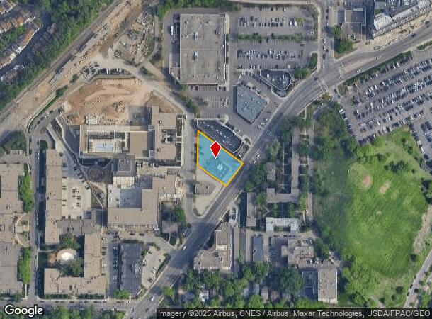
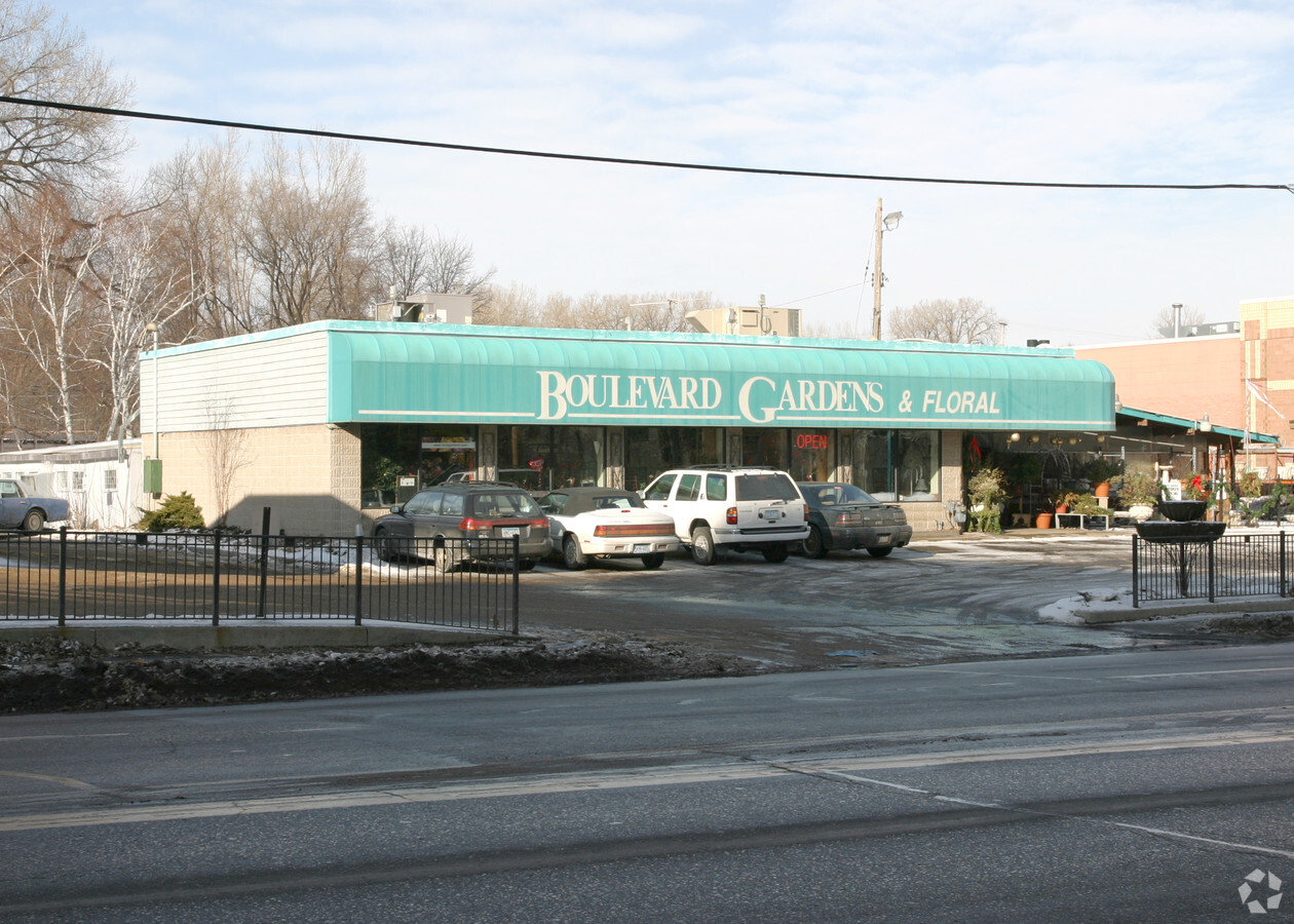
Property Record
3100 Excelsior Blvd, Minneapolis, MN 55416
NEARBY LISTINGS FOR SALE OR LEASE
Property Detail
3100 Excelsior Blvd
05-028-24-21-0037
Reg. Land Survey No. 0967
Commercialnec
T REG. LAND SURVEY NO. 0967 TRACT G 19555 SQ. FT.
X
Hennepin
27053C0354F
Minnesota
2024
0.45 AC
2023
Calhoun
1091001008
Minneapolis/St Paul
4,410 SF
Minneapolis-St. Paul-Bloomington, MN-WI
DEMOGRAPHICS near 3100 Excelsior Blvd
1 Mile
3 Mile
5 Mile
2024 Total Population
14,187
178,570
459,386
2029 Population
14,059
175,766
452,899
Pop Growth 2024-2029
(0.90%)
(1.57%)
(1.41%)
Average Age
39
38
38
2024 Total Households
7,860
86,151
205,848
HH Growth 2024-2029
(0.83%)
(1.49%)
(1.33%)
Median Household Inc
$90,148
$77,193
$76,002
Avg Household Size
1.70
2.00
2.10
2024 Avg HH Vehicles
2.00
1.00
1.00
Median Home Value
$587,090
$415,858
$370,817
Median Year Built
1972
1956
1960
Nearby Places
- Restaurants
- Banks
- Shops
- Fitness
- Groceries
PUBLIC TRANSPORTATION
COMMUTER RAIL
Target Field Station (Northstar Corridor - Northstar Commuter Rail)
DRIVE
WALK
Distance
Target Field Station (Northstar Corridor - Northstar Commuter Rail)
13 min
6.9 mi
AIRPORT
Minneapolis-St Paul International/Wold-Chamberlain
DRIVE
WALK
Distance
Minneapolis-St Paul International/Wold-Chamberlain
24 min
15.6 mi
Freight Ports
Port Milwaukee
DRIVE
WALK
Distance
Port Milwaukee
383 min
341.7 mi
Nearby Properties
Address
Land Use
TOTAL SIZE
Lot Size
Zoning
Address
Land Use
TOTAL SIZE
Lot Size
Zoning
3,008,334 SF
7.72 AC
Address
Land Use
TOTAL SIZE
Lot Size
Zoning
1,424,796 SF
1.13 AC
B4-1
Address
Land Use
TOTAL SIZE
Lot Size
Zoning
Address
Land Use
TOTAL SIZE
Lot Size
Zoning
451,860 SF
2.40 AC
C3A
Address
Land Use
TOTAL SIZE
Lot Size
Zoning
659,076 SF
1.45 AC
C3A
Address
Land Use
TOTAL SIZE
Lot Size
Zoning
Address
Land Use
TOTAL SIZE
Lot Size
Zoning
5.84 AC
Address
Land Use
TOTAL SIZE
Lot Size
Zoning
561,598 SF
1 AC
B4N
Address
Land Use
TOTAL SIZE
Lot Size
Zoning
Address
Land Use
TOTAL SIZE
Lot Size
Zoning
788,506 SF
2.85 AC
B4S-1
Address
Land Use
TOTAL SIZE
Lot Size
Zoning
1.50 AC
Address
Land Use
TOTAL SIZE
Lot Size
Zoning
313,009 SF
1.61 AC
OR2
Address
Land Use
TOTAL SIZE
Lot Size
Zoning
4,497,396 SF
11.05 AC
Address
Land Use
TOTAL SIZE
Lot Size
Zoning
2,207,532 SF
11.15 AC
Address
Land Use
TOTAL SIZE
Lot Size
Zoning
Address
Land Use
TOTAL SIZE
Lot Size
Zoning
390,060 SF
3.11 AC
Address
Land Use
TOTAL SIZE
Lot Size
Zoning
398,595 SF
1.91 AC
Address
Land Use
TOTAL SIZE
Lot Size
Zoning
288,096 SF
10.19 AC
Address
Land Use
TOTAL SIZE
Lot Size
Zoning
406,842 SF
1.59 AC
Address
Land Use
TOTAL SIZE
Lot Size
Zoning
580,942 SF
1.51 AC
B4-2
Address
Land Use
TOTAL SIZE
Lot Size
Zoning
241,187 SF
0.51 AC
B4-1
Address
Land Use
TOTAL SIZE
Lot Size
Zoning
2,018,298 SF
7.35 AC
Address
Land Use
TOTAL SIZE
Lot Size
Zoning
413,280 SF
1.87 AC
B4N
Address
Land Use
TOTAL SIZE
Lot Size
Zoning
295,036 SF
1.82 AC
R6
Address
Land Use
TOTAL SIZE
Lot Size
Zoning
319,792 SF
1.52 AC
OR3
Address
Land Use
TOTAL SIZE
Lot Size
Zoning
524,556 SF
4.56 AC
Address
Land Use
TOTAL SIZE
Lot Size
Zoning
Address
Land Use
TOTAL SIZE
Lot Size
Zoning
268,404 SF
1.22 AC
C2
Address
Land Use
TOTAL SIZE
Lot Size
Zoning
379,488 SF
2.68 AC
Address
Land Use
TOTAL SIZE
Lot Size
Zoning
280,748 SF
1.60 AC
The World's #1 Commercial Real Estate Marketplace
Connect with us
© 2025 CoStar Group
The information above has been obtained from sources believed reliable. While we do not doubt its accuracy we have not verified it and make no guarantee, warranty or representation about it. It is your responsibility to independently confirm its accuracy and completeness. Any projections, opinions, assumptions, or estimates used are for example only and do not represent the current or future performance of the property. The value of this transaction to you depends on tax and other factors which should be evaluated by your tax, financial, and legal advisors. You and your advisors should conduct a careful, independent investigation of the property to determine to your satisfaction the suitability of the property for your needs.