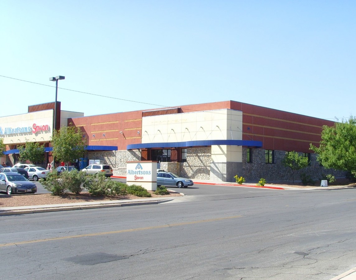
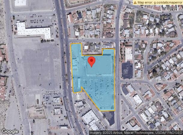
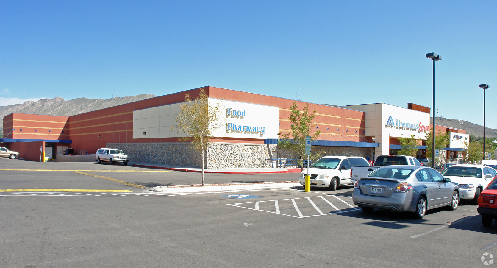
Property Record
3100 N Mesa St, El Paso, TX 79902
NEARBY LISTINGS FOR SALE OR LEASE
Property Detail
3100 N Mesa St
El Paso, TX
Kern Place
K216-999-0510-0300
51 KERN PLACE 10 (EXC 467 SQ FT) & BLKS (FR 27 & N PT OF 229 ALEXANDER) & 687 SQ FT IN BROWN SURV 202 & CLSD
Commercialnec
El Paso
2023
Texas
2023
6.16 AC
001502
West
61,486 SF
El Paso
DEMOGRAPHICS near 3100 N Mesa St
1 Mile
3 Mile
5 Mile
2024 Total Population
9,029
59,874
143,893
2029 Population
9,285
61,691
147,047
Pop Growth 2024-2029
+ 2.84%
+ 3.03%
+ 2.19%
Average Age
39
39
39
2024 Total Households
3,695
25,364
58,118
HH Growth 2024-2029
+ 3.11%
+ 3.09%
+ 2.16%
Median Household Inc
$47,804
$31,728
$37,595
Avg Household Size
2.00
2.20
2.40
2024 Avg HH Vehicles
2.00
1.00
2.00
Median Home Value
$295,203
$175,515
$156,745
Median Year Built
1963
1963
1968
Nearby Places
- Restaurants
- Banks
- Shops
- Fitness
- Groceries
PUBLIC TRANSPORTATION
AIRPORT
El Paso International
DRIVE
WALK
Distance
El Paso International
27 min
14.7 mi
Freight Ports
Port of Corpus Christi
DRIVE
WALK
Distance
Port of Corpus Christi
684 min
696.9 mi
SALE & LEASE HISTORY
LISTING DATE
SALE/LEASE

Mar 17, 2017
For Lease
Nearby Properties
Address
Land Use
TOTAL SIZE
Lot Size
Zoning
Address
Land Use
TOTAL SIZE
Lot Size
Zoning
1,387,028 SF
65.27 AC
R4
Address
Land Use
TOTAL SIZE
Lot Size
Zoning
558,800 SF
1.55 AC
C5
Address
Land Use
TOTAL SIZE
Lot Size
Zoning
318,665 SF
1.43 AC
C5
Address
Land Use
TOTAL SIZE
Lot Size
Zoning
859,302 SF
21.17 AC
C2
Address
Land Use
TOTAL SIZE
Lot Size
Zoning
324,056 SF
1.49 AC
C4
Address
Land Use
TOTAL SIZE
Lot Size
Zoning
1 SF
5.75 AC
C5S
Address
Land Use
TOTAL SIZE
Lot Size
Zoning
89,935 SF
7.01 AC
PMD
Address
Land Use
TOTAL SIZE
Lot Size
Zoning
169,031 SF
1.22 AC
SP
Address
Land Use
TOTAL SIZE
Lot Size
Zoning
313,532 SF
5.73 AC
C1S
Address
Land Use
TOTAL SIZE
Lot Size
Zoning
347,241 SF
Address
Land Use
TOTAL SIZE
Lot Size
Zoning
1 SF
45.46 AC
M1
Address
Land Use
TOTAL SIZE
Lot Size
Zoning
128,916 SF
1.50 AC
C5
Address
Land Use
TOTAL SIZE
Lot Size
Zoning
60,057 SF
7.22 AC
SCZ
Address
Land Use
TOTAL SIZE
Lot Size
Zoning
128,560 SF
0.72 AC
M1
Address
Land Use
TOTAL SIZE
Lot Size
Zoning
73,574 SF
0.69 AC
C5
Address
Land Use
TOTAL SIZE
Lot Size
Zoning
221,370 SF
0.73 AC
GMU
Address
Land Use
TOTAL SIZE
Lot Size
Zoning
164,712 SF
4.68 AC
GM
Address
Land Use
TOTAL SIZE
Lot Size
Zoning
629,002 SF
1.22 AC
C5
Address
Land Use
TOTAL SIZE
Lot Size
Zoning
231,480 SF
12.77 AC
C4S
Address
Land Use
TOTAL SIZE
Lot Size
Zoning
79,186 SF
1.55 AC
C5
Address
Land Use
TOTAL SIZE
Lot Size
Zoning
55,208 SF
5.34 AC
SD
Address
Land Use
TOTAL SIZE
Lot Size
Zoning
155,308 SF
Address
Land Use
TOTAL SIZE
Lot Size
Zoning
214,423 SF
0.42 AC
C5
Address
Land Use
TOTAL SIZE
Lot Size
Zoning
109,585 SF
1.97 AC
SD
Address
Land Use
TOTAL SIZE
Lot Size
Zoning
260,800 SF
0.61 AC
C5
Address
Land Use
TOTAL SIZE
Lot Size
Zoning
44,909 SF
3.01 AC
C3
Address
Land Use
TOTAL SIZE
Lot Size
Zoning
185,087 SF
10.27 AC
A3S
Address
Land Use
TOTAL SIZE
Lot Size
Zoning
229,821 SF
10.18 AC
A2
Address
Land Use
TOTAL SIZE
Lot Size
Zoning
420,509 SF
1.02 AC
C5
The World's #1 Commercial Real Estate Marketplace
Connect with us
© 2025 CoStar Group
The information above has been obtained from sources believed reliable. While we do not doubt its accuracy we have not verified it and make no guarantee, warranty or representation about it. It is your responsibility to independently confirm its accuracy and completeness. Any projections, opinions, assumptions, or estimates used are for example only and do not represent the current or future performance of the property. The value of this transaction to you depends on tax and other factors which should be evaluated by your tax, financial, and legal advisors. You and your advisors should conduct a careful, independent investigation of the property to determine to your satisfaction the suitability of the property for your needs.