Property Record
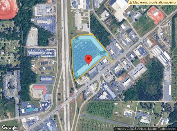
311 Ga Highway 49 N, Byron, GA 31008


NEARBY LISTINGS FOR SALE OR LEASE
Property Detail
311 Ga Highway 49 N
Warner Robins, GA
Byron Commercial 404-A
055D-087
PARCEL 5 12.72 ACRES IN MALL LL30 LD5
Wholesaleoutletdiscountstore
Peach
X
Georgia
13021C0240G
5
2024
12.72 AC
2024
Perry/Warner Robins
040104
Other Market Areas
54,175 SF
DEMOGRAPHICS near 311 Ga Highway 49 N
1 Mile
3 Mile
5 Mile
2024 Total Population
1,146
14,409
38,093
2029 Population
1,210
15,430
40,503
Pop Growth 2024-2029
+ 5.58%
+ 7.09%
+ 6.33%
Average Age
43
40
40
2024 Total Households
482
5,546
14,998
HH Growth 2024-2029
+ 5.60%
+ 6.87%
+ 6.21%
Median Household Inc
$59,332
$69,777
$66,595
Avg Household Size
2.40
2.60
2.50
2024 Avg HH Vehicles
2.00
2.00
2.00
Median Home Value
$147,752
$145,529
$157,155
Median Year Built
1994
1994
1994
Nearby Places
- Restaurants
- Banks
- Shops
- Fitness
- Groceries
SALE & LEASE HISTORY
LISTING DATE
SALE/LEASE

Sep 25, 2016
For Lease
Nov 14, 2019
For Lease
May 11, 2018
For Lease
Apr 25, 2017
For Lease
Nearby Properties
Address
Land Use
TOTAL SIZE
Lot Size
Zoning
Address
Land Use
TOTAL SIZE
Lot Size
Zoning
10,000 SF
1,163 AC
R-AG
Address
Land Use
TOTAL SIZE
Lot Size
Zoning
10,000 SF
43.93 AC
I-1
Address
Land Use
TOTAL SIZE
Lot Size
Zoning
80,825 SF
7.20 AC
I-1
Address
Land Use
TOTAL SIZE
Lot Size
Zoning
70,500 SF
18.47 AC
R1
Address
Land Use
TOTAL SIZE
Lot Size
Zoning
8,640 SF
12.49 AC
R-AG
Address
Land Use
TOTAL SIZE
Lot Size
Zoning
47,568 SF
1.51 AC
C-3
Address
Land Use
TOTAL SIZE
Lot Size
Zoning
42,056 SF
2.14 AC
C-3
Address
Land Use
TOTAL SIZE
Lot Size
Zoning
58,534 SF
7.82 AC
MULTI
Address
Land Use
TOTAL SIZE
Lot Size
Zoning
35,004 SF
1.45 AC
C-3
Address
Land Use
TOTAL SIZE
Lot Size
Zoning
17,388 SF
7.02 AC
MULTI
Address
Land Use
TOTAL SIZE
Lot Size
Zoning
24,400 SF
7 AC
MULTI
Address
Land Use
TOTAL SIZE
Lot Size
Zoning
57,888 SF
1.01 AC
I-1
Address
Land Use
TOTAL SIZE
Lot Size
Zoning
1,800 SF
33 AC
I-1
Address
Land Use
TOTAL SIZE
Lot Size
Zoning
26,131 SF
5.96 AC
C-1
Address
Land Use
TOTAL SIZE
Lot Size
Zoning
7,680 SF
1.31 AC
C2
Address
Land Use
TOTAL SIZE
Lot Size
Zoning
5,110 SF
2.03 AC
C-3
Address
Land Use
TOTAL SIZE
Lot Size
Zoning
35,784 SF
6.23 AC
C-3
Address
Land Use
TOTAL SIZE
Lot Size
Zoning
4,294 SF
12 AC
R-AG
Address
Land Use
TOTAL SIZE
Lot Size
Zoning
12,026 SF
11.75 AC
R-1
Address
Land Use
TOTAL SIZE
Lot Size
Zoning
5,346 SF
2.13 AC
C-3
Address
Land Use
TOTAL SIZE
Lot Size
Zoning
11,083 SF
6.14 AC
C-2
Address
Land Use
TOTAL SIZE
Lot Size
Zoning
12,154 SF
15.06 AC
R-1
Address
Land Use
TOTAL SIZE
Lot Size
Zoning
7,232 SF
5.25 AC
C-1
Address
Land Use
TOTAL SIZE
Lot Size
Zoning
13,000 SF
11.68 AC
MULTI
Address
Land Use
TOTAL SIZE
Lot Size
Zoning
15,946 SF
2.26 AC
C-2
Address
Land Use
TOTAL SIZE
Lot Size
Zoning
3,000 SF
6.19 AC
C-3
Address
Land Use
TOTAL SIZE
Lot Size
Zoning
44,700 SF
6.20 AC
I-1
Address
Land Use
TOTAL SIZE
Lot Size
Zoning
3,500 SF
2.90 AC
C-1
Address
Land Use
TOTAL SIZE
Lot Size
Zoning
8,810 SF
5.48 AC
C-3
The World's #1 Commercial Real Estate Marketplace
Connect with us
© 2025 CoStar Group
The information above has been obtained from sources believed reliable. While we do not doubt its accuracy we have not verified it and make no guarantee, warranty or representation about it. It is your responsibility to independently confirm its accuracy and completeness. Any projections, opinions, assumptions, or estimates used are for example only and do not represent the current or future performance of the property. The value of this transaction to you depends on tax and other factors which should be evaluated by your tax, financial, and legal advisors. You and your advisors should conduct a careful, independent investigation of the property to determine to your satisfaction the suitability of the property for your needs.