Property Record
311 West Ln, Riverhead, NY 11901
NEARBY LISTINGS FOR SALE OR LEASE
-
-
View all Riverhead listings for sale on LoopNet.com
Property Detail
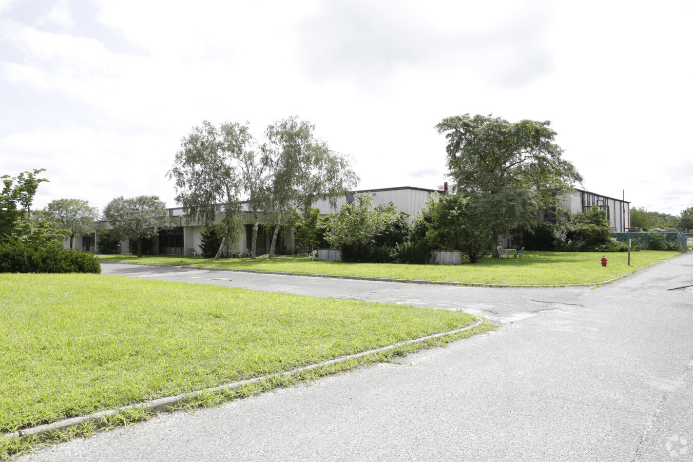
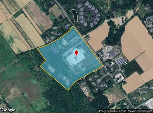
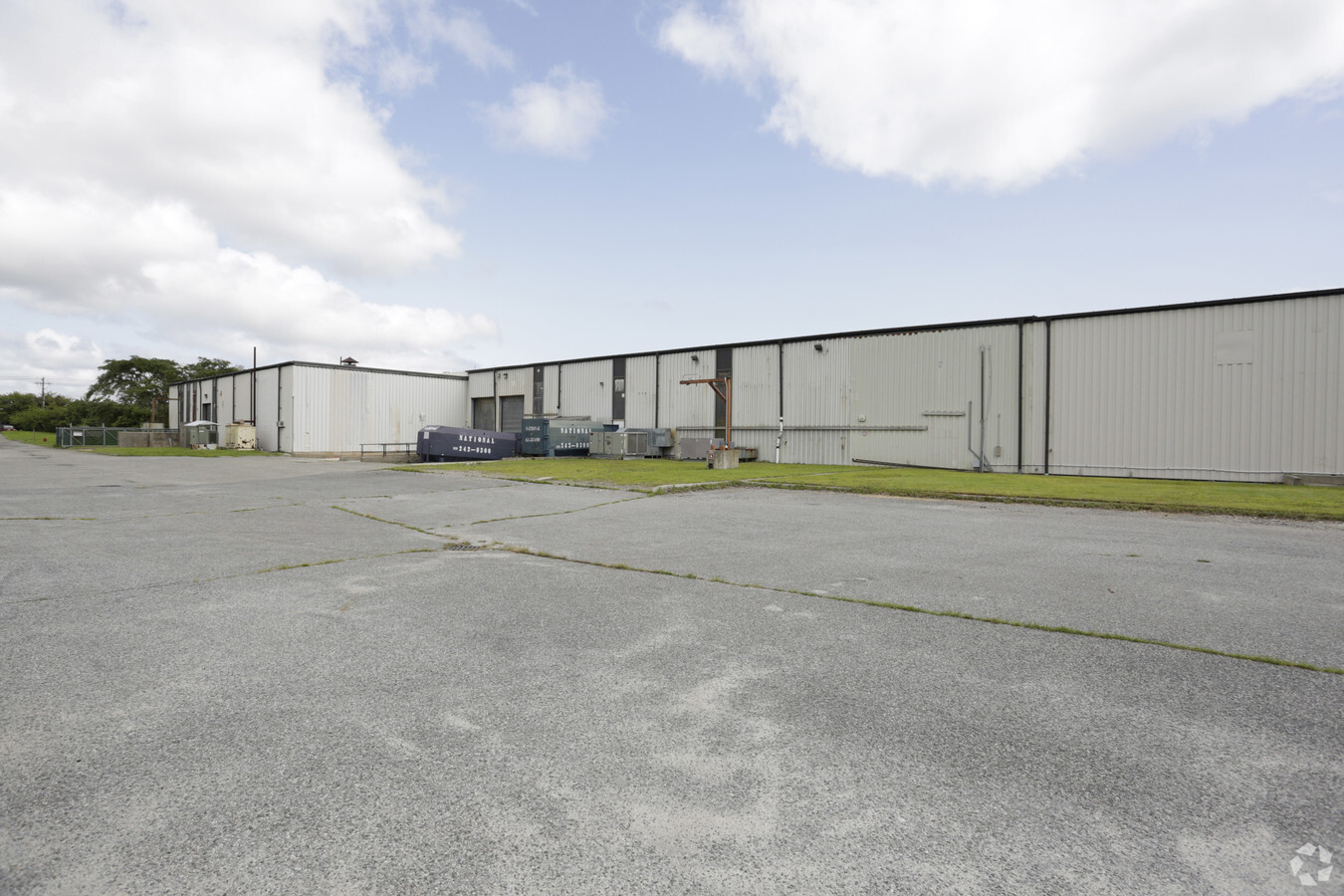
311 West Ln
Nassau County-Suffolk County, NY
Map Amp Circuits
0600-045-00-01-00-016-000
MAP OF AMP CIRCUITS # 10199 10/19/98 LOT 1
Industrialgeneral
Suffolk
X
New York
36103C0460H
16
2023
27.49 AC
2023
Eastern Suffolk
169906
Long Island (New York)
111,534 SF
DEMOGRAPHICS near 311 West Ln
1 Mile
3 Mile
5 Mile
2024 Total Population
946
15,751
34,445
2029 Population
916
15,566
34,267
Pop Growth 2024-2029
(3.17%)
(1.17%)
(0.52%)
Average Age
47
43
43
2024 Total Households
357
5,824
12,550
HH Growth 2024-2029
(3.36%)
(1.51%)
(0.79%)
Median Household Inc
$121,265
$74,007
$73,520
Avg Household Size
2.60
2.60
2.60
2024 Avg HH Vehicles
3.00
2.00
2.00
Median Home Value
$751,396
$482,132
$446,596
Median Year Built
1987
1988
1982
Nearby Places
- Restaurants
- Banks
- Shops
- Fitness
- Groceries
PUBLIC TRANSPORTATION
COMMUTER RAIL
Riverhead Station (Greenport Branch - Long Island Rail Road)
DRIVE
WALK
Distance
Riverhead Station (Greenport Branch - Long Island Rail Road)
9 min
4.4 mi
Mattituck Station (Greenport Branch - Long Island Rail Road)
DRIVE
WALK
Distance
Mattituck Station (Greenport Branch - Long Island Rail Road)
12 min
7.0 mi
AIRPORT
Long Island MacArthur
DRIVE
WALK
Distance
Long Island MacArthur
51 min
33.0 mi
Freight Ports
Port of New Haven
DRIVE
WALK
Distance
Port of New Haven
151 min
61.8 mi
Nearby Properties
Address
Land Use
TOTAL SIZE
Lot Size
Zoning
Address
Land Use
TOTAL SIZE
Lot Size
Zoning
450,000 SF
8.50 AC
3
Address
Land Use
TOTAL SIZE
Lot Size
Zoning
51.70 AC
R15
Address
Land Use
TOTAL SIZE
Lot Size
Zoning
197.50 AC
Address
Land Use
TOTAL SIZE
Lot Size
Zoning
151,290 SF
6.17 AC
08
Address
Land Use
TOTAL SIZE
Lot Size
Zoning
81.70 AC
R60
Address
Land Use
TOTAL SIZE
Lot Size
Zoning
485.30 AC
CR60
Address
Land Use
TOTAL SIZE
Lot Size
Zoning
16,699 SF
24.81 AC
03
Address
Land Use
TOTAL SIZE
Lot Size
Zoning
20.72 AC
09
Address
Land Use
TOTAL SIZE
Lot Size
Zoning
29.72 AC
R20
Address
Land Use
TOTAL SIZE
Lot Size
Zoning
68.90 AC
H2O
Address
Land Use
TOTAL SIZE
Lot Size
Zoning
586.10 AC
OSC
Address
Land Use
TOTAL SIZE
Lot Size
Zoning
403.50 AC
CR200
Address
Land Use
TOTAL SIZE
Lot Size
Zoning
13,773 SF
11.65 AC
03
Address
Land Use
TOTAL SIZE
Lot Size
Zoning
36.60 AC
RC
Address
Land Use
TOTAL SIZE
Lot Size
Zoning
214.30 AC
10
Address
Land Use
TOTAL SIZE
Lot Size
Zoning
292.40 AC
CR200
Address
Land Use
TOTAL SIZE
Lot Size
Zoning
73,651 SF
8.50 AC
3
Address
Land Use
TOTAL SIZE
Lot Size
Zoning
2,860 SF
9.38 AC
3
Address
Land Use
TOTAL SIZE
Lot Size
Zoning
14,520 SF
21.20 AC
04
Address
Land Use
TOTAL SIZE
Lot Size
Zoning
274.40 AC
05
Address
Land Use
TOTAL SIZE
Lot Size
Zoning
108,504 SF
31.20 AC
SC
Address
Land Use
TOTAL SIZE
Lot Size
Zoning
15.40 AC
RA40
Address
Land Use
TOTAL SIZE
Lot Size
Zoning
19,179 SF
0.74 AC
08
Address
Land Use
TOTAL SIZE
Lot Size
Zoning
4.20 AC
R10
Address
Land Use
TOTAL SIZE
Lot Size
Zoning
126,200 SF
14.09 AC
3
Address
Land Use
TOTAL SIZE
Lot Size
Zoning
214.95 AC
CR60
Address
Land Use
TOTAL SIZE
Lot Size
Zoning
7.20 AC
RA40
Address
Land Use
TOTAL SIZE
Lot Size
Zoning
43,840 SF
1.87 AC
3
Address
Land Use
TOTAL SIZE
Lot Size
Zoning
213.85 AC
CR200
The World's #1 Commercial Real Estate Marketplace
Connect with us
© 2025 CoStar Group
The information above has been obtained from sources believed reliable. While we do not doubt its accuracy we have not verified it and make no guarantee, warranty or representation about it. It is your responsibility to independently confirm its accuracy and completeness. Any projections, opinions, assumptions, or estimates used are for example only and do not represent the current or future performance of the property. The value of this transaction to you depends on tax and other factors which should be evaluated by your tax, financial, and legal advisors. You and your advisors should conduct a careful, independent investigation of the property to determine to your satisfaction the suitability of the property for your needs.