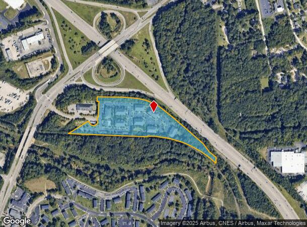
Property Record
3110 Kelly Austin Dr, Raleigh, NC 27610

NEARBY LISTINGS FOR SALE OR LEASE
Property Detail
3110 Kelly Austin Dr
Raleigh, NC
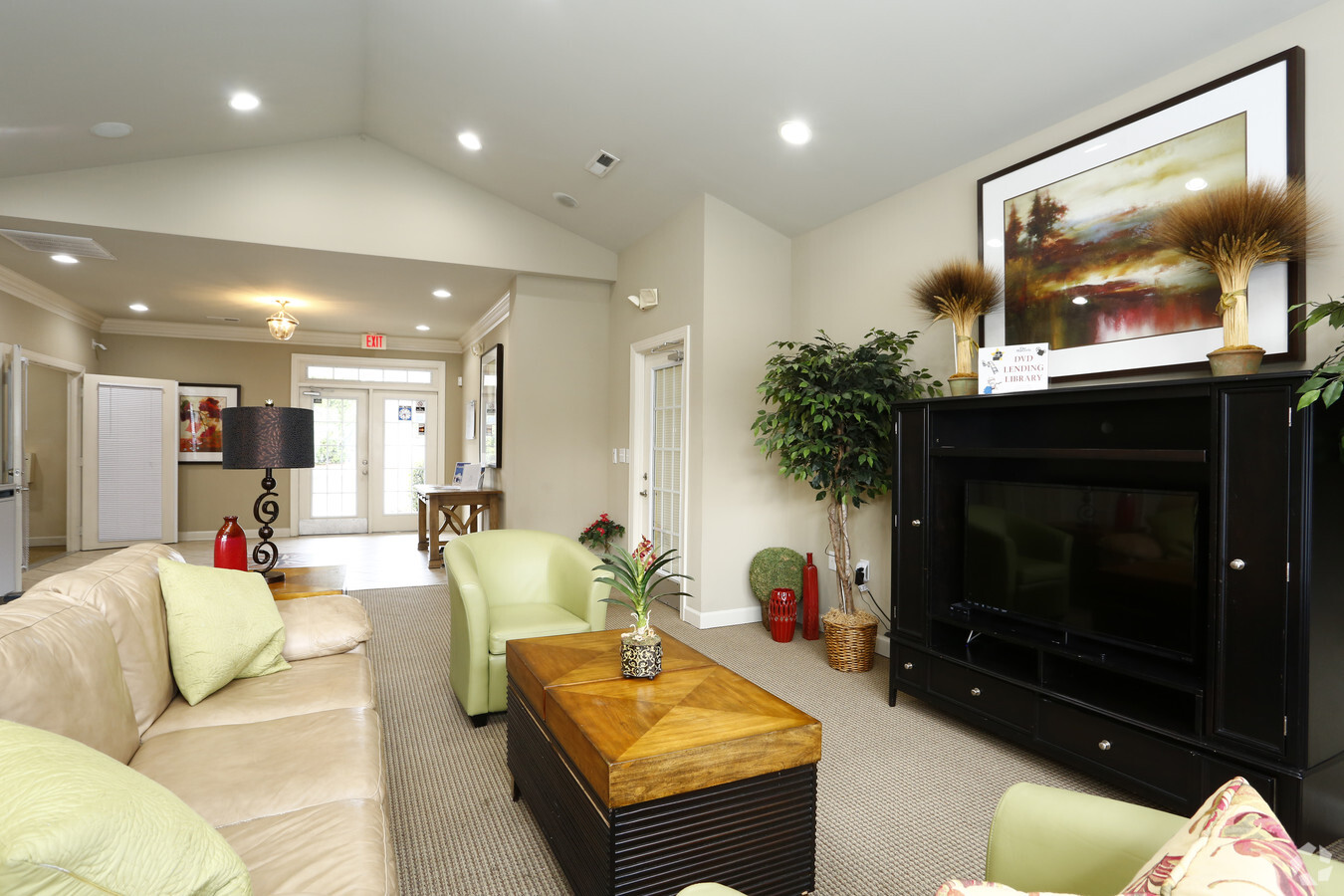
Waverly Apts
1724.14-43-1441-000
LO1 WAVERLY APTS BM2018-01870
Apartment
Wake
AE
North Carolina
3720172400K
1
2024
12.37 AC
2024
King Charles
052811
Raleigh/Durham
203,777 SF
DEMOGRAPHICS near 3110 Kelly Austin Dr
1 Mile
3 Mile
5 Mile
2024 Total Population
4,955
79,341
218,815
2029 Population
5,364
86,041
238,095
Pop Growth 2024-2029
+ 8.25%
+ 8.44%
+ 8.81%
Average Age
35
38
37
2024 Total Households
1,865
30,555
88,218
HH Growth 2024-2029
+ 8.31%
+ 8.64%
+ 9.13%
Median Household Inc
$41,157
$66,903
$69,495
Avg Household Size
2.50
2.40
2.30
2024 Avg HH Vehicles
1.00
2.00
2.00
Median Home Value
$226,785
$243,527
$279,099
Median Year Built
1979
1990
1992
Nearby Places
- Restaurants
- Banks
- Shops
- Fitness
- Groceries
PUBLIC TRANSPORTATION
COMMUTER RAIL
Raleigh Union Station (Piedmont - North Carolina by Train (NC Train))
DRIVE
WALK
Distance
Raleigh Union Station (Piedmont - North Carolina by Train (NC Train))
10 min
4.6 mi
AIRPORT
Raleigh-Durham International
DRIVE
WALK
Distance
Raleigh-Durham International
27 min
18.7 mi
Freight Ports
Port of Wilmington
DRIVE
WALK
Distance
Port of Wilmington
152 min
133.0 mi
Nearby Properties
Address
Land Use
TOTAL SIZE
Lot Size
Zoning
Address
Land Use
TOTAL SIZE
Lot Size
Zoning
2,660,245 SF
38.98 AC
OX-7
Address
Land Use
TOTAL SIZE
Lot Size
Zoning
376,902 SF
189.85 AC
OX-3
Address
Land Use
TOTAL SIZE
Lot Size
Zoning
354,131 SF
15.23 AC
RX-4
Address
Land Use
TOTAL SIZE
Lot Size
Zoning
319,136 SF
22.25 AC
OX-12
Address
Land Use
TOTAL SIZE
Lot Size
Zoning
289,301 SF
20.67 AC
OX-12
Address
Land Use
TOTAL SIZE
Lot Size
Zoning
373,187 SF
6.61 AC
PD
Address
Land Use
TOTAL SIZE
Lot Size
Zoning
491,548 SF
81.90 AC
OX-7
Address
Land Use
TOTAL SIZE
Lot Size
Zoning
438,469 SF
50 AC
R-4
Address
Land Use
TOTAL SIZE
Lot Size
Zoning
358,520 SF
2.46 AC
CX-7
Address
Land Use
TOTAL SIZE
Lot Size
Zoning
211,289 SF
6.87 AC
CX-5
Address
Land Use
TOTAL SIZE
Lot Size
Zoning
313,755 SF
22.44 AC
PD
Address
Land Use
TOTAL SIZE
Lot Size
Zoning
433,221 SF
7.78 AC
OX-7
Address
Land Use
TOTAL SIZE
Lot Size
Zoning
234,353 SF
102.82 AC
IX-3
Address
Land Use
TOTAL SIZE
Lot Size
Zoning
2,916 SF
81 AC
R-6
Address
Land Use
TOTAL SIZE
Lot Size
Zoning
546,791 SF
32.35 AC
IX-3
Address
Land Use
TOTAL SIZE
Lot Size
Zoning
202,055 SF
15.11 AC
RX-4
Address
Land Use
TOTAL SIZE
Lot Size
Zoning
175,250 SF
1.74 AC
OX-5
Address
Land Use
TOTAL SIZE
Lot Size
Zoning
194,832 SF
11.06 AC
RX-3
Address
Land Use
TOTAL SIZE
Lot Size
Zoning
252,424 SF
19.79 AC
IX-3
Address
Land Use
TOTAL SIZE
Lot Size
Zoning
202,980 SF
16.96 AC
RX-3
Address
Land Use
TOTAL SIZE
Lot Size
Zoning
296,209 SF
19.08 AC
IX-3
Address
Land Use
TOTAL SIZE
Lot Size
Zoning
38,341 SF
259.59 AC
IH
Address
Land Use
TOTAL SIZE
Lot Size
Zoning
231,168 SF
16.85 AC
RX-3
Address
Land Use
TOTAL SIZE
Lot Size
Zoning
196,732 SF
12.02 AC
RX-3
Address
Land Use
TOTAL SIZE
Lot Size
Zoning
95,252 SF
19.04 AC
IX-3
Address
Land Use
TOTAL SIZE
Lot Size
Zoning
116,551 SF
18.76 AC
CX-5
Address
Land Use
TOTAL SIZE
Lot Size
Zoning
94,876 SF
42.83 AC
OX-3
Address
Land Use
TOTAL SIZE
Lot Size
Zoning
296,313 SF
5.76 AC
OP-12
Address
Land Use
TOTAL SIZE
Lot Size
Zoning
349,950 SF
7.59 AC
OP-12
The World's #1 Commercial Real Estate Marketplace
Connect with us
© 2025 CoStar Group
The information above has been obtained from sources believed reliable. While we do not doubt its accuracy we have not verified it and make no guarantee, warranty or representation about it. It is your responsibility to independently confirm its accuracy and completeness. Any projections, opinions, assumptions, or estimates used are for example only and do not represent the current or future performance of the property. The value of this transaction to you depends on tax and other factors which should be evaluated by your tax, financial, and legal advisors. You and your advisors should conduct a careful, independent investigation of the property to determine to your satisfaction the suitability of the property for your needs.