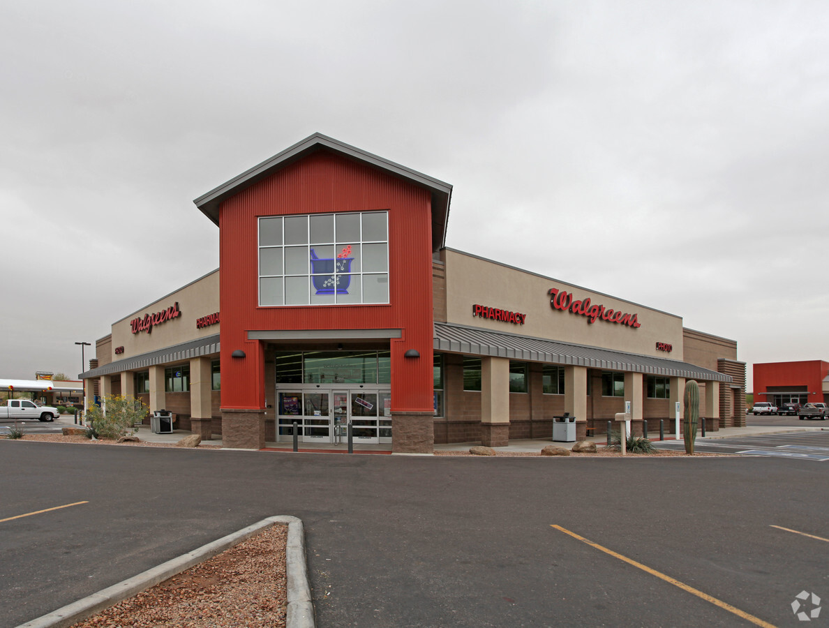
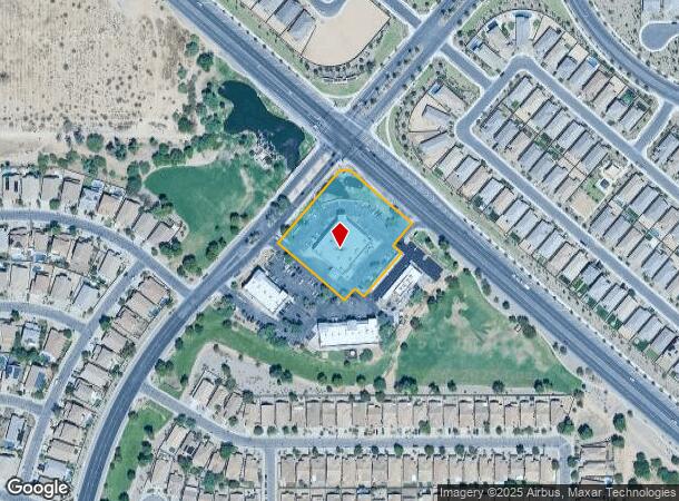
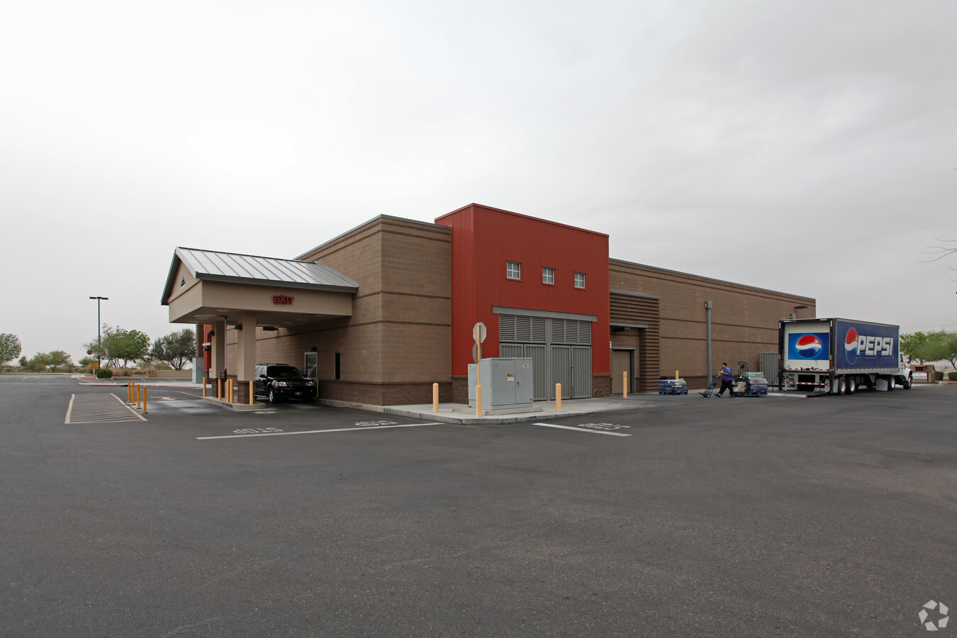
Property Record
3111 W Hunt Hwy, San Tan Valley, AZ 85144

NEARBY LISTINGS FOR SALE OR LEASE
Property Detail
3111 W Hunt Hwy
509-12-004B
Florence Gardens Unit A
Storebuilding
PART OF PARCEL G OF FINAL PLAT MOUNTAIN VISTA BOULEVARD HUNT HIGH WAY PARCEL G AND H CAB D SLD 175 SECS 11 AND 12-03S-07E DESC AS C OM @ NE COR SEC 11-03S-07E TH S-164.92 TO POB TH S 49D E-144.86 T H S 41D W-82.01 TH S 49D E-34.13 TH S 41D W-169.95 T
X
Pinal
04013C3155L
Arizona
2024
1.92 AC
2025
Outlying Pinal County
000222
Phoenix
14,748 SF
Phoenix-Mesa-Scottsdale, AZ
DEMOGRAPHICS near 3111 W Hunt Hwy
1 Mile
3 Mile
5 Mile
2024 Total Population
24,714
63,334
142,963
2029 Population
32,371
80,880
175,657
Pop Growth 2024-2029
+ 30.98%
+ 27.70%
+ 22.87%
Average Age
34
36
36
2024 Total Households
7,643
20,126
44,609
HH Growth 2024-2029
+ 30.96%
+ 27.86%
+ 23.21%
Median Household Inc
$91,025
$93,121
$96,057
Avg Household Size
3.20
3.10
3.20
2024 Avg HH Vehicles
2.00
2.00
2.00
Median Home Value
$314,759
$343,594
$366,428
Median Year Built
2010
2010
2008
Nearby Places
- Restaurants
- Banks
- Shops
- Fitness
- Groceries
PUBLIC TRANSPORTATION
AIRPORT
Phoenix-Mesa Gateway
DRIVE
WALK
Distance
Phoenix-Mesa Gateway
19 min
10.7 mi
Phoenix Sky Harbor International
DRIVE
WALK
Distance
Phoenix Sky Harbor International
57 min
39.9 mi
Freight Ports
Port of San Diego
DRIVE
WALK
Distance
Port of San Diego
419 min
376.2 mi
Nearby Properties
Address
Land Use
TOTAL SIZE
Lot Size
Zoning
Address
Land Use
TOTAL SIZE
Lot Size
Zoning
590,319 SF
41.54 AC
Address
Land Use
TOTAL SIZE
Lot Size
Zoning
193,293 SF
22.36 AC
UNDESIGNAT
Address
Land Use
TOTAL SIZE
Lot Size
Zoning
208,206 SF
22.84 AC
CB2
Address
Land Use
TOTAL SIZE
Lot Size
Zoning
92,153 SF
8.34 AC
GR
Address
Land Use
TOTAL SIZE
Lot Size
Zoning
107,352 SF
12.70 AC
CB2
Address
Land Use
TOTAL SIZE
Lot Size
Zoning
53,995 SF
10.12 AC
Address
Land Use
TOTAL SIZE
Lot Size
Zoning
250,050 SF
17.47 AC
Address
Land Use
TOTAL SIZE
Lot Size
Zoning
107,832 SF
9.23 AC
Address
Land Use
TOTAL SIZE
Lot Size
Zoning
52,327 SF
21.32 AC
Address
Land Use
TOTAL SIZE
Lot Size
Zoning
Address
Land Use
TOTAL SIZE
Lot Size
Zoning
37,368 SF
5 AC
Address
Land Use
TOTAL SIZE
Lot Size
Zoning
30,944 SF
7.03 AC
Address
Land Use
TOTAL SIZE
Lot Size
Zoning
64,499 SF
10 AC
Address
Land Use
TOTAL SIZE
Lot Size
Zoning
156,414 SF
4.81 AC
CB2
Address
Land Use
TOTAL SIZE
Lot Size
Zoning
97,313 SF
5.69 AC
CB2
Address
Land Use
TOTAL SIZE
Lot Size
Zoning
18,568 SF
6.92 AC
Address
Land Use
TOTAL SIZE
Lot Size
Zoning
Address
Land Use
TOTAL SIZE
Lot Size
Zoning
37,375 SF
3.72 AC
Address
Land Use
TOTAL SIZE
Lot Size
Zoning
4,524 SF
20.66 AC
Address
Land Use
TOTAL SIZE
Lot Size
Zoning
8,022 SF
1.14 AC
Address
Land Use
TOTAL SIZE
Lot Size
Zoning
16,446 SF
4.39 AC
Address
Land Use
TOTAL SIZE
Lot Size
Zoning
4,945 SF
2.17 AC
CB1
Address
Land Use
TOTAL SIZE
Lot Size
Zoning
17,632 SF
2.09 AC
CB2
Address
Land Use
TOTAL SIZE
Lot Size
Zoning
16 AC
GR
Address
Land Use
TOTAL SIZE
Lot Size
Zoning
23,600 SF
2.66 AC
Address
Land Use
TOTAL SIZE
Lot Size
Zoning
14,736 SF
1.55 AC
Address
Land Use
TOTAL SIZE
Lot Size
Zoning
The World's #1 Commercial Real Estate Marketplace
Connect with us
© 2025 CoStar Group
The information above has been obtained from sources believed reliable. While we do not doubt its accuracy we have not verified it and make no guarantee, warranty or representation about it. It is your responsibility to independently confirm its accuracy and completeness. Any projections, opinions, assumptions, or estimates used are for example only and do not represent the current or future performance of the property. The value of this transaction to you depends on tax and other factors which should be evaluated by your tax, financial, and legal advisors. You and your advisors should conduct a careful, independent investigation of the property to determine to your satisfaction the suitability of the property for your needs.