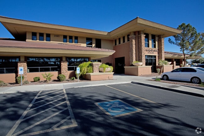
Property Record
3115 S Price Rd, Chandler, AZ 85248


NEARBY LISTINGS FOR SALE OR LEASE
Property Detail
3115 S Price Rd
Phoenix-Mesa-Scottsdale, AZ
Aquila Ocotillo Condominium
303-37-966
AQUILA OCOTILLO CONDOMINIUM MCR 620-26
Officecondo
Maricopa
X
Arizona
04013C2720L
130
2025
0.13 AC
2025
Chandler
812600
Phoenix
12,605 SF
DEMOGRAPHICS near 3115 S Price Rd
1 Mile
3 Mile
5 Mile
2024 Total Population
5,902
64,980
188,577
2029 Population
6,456
70,722
204,252
Pop Growth 2024-2029
+ 9.39%
+ 8.84%
+ 8.31%
Average Age
40
41
40
2024 Total Households
2,369
25,544
72,930
HH Growth 2024-2029
+ 9.58%
+ 8.93%
+ 8.42%
Median Household Inc
$116,650
$103,743
$92,159
Avg Household Size
2.40
2.50
2.50
2024 Avg HH Vehicles
2.00
2.00
2.00
Median Home Value
$477,924
$477,552
$422,769
Median Year Built
1998
2002
1996
Nearby Places
Map Layers
Map Styles
 Street
 Aerial
- Restaurants
- Banks
- Shops
- Fitness
- Groceries
PUBLIC TRANSPORTATION
AIRPORT
Phoenix-Mesa Gateway
DRIVE
WALK
Distance
Phoenix-Mesa Gateway
26 min
16.0 mi
Phoenix Sky Harbor International
DRIVE
WALK
Distance
Phoenix Sky Harbor International
28 min
19.3 mi
Freight Ports
Port of San Diego
DRIVE
WALK
Distance
Port of San Diego
392 min
360.1 mi
Nearby Properties
Address
Land Use
TOTAL SIZE
Lot Size
Zoning
Address
Land Use
TOTAL SIZE
Lot Size
Zoning
221,091 SF
14.76 AC
I-1
Address
Land Use
TOTAL SIZE
Lot Size
Zoning
1,420,114 SF
66.08 AC
PAD
Address
Land Use
TOTAL SIZE
Lot Size
Zoning
71,100 SF
9.07 AC
PAD
Address
Land Use
TOTAL SIZE
Lot Size
Zoning
733,019 SF
13.13 AC
PAD
Address
Land Use
TOTAL SIZE
Lot Size
Zoning
10.02 AC
Address
Land Use
TOTAL SIZE
Lot Size
Zoning
24,739 SF
5.39 AC
PAD
Address
Land Use
TOTAL SIZE
Lot Size
Zoning
51,091 SF
3.59 AC
PAD
Address
Land Use
TOTAL SIZE
Lot Size
Zoning
3,688,548 SF
285.19 AC
PAD
Address
Land Use
TOTAL SIZE
Lot Size
Zoning
687,690 SF
44.05 AC
PAD
Address
Land Use
TOTAL SIZE
Lot Size
Zoning
724,125 SF
41.62 AC
PAD
Address
Land Use
TOTAL SIZE
Lot Size
Zoning
434,857 SF
36.73 AC
PF
Address
Land Use
TOTAL SIZE
Lot Size
Zoning
724,125 SF
39.23 AC
Address
Land Use
TOTAL SIZE
Lot Size
Zoning
43,044 SF
3.46 AC
PAD
Address
Land Use
TOTAL SIZE
Lot Size
Zoning
519,664 SF
20.95 AC
PAD
Address
Land Use
TOTAL SIZE
Lot Size
Zoning
2.57 AC
Address
Land Use
TOTAL SIZE
Lot Size
Zoning
1.83 AC
Address
Land Use
TOTAL SIZE
Lot Size
Zoning
456,122 SF
25.97 AC
PAD
Address
Land Use
TOTAL SIZE
Lot Size
Zoning
24,038 SF
40.27 AC
AG1
Address
Land Use
TOTAL SIZE
Lot Size
Zoning
1.64 AC
Address
Land Use
TOTAL SIZE
Lot Size
Zoning
263,599 SF
18.33 AC
PAD
Address
Land Use
TOTAL SIZE
Lot Size
Zoning
416,098 SF
22.48 AC
Address
Land Use
TOTAL SIZE
Lot Size
Zoning
395,055 SF
8.33 AC
PAD
Address
Land Use
TOTAL SIZE
Lot Size
Zoning
331,556 SF
19.73 AC
PAD
Address
Land Use
TOTAL SIZE
Lot Size
Zoning
374,847 SF
20.84 AC
PAD
Address
Land Use
TOTAL SIZE
Lot Size
Zoning
269,504 SF
8.87 AC
I-1
Address
Land Use
TOTAL SIZE
Lot Size
Zoning
256,618 SF
19.49 AC
PAD
Address
Land Use
TOTAL SIZE
Lot Size
Zoning
58,989 SF
37.62 AC
PAD
Address
Land Use
TOTAL SIZE
Lot Size
Zoning
444,707 SF
21.62 AC
I-2
Address
Land Use
TOTAL SIZE
Lot Size
Zoning
403,326 SF
8.71 AC
PAD
The World's #1 Commercial Real Estate Marketplace
Connect with us
© 2025 CoStar Group
The information above has been obtained from sources believed reliable. While we do not doubt its accuracy we have not verified it and make no guarantee, warranty or representation about it. It is your responsibility to independently confirm its accuracy and completeness. Any projections, opinions, assumptions, or estimates used are for example only and do not represent the current or future performance of the property. The value of this transaction to you depends on tax and other factors which should be evaluated by your tax, financial, and legal advisors. You and your advisors should conduct a careful, independent investigation of the property to determine to your satisfaction the suitability of the property for your needs.