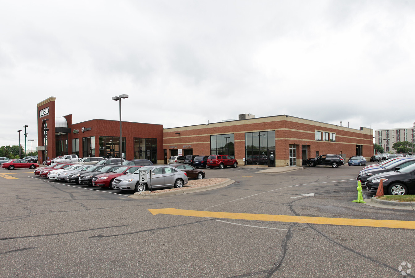
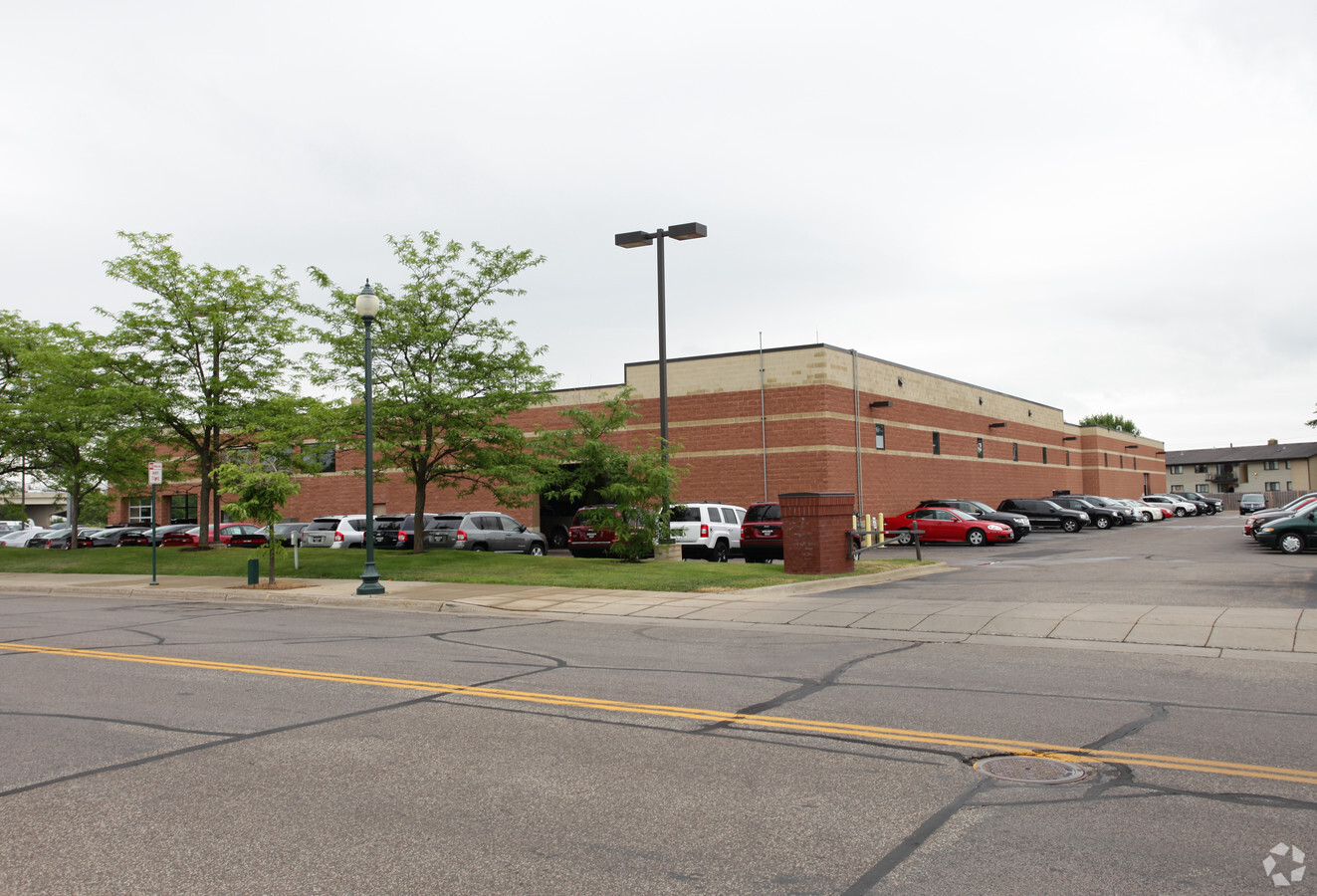
Property Record
314 Mainstreet, Hopkins, MN 55343
NEARBY LISTINGS FOR SALE OR LEASE
Property Detail
314 Mainstreet
Minneapolis-St. Paul-Bloomington, MN-WI
Auditors Subd. No. 242
24-117-22-44-0043
LOT 015 B AUDITORS SUBD. NO. 242 LOTS 15 TO 17 INCL AND COM AT THE NW COR OF LOT 14 TH S ALONG THE W LINE THOF 240 FT TH E PAR WITH SLY LINE OF EXCELSIOR AVE 275 FT T IRREGULAR
Commercialnec
Hennepin
X
Minnesota
27053C0342F
15
2024
1.56 AC
2023
Ridgedale
023300
Minneapolis/St Paul
DEMOGRAPHICS near 314 Mainstreet
1 Mile
3 Mile
5 Mile
2024 Total Population
13,757
83,365
215,029
2029 Population
13,503
82,213
212,115
Pop Growth 2024-2029
(1.85%)
(1.38%)
(1.36%)
Average Age
40
42
42
2024 Total Households
6,337
37,723
95,206
HH Growth 2024-2029
(1.96%)
(1.49%)
(1.36%)
Median Household Inc
$66,354
$89,242
$102,005
Avg Household Size
2.10
2.10
2.20
2024 Avg HH Vehicles
1.00
2.00
2.00
Median Home Value
$355,384
$374,494
$433,582
Median Year Built
1970
1971
1972
Nearby Places
- Restaurants
- Banks
- Shops
- Fitness
- Groceries
PUBLIC TRANSPORTATION
COMMUTER RAIL
Target Field Station (Northstar Corridor - Northstar Commuter Rail)
DRIVE
WALK
Distance
Target Field Station (Northstar Corridor - Northstar Commuter Rail)
16 min
9.6 mi
AIRPORT
Minneapolis-St Paul International/Wold-Chamberlain
DRIVE
WALK
Distance
Minneapolis-St Paul International/Wold-Chamberlain
23 min
15.4 mi
Freight Ports
Port Milwaukee
DRIVE
WALK
Distance
Port Milwaukee
389 min
348.2 mi
Nearby Properties
Address
Land Use
TOTAL SIZE
Lot Size
Zoning
Address
Land Use
TOTAL SIZE
Lot Size
Zoning
7.68 AC
Address
Land Use
TOTAL SIZE
Lot Size
Zoning
6.83 AC
Address
Land Use
TOTAL SIZE
Lot Size
Zoning
138,997 SF
14.03 AC
OFC
Address
Land Use
TOTAL SIZE
Lot Size
Zoning
4.84 AC
Address
Land Use
TOTAL SIZE
Lot Size
Zoning
0.90 AC
Address
Land Use
TOTAL SIZE
Lot Size
Zoning
19.75 AC
Address
Land Use
TOTAL SIZE
Lot Size
Zoning
1.74 AC
Address
Land Use
TOTAL SIZE
Lot Size
Zoning
4,497,396 SF
11.05 AC
Address
Land Use
TOTAL SIZE
Lot Size
Zoning
93,982 SF
9.33 AC
OFC
Address
Land Use
TOTAL SIZE
Lot Size
Zoning
4.55 AC
Address
Land Use
TOTAL SIZE
Lot Size
Zoning
224,581 SF
13.72 AC
PUD
Address
Land Use
TOTAL SIZE
Lot Size
Zoning
233,320 SF
17.37 AC
PUD
Address
Land Use
TOTAL SIZE
Lot Size
Zoning
524,556 SF
4.56 AC
Address
Land Use
TOTAL SIZE
Lot Size
Zoning
38.20 AC
Address
Land Use
TOTAL SIZE
Lot Size
Zoning
244,941 SF
5.24 AC
Address
Land Use
TOTAL SIZE
Lot Size
Zoning
41,398 SF
6.78 AC
PUD
Address
Land Use
TOTAL SIZE
Lot Size
Zoning
13.80 AC
Address
Land Use
TOTAL SIZE
Lot Size
Zoning
127,084 SF
17.21 AC
Address
Land Use
TOTAL SIZE
Lot Size
Zoning
32,373 SF
3.82 AC
PUD
Address
Land Use
TOTAL SIZE
Lot Size
Zoning
73,905 SF
11.66 AC
B3
Address
Land Use
TOTAL SIZE
Lot Size
Zoning
7.06 AC
Address
Land Use
TOTAL SIZE
Lot Size
Zoning
3.15 AC
Address
Land Use
TOTAL SIZE
Lot Size
Zoning
5.90 AC
Address
Land Use
TOTAL SIZE
Lot Size
Zoning
206,232 SF
6.65 AC
Address
Land Use
TOTAL SIZE
Lot Size
Zoning
7.32 AC
Address
Land Use
TOTAL SIZE
Lot Size
Zoning
122,801 SF
8.41 AC
RM25
Address
Land Use
TOTAL SIZE
Lot Size
Zoning
4.89 AC
Address
Land Use
TOTAL SIZE
Lot Size
Zoning
127,028 SF
9.04 AC
R4
Address
Land Use
TOTAL SIZE
Lot Size
Zoning
13.42 AC
Address
Land Use
TOTAL SIZE
Lot Size
Zoning
137,516 SF
9.83 AC
The World's #1 Commercial Real Estate Marketplace
Connect with us
© 2025 CoStar Group
The information above has been obtained from sources believed reliable. While we do not doubt its accuracy we have not verified it and make no guarantee, warranty or representation about it. It is your responsibility to independently confirm its accuracy and completeness. Any projections, opinions, assumptions, or estimates used are for example only and do not represent the current or future performance of the property. The value of this transaction to you depends on tax and other factors which should be evaluated by your tax, financial, and legal advisors. You and your advisors should conduct a careful, independent investigation of the property to determine to your satisfaction the suitability of the property for your needs.