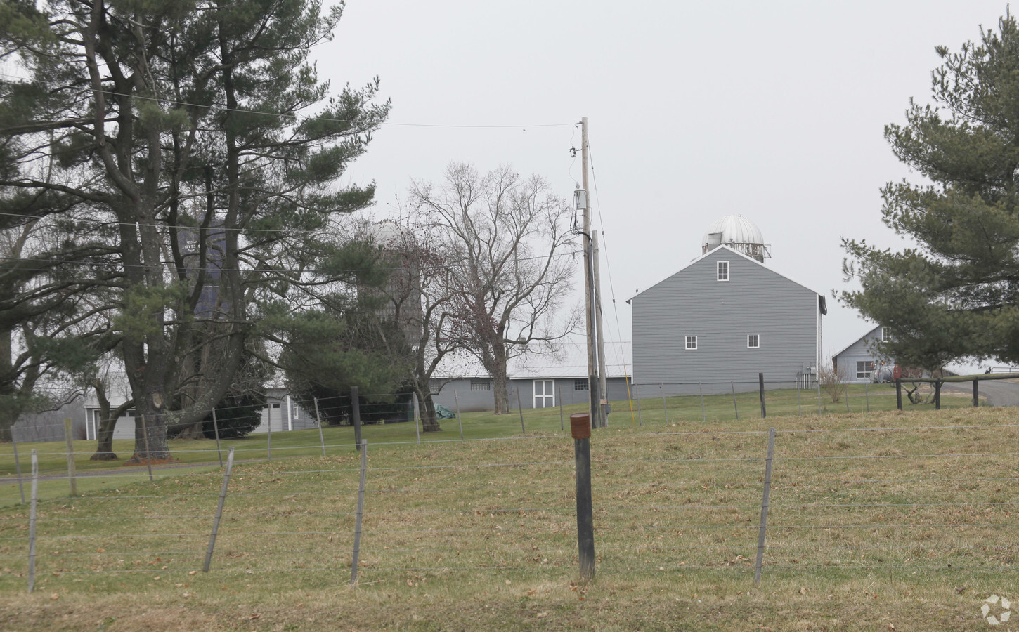
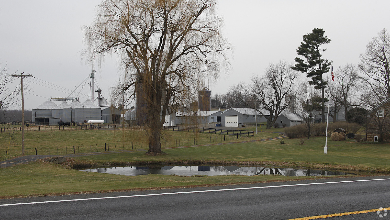
Property Record
3143 State Route 9H, Kinderhook, NY 12106
NEARBY LISTINGS FOR SALE OR LEASE
-
-
View all Kinderhook listings for sale on LoopNet.com
Property Detail
3143 State Route 9H
Hudson, NY
MICRO 4110
104489-023-000-0001-020-000-0000
Columbia
Commercialbuilding
New York
2023
20.000
2023
10.50 AC
000401
Columbia County
82,771 SF
Albany/Schenectady/Troy
DEMOGRAPHICS near 3143 State Route 9H
1 Mile
3 Mile
5 Mile
2024 Total Population
174
2,157
5,833
2029 Population
172
2,127
5,753
Pop Growth 2024-2029
(1.15%)
(1.39%)
(1.37%)
Average Age
47
47
47
2024 Total Households
76
923
2,483
HH Growth 2024-2029
(2.63%)
(1.41%)
(1.37%)
Median Household Inc
$53,333
$64,200
$70,758
Avg Household Size
2.20
2.20
2.20
2024 Avg HH Vehicles
2.00
2.00
2.00
Median Home Value
$285,293
$283,157
$290,765
Median Year Built
1980
1973
1970
Nearby Places
- Restaurants
- Banks
- Shops
- Fitness
- Groceries
PUBLIC TRANSPORTATION
AIRPORT
Albany International
DRIVE
WALK
Distance
Albany International
40 min
27.1 mi
Freight Ports
Albany, NY Port
DRIVE
WALK
Distance
Albany, NY Port
28 min
19.6 mi
Nearby Properties
Address
Land Use
TOTAL SIZE
Lot Size
Zoning
Address
Land Use
TOTAL SIZE
Lot Size
Zoning
110,043 SF
120.60 AC
07 - MIXED
Address
Land Use
TOTAL SIZE
Lot Size
Zoning
62,192 SF
19.16 AC
05 - COMME
Address
Land Use
TOTAL SIZE
Lot Size
Zoning
80,893 SF
4.89 AC
07 - MIXED
Address
Land Use
TOTAL SIZE
Lot Size
Zoning
72,355 SF
15.71 AC
05 - COMME
Address
Land Use
TOTAL SIZE
Lot Size
Zoning
59,049 SF
233 AC
07 - MIXED
Address
Land Use
TOTAL SIZE
Lot Size
Zoning
32,010 SF
3.75 AC
05 - COMME
Address
Land Use
TOTAL SIZE
Lot Size
Zoning
20,297 SF
6.60 AC
07 - MIXED
Address
Land Use
TOTAL SIZE
Lot Size
Zoning
1,452 SF
39.10 AC
07 - MIXED
Address
Land Use
TOTAL SIZE
Lot Size
Zoning
26,000 SF
2.28 AC
03 - MULTI
Address
Land Use
TOTAL SIZE
Lot Size
Zoning
13,225 SF
2.62 AC
05 - COMME
Address
Land Use
TOTAL SIZE
Lot Size
Zoning
4,436 SF
16 AC
08 - GOVER
Address
Land Use
TOTAL SIZE
Lot Size
Zoning
6,362 SF
166.30 AC
05 - COMME
Address
Land Use
TOTAL SIZE
Lot Size
Zoning
3,000 SF
342.82 AC
07 - MIXED
Address
Land Use
TOTAL SIZE
Lot Size
Zoning
9,110 SF
2.40 AC
07 - MIXED
Address
Land Use
TOTAL SIZE
Lot Size
Zoning
10,775 SF
3.50 AC
05 - COMME
Address
Land Use
TOTAL SIZE
Lot Size
Zoning
46,650 SF
1.40 AC
05 - COMME
Address
Land Use
TOTAL SIZE
Lot Size
Zoning
1,544 SF
4.60 AC
05 - COMME
Address
Land Use
TOTAL SIZE
Lot Size
Zoning
5,216 SF
39.30 AC
02 - SINGL
Address
Land Use
TOTAL SIZE
Lot Size
Zoning
2,730 SF
2 AC
05 - COMME
Address
Land Use
TOTAL SIZE
Lot Size
Zoning
11,838 SF
4.55 AC
07 - MIXED
Address
Land Use
TOTAL SIZE
Lot Size
Zoning
84.40 AC
Address
Land Use
TOTAL SIZE
Lot Size
Zoning
33,172 SF
41 AC
05 - COMME
Address
Land Use
TOTAL SIZE
Lot Size
Zoning
8,112 SF
60 AC
05 - COMME
Address
Land Use
TOTAL SIZE
Lot Size
Zoning
5,896 SF
6.90 AC
07 - MIXED
Address
Land Use
TOTAL SIZE
Lot Size
Zoning
1,810 SF
185.02 AC
04 - FARM
Address
Land Use
TOTAL SIZE
Lot Size
Zoning
8,080 SF
10.82 AC
05 - COMME
Address
Land Use
TOTAL SIZE
Lot Size
Zoning
226.82 AC
RL20
Address
Land Use
TOTAL SIZE
Lot Size
Zoning
226.82 AC
RL20
Address
Land Use
TOTAL SIZE
Lot Size
Zoning
14,400 SF
20 AC
05 - COMME
The World's #1 Commercial Real Estate Marketplace
Connect with us
© 2025 CoStar Group
The information above has been obtained from sources believed reliable. While we do not doubt its accuracy we have not verified it and make no guarantee, warranty or representation about it. It is your responsibility to independently confirm its accuracy and completeness. Any projections, opinions, assumptions, or estimates used are for example only and do not represent the current or future performance of the property. The value of this transaction to you depends on tax and other factors which should be evaluated by your tax, financial, and legal advisors. You and your advisors should conduct a careful, independent investigation of the property to determine to your satisfaction the suitability of the property for your needs.