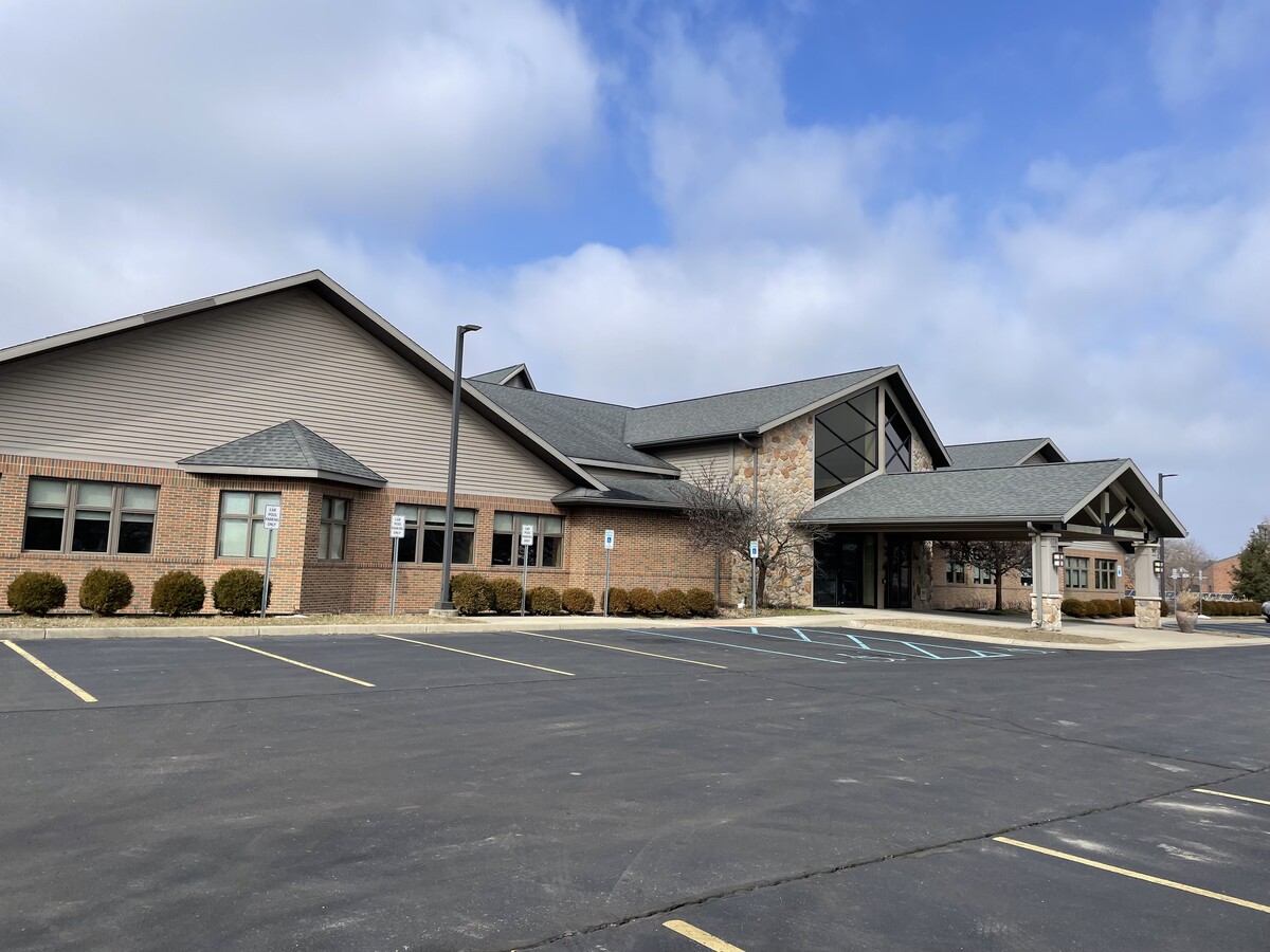
Property Record
3145 Benham Ave, Elkhart, IN 46517

Current Lease Availabilities
NEARBY LISTINGS FOR SALE OR LEASE
Property Detail
3145 Benham Ave
Elkhart-Goshen, IN
Associated Seminaries
20-06-17-403-002.000-012
ASSOCIATED SEMINARIES SD SE COR LOT 22 EX .114A ROW
Privateschool
Elkhart
X
Indiana
18039C0138D
22
2023
3.31 AC
2024
Outlying Elkhart County
002202
South Bend/Mishawaka
38,520 SF
DEMOGRAPHICS near 3145 Benham Ave
1 Mile
3 Mile
5 Mile
2024 Total Population
9,902
49,986
92,374
2029 Population
9,860
50,222
92,516
Pop Growth 2024-2029
(0.42%)
+ 0.47%
+ 0.15%
Average Age
36
36
38
2024 Total Households
3,531
18,140
34,482
HH Growth 2024-2029
(0.42%)
+ 0.58%
+ 0.19%
Median Household Inc
$44,669
$47,655
$53,307
Avg Household Size
2.70
2.60
2.60
2024 Avg HH Vehicles
2.00
2.00
2.00
Median Home Value
$124,558
$129,902
$147,770
Median Year Built
1968
1962
1971
Nearby Places
- Restaurants
- Banks
- Shops
- Fitness
- Groceries
PUBLIC TRANSPORTATION
COMMUTER RAIL
Elkhart Amtrak Station (Capitol Limited - Amtrak, Lake Shore Limited - Amtrak)
DRIVE
WALK
Distance
Elkhart Amtrak Station (Capitol Limited - Amtrak, Lake Shore Limited - Amtrak)
4 min
2.0 mi
AIRPORT
South Bend International
DRIVE
WALK
Distance
South Bend International
42 min
25.8 mi
Freight Ports
Port of Toledo
DRIVE
WALK
Distance
Port of Toledo
175 min
146.4 mi
Nearby Properties
Address
Land Use
TOTAL SIZE
Lot Size
Zoning
Address
Land Use
TOTAL SIZE
Lot Size
Zoning
373,218 SF
14.58 AC
ZO01
Address
Land Use
TOTAL SIZE
Lot Size
Zoning
538,127 SF
39.88 AC
ZO01
Address
Land Use
TOTAL SIZE
Lot Size
Zoning
133,214 SF
0.30 AC
ZO01
Address
Land Use
TOTAL SIZE
Lot Size
Zoning
630,852 SF
37.12 AC
ZO01
Address
Land Use
TOTAL SIZE
Lot Size
Zoning
243,442 SF
6.54 AC
ZO01
Address
Land Use
TOTAL SIZE
Lot Size
Zoning
546,931 SF
59.73 AC
ZO01
Address
Land Use
TOTAL SIZE
Lot Size
Zoning
333,124 SF
16.47 AC
ZO01
Address
Land Use
TOTAL SIZE
Lot Size
Zoning
169,510 SF
26.46 AC
Address
Land Use
TOTAL SIZE
Lot Size
Zoning
106,029 SF
35.15 AC
ZO01
Address
Land Use
TOTAL SIZE
Lot Size
Zoning
278,692 SF
13.86 AC
ZO01
Address
Land Use
TOTAL SIZE
Lot Size
Zoning
92,926 SF
14.29 AC
Address
Land Use
TOTAL SIZE
Lot Size
Zoning
129,147 SF
3.23 AC
Address
Land Use
TOTAL SIZE
Lot Size
Zoning
301,018 SF
19.68 AC
ZO01
Address
Land Use
TOTAL SIZE
Lot Size
Zoning
289,195 SF
48.88 AC
ZO01
Address
Land Use
TOTAL SIZE
Lot Size
Zoning
56,310 SF
2.85 AC
ZO01
Address
Land Use
TOTAL SIZE
Lot Size
Zoning
258,244 SF
9.99 AC
ZO01
Address
Land Use
TOTAL SIZE
Lot Size
Zoning
47,495 SF
7.84 AC
ZO01
Address
Land Use
TOTAL SIZE
Lot Size
Zoning
223,713 SF
14.05 AC
ZO01
Address
Land Use
TOTAL SIZE
Lot Size
Zoning
47,936 SF
0.92 AC
ZO01
Address
Land Use
TOTAL SIZE
Lot Size
Zoning
89,295 SF
4.03 AC
ZO01
Address
Land Use
TOTAL SIZE
Lot Size
Zoning
65,387 SF
7.72 AC
ZO01
Address
Land Use
TOTAL SIZE
Lot Size
Zoning
425,363 SF
32.52 AC
ZO01
Address
Land Use
TOTAL SIZE
Lot Size
Zoning
240,587 SF
12 AC
ZO01
Address
Land Use
TOTAL SIZE
Lot Size
Zoning
71,977 SF
8.60 AC
Address
Land Use
TOTAL SIZE
Lot Size
Zoning
86,252 SF
9.13 AC
ZO01
Address
Land Use
TOTAL SIZE
Lot Size
Zoning
207,070 SF
13.38 AC
ZO01
Address
Land Use
TOTAL SIZE
Lot Size
Zoning
40,000 SF
1.79 AC
ZO01
Address
Land Use
TOTAL SIZE
Lot Size
Zoning
132,060 SF
7.12 AC
Address
Land Use
TOTAL SIZE
Lot Size
Zoning
101,306 SF
35.25 AC
ZO01
The World's #1 Commercial Real Estate Marketplace
Connect with us
© 2025 CoStar Group
The information above has been obtained from sources believed reliable. While we do not doubt its accuracy we have not verified it and make no guarantee, warranty or representation about it. It is your responsibility to independently confirm its accuracy and completeness. Any projections, opinions, assumptions, or estimates used are for example only and do not represent the current or future performance of the property. The value of this transaction to you depends on tax and other factors which should be evaluated by your tax, financial, and legal advisors. You and your advisors should conduct a careful, independent investigation of the property to determine to your satisfaction the suitability of the property for your needs.