Property Record
315 N 74 Hwy N, Peachtree City, GA 30269


NEARBY LISTINGS FOR SALE OR LEASE
Property Detail
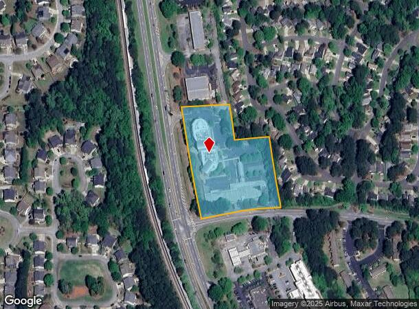
315 N 74 Hwy N
07-34-00-052
Spooner Ridge Subdivision
Financialbuilding
HWY 74 & WISDOM RD
X
Fayette
13077C0190D
Georgia
0
4.01 AC
2024
Fayette/Coweta County
140209
Atlanta
52,001 SF
Atlanta-Sandy Springs-Roswell, GA
DEMOGRAPHICS near 315 N 74 Hwy N
1 Mile
3 Mile
5 Mile
2024 Total Population
7,167
30,959
63,464
2029 Population
7,512
32,825
68,114
Pop Growth 2024-2029
+ 4.81%
+ 6.03%
+ 7.33%
Average Age
40
42
42
2024 Total Households
2,687
11,630
23,289
HH Growth 2024-2029
+ 4.88%
+ 6.02%
+ 7.32%
Median Household Inc
$105,152
$99,573
$99,989
Avg Household Size
2.60
2.60
2.70
2024 Avg HH Vehicles
2.00
2.00
2.00
Median Home Value
$391,693
$408,238
$369,031
Median Year Built
1995
1992
1993
Nearby Places
- Restaurants
- Banks
- Shops
- Fitness
- Groceries
PUBLIC TRANSPORTATION
AIRPORT
Hartsfield - Jackson Atlanta International
DRIVE
WALK
Distance
Hartsfield - Jackson Atlanta International
35 min
24.1 mi
Freight Ports
Georgia Ports - Savannah
DRIVE
WALK
Distance
Georgia Ports - Savannah
287 min
246.7 mi
Nearby Properties
Address
Land Use
TOTAL SIZE
Lot Size
Zoning
Address
Land Use
TOTAL SIZE
Lot Size
Zoning
353,300 SF
38 AC
Address
Land Use
TOTAL SIZE
Lot Size
Zoning
171,535 SF
27.60 AC
C GC
Address
Land Use
TOTAL SIZE
Lot Size
Zoning
194,839 SF
25.40 AC
C GC
Address
Land Use
TOTAL SIZE
Lot Size
Zoning
118,729 SF
21.25 AC
C GR10
Address
Land Use
TOTAL SIZE
Lot Size
Zoning
163,447 SF
18.70 AC
C LUC
Address
Land Use
TOTAL SIZE
Lot Size
Zoning
218,763 SF
38.40 AC
C GC
Address
Land Use
TOTAL SIZE
Lot Size
Zoning
155,422 SF
25.37 AC
001
Address
Land Use
TOTAL SIZE
Lot Size
Zoning
102,516 SF
19.60 AC
Address
Land Use
TOTAL SIZE
Lot Size
Zoning
89,736 SF
11.56 AC
C GC
Address
Land Use
TOTAL SIZE
Lot Size
Zoning
75,217 SF
15 AC
CS
Address
Land Use
TOTAL SIZE
Lot Size
Zoning
39,195 SF
14.06 AC
C GC
Address
Land Use
TOTAL SIZE
Lot Size
Zoning
151,533 SF
17.78 AC
C GC
Address
Land Use
TOTAL SIZE
Lot Size
Zoning
202,691 SF
24.65 AC
C GC
Address
Land Use
TOTAL SIZE
Lot Size
Zoning
106,142 SF
13.93 AC
C GR14
Address
Land Use
TOTAL SIZE
Lot Size
Zoning
93,072 SF
28.10 AC
C LUC
Address
Land Use
TOTAL SIZE
Lot Size
Zoning
96,409 SF
12.74 AC
C GC
Address
Land Use
TOTAL SIZE
Lot Size
Zoning
32,126 SF
8.41 AC
C LUC
Address
Land Use
TOTAL SIZE
Lot Size
Zoning
72,703 SF
8 AC
C GC
Address
Land Use
TOTAL SIZE
Lot Size
Zoning
377,939 SF
14.42 AC
I GI
Address
Land Use
TOTAL SIZE
Lot Size
Zoning
55,360 SF
4.80 AC
C LUC
Address
Land Use
TOTAL SIZE
Lot Size
Zoning
48,355 SF
26.70 AC
Address
Land Use
TOTAL SIZE
Lot Size
Zoning
47,505 SF
9.83 AC
I GI
Address
Land Use
TOTAL SIZE
Lot Size
Zoning
153,191 SF
20.95 AC
R1
Address
Land Use
TOTAL SIZE
Lot Size
Zoning
44,100 SF
4.69 AC
I GI
Address
Land Use
TOTAL SIZE
Lot Size
Zoning
93,925 SF
5.18 AC
C GC
Address
Land Use
TOTAL SIZE
Lot Size
Zoning
35,802 SF
4.39 AC
C OI
Address
Land Use
TOTAL SIZE
Lot Size
Zoning
160,007 SF
20.10 AC
I GI
Address
Land Use
TOTAL SIZE
Lot Size
Zoning
66,902 SF
8.19 AC
C GC
Address
Land Use
TOTAL SIZE
Lot Size
Zoning
86,761 SF
6.35 AC
C LUC
Address
Land Use
TOTAL SIZE
Lot Size
Zoning
14,166 SF
5.05 AC
C GC
The World's #1 Commercial Real Estate Marketplace
Connect with us
© 2025 CoStar Group
The information above has been obtained from sources believed reliable. While we do not doubt its accuracy we have not verified it and make no guarantee, warranty or representation about it. It is your responsibility to independently confirm its accuracy and completeness. Any projections, opinions, assumptions, or estimates used are for example only and do not represent the current or future performance of the property. The value of this transaction to you depends on tax and other factors which should be evaluated by your tax, financial, and legal advisors. You and your advisors should conduct a careful, independent investigation of the property to determine to your satisfaction the suitability of the property for your needs.