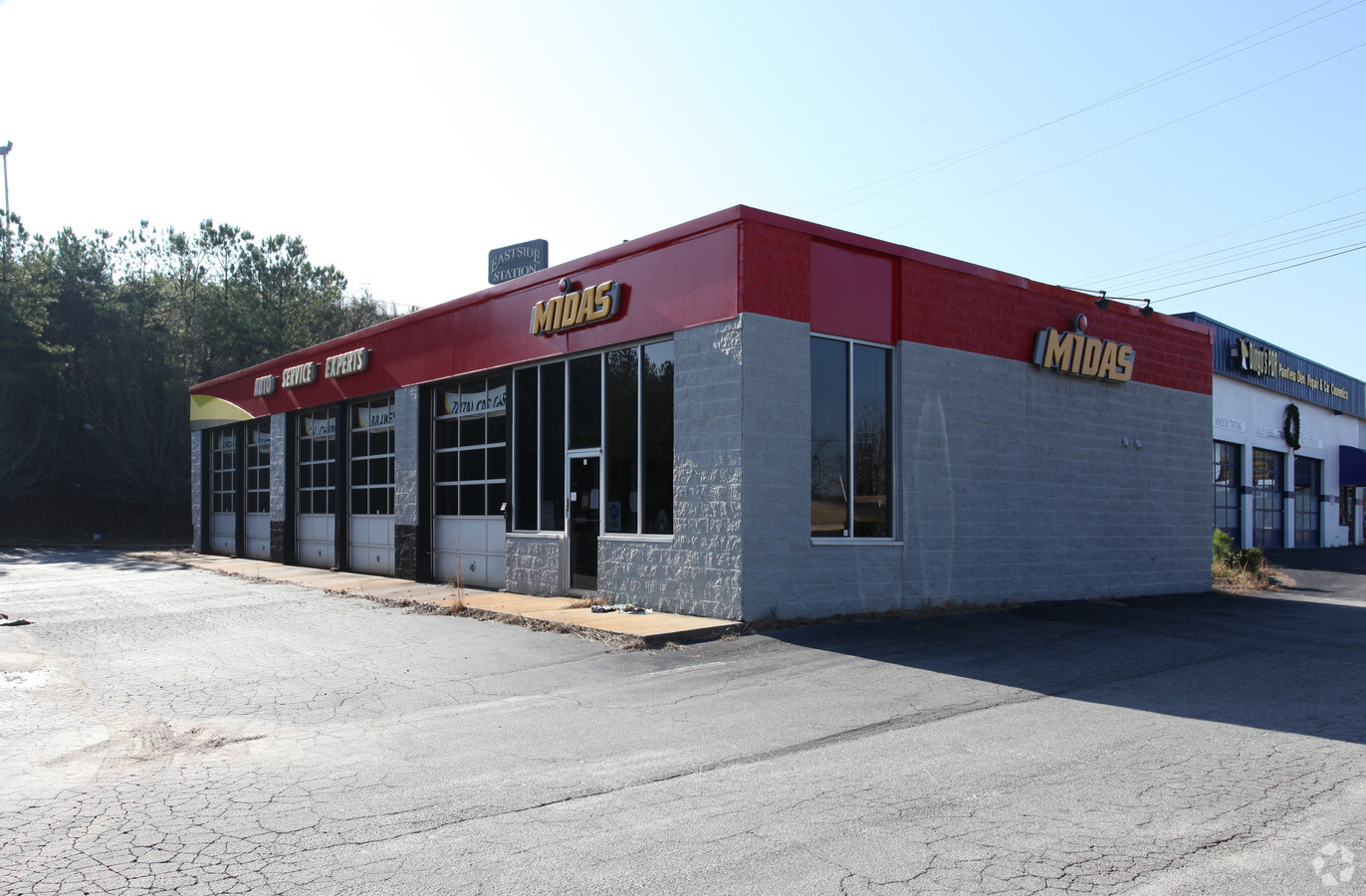
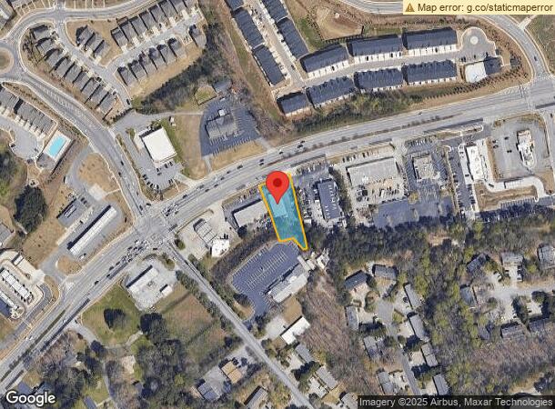
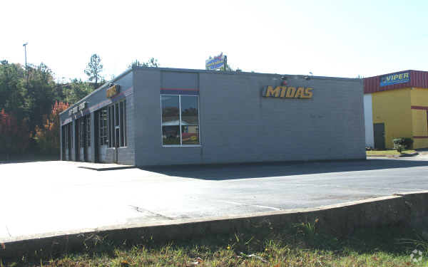
Property Record
3150 Main St W, Snellville, GA 30078

NEARBY LISTINGS FOR SALE OR LEASE
Property Detail
3150 Main St W
Atlanta-Sandy Springs-Roswell, GA
Hwy 78
6-051-341
HWY 78
Autorepair
Gwinnett
X
Georgia
13135C0128F
52
2024
0.75 AC
2023
Lilburn/Snellville
050763
Atlanta
3,200 SF
DEMOGRAPHICS near 3150 Main St W
1 Mile
3 Mile
5 Mile
2024 Total Population
9,072
66,389
177,241
2029 Population
9,545
69,339
184,913
Pop Growth 2024-2029
+ 5.21%
+ 4.44%
+ 4.33%
Average Age
37
38
39
2024 Total Households
2,937
21,577
56,934
HH Growth 2024-2029
+ 5.18%
+ 4.54%
+ 4.40%
Median Household Inc
$68,898
$86,867
$89,604
Avg Household Size
3.00
3.00
3.10
2024 Avg HH Vehicles
2.00
2.00
2.00
Median Home Value
$255,670
$291,545
$296,285
Median Year Built
1986
1987
1989
Nearby Places
- Restaurants
- Banks
- Shops
- Fitness
- Groceries
PUBLIC TRANSPORTATION
AIRPORT
Hartsfield - Jackson Atlanta International
DRIVE
WALK
Distance
Hartsfield - Jackson Atlanta International
47 min
31.7 mi
Freight Ports
Georgia Ports - Savannah
DRIVE
WALK
Distance
Georgia Ports - Savannah
300 min
263.5 mi
Nearby Properties
Address
Land Use
TOTAL SIZE
Lot Size
Zoning
Address
Land Use
TOTAL SIZE
Lot Size
Zoning
462,669 SF
102.65 AC
R100
Address
Land Use
TOTAL SIZE
Lot Size
Zoning
242,202 SF
2.05 AC
TC-MU
Address
Land Use
TOTAL SIZE
Lot Size
Zoning
301,014 SF
24.12 AC
RM13
Address
Land Use
TOTAL SIZE
Lot Size
Zoning
23,286 SF
27.72 AC
RM-MULTI-F
Address
Land Use
TOTAL SIZE
Lot Size
Zoning
362,674 SF
43.59 AC
CI
Address
Land Use
TOTAL SIZE
Lot Size
Zoning
245,208 SF
15.37 AC
RO
Address
Land Use
TOTAL SIZE
Lot Size
Zoning
280,353 SF
29.36 AC
BG
Address
Land Use
TOTAL SIZE
Lot Size
Zoning
253,355 SF
20.56 AC
RS15
Address
Land Use
TOTAL SIZE
Lot Size
Zoning
84,788 SF
24.09 AC
BG-GENERAL
Address
Land Use
TOTAL SIZE
Lot Size
Zoning
100,138 SF
18.56 AC
BG-GENERAL
Address
Land Use
TOTAL SIZE
Lot Size
Zoning
454,250 SF
24.30 AC
RS180
Address
Land Use
TOTAL SIZE
Lot Size
Zoning
357,243 SF
59.63 AC
R100
Address
Land Use
TOTAL SIZE
Lot Size
Zoning
125,097 SF
1.01 AC
CI-CIVIC I
Address
Land Use
TOTAL SIZE
Lot Size
Zoning
123,713 SF
5.97 AC
C2
Address
Land Use
TOTAL SIZE
Lot Size
Zoning
106,114 SF
16.59 AC
C2
Address
Land Use
TOTAL SIZE
Lot Size
Zoning
162,000 SF
1.35 AC
OP-OFFICE
Address
Land Use
TOTAL SIZE
Lot Size
Zoning
143,562 SF
15.97 AC
RM
Address
Land Use
TOTAL SIZE
Lot Size
Zoning
48,985 SF
17.87 AC
C2
Address
Land Use
TOTAL SIZE
Lot Size
Zoning
104,989 SF
9.71 AC
CI
Address
Land Use
TOTAL SIZE
Lot Size
Zoning
146,587 SF
13.91 AC
BG
Address
Land Use
TOTAL SIZE
Lot Size
Zoning
49,278 SF
8.28 AC
R100
Address
Land Use
TOTAL SIZE
Lot Size
Zoning
57,322 SF
9.18 AC
C2
Address
Land Use
TOTAL SIZE
Lot Size
Zoning
113,100 SF
11.39 AC
C2
Address
Land Use
TOTAL SIZE
Lot Size
Zoning
27,564 SF
6.02 AC
C3-CENTRAL
Address
Land Use
TOTAL SIZE
Lot Size
Zoning
85,810 SF
11.32 AC
BG
Address
Land Use
TOTAL SIZE
Lot Size
Zoning
75,354 SF
8.30 AC
HSB-HIGHWA
Address
Land Use
TOTAL SIZE
Lot Size
Zoning
37,113 SF
130.10 AC
R100
Address
Land Use
TOTAL SIZE
Lot Size
Zoning
73,182 SF
17.63 AC
R100
Address
Land Use
TOTAL SIZE
Lot Size
Zoning
46,000 SF
5.44 AC
BG
Address
Land Use
TOTAL SIZE
Lot Size
Zoning
103,700 SF
10.20 AC
C2
The World's #1 Commercial Real Estate Marketplace
Connect with us
© 2025 CoStar Group
The information above has been obtained from sources believed reliable. While we do not doubt its accuracy we have not verified it and make no guarantee, warranty or representation about it. It is your responsibility to independently confirm its accuracy and completeness. Any projections, opinions, assumptions, or estimates used are for example only and do not represent the current or future performance of the property. The value of this transaction to you depends on tax and other factors which should be evaluated by your tax, financial, and legal advisors. You and your advisors should conduct a careful, independent investigation of the property to determine to your satisfaction the suitability of the property for your needs.