Property Record
3151 Charleston Hwy, West Columbia, SC 29172
NEARBY LISTINGS FOR SALE OR LEASE
-
-
View all West Columbia listings for sale on LoopNet.com
Property Detail
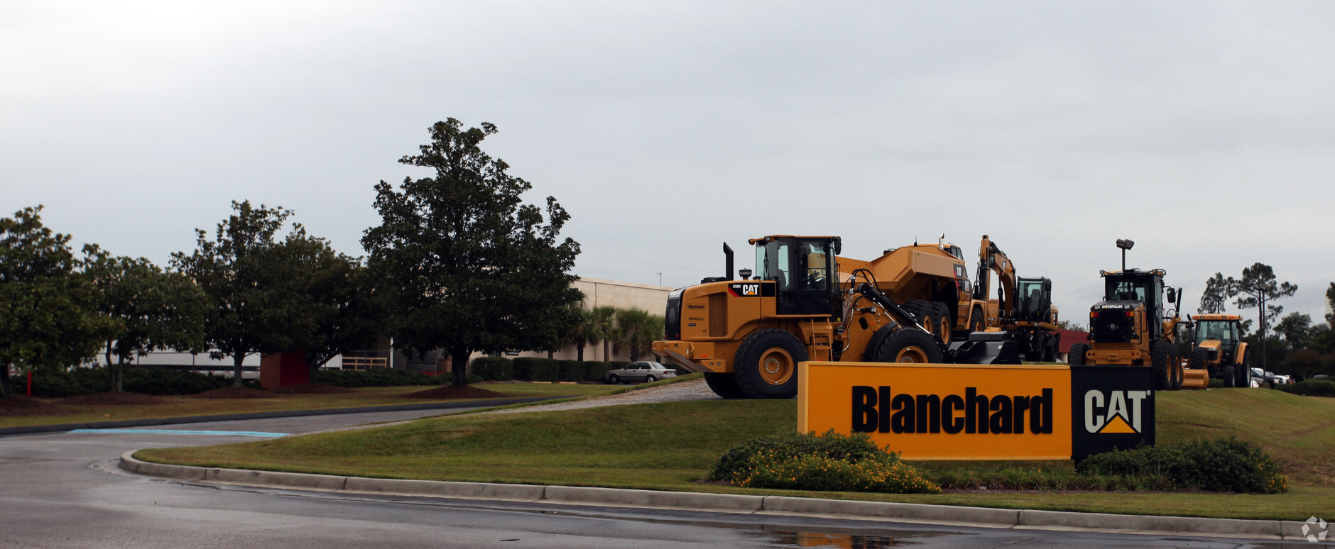
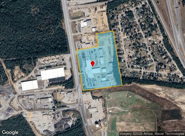
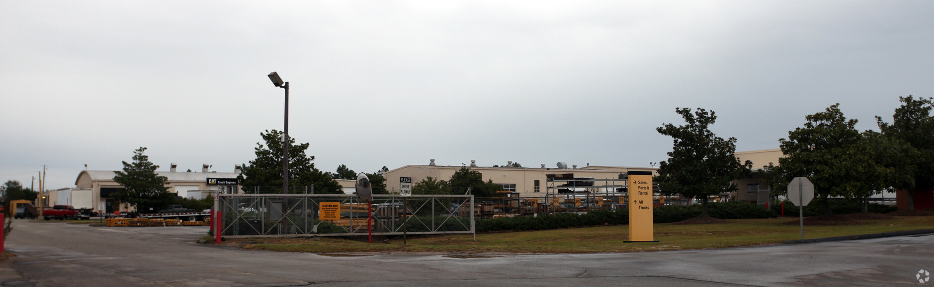
3151 Charleston Hwy
006899-03-003
TRACT A
Warehouse
Lexington
X
South Carolina
45063C0287J
19.74 AC
0
Cayce/West Columbia
2024
Columbia
020605
Columbia, SC
57,730 SF
DEMOGRAPHICS near 3151 Charleston Hwy
1 Mile
3 Mile
5 Mile
2024 Total Population
763
15,824
54,423
2029 Population
827
17,311
59,404
Pop Growth 2024-2029
+ 8.39%
+ 9.40%
+ 9.15%
Average Age
39
40
38
2024 Total Households
349
6,635
23,522
HH Growth 2024-2029
+ 8.31%
+ 9.50%
+ 9.37%
Median Household Inc
$63,750
$56,767
$50,583
Avg Household Size
2.20
2.30
2.20
2024 Avg HH Vehicles
2.00
2.00
2.00
Median Home Value
$152,380
$140,219
$145,121
Median Year Built
1985
1978
1979
Nearby Places
- Restaurants
- Banks
- Shops
- Fitness
- Groceries
PUBLIC TRANSPORTATION
COMMUTER RAIL
Columbia Amtrak Station (Silver Star - Amtrak)
DRIVE
WALK
Distance
Columbia Amtrak Station (Silver Star - Amtrak)
12 min
7.3 mi
AIRPORT
Columbia Metro
DRIVE
WALK
Distance
Columbia Metro
17 min
7.4 mi
Freight Ports
North Charleston Terminal
DRIVE
WALK
Distance
North Charleston Terminal
110 min
98.1 mi
Nearby Properties
Address
Land Use
TOTAL SIZE
Lot Size
Zoning
Address
Land Use
TOTAL SIZE
Lot Size
Zoning
1,253,820 SF
87.15 AC
Address
Land Use
TOTAL SIZE
Lot Size
Zoning
3,614 SF
1,444.32 AC
ID
Address
Land Use
TOTAL SIZE
Lot Size
Zoning
466,400 SF
52.42 AC
ID
Address
Land Use
TOTAL SIZE
Lot Size
Zoning
4,586 SF
19.15 AC
Address
Land Use
TOTAL SIZE
Lot Size
Zoning
8,118 SF
10.98 AC
RG
Address
Land Use
TOTAL SIZE
Lot Size
Zoning
180,000 SF
27.57 AC
ID
Address
Land Use
TOTAL SIZE
Lot Size
Zoning
9,800 SF
13.52 AC
ID
Address
Land Use
TOTAL SIZE
Lot Size
Zoning
5,502 SF
16.15 AC
ID
Address
Land Use
TOTAL SIZE
Lot Size
Zoning
200,000 SF
10.58 AC
ID
Address
Land Use
TOTAL SIZE
Lot Size
Zoning
61,012 SF
5.34 AC
Address
Land Use
TOTAL SIZE
Lot Size
Zoning
200,000 SF
9.66 AC
ID
Address
Land Use
TOTAL SIZE
Lot Size
Zoning
279,568 SF
11.38 AC
ID
Address
Land Use
TOTAL SIZE
Lot Size
Zoning
254,399 SF
49.79 AC
ID
Address
Land Use
TOTAL SIZE
Lot Size
Zoning
202,029 SF
21.13 AC
ID
Address
Land Use
TOTAL SIZE
Lot Size
Zoning
215,770 SF
24.51 AC
Address
Land Use
TOTAL SIZE
Lot Size
Zoning
50,400 SF
11 AC
ID
Address
Land Use
TOTAL SIZE
Lot Size
Zoning
92.08 AC
Address
Land Use
TOTAL SIZE
Lot Size
Zoning
120,000 SF
18.44 AC
ID
Address
Land Use
TOTAL SIZE
Lot Size
Zoning
90,736 SF
9.73 AC
C3
Address
Land Use
TOTAL SIZE
Lot Size
Zoning
9,444 SF
13.72 AC
M1
Address
Land Use
TOTAL SIZE
Lot Size
Zoning
28,210 SF
9.54 AC
Address
Land Use
TOTAL SIZE
Lot Size
Zoning
29,167 SF
3.15 AC
ID
Address
Land Use
TOTAL SIZE
Lot Size
Zoning
Address
Land Use
TOTAL SIZE
Lot Size
Zoning
40,360 SF
4 AC
ID
Address
Land Use
TOTAL SIZE
Lot Size
Zoning
35,712 SF
1.74 AC
RS1
Address
Land Use
TOTAL SIZE
Lot Size
Zoning
12,219 SF
14.60 AC
Address
Land Use
TOTAL SIZE
Lot Size
Zoning
630.08 AC
RD
Address
Land Use
TOTAL SIZE
Lot Size
Zoning
3,864 SF
20.22 AC
ID
Address
Land Use
TOTAL SIZE
Lot Size
Zoning
181,060 SF
10.61 AC
ID
The World's #1 Commercial Real Estate Marketplace
Connect with us
© 2025 CoStar Group
The information above has been obtained from sources believed reliable. While we do not doubt its accuracy we have not verified it and make no guarantee, warranty or representation about it. It is your responsibility to independently confirm its accuracy and completeness. Any projections, opinions, assumptions, or estimates used are for example only and do not represent the current or future performance of the property. The value of this transaction to you depends on tax and other factors which should be evaluated by your tax, financial, and legal advisors. You and your advisors should conduct a careful, independent investigation of the property to determine to your satisfaction the suitability of the property for your needs.