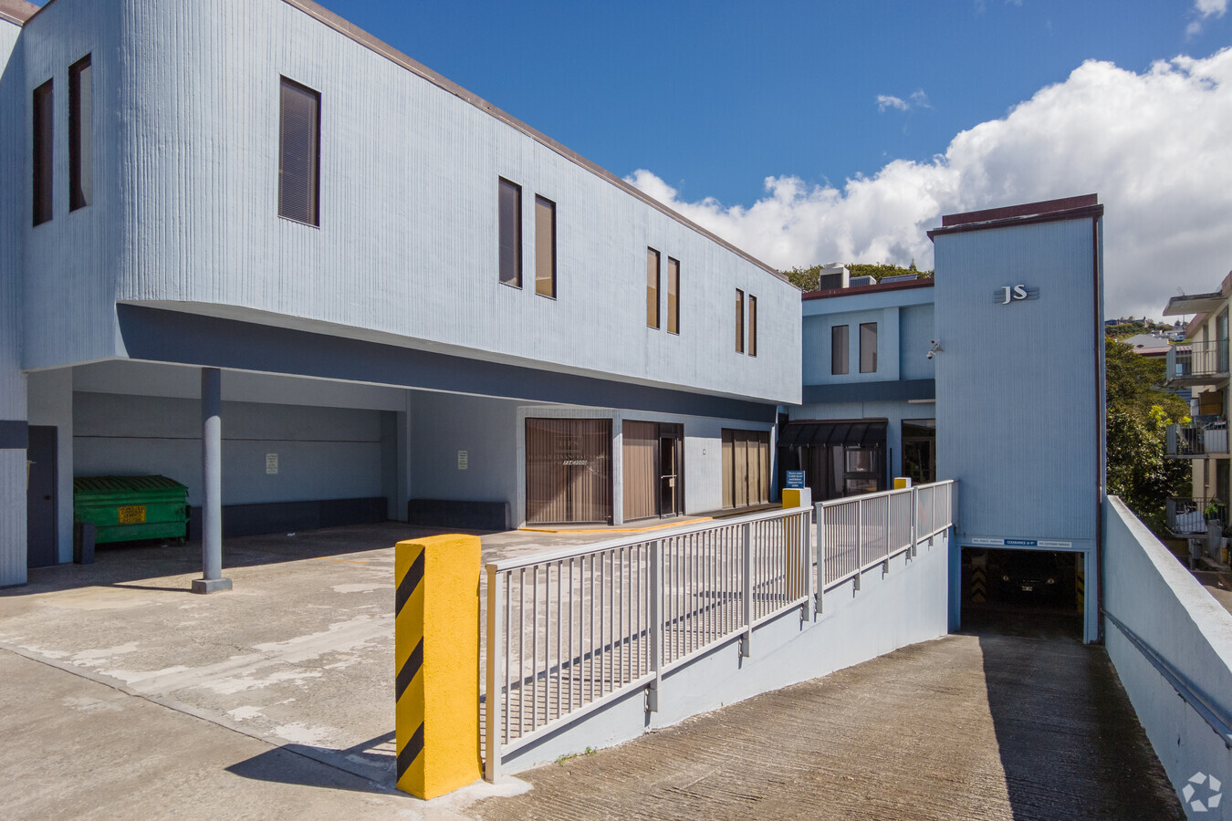
Property Record
3160 Waialae Ave, Honolulu, HI 96816
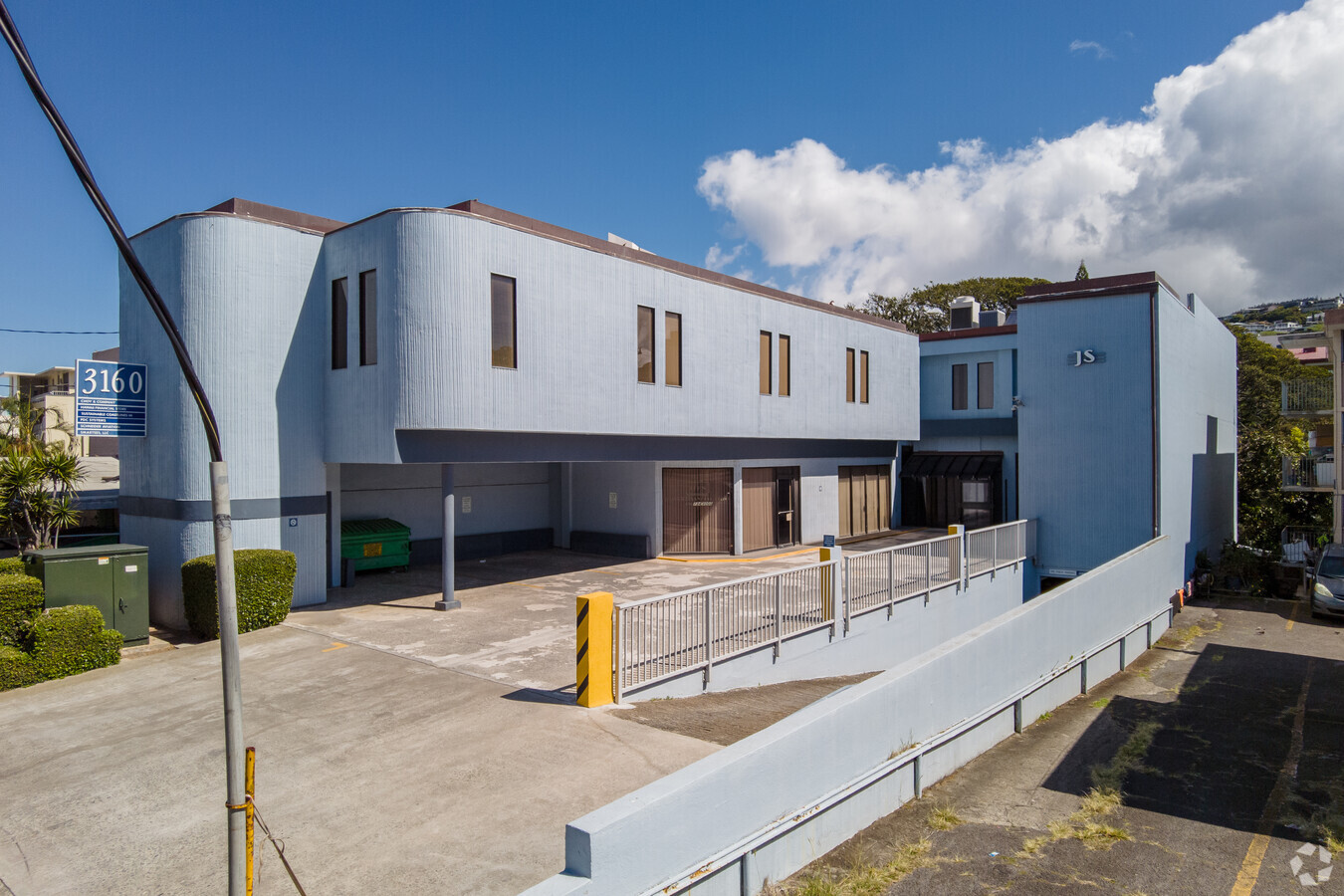
This Property Is For Sale
NEARBY LISTINGS FOR SALE OR LEASE
Property Detail
3160 Waialae Ave
Urban Honolulu, HI
Kaauila Tract
1-3-3-002-035-0000
LOT 9 POR LCAW 8515,PT 4 KAAUILA TRACT 8,236 SF DES *SAV/EXC PAR 102 POR LOT 9 527 SF DES
Commercialnec
Honolulu
AE
Hawaii
15003C0366G
9
2024
0.18 AC
2024
East Oahu
001201
Hawaii
7,057 SF
DEMOGRAPHICS near 3160 Waialae Ave
1 Mile
3 Mile
5 Mile
2024 Total Population
39,504
214,659
300,626
2029 Population
38,432
214,350
298,282
Pop Growth 2024-2029
(2.71%)
(0.14%)
(0.78%)
Average Age
42
45
45
2024 Total Households
14,528
94,679
127,805
HH Growth 2024-2029
(3.39%)
(0.27%)
(0.87%)
Median Household Inc
$79,646
$75,170
$75,876
Avg Household Size
2.40
2.10
2.20
2024 Avg HH Vehicles
2.00
1.00
1.00
Median Home Value
$863,905
$812,978
$827,083
Median Year Built
1967
1972
1973
Nearby Places
- Restaurants
- Banks
- Shops
- Fitness
- Groceries
PUBLIC TRANSPORTATION
AIRPORT
Daniel K Inouye International
Drive
Walk
Distance
Daniel K Inouye International
16 min
9.2 mi
Freight Ports
Honolulu Harbor, Oahu
Drive
Walk
Distance
Honolulu Harbor, Oahu
18 min
9.1 mi
Nearby Properties
Address
Land Use
TOTAL SIZE
Lot Size
Zoning
Address
Land Use
TOTAL SIZE
Lot Size
Zoning
7944402
34.93 AC
U/33/30
Address
Land Use
TOTAL SIZE
Lot Size
Zoning
491116
9.06 AC
U/X6/20
Address
Land Use
TOTAL SIZE
Lot Size
Zoning
119.90 AC
U/X7/60
Address
Land Use
TOTAL SIZE
Lot Size
Zoning
264870
3.47 AC
U/X6/20
Address
Land Use
TOTAL SIZE
Lot Size
Zoning
13088
75.21 AC
U/62/90
Address
Land Use
TOTAL SIZE
Lot Size
Zoning
193478
10.34 AC
U/X6/20
Address
Land Use
TOTAL SIZE
Lot Size
Zoning
1100000
9.65 AC
U/33/30
Address
Land Use
TOTAL SIZE
Lot Size
Zoning
292691
1.09 AC
U/X6/20
Address
Land Use
TOTAL SIZE
Lot Size
Zoning
164234
2.56 AC
U/X6/20
Address
Land Use
TOTAL SIZE
Lot Size
Zoning
495002
2.42 AC
U/X6/20
Address
Land Use
TOTAL SIZE
Lot Size
Zoning
471798
6.31 AC
U/X5/30
Address
Land Use
TOTAL SIZE
Lot Size
Zoning
130002
2.50 AC
U/X6/20
Address
Land Use
TOTAL SIZE
Lot Size
Zoning
45.65 AC
U/KA/70
Address
Land Use
TOTAL SIZE
Lot Size
Zoning
42.67 AC
U/62/90
Address
Land Use
TOTAL SIZE
Lot Size
Zoning
1339500
7.27 AC
U/33/30
Address
Land Use
TOTAL SIZE
Lot Size
Zoning
107721
2.76 AC
U/X6/20
Address
Land Use
TOTAL SIZE
Lot Size
Zoning
103284
1.84 AC
U/X6/20
Address
Land Use
TOTAL SIZE
Lot Size
Zoning
242241
2.40 AC
U/X6/20
Address
Land Use
TOTAL SIZE
Lot Size
Zoning
172305
2.54 AC
U/X6/70
Address
Land Use
TOTAL SIZE
Lot Size
Zoning
64300
0.77 AC
U/X6/20
Address
Land Use
TOTAL SIZE
Lot Size
Zoning
104386
1.04 AC
U/X6/20
Address
Land Use
TOTAL SIZE
Lot Size
Zoning
206214
6.48 AC
U/21/20
Address
Land Use
TOTAL SIZE
Lot Size
Zoning
144855
1.74 AC
U/X6/20
Address
Land Use
TOTAL SIZE
Lot Size
Zoning
139740
2.82 AC
U/X6/20
Address
Land Use
TOTAL SIZE
Lot Size
Zoning
142306
3.02 AC
U/X6/20
Address
Land Use
TOTAL SIZE
Lot Size
Zoning
92885
1.18 AC
U/X6/20
Address
Land Use
TOTAL SIZE
Lot Size
Zoning
79613
1.33 AC
U/X6/20
Address
Land Use
TOTAL SIZE
Lot Size
Zoning
240702
2.60 AC
U/X6/20
Address
Land Use
TOTAL SIZE
Lot Size
Zoning
22.36 AC
U/X7/70
Address
Land Use
TOTAL SIZE
Lot Size
Zoning
66180
1.61 AC
U/X6/20
Start a new search to find other properties for sale or lease
Connect with us
© 2024 CoStar Group
The information above has been obtained from sources believed reliable. While we do not doubt its accuracy we have not verified it and make no guarantee, warranty or representation about it. It is your responsibility to independently confirm its accuracy and completeness. Any projections, opinions, assumptions, or estimates used are for example only and do not represent the current or future performance of the property. The value of this transaction to you depends on tax and other factors which should be evaluated by your tax, financial, and legal advisors. You and your advisors should conduct a careful, independent investigation of the property to determine to your satisfaction the suitability of the property for your needs.