Property Record
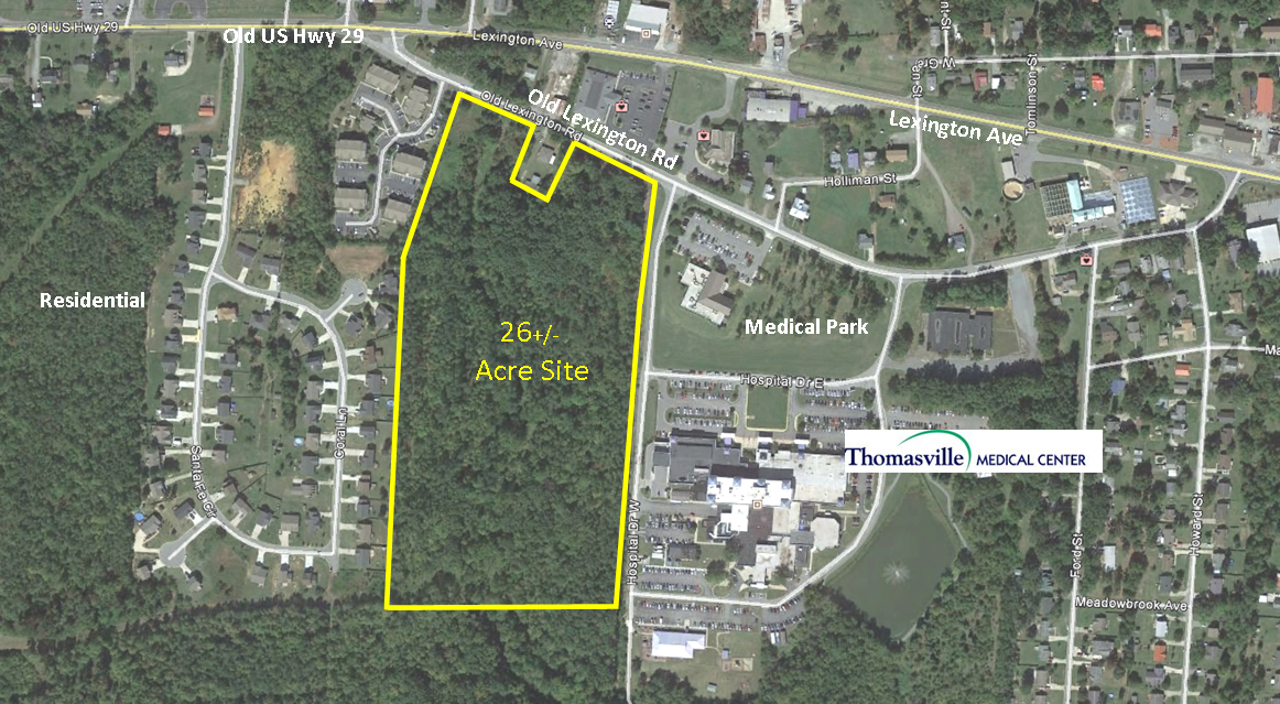
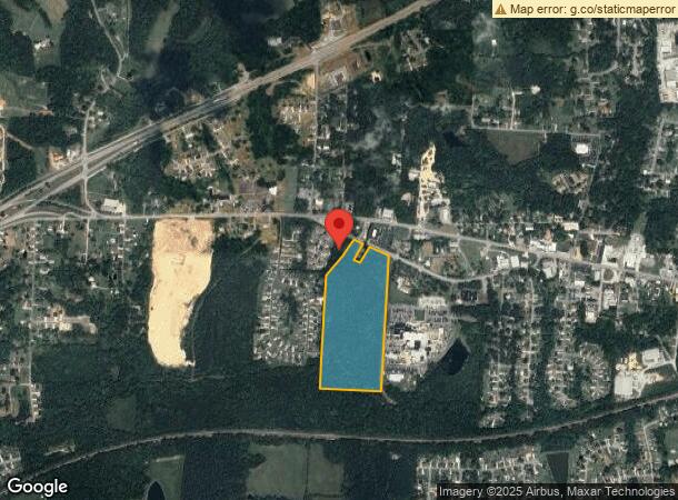
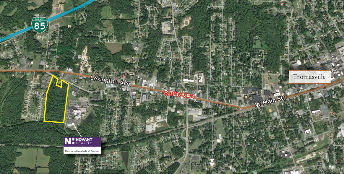
319 Old Lexington Rd, Thomasville, NC 27360
This Property Is For Sale
NEARBY LISTINGS FOR SALE OR LEASE
-
-
View all Thomasville listings for sale on LoopNet.com
Property Detail
319 Old Lexington Rd
Winston-Salem, NC
Thomasville
16-325-0-000-0096-0-0-0
L96 BK1904-34 OLD LEX RD
Vacantlandnec
Davidson
AE
North Carolina
3710676700J
24.88 AC
2024
North Davidson County
2024
Greensboro/Winston-Salem
060800
DEMOGRAPHICS near 319 Old Lexington Rd
1 Mile
3 Mile
5 Mile
2024 Total Population
3,137
24,961
45,876
2029 Population
3,328
26,417
48,356
Pop Growth 2024-2029
+ 6.09%
+ 5.83%
+ 5.41%
Average Age
40
40
41
2024 Total Households
1,313
10,058
18,343
HH Growth 2024-2029
+ 6.02%
+ 5.75%
+ 5.32%
Median Household Inc
$45,726
$41,708
$52,143
Avg Household Size
2.40
2.40
2.40
2024 Avg HH Vehicles
2.00
2.00
2.00
Median Home Value
$144,178
$142,924
$159,815
Median Year Built
1976
1970
1980
Nearby Places
- Restaurants
- Banks
- Shops
- Fitness
- Groceries
PUBLIC TRANSPORTATION
AIRPORT
Piedmont Triad International
DRIVE
WALK
Distance
Piedmont Triad International
37 min
22.6 mi
Freight Ports
Port of Wilmington
DRIVE
WALK
Distance
Port of Wilmington
257 min
218.9 mi
Nearby Properties
Address
Land Use
TOTAL SIZE
Lot Size
Zoning
Address
Land Use
TOTAL SIZE
Lot Size
Zoning
51,988 SF
82.73 AC
OI
Address
Land Use
TOTAL SIZE
Lot Size
Zoning
103,482 SF
49.98 AC
OI
Address
Land Use
TOTAL SIZE
Lot Size
Zoning
66,674 SF
59.96 AC
OI
Address
Land Use
TOTAL SIZE
Lot Size
Zoning
35.69 AC
OI
Address
Land Use
TOTAL SIZE
Lot Size
Zoning
4,480 SF
20.67 AC
R10
Address
Land Use
TOTAL SIZE
Lot Size
Zoning
13,770 SF
34.64 AC
R10
Address
Land Use
TOTAL SIZE
Lot Size
Zoning
122,865 SF
30.57 AC
R15
Address
Land Use
TOTAL SIZE
Lot Size
Zoning
20,016 SF
135.18 AC
M1CZ
Address
Land Use
TOTAL SIZE
Lot Size
Zoning
41,284 SF
19.05 AC
R10
Address
Land Use
TOTAL SIZE
Lot Size
Zoning
900 SF
7.52 AC
C2
Address
Land Use
TOTAL SIZE
Lot Size
Zoning
56,305 SF
5.39 AC
OI
Address
Land Use
TOTAL SIZE
Lot Size
Zoning
12,536 SF
300.20 AC
M1CZ
Address
Land Use
TOTAL SIZE
Lot Size
Zoning
1,104 SF
50.07 AC
M2
Address
Land Use
TOTAL SIZE
Lot Size
Zoning
72,642 SF
10.53 AC
R10
Address
Land Use
TOTAL SIZE
Lot Size
Zoning
124,326 SF
13.45 AC
C3
Address
Land Use
TOTAL SIZE
Lot Size
Zoning
4,560 SF
187.84 AC
R10
Address
Land Use
TOTAL SIZE
Lot Size
Zoning
149,129 SF
15.65 AC
R10
Address
Land Use
TOTAL SIZE
Lot Size
Zoning
5,220 SF
9.61 AC
R8
Address
Land Use
TOTAL SIZE
Lot Size
Zoning
38,896 SF
6.64 AC
C2
Address
Land Use
TOTAL SIZE
Lot Size
Zoning
12,040 SF
17.95 AC
RA3
Address
Land Use
TOTAL SIZE
Lot Size
Zoning
52,466 SF
3.57 AC
C2
Address
Land Use
TOTAL SIZE
Lot Size
Zoning
39,842 SF
12.49 AC
M2
Address
Land Use
TOTAL SIZE
Lot Size
Zoning
1,152 SF
0.03 AC
RA3
Address
Land Use
TOTAL SIZE
Lot Size
Zoning
63,730 SF
19.47 AC
R10
Address
Land Use
TOTAL SIZE
Lot Size
Zoning
2,460 SF
26.64 AC
R8
Address
Land Use
TOTAL SIZE
Lot Size
Zoning
1,551 SF
16.15 AC
R8
Address
Land Use
TOTAL SIZE
Lot Size
Zoning
13,891 SF
63.54 AC
RA3
Address
Land Use
TOTAL SIZE
Lot Size
Zoning
35,582 SF
4.95 AC
R8
Address
Land Use
TOTAL SIZE
Lot Size
Zoning
8,400 SF
5.31 AC
C2
Address
Land Use
TOTAL SIZE
Lot Size
Zoning
34,506 SF
12.70 AC
R10
The World's #1 Commercial Real Estate Marketplace
Connect with us
© 2025 CoStar Group
The information above has been obtained from sources believed reliable. While we do not doubt its accuracy we have not verified it and make no guarantee, warranty or representation about it. It is your responsibility to independently confirm its accuracy and completeness. Any projections, opinions, assumptions, or estimates used are for example only and do not represent the current or future performance of the property. The value of this transaction to you depends on tax and other factors which should be evaluated by your tax, financial, and legal advisors. You and your advisors should conduct a careful, independent investigation of the property to determine to your satisfaction the suitability of the property for your needs.