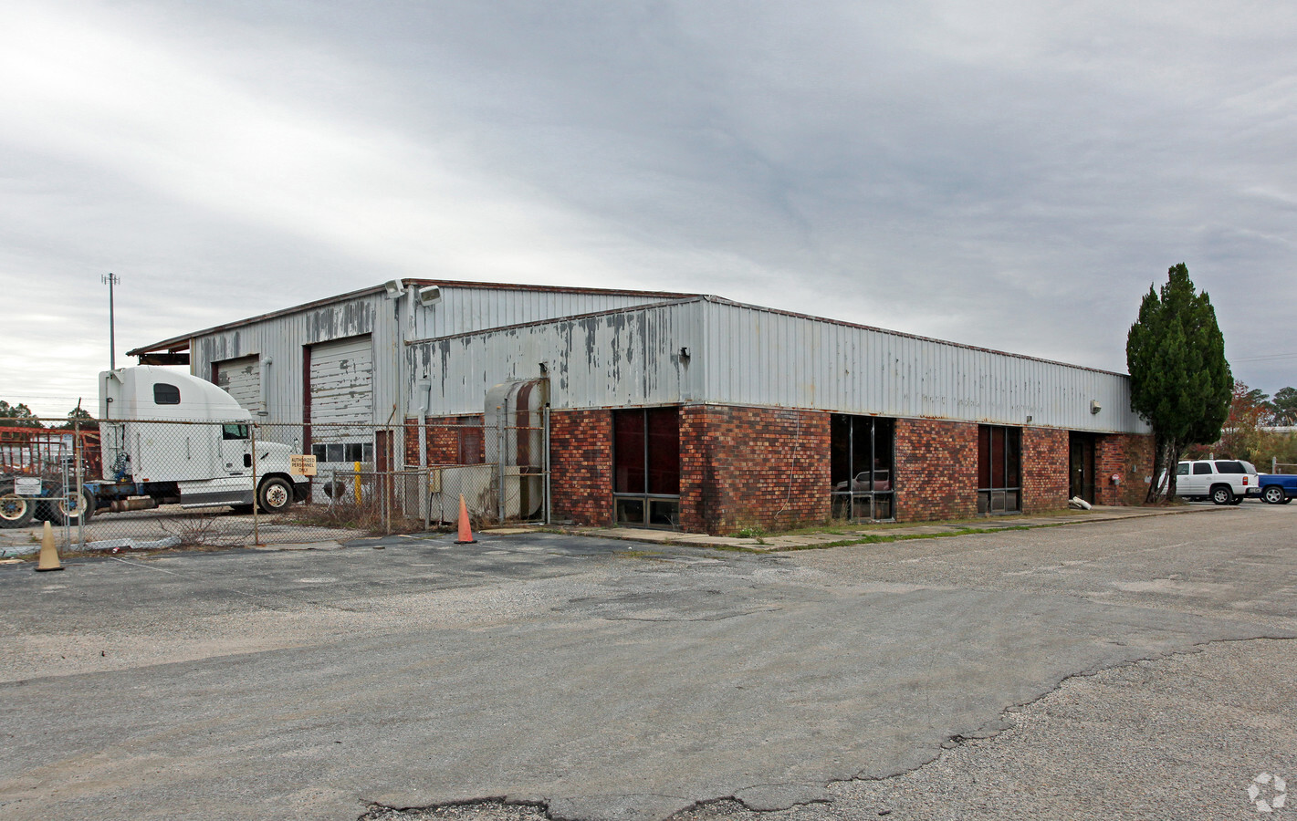
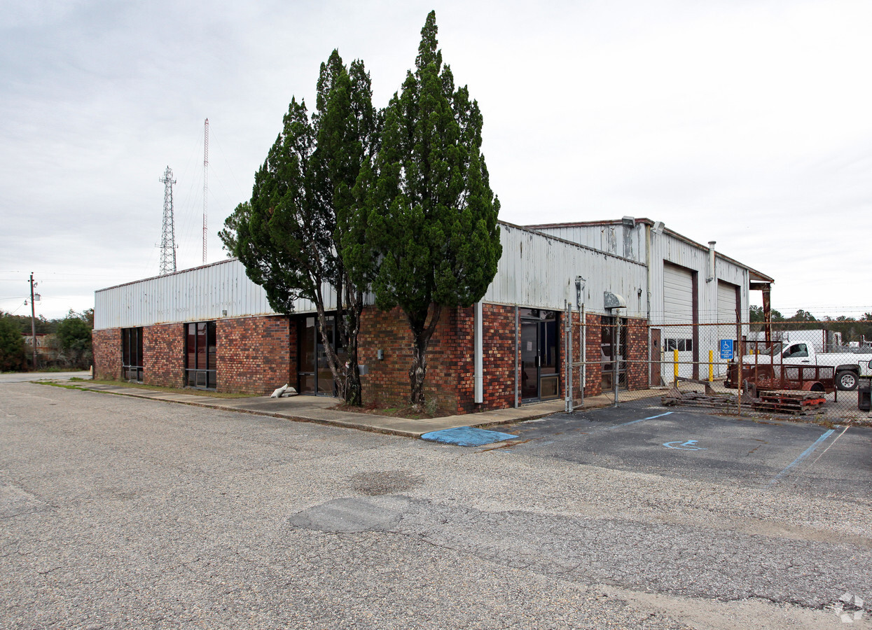
Property Record
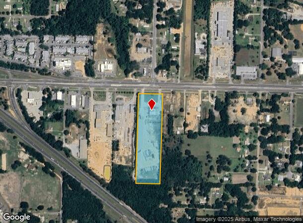
3191 W Nine Mile Rd, Pensacola, FL 32534
NEARBY LISTINGS FOR SALE OR LEASE
-
-
View all Pensacola listings for sale on LoopNet.com
Property Detail
3191 W Nine Mile Rd
11-1S-31-2201-000-000
Subdivision Number: 2201
Vehiclerentalsvehiclesales
E1/2 OF E1/2 OF NW1/4 OF NW1/4 OR 4534 P 838 OR 8247 P 773 OR 9153 P 416
X
Escambia
12033C0290G
Florida
2023
9.23 AC
2024
Myrtle Grove/Bellview
003400
Pensacola
8,318 SF
Pensacola-Ferry Pass-Brent, FL
DEMOGRAPHICS near 3191 W Nine Mile Rd
1 Mile
3 Mile
5 Mile
2024 Total Population
3,146
27,033
75,849
2029 Population
3,257
27,913
77,729
Pop Growth 2024-2029
+ 3.53%
+ 3.26%
+ 2.48%
Average Age
42
42
41
2024 Total Households
1,293
10,825
29,739
HH Growth 2024-2029
+ 3.40%
+ 3.27%
+ 2.46%
Median Household Inc
$77,860
$71,277
$63,942
Avg Household Size
2.40
2.40
2.50
2024 Avg HH Vehicles
2.00
2.00
2.00
Median Home Value
$232,294
$239,912
$221,538
Median Year Built
1999
1998
1993
Nearby Places
- Restaurants
- Banks
- Shops
- Fitness
- Groceries
PUBLIC TRANSPORTATION
AIRPORT
Pensacola International
DRIVE
WALK
Distance
Pensacola International
21 min
12.5 mi
Freight Ports
Port of Mobile
DRIVE
WALK
Distance
Port of Mobile
53 min
46.7 mi
Nearby Properties
Address
Land Use
TOTAL SIZE
Lot Size
Zoning
Address
Land Use
TOTAL SIZE
Lot Size
Zoning
3,663,601 SF
237.88 AC
HC/LI
Address
Land Use
TOTAL SIZE
Lot Size
Zoning
374,350 SF
26.17 AC
COM
Address
Land Use
TOTAL SIZE
Lot Size
Zoning
295,911 SF
15.53 AC
HC/LI,HDR
Address
Land Use
TOTAL SIZE
Lot Size
Zoning
303,273 SF
9.95 AC
HC/LI
Address
Land Use
TOTAL SIZE
Lot Size
Zoning
264,273 SF
15.97 AC
HC/LI
Address
Land Use
TOTAL SIZE
Lot Size
Zoning
263,838 SF
9.03 AC
HC/LI
Address
Land Use
TOTAL SIZE
Lot Size
Zoning
274,822 SF
12.67 AC
HC/LI
Address
Land Use
TOTAL SIZE
Lot Size
Zoning
243,052 SF
14.51 AC
HC/LI
Address
Land Use
TOTAL SIZE
Lot Size
Zoning
235,695 SF
1.61 AC
HC/LI
Address
Land Use
TOTAL SIZE
Lot Size
Zoning
170,669 SF
8.92 AC
COM
Address
Land Use
TOTAL SIZE
Lot Size
Zoning
145,610 SF
5.42 AC
COM,HC/LI
Address
Land Use
TOTAL SIZE
Lot Size
Zoning
155,562 SF
1.86 AC
HC/LI
Address
Land Use
TOTAL SIZE
Lot Size
Zoning
141,020 SF
9.61 AC
HC/LI
Address
Land Use
TOTAL SIZE
Lot Size
Zoning
434,173 SF
1.98 AC
HC/LI
Address
Land Use
TOTAL SIZE
Lot Size
Zoning
75,966 SF
3.11 AC
COM,HC/LI
Address
Land Use
TOTAL SIZE
Lot Size
Zoning
72,248 SF
6.07 AC
COM,HC/LI
Address
Land Use
TOTAL SIZE
Lot Size
Zoning
140,190 SF
13.05 AC
HC/LI
Address
Land Use
TOTAL SIZE
Lot Size
Zoning
56,022 SF
19.32 AC
HC/LI
Address
Land Use
TOTAL SIZE
Lot Size
Zoning
129,314 SF
4.48 AC
COM
Address
Land Use
TOTAL SIZE
Lot Size
Zoning
54,556 SF
3.98 AC
HC/LI
Address
Land Use
TOTAL SIZE
Lot Size
Zoning
103,670 SF
10.10 AC
HC/LI
Address
Land Use
TOTAL SIZE
Lot Size
Zoning
27,752 SF
5.03 AC
COM
Address
Land Use
TOTAL SIZE
Lot Size
Zoning
54,158 SF
1.27 AC
HC/LI
Address
Land Use
TOTAL SIZE
Lot Size
Zoning
102,019 SF
9.85 AC
COM
Address
Land Use
TOTAL SIZE
Lot Size
Zoning
538.58 AC
NONE,PUB
Address
Land Use
TOTAL SIZE
Lot Size
Zoning
77,537 SF
6.57 AC
HC/LI
Address
Land Use
TOTAL SIZE
Lot Size
Zoning
51,241 SF
5.95 AC
HC/LI
Address
Land Use
TOTAL SIZE
Lot Size
Zoning
57,494 SF
5.48 AC
COM
Address
Land Use
TOTAL SIZE
Lot Size
Zoning
97,699 SF
18 AC
MDR
Address
Land Use
TOTAL SIZE
Lot Size
Zoning
48,100 SF
3.69 AC
COM
The World's #1 Commercial Real Estate Marketplace
Connect with us
© 2025 CoStar Group
The information above has been obtained from sources believed reliable. While we do not doubt its accuracy we have not verified it and make no guarantee, warranty or representation about it. It is your responsibility to independently confirm its accuracy and completeness. Any projections, opinions, assumptions, or estimates used are for example only and do not represent the current or future performance of the property. The value of this transaction to you depends on tax and other factors which should be evaluated by your tax, financial, and legal advisors. You and your advisors should conduct a careful, independent investigation of the property to determine to your satisfaction the suitability of the property for your needs.