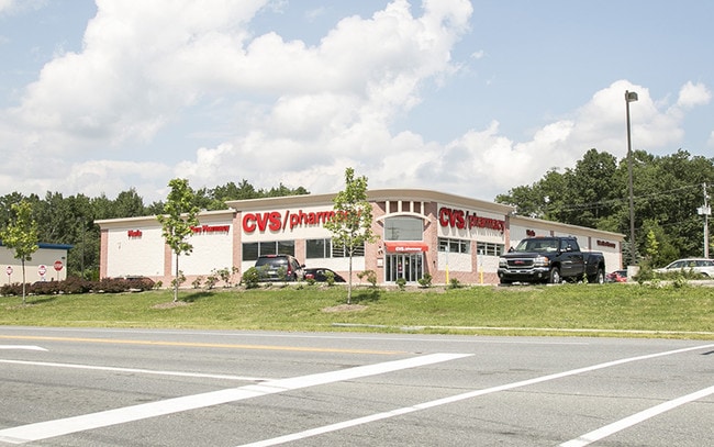
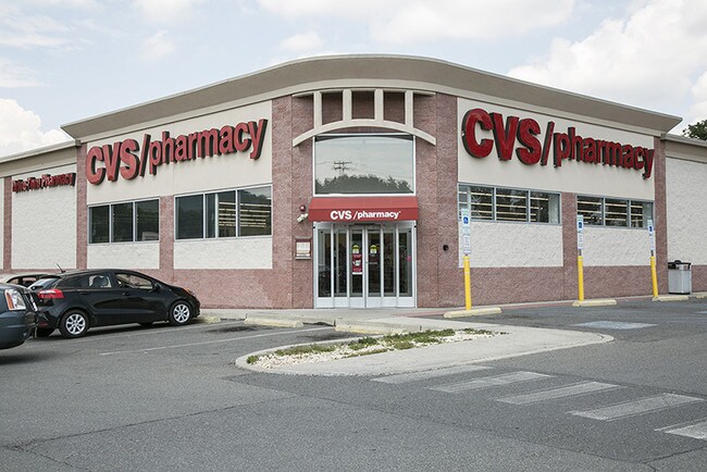
Property Record
Rte 115, Brodheadsville, PA 18322

NEARBY LISTINGS FOR SALE OR LEASE
Property Detail
Rte 115
East Stroudsburg, PA
Cvs Mt Effort
02.94792
UNIT 1
Storebuilding
Monroe
X
Pennsylvania
42089C0380E
1
2025
0.30 AC
2025
Monroe County
000030
Philadelphia
13,375 SF
DEMOGRAPHICS near Rte 115
1 Mile
3 Mile
5 Mile
2024 Total Population
2,677
15,445
30,891
2029 Population
2,755
15,567
31,085
Pop Growth 2024-2029
+ 2.91%
+ 0.79%
+ 0.63%
Average Age
40
42
42
2024 Total Households
899
5,448
11,224
HH Growth 2024-2029
+ 2.89%
+ 0.70%
+ 0.61%
Median Household Inc
$81,393
$79,133
$77,530
Avg Household Size
2.90
2.80
2.70
2024 Avg HH Vehicles
2.00
2.00
2.00
Median Home Value
$238,508
$226,799
$219,744
Median Year Built
1993
1989
1987
Nearby Places
Map Layers
Map Styles
 Street
 Aerial
- Restaurants
- Banks
- Shops
- Fitness
- Groceries
PUBLIC TRANSPORTATION
AIRPORT
Lehigh Valley International
DRIVE
WALK
Distance
Lehigh Valley International
45 min
36.0 mi
Wilkes-Barre/Scranton International
DRIVE
WALK
Distance
Wilkes-Barre/Scranton International
48 min
41.6 mi
Freight Ports
Maher Terminal
DRIVE
WALK
Distance
Maher Terminal
1 min
70.0 mi
SALE & LEASE HISTORY
LISTING DATE
SALE/LEASE

Sep 24, 2016
For Sale
Jul 23, 2018
For Sale
Aug 31, 2017
For Sale
Aug 31, 2017
For Sale
Apr 03, 2018
For Sale
Nearby Properties
Address
Land Use
TOTAL SIZE
Lot Size
Zoning
Address
Land Use
TOTAL SIZE
Lot Size
Zoning
6,540 SF
3.54 AC
GC
Address
Land Use
TOTAL SIZE
Lot Size
Zoning
18,810 SF
3.88 AC
R2
Address
Land Use
TOTAL SIZE
Lot Size
Zoning
24,000 SF
8.32 AC
CI
Address
Land Use
TOTAL SIZE
Lot Size
Zoning
3,408 SF
1.46 AC
GC
Address
Land Use
TOTAL SIZE
Lot Size
Zoning
9,360 SF
2 AC
GC
Address
Land Use
TOTAL SIZE
Lot Size
Zoning
20,982 SF
3.15 AC
RR
Address
Land Use
TOTAL SIZE
Lot Size
Zoning
3,627 SF
0.08 AC
GC
Address
Land Use
TOTAL SIZE
Lot Size
Zoning
13,020 SF
1 AC
GC
Address
Land Use
TOTAL SIZE
Lot Size
Zoning
6,424 SF
1.74 AC
C-1
Address
Land Use
TOTAL SIZE
Lot Size
Zoning
11,841 SF
15.38 AC
GC
Address
Land Use
TOTAL SIZE
Lot Size
Zoning
12,938 SF
3 AC
GC
Address
Land Use
TOTAL SIZE
Lot Size
Zoning
2,996 SF
1.33 AC
GC
Address
Land Use
TOTAL SIZE
Lot Size
Zoning
6,056 SF
88.86 AC
CIA
Address
Land Use
TOTAL SIZE
Lot Size
Zoning
5,760 SF
24.58 AC
RR
Address
Land Use
TOTAL SIZE
Lot Size
Zoning
4,782 SF
58.27 AC
RR
Address
Land Use
TOTAL SIZE
Lot Size
Zoning
7,500 SF
2.91 AC
C-1
Address
Land Use
TOTAL SIZE
Lot Size
Zoning
7,284 SF
4.44 AC
R-1
Address
Land Use
TOTAL SIZE
Lot Size
Zoning
2,400 SF
1.30 AC
VC
Address
Land Use
TOTAL SIZE
Lot Size
Zoning
3,822 SF
1.36 AC
VC
Address
Land Use
TOTAL SIZE
Lot Size
Zoning
16,921 SF
4.44 AC
VC
Address
Land Use
TOTAL SIZE
Lot Size
Zoning
5,376 SF
16.70 AC
GC
Address
Land Use
TOTAL SIZE
Lot Size
Zoning
244 AC
I
Address
Land Use
TOTAL SIZE
Lot Size
Zoning
2,240 SF
25.44 AC
LIC
Address
Land Use
TOTAL SIZE
Lot Size
Zoning
5,376 SF
1.67 AC
R-1
Address
Land Use
TOTAL SIZE
Lot Size
Zoning
12.76 AC
R-1
Address
Land Use
TOTAL SIZE
Lot Size
Zoning
58.11 AC
RR
Address
Land Use
TOTAL SIZE
Lot Size
Zoning
2,641 SF
1.27 AC
GC
Address
Land Use
TOTAL SIZE
Lot Size
Zoning
1,920 SF
1.59 AC
GC
Address
Land Use
TOTAL SIZE
Lot Size
Zoning
7,443 SF
2.05 AC
VC
The World's #1 Commercial Real Estate Marketplace
Connect with us
© 2025 CoStar Group
The information above has been obtained from sources believed reliable. While we do not doubt its accuracy we have not verified it and make no guarantee, warranty or representation about it. It is your responsibility to independently confirm its accuracy and completeness. Any projections, opinions, assumptions, or estimates used are for example only and do not represent the current or future performance of the property. The value of this transaction to you depends on tax and other factors which should be evaluated by your tax, financial, and legal advisors. You and your advisors should conduct a careful, independent investigation of the property to determine to your satisfaction the suitability of the property for your needs.