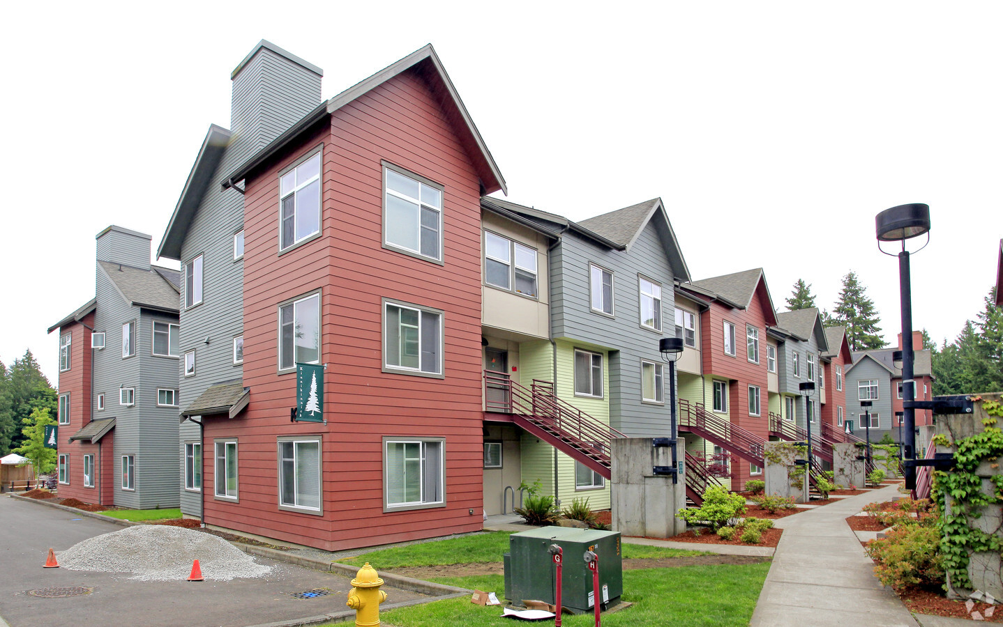
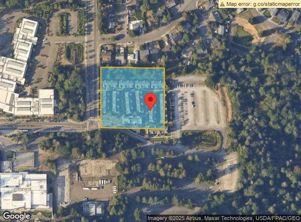
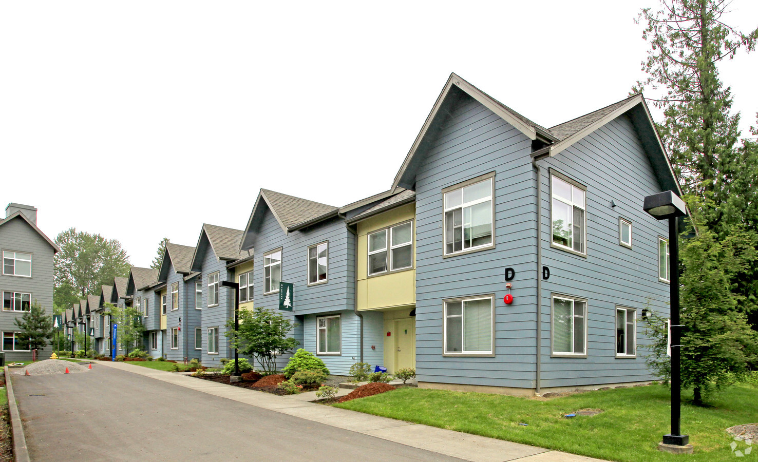
Property Record
31920 124Th Ave Se, Auburn, WA 98092
NEARBY LISTINGS FOR SALE OR LEASE
Property Detail
31920 124Th Ave Se
092105-9164
W 722.58 FT OF S 1/2 OF S 1/2 OF SW 1/4 OF SE 1/4 LESS E 350 FT LESS POR FOR CO RD TGW VAC CO RD LY ADJ
Apartment
King
X
Washington
53033C1260G
92105
2021
2.57 AC
2024
Lea Hill
031206
Seattle/Puget Sound
101,833 SF
Seattle-Tacoma-Bellevue, WA
DEMOGRAPHICS near 31920 124Th Ave Se
1 Mile
3 Mile
5 Mile
2024 Total Population
11,714
69,629
174,467
2029 Population
11,729
69,964
175,717
Pop Growth 2024-2029
+ 0.13%
+ 0.48%
+ 0.72%
Average Age
35
38
38
2024 Total Households
3,621
24,082
59,651
HH Growth 2024-2029
(0.17%)
+ 0.29%
+ 0.58%
Median Household Inc
$93,115
$75,364
$88,931
Avg Household Size
3.10
2.80
2.80
2024 Avg HH Vehicles
2.00
2.00
2.00
Median Home Value
$468,476
$446,466
$482,798
Median Year Built
1995
1983
1987
Nearby Places
- Restaurants
- Banks
- Shops
- Fitness
- Groceries
PUBLIC TRANSPORTATION
COMMUTER RAIL
Auburn Station (Sounder South Line - Central Puget Sound Regional Transit Authority Rail (Link Light Rail/Sounder))
DRIVE
WALK
Distance
Auburn Station (Sounder South Line - Central Puget Sound Regional Transit Authority Rail (Link Light Rail/Sounder))
11 min
4.2 mi
Kent Station (Sounder South Line - Central Puget Sound Regional Transit Authority Rail (Link Light Rail/Sounder))
DRIVE
WALK
Distance
Kent Station (Sounder South Line - Central Puget Sound Regional Transit Authority Rail (Link Light Rail/Sounder))
15 min
6.8 mi
AIRPORT
Seattle-Tacoma International
DRIVE
WALK
Distance
Seattle-Tacoma International
32 min
16.0 mi
Freight Ports
Port of Tacoma
DRIVE
WALK
Distance
Port of Tacoma
28 min
16.2 mi
Nearby Properties
Address
Land Use
TOTAL SIZE
Lot Size
Zoning
Address
Land Use
TOTAL SIZE
Lot Size
Zoning
369,280 SF
31.30 AC
M1
Address
Land Use
TOTAL SIZE
Lot Size
Zoning
662,963 SF
29.75 AC
M2
Address
Land Use
TOTAL SIZE
Lot Size
Zoning
217,000 SF
19.99 AC
R20
Address
Land Use
TOTAL SIZE
Lot Size
Zoning
326,634 SF
14.40 AC
C1
Address
Land Use
TOTAL SIZE
Lot Size
Zoning
9,765 SF
87.33 AC
I
Address
Land Use
TOTAL SIZE
Lot Size
Zoning
253,354 SF
26.78 AC
MR-G
Address
Land Use
TOTAL SIZE
Lot Size
Zoning
245,393 SF
2.48 AC
DUC
Address
Land Use
TOTAL SIZE
Lot Size
Zoning
288,600 SF
21.93 AC
M2
Address
Land Use
TOTAL SIZE
Lot Size
Zoning
160,432 SF
4.70 AC
C1
Address
Land Use
TOTAL SIZE
Lot Size
Zoning
258,308 SF
10.55 AC
M2
Address
Land Use
TOTAL SIZE
Lot Size
Zoning
68,040 SF
14.68 AC
M1
Address
Land Use
TOTAL SIZE
Lot Size
Zoning
125,664 SF
5.28 AC
R20
Address
Land Use
TOTAL SIZE
Lot Size
Zoning
158,650 SF
9.24 AC
R20
Address
Land Use
TOTAL SIZE
Lot Size
Zoning
148,248 SF
9.14 AC
MR-G
Address
Land Use
TOTAL SIZE
Lot Size
Zoning
144,780 SF
9.54 AC
R20
Address
Land Use
TOTAL SIZE
Lot Size
Zoning
109,403 SF
17.68 AC
P1
Address
Land Use
TOTAL SIZE
Lot Size
Zoning
134,078 SF
14.31 AC
R20
Address
Land Use
TOTAL SIZE
Lot Size
Zoning
191,824 SF
10.20 AC
M1
Address
Land Use
TOTAL SIZE
Lot Size
Zoning
84,042 SF
0.72 AC
DUC
Address
Land Use
TOTAL SIZE
Lot Size
Zoning
125,800 SF
5.61 AC
C3
Address
Land Use
TOTAL SIZE
Lot Size
Zoning
181,300 SF
8.14 AC
M1
Address
Land Use
TOTAL SIZE
Lot Size
Zoning
154,000 SF
12.12 AC
M1
Address
Land Use
TOTAL SIZE
Lot Size
Zoning
12,736 SF
5.84 AC
M2
Address
Land Use
TOTAL SIZE
Lot Size
Zoning
136,160 SF
8.15 AC
R20
Address
Land Use
TOTAL SIZE
Lot Size
Zoning
141,440 SF
8.56 AC
R20
Address
Land Use
TOTAL SIZE
Lot Size
Zoning
2,746 SF
86.86 AC
LF
Address
Land Use
TOTAL SIZE
Lot Size
Zoning
123,114 SF
11.85 AC
R10
Address
Land Use
TOTAL SIZE
Lot Size
Zoning
76,371 SF
9.13 AC
P1
Address
Land Use
TOTAL SIZE
Lot Size
Zoning
87,848 SF
31.96 AC
I
The World's #1 Commercial Real Estate Marketplace
Connect with us
© 2025 CoStar Group
The information above has been obtained from sources believed reliable. While we do not doubt its accuracy we have not verified it and make no guarantee, warranty or representation about it. It is your responsibility to independently confirm its accuracy and completeness. Any projections, opinions, assumptions, or estimates used are for example only and do not represent the current or future performance of the property. The value of this transaction to you depends on tax and other factors which should be evaluated by your tax, financial, and legal advisors. You and your advisors should conduct a careful, independent investigation of the property to determine to your satisfaction the suitability of the property for your needs.