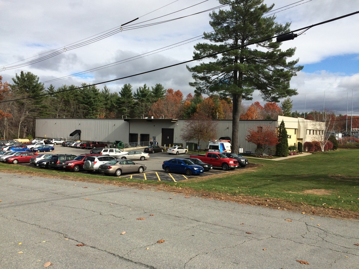
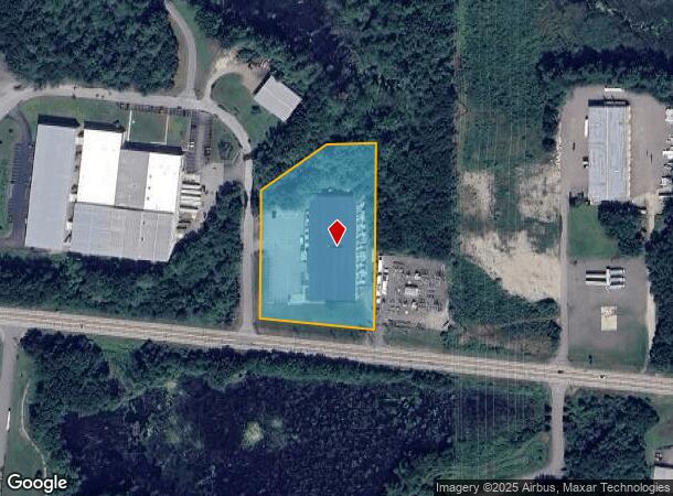
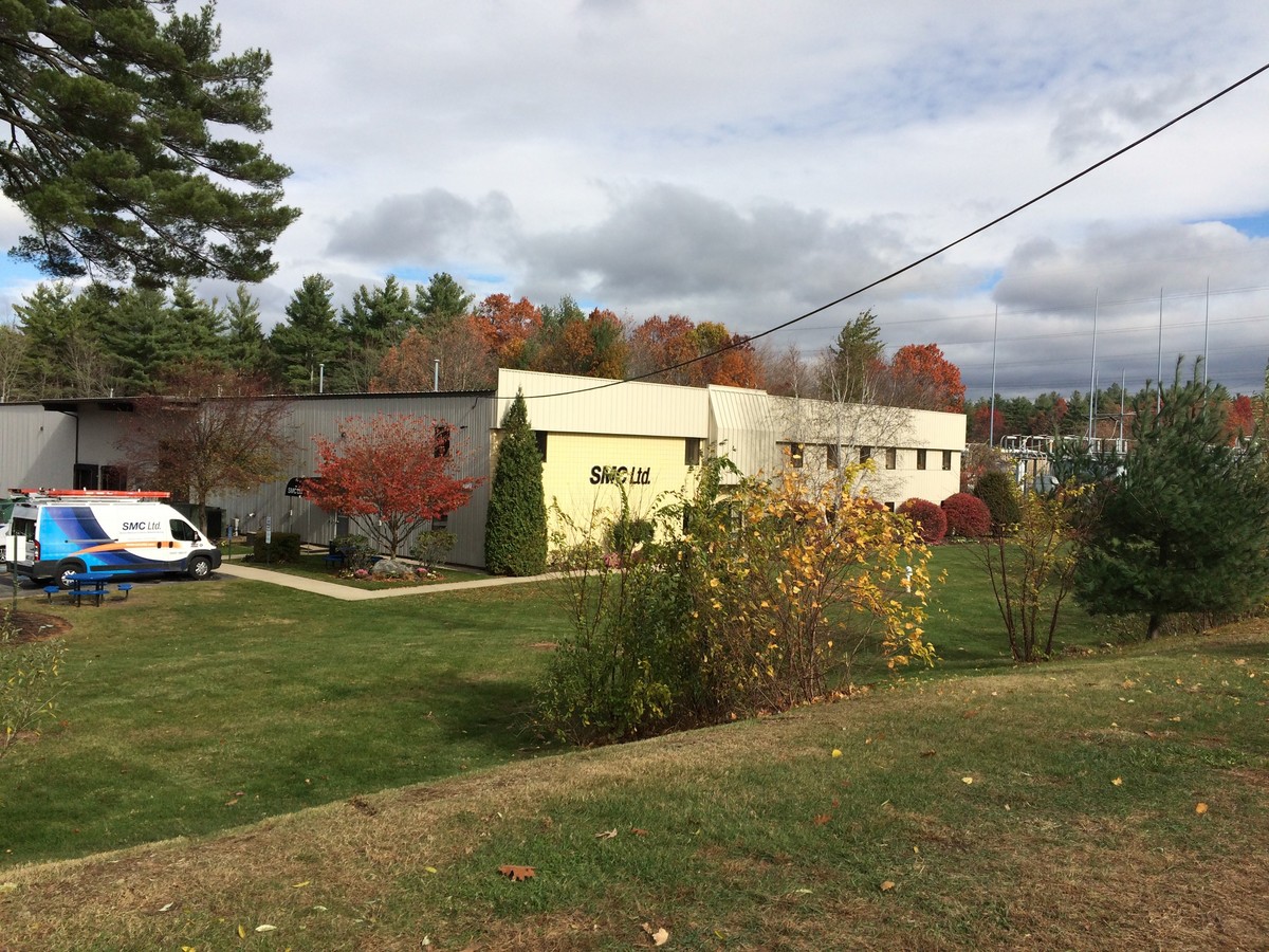
Property Record
32 Chocksett Rd, Sterling, MA 01564
NEARBY LISTINGS FOR SALE OR LEASE
Property Detail
32 Chocksett Rd
STER-000066-000000-000017
Worcester
Manufacturinglight
Massachusetts
ARE
17
25027C0453E
3 AC
2024
Outlying Worcester
2024
Boston
719100
Worcester, MA-CT
36,000 SF
DEMOGRAPHICS near 32 Chocksett Rd
1 Mile
3 Mile
5 Mile
2024 Total Population
1,280
12,639
50,109
2029 Population
1,281
12,624
49,808
Pop Growth 2024-2029
+ 0.08%
(0.12%)
(0.60%)
Average Age
43
43
42
2024 Total Households
473
4,565
19,813
HH Growth 2024-2029
0.00%
(0.13%)
(0.65%)
Median Household Inc
$128,409
$113,773
$87,915
Avg Household Size
2.70
2.60
2.40
2024 Avg HH Vehicles
2.00
2.00
2.00
Median Home Value
$407,547
$409,228
$368,698
Median Year Built
1986
1974
1966
Nearby Places
- Restaurants
- Banks
- Shops
- Fitness
- Groceries
PUBLIC TRANSPORTATION
COMMUTER RAIL
North Leominster (Fitchburg/South Acton Line - Massachusetts Bay Transportation Authority Commuter Rail (Purple Line))
DRIVE
WALK
Distance
North Leominster (Fitchburg/South Acton Line - Massachusetts Bay Transportation Authority Commuter Rail (Purple Line))
10 min
7.7 mi
AIRPORT
Worcester Regional
DRIVE
WALK
Distance
Worcester Regional
32 min
21.5 mi
Freight Ports
Port of Boston
DRIVE
WALK
Distance
Port of Boston
72 min
50.6 mi
Nearby Properties
Address
Land Use
TOTAL SIZE
Lot Size
Zoning
Address
Land Use
TOTAL SIZE
Lot Size
Zoning
344,000 SF
20.63 AC
Address
Land Use
TOTAL SIZE
Lot Size
Zoning
455,636 SF
54.47 AC
Address
Land Use
TOTAL SIZE
Lot Size
Zoning
85,557 SF
9.27 AC
Address
Land Use
TOTAL SIZE
Lot Size
Zoning
68,822 SF
9.83 AC
Address
Land Use
TOTAL SIZE
Lot Size
Zoning
171,063 SF
14.62 AC
Address
Land Use
TOTAL SIZE
Lot Size
Zoning
107,828 SF
7.41 AC
Address
Land Use
TOTAL SIZE
Lot Size
Zoning
119,038 SF
12.17 AC
Address
Land Use
TOTAL SIZE
Lot Size
Zoning
102,628 SF
10.50 AC
Address
Land Use
TOTAL SIZE
Lot Size
Zoning
133,068 SF
9 AC
Address
Land Use
TOTAL SIZE
Lot Size
Zoning
171,354 SF
21.97 AC
Address
Land Use
TOTAL SIZE
Lot Size
Zoning
Address
Land Use
TOTAL SIZE
Lot Size
Zoning
60.46 AC
Address
Land Use
TOTAL SIZE
Lot Size
Zoning
128,788 SF
6.44 AC
Address
Land Use
TOTAL SIZE
Lot Size
Zoning
Address
Land Use
TOTAL SIZE
Lot Size
Zoning
111,960 SF
4.75 AC
Address
Land Use
TOTAL SIZE
Lot Size
Zoning
24,776 SF
13.58 AC
Address
Land Use
TOTAL SIZE
Lot Size
Zoning
57,400 SF
4.81 AC
Address
Land Use
TOTAL SIZE
Lot Size
Zoning
77,420 SF
7.76 AC
Address
Land Use
TOTAL SIZE
Lot Size
Zoning
7.51 AC
Address
Land Use
TOTAL SIZE
Lot Size
Zoning
110,080 SF
4.44 AC
Address
Land Use
TOTAL SIZE
Lot Size
Zoning
90,848 SF
7 AC
Address
Land Use
TOTAL SIZE
Lot Size
Zoning
89.31 AC
Address
Land Use
TOTAL SIZE
Lot Size
Zoning
32,022 SF
18.09 AC
Address
Land Use
TOTAL SIZE
Lot Size
Zoning
522 AC
Address
Land Use
TOTAL SIZE
Lot Size
Zoning
19,120 SF
3.80 AC
Address
Land Use
TOTAL SIZE
Lot Size
Zoning
75,600 SF
3.89 AC
Address
Land Use
TOTAL SIZE
Lot Size
Zoning
64.44 AC
Address
Land Use
TOTAL SIZE
Lot Size
Zoning
Address
Land Use
TOTAL SIZE
Lot Size
Zoning
38,905 SF
8.20 AC
Address
Land Use
TOTAL SIZE
Lot Size
Zoning
36,498 SF
1.90 AC
The World's #1 Commercial Real Estate Marketplace
Connect with us
© 2025 CoStar Group
The information above has been obtained from sources believed reliable. While we do not doubt its accuracy we have not verified it and make no guarantee, warranty or representation about it. It is your responsibility to independently confirm its accuracy and completeness. Any projections, opinions, assumptions, or estimates used are for example only and do not represent the current or future performance of the property. The value of this transaction to you depends on tax and other factors which should be evaluated by your tax, financial, and legal advisors. You and your advisors should conduct a careful, independent investigation of the property to determine to your satisfaction the suitability of the property for your needs.