Property Record
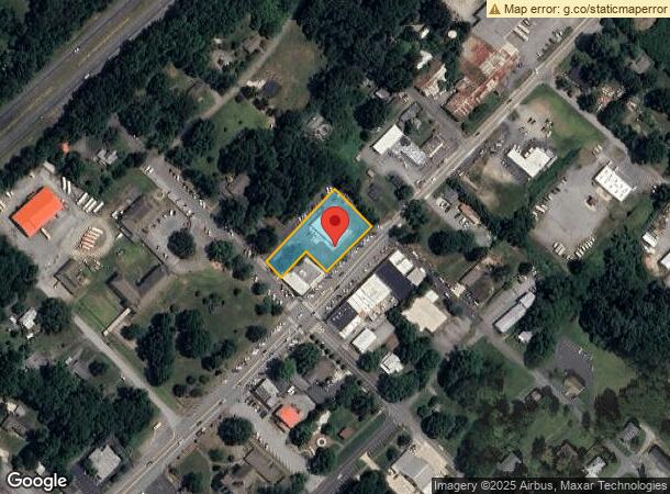
32 N Peak St, Columbus, NC 28722


NEARBY LISTINGS FOR SALE OR LEASE
Property Detail
32 N Peak St
C7-K6
Columbus Value Area 55
Storebuilding
.95 ACRE, CMB, 0C55 COLUMBUS VALUE AREA 55
X
Polk
3710054600J
North Carolina
2025
0.95 AC
2025
North Carolina West/Cherokee Area
920104
Other Market Areas
5,400 SF
DEMOGRAPHICS near 32 N Peak St
1 Mile
3 Mile
5 Mile
2024 Total Population
1,050
5,119
11,637
2029 Population
1,140
5,556
12,705
Pop Growth 2024-2029
+ 8.57%
+ 8.54%
+ 9.18%
Average Age
51
51
50
2024 Total Households
464
2,224
5,264
HH Growth 2024-2029
+ 8.41%
+ 8.63%
+ 9.25%
Median Household Inc
$54,519
$54,926
$56,491
Avg Household Size
2.10
2.20
2.10
2024 Avg HH Vehicles
2.00
2.00
2.00
Median Home Value
$198,015
$237,219
$274,027
Median Year Built
1987
1985
1981
Nearby Places
Map Layers
Map Styles
 Street
 Aerial
- Restaurants
- Banks
- Shops
- Fitness
- Groceries
PUBLIC TRANSPORTATION
AIRPORT
Asheville Regional
DRIVE
WALK
Distance
Asheville Regional
35 min
27.5 mi
Greenville Spartanburg International
DRIVE
WALK
Distance
Greenville Spartanburg International
49 min
37.9 mi
Freight Ports
North Charleston Terminal
DRIVE
WALK
Distance
North Charleston Terminal
244 min
218.7 mi
SALE & LEASE HISTORY
LISTING DATE
SALE/LEASE

Aug 23, 2017
For Sale
Nearby Properties
Address
Land Use
TOTAL SIZE
Lot Size
Zoning
Address
Land Use
TOTAL SIZE
Lot Size
Zoning
68,155 SF
63.56 AC
MX
Address
Land Use
TOTAL SIZE
Lot Size
Zoning
63.34 AC
MX
Address
Land Use
TOTAL SIZE
Lot Size
Zoning
92,600 SF
15.84 AC
MX
Address
Land Use
TOTAL SIZE
Lot Size
Zoning
11.67 AC
Address
Land Use
TOTAL SIZE
Lot Size
Zoning
16,744 SF
7.58 AC
M
Address
Land Use
TOTAL SIZE
Lot Size
Zoning
11,382 SF
5.75 AC
M
Address
Land Use
TOTAL SIZE
Lot Size
Zoning
14,926 SF
4.48 AC
M
Address
Land Use
TOTAL SIZE
Lot Size
Zoning
6,735 SF
8.20 AC
M
Address
Land Use
TOTAL SIZE
Lot Size
Zoning
6.73 AC
Address
Land Use
TOTAL SIZE
Lot Size
Zoning
600 AC
Address
Land Use
TOTAL SIZE
Lot Size
Zoning
2,966 SF
11.53 AC
MX
Address
Land Use
TOTAL SIZE
Lot Size
Zoning
5,442 SF
1.66 AC
M
Address
Land Use
TOTAL SIZE
Lot Size
Zoning
11,925 SF
1.93 AC
M
Address
Land Use
TOTAL SIZE
Lot Size
Zoning
4,368 SF
3.71 AC
M
Address
Land Use
TOTAL SIZE
Lot Size
Zoning
9,076 SF
1.50 AC
M
Address
Land Use
TOTAL SIZE
Lot Size
Zoning
14,016 SF
3.88 AC
M
Address
Land Use
TOTAL SIZE
Lot Size
Zoning
36,300 SF
6.62 AC
M
Address
Land Use
TOTAL SIZE
Lot Size
Zoning
12.90 AC
Address
Land Use
TOTAL SIZE
Lot Size
Zoning
3.24 AC
M
Address
Land Use
TOTAL SIZE
Lot Size
Zoning
300 AC
Address
Land Use
TOTAL SIZE
Lot Size
Zoning
7,316 SF
3.01 AC
M
Address
Land Use
TOTAL SIZE
Lot Size
Zoning
10,125 SF
2.07 AC
M
Address
Land Use
TOTAL SIZE
Lot Size
Zoning
8.38 AC
Address
Land Use
TOTAL SIZE
Lot Size
Zoning
74,862 SF
7.93 AC
I
Address
Land Use
TOTAL SIZE
Lot Size
Zoning
4,635 SF
2.49 AC
M
Address
Land Use
TOTAL SIZE
Lot Size
Zoning
8,870 SF
0.83 AC
MX
Address
Land Use
TOTAL SIZE
Lot Size
Zoning
112,000 SF
14.97 AC
I
Address
Land Use
TOTAL SIZE
Lot Size
Zoning
5,000 SF
1.24 AC
M
Address
Land Use
TOTAL SIZE
Lot Size
Zoning
8,463 SF
6.11 AC
RE1
Address
Land Use
TOTAL SIZE
Lot Size
Zoning
19,759 SF
6 AC
MX
The World's #1 Commercial Real Estate Marketplace
Connect with us
© 2026 CoStar Group
The information above has been obtained from sources believed reliable. While we do not doubt its accuracy we have not verified it and make no guarantee, warranty or representation about it. It is your responsibility to independently confirm its accuracy and completeness. Any projections, opinions, assumptions, or estimates used are for example only and do not represent the current or future performance of the property. The value of this transaction to you depends on tax and other factors which should be evaluated by your tax, financial, and legal advisors. You and your advisors should conduct a careful, independent investigation of the property to determine to your satisfaction the suitability of the property for your needs.